Colonial Despatches
The colonial despatches of Vancouver Island and British Columbia 1846-1871
Sketch of Ahouset. Lat. 49 12N. Long. 126 12W. (Variation estimated 19 40 E.)
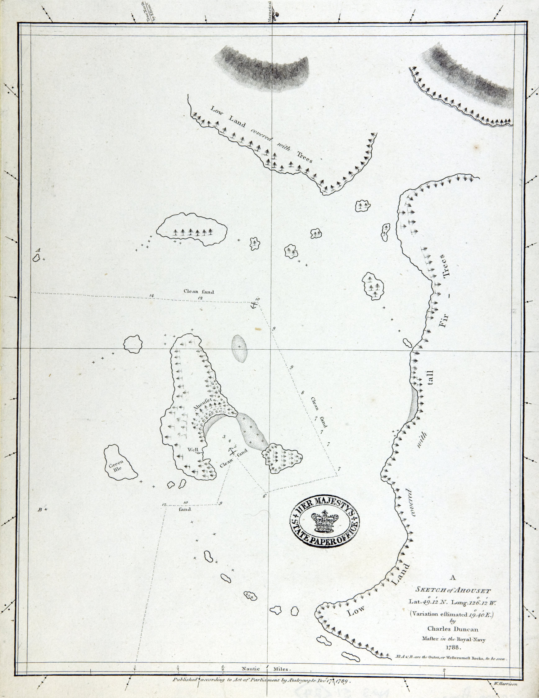
Title: Sketch of Ahouset. Lat. 49 12N. Long. 126 12W. (Variation estimated 19 40 E.)
Title: Sketch of Ahousat.
Author: Duncan, Charles, fl. 1782-96
Subject: Ahousat (B.C.) -- Maps. Vancouver Island (B.C.) -- Maps.
Subject: British Columbia, 1786-1789
Identifier (repository): CO
Identifier (repoNumber): 700
Identifier (repoVol): america
Identifier (libFileName): CO700-AMERICA NORTH and SOUTH51 (24)
Identifier (penfoldNum): 357
Identifier (doc_id): CO 700/AMERICA NORTH AND SOUTH51
Date: 1789
Funder: Funded by a Canadian Council of Archives, Archival Community Digitization Program.
Publisher: Dalrymple, Alexander, 1737-1808
Publisher: National Archives of the UK.
Identifier (CONTENTdm): oai:contentdm.library.uvic.ca:collection5/232
49.060095 -126.334223 49.060095 -125.970322 49.416950 -125.970322 49.416950 -126.334223 49.060095 -126.334223