Colonial Despatches
The colonial despatches of Vancouver Island and British Columbia 1846-1871
Index Map: to explain the connection between the separate District Maps (16 in number), 8 of which, coloured pink, are described in the communication to His Exellency the Governor dated July 22nd, 1859.
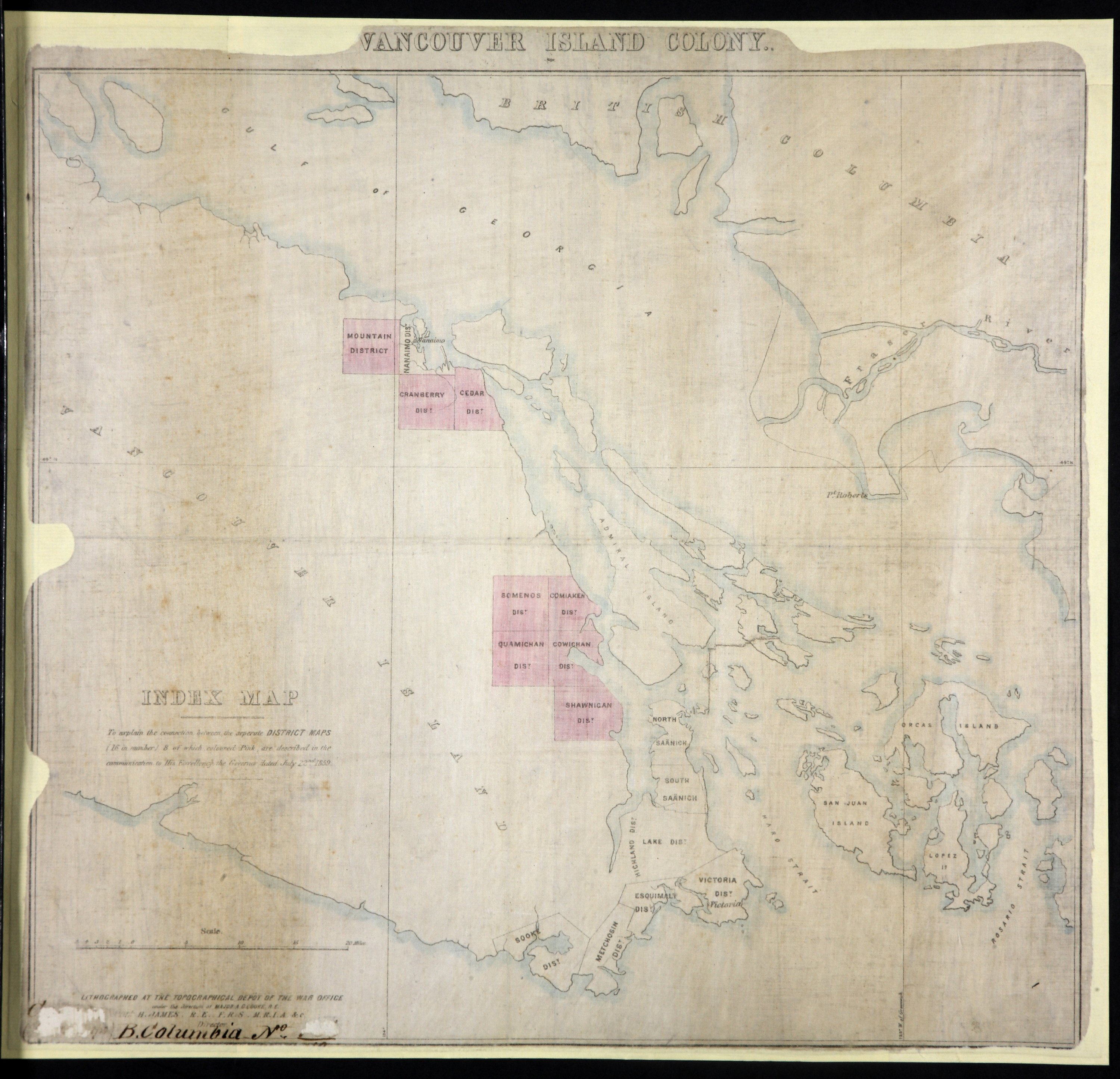
Title: Index Map: to explain the connection between the separate District Maps (16 in number), 8 of which, coloured pink, are described in the communication to His Exellency the Governor dated July 22nd, 1859.
Title: Vancouver Island Colony. Sketch Maps of Districts.
Author: Great Britain. War Office. Topographical Depot
Subject: Vancouver Island (B.C.) -- Maps -- Indexes
Subject: Vancouver Island, 1859
Identifier (repository): CO
Identifier (repoNumber): 700
Identifier (repoVol): bc
Identifier (libFileName): CO700-BRITISH COLUMBIA7 (10)
Identifier (penfoldNum): 568
Identifier (doc_id): CO 700/BRITISH COLUMBIA7/10
Date: 1859
Funder: Funded by a Canadian Council of Archives, Archival Community Digitization Program.
Publisher: National Archives of the UK.
Identifier (CONTENTdm): oai:contentdm.library.uvic.ca:collection5/1