Colonial Despatches
The colonial despatches of Vancouver Island and British Columbia 1846-1871
Thompson River District, from a Map in the possession of H. E. Gov. Douglas, C.B., made in 1835 by S. Black, Esq., Hudson's Bay Company's service. The positions of New Westminster, Douglas & Hope, are those determined by the Royal Engineers.
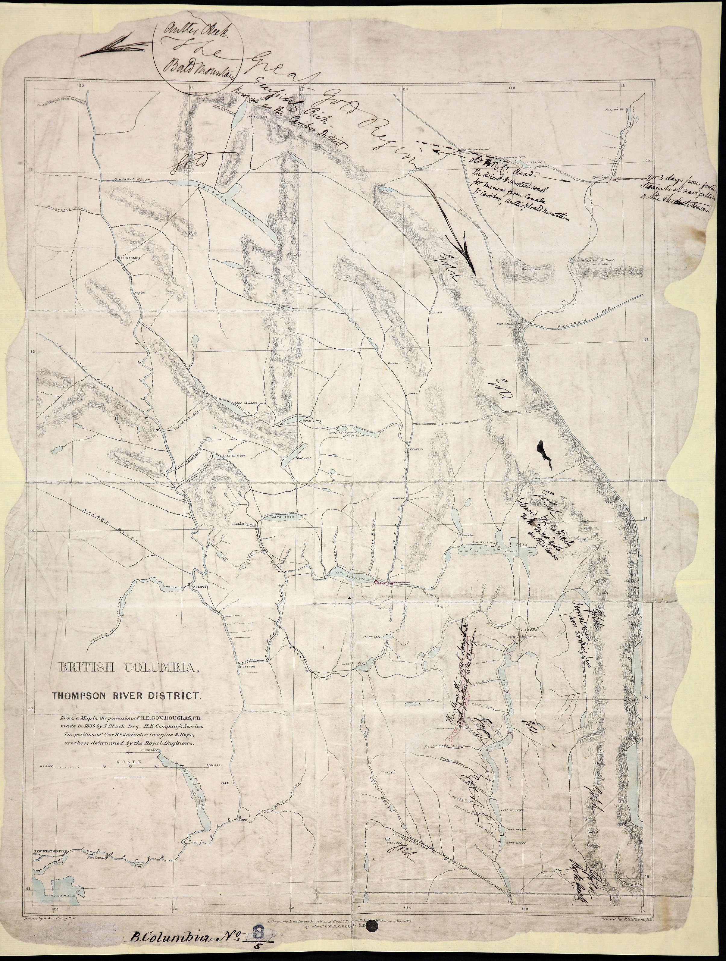
Title: Thompson River District, from a Map in the possession of H. E. Gov. Douglas, C.B., made in 1835 by S. Black, Esq., Hudson's Bay Company's service. The positions of New Westminster, Douglas & Hope, are those determined by the Royal Engineers.
Author: Armstrong, Robert.
Subject: Thompson River (B.C.) -- Maps; British Columbia -- Maps; Cariboo Region (B.C.) -- Maps; Cariboo (B.C. : Regional district)
Subject: British Columbia, 1861
Identifier (repository): CO
Identifier (repoNumber): 700
Identifier (repoVol): bc
Identifier (libFileName): CO700-BRITISH COLUMBIA8 (5)
Identifier (penfoldNum): 395
Identifier (doc_id): CO 700/BRITISH COLUMBIA8/5
Date: 1861
Funder: Funded by a Canadian Council of Archives, Archival Community Digitization Program.
Publisher: Great Britain. Army. Royal Engineers. Columbia Detachment.
Publisher: National Archives of the UK.
Identifier (CONTENTdm): oai:contentdm.library.uvic.ca:collection5/258
53N--49N / 123W--118W