Colonial Despatches
The colonial despatches of Vancouver Island and British Columbia 1846-1871
Map of Vancouver Island and the adjacent coasts.
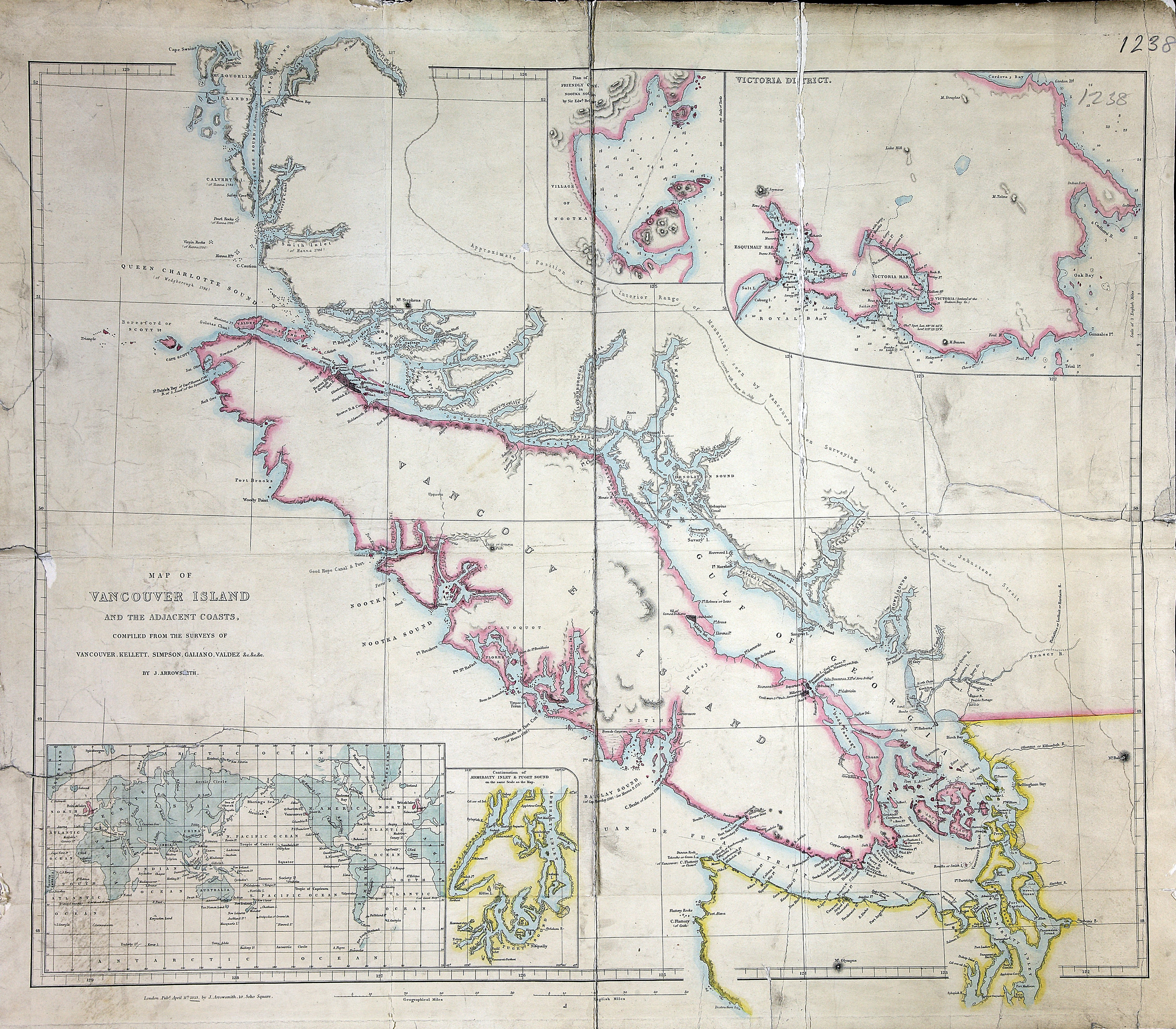
Title: Map of Vancouver Island and the adjacent coasts.
Title: Vancouver Island and the adjacent coasts.
Author: Arrowsmith, John, 1790-1873
Subject: Vancouver Island (B.C.)--Maps; Pacific Coast (B.C.)--Maps; Victoria (B.C.)--Maps; British Columbia--Yuquot--Maps
Subject: Vancouver Island, 1853
Identifier (repository): FO
Identifier (repoNumber): 925
Identifier (repoVol): 1238
Identifier (libFileName): FO925-1238
Identifier (penfoldNum): 565
Identifier (doc_id): FO 925/1238
Date: 1853
Funder: Funded by a Canadian Council of Archives, Archival Community Digitization Program.
Publisher: John Arrowsmith
Publisher: National Archives of the UK.
Identifier (CONTENTdm): oai:contentdm.library.uvic.ca:collection5/128
52 00'N--48 00'N / 129 00'W--122 00'W