Colonial Despatches
The colonial despatches of Vancouver Island and British Columbia 1846-1871
Map of part of Vancouver's Island, the Gulf of Georgia and supposed Strait of Juan de Fuca
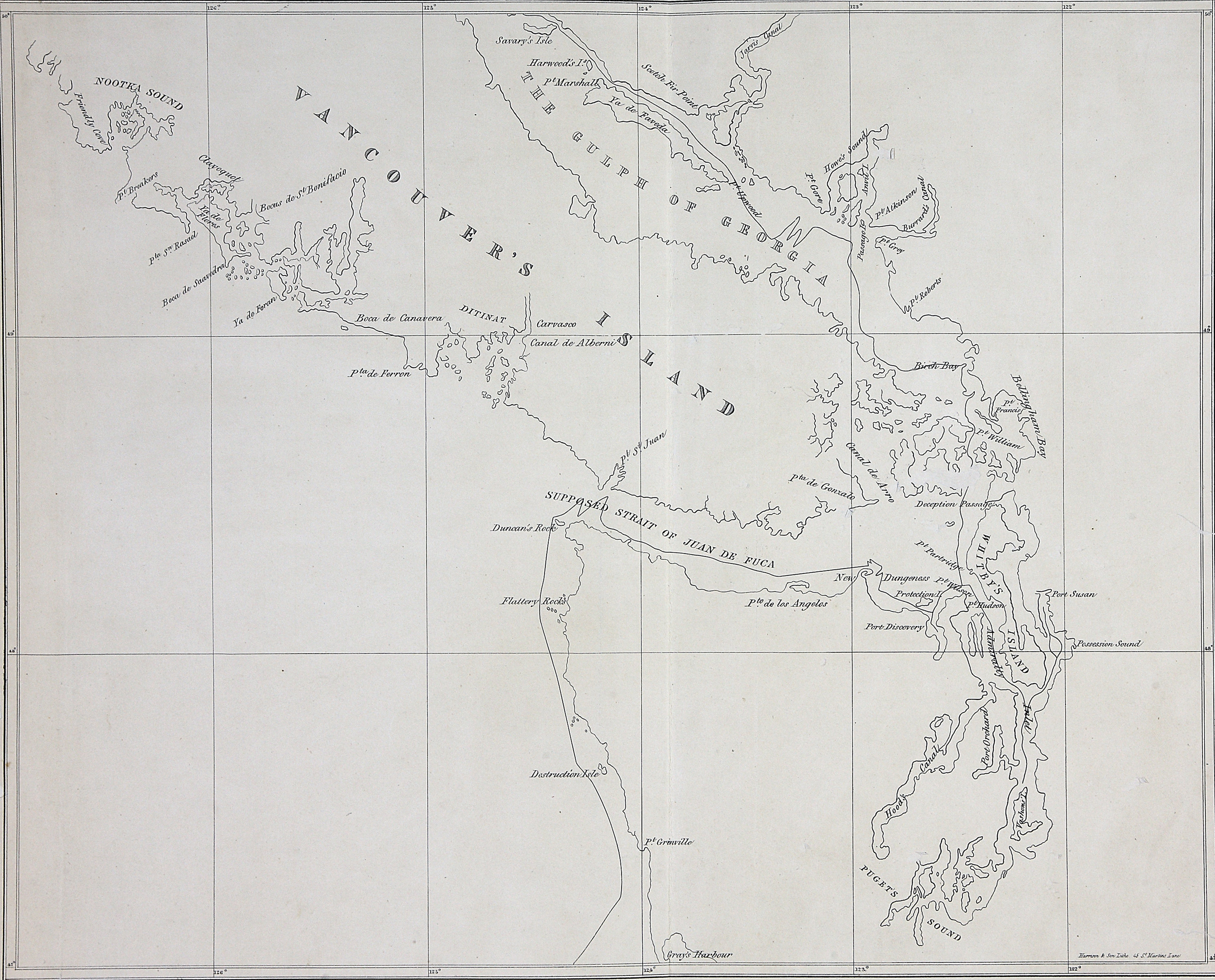
Title: Map of part of Vancouver's Island, the Gulf of Georgia and supposed Strait of Juan de Fuca
Title: Vancouver Island
Subject: Vancouver Island (B.C.)--Maps; Georgia, Gulf of (B.C. and Wash.)--Maps; Juan de Fuca Strait (B.C. and Wash.)--Maps
Subject: Vancouver Island, 1848
Identifier (repository): FO
Identifier (repoNumber): 925
Identifier (repoVol): 1375
Identifier (libFileName): FO925-1375
Identifier (penfoldNum): 557
Identifier (doc_id): FO 925/1375
Date: 1848
Funder: Funded by a Canadian Council of Archives, Archival Community Digitization Program.
Publisher: National Archives of the UK.
Identifier (CONTENTdm): oai:contentdm.library.uvic.ca:collection5/184
50 00'N--47 00'N / 126 00'W--122 00'W