Colonial Despatches
The colonial despatches of Vancouver Island and British Columbia 1846-1871
Chart shewing part of the coast of N.W. America, with the tracks of His Majesty's sloop Discovery and armed tender Chatham / ǂc commanded by George Vancouver, esqr. and prepared under his immediate inspection by Lieut. Joseph Baker, in which the continental shore has been correctly traced and determined from latd. 59⁰.45ʹ N. and longd. 219⁰.30ʹ E. to latd. 59⁰.56ʹ N. and longd. 212⁰.08ʹ E. at the periods shewn by the track ; engraved by T. Foot.
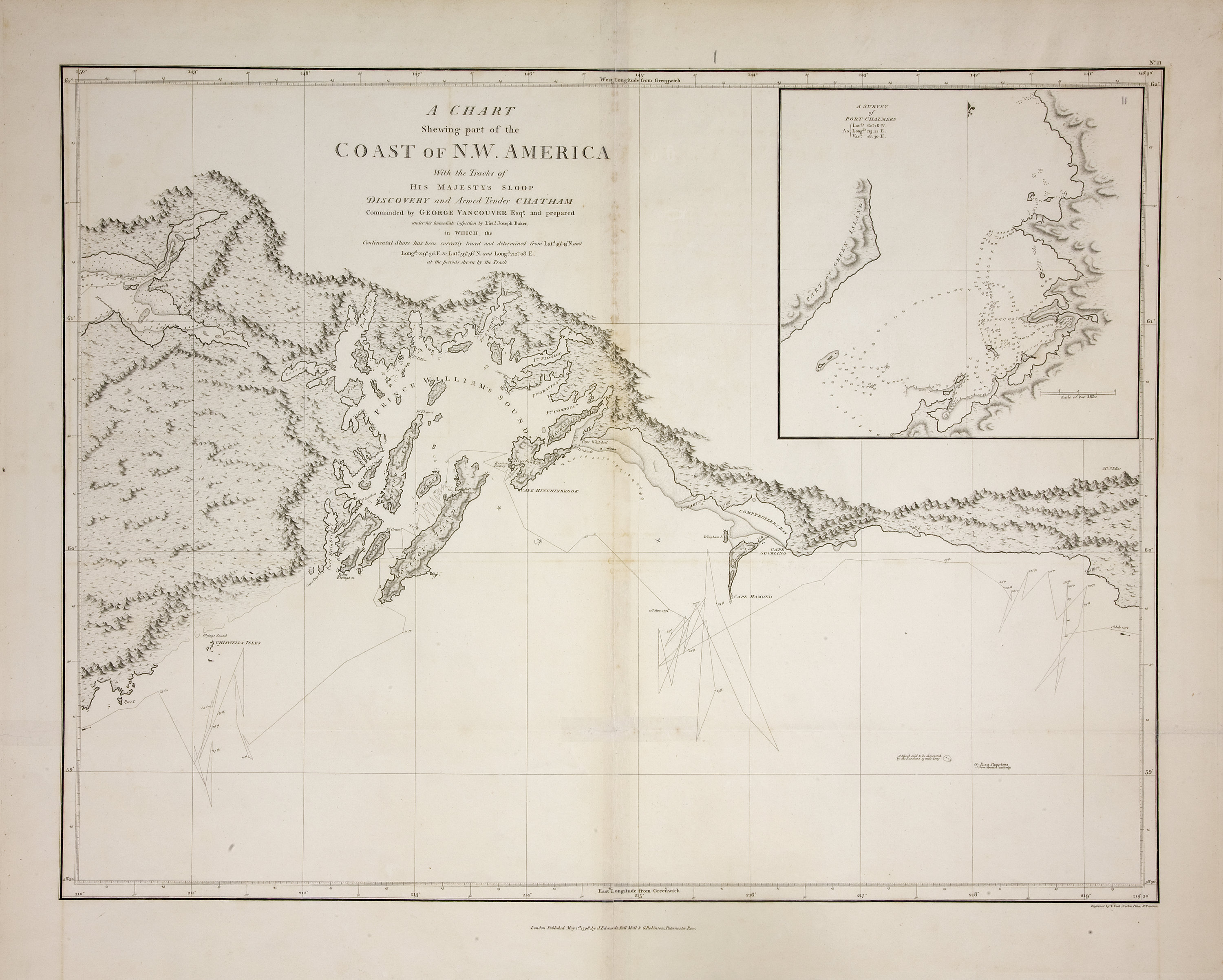
Title: Chart shewing part of the coast of N.W. America, with the tracks of His Majesty's sloop Discovery and armed tender Chatham / ǂc commanded by George Vancouver, esqr. and prepared under his immediate inspection by Lieut. Joseph Baker, in which the continental shore has been correctly traced and determined from latd. 59⁰.45ʹ N. and longd. 219⁰.30ʹ E. to latd. 59⁰.56ʹ N. and longd. 212⁰.08ʹ E. at the periods shewn by the track ; engraved by T. Foot.
Title: Voyage of discovery to the North Pacific Ocean, and round the world.
Author: Vancouver, George, 1757-1798
Subject: Alaska -- Maps; Coasts -- Alaska -- Maps.
Identifier (repository): FO
Identifier (repoNumber): 925
Identifier (repoVol): 1386
Identifier (libFileName): FO925-1386 pt2 (11)
Identifier (penfoldNum):
Identifier (doc_id): FO 925/1386
Date: 1798
Funder: Funded by a Canadian Council of Archives, Archival Community Digitization Program.
Publisher: J. Edwards & G. Robinson
Publisher: National Archives of the UK.
Identifier (CONTENTdm): oai:contentdm.library.uvic.ca:collection5/159
62N-58 30'N/150W-140 30W