Colonial Despatches
The colonial despatches of Vancouver Island and British Columbia 1846-1871
Strait of Juan de Fuca and the channels between the continent & Vancouver Id. showing the boundary line between British & American possessions.
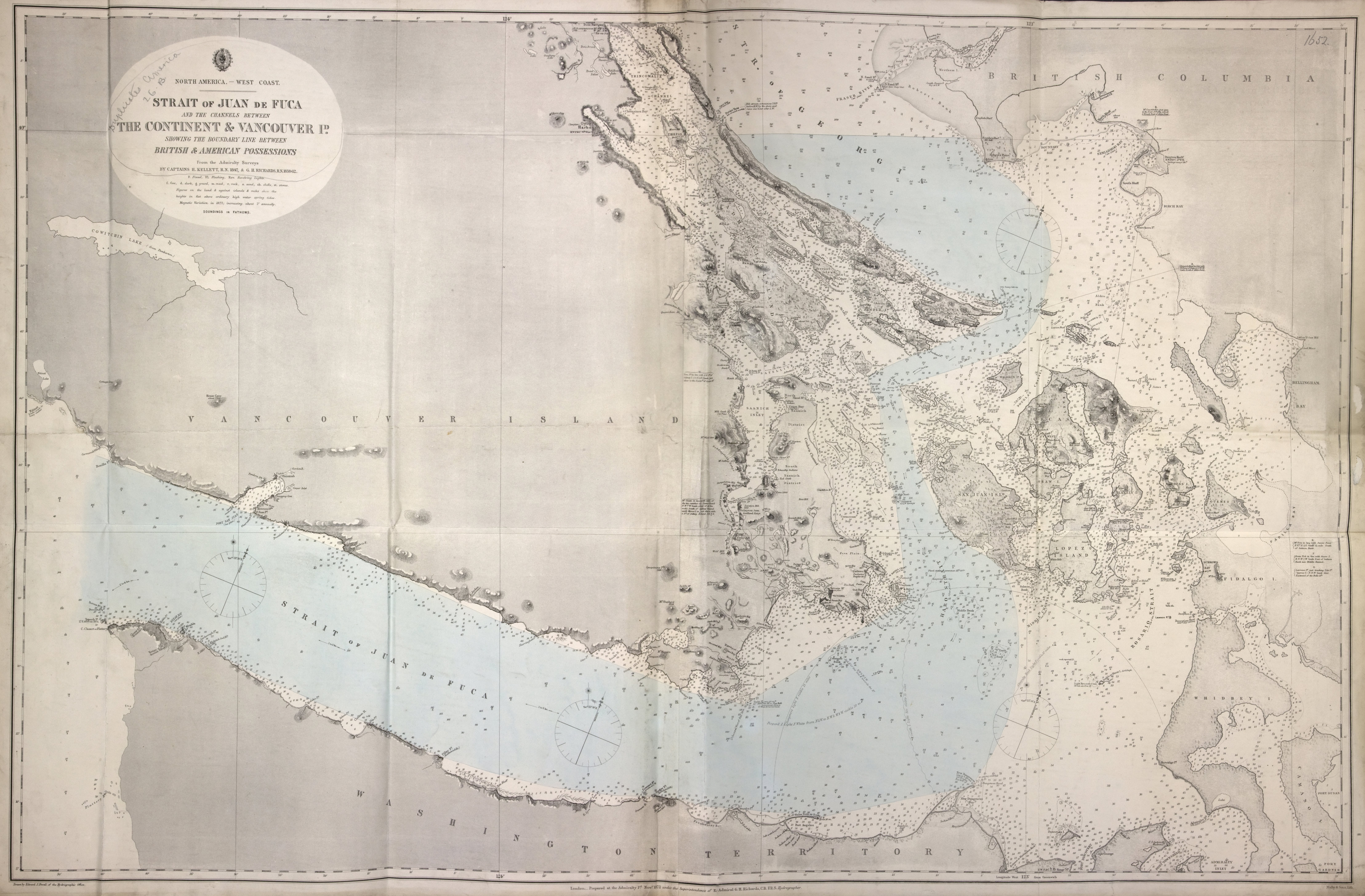
Title: Strait of Juan de Fuca and the channels between the continent & Vancouver Id. showing the boundary line between British & American possessions.
Title: Strait of Juan de Fuca.
Author: Powell, E. J.
Subject: Vancouver Island (B.C.) -- Maps; Juan de Fuca, Strait of (B.C. and Wash.) -- Maps; Nautical charts -- Juan de Fuca, Strait of (B.C. and Wash.); Puget Sound (Wash.) -- Maps; Nautical charts -- Puget Sound (Wash.); Nautical charts -- Haro Strait (B.C. and Wash.); Nautical charts -- Rosario Strait (Wash.); Nautical charts -- Georgia, Strait of (B.C. and Wash.); Flattery, Cape (Wash.); San Juan Boundary Dispute, 1846-1872.
Subject: Juan de Fuca, Strait, 1872
Identifier (repository): FO
Identifier (repoNumber): 925
Identifier (repoVol): 1652
Identifier (libFileName): FO925-1652
Identifier (penfoldNum): 522
Identifier (doc_id): FO925-1652
Date: 1872
Funder: Funded by a Canadian Council of Archives, Archival Community Digitization Program.
Publisher: Great Britain. Hydrographic Office
Publisher: National Archives of the UK.
Identifier (CONTENTdm): oai:contentdm.library.uvic.ca:collection5/192
49 05'N--48 05'N / 124 50'W--122 25'W