Colonial Despatches
The colonial despatches of Vancouver Island and British Columbia 1846-1871
Chart shewing part of the coast of N.W. America : with the tracks of His Majesty's sloop Discovery and armed tender Chatham commanded by George Vancouver, esqr. and prepared under his immediate inspection by Lieut. Joseph Baker, in which the continental shore has been traced and determined from lat: 45⁰, 30ʹ N. and long. 236⁰, 12ʹ E. to lat: 52⁰, 15ʹ N. and long. 232⁰, 40ʹ E. at the different periods shewn by the tracks ; Warner, sculp.
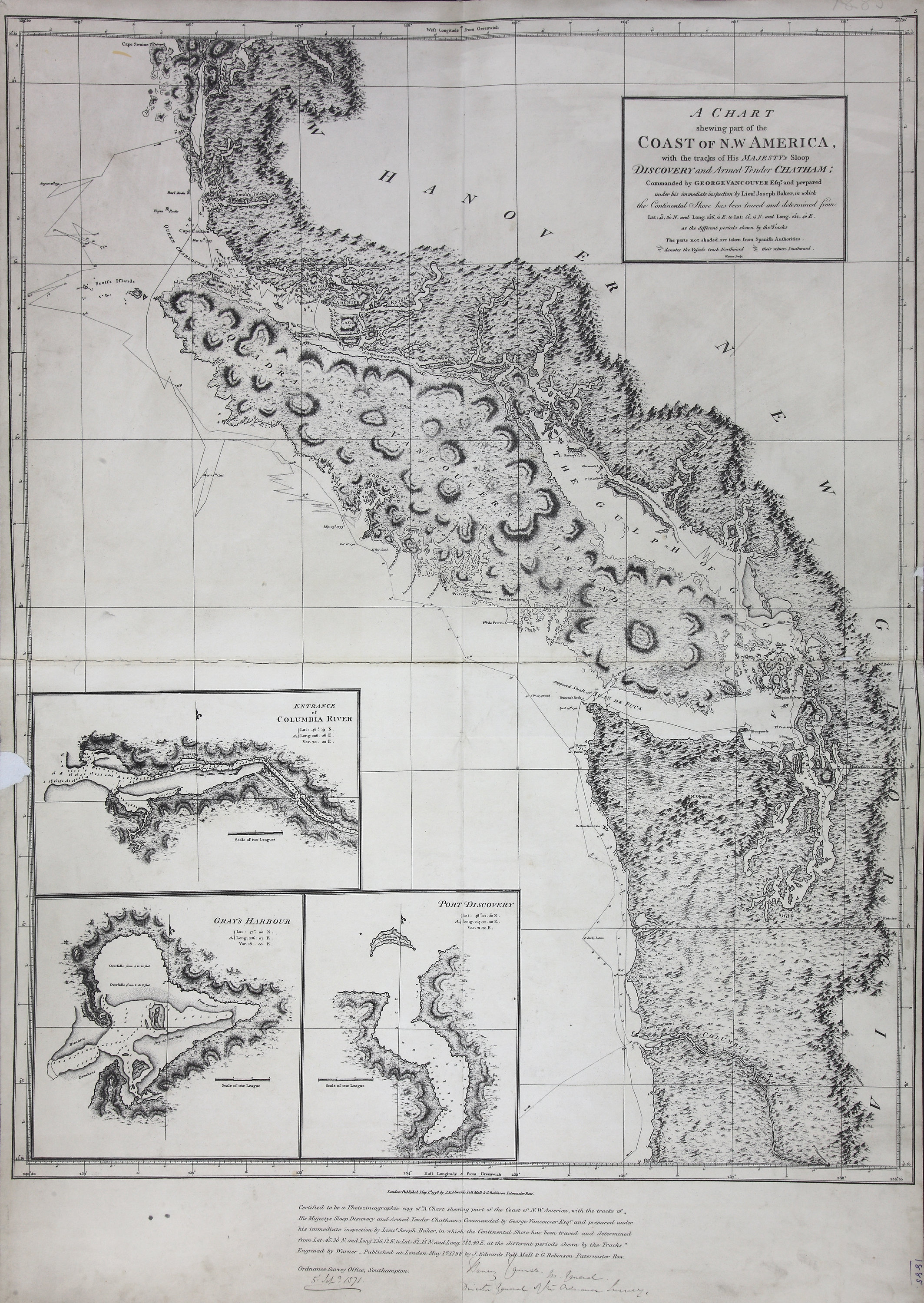
Title: Chart shewing part of the coast of N.W. America : with the tracks of His Majesty's sloop Discovery and armed tender Chatham commanded by George Vancouver, esqr. and prepared under his immediate inspection by Lieut. Joseph Baker, in which the continental shore has been traced and determined from lat: 45⁰, 30ʹ N. and long. 236⁰, 12ʹ E. to lat: 52⁰, 15ʹ N. and long. 232⁰, 40ʹ E. at the different periods shewn by the tracks ; Warner, sculp.
Author: Vancouver, George, 1757-1798
Subject: Juan de Fuca Strait (B.C. and Wash.) -- Maps; Vancouver Island (B.C.) -- Maps; San Juan Boundary Dispute, 1846-1872; Coasts -- British Columbia -- Maps; Coasts -- Washington (State) -- Maps .
Subject: British Columbia, Washington, 1798, 1871
Identifier (repository): FO
Identifier (repoNumber): 925
Identifier (repoVol): 1885
Identifier (libFileName): FO925-1885
Identifier (penfoldNum): 371
Identifier (doc_id): FO 925/1885
Date: 1798
Funder: Funded by a Canadian Council of Archives, Archival Community Digitization Program.
Publisher: Great Britain. Ordnance Survey.
Publisher: National Archives of the UK.
Identifier (CONTENTdm): oai:contentdm.library.uvic.ca:collection5/26
52 15'N-45 30'N/129 30'W-122 30'W.