Colonial Despatches
The colonial despatches of Vancouver Island and British Columbia 1846-1871
Map showing America, the eastern Pacific and Atlantic Oceans, the British Isles, France, Spain and West Africa.
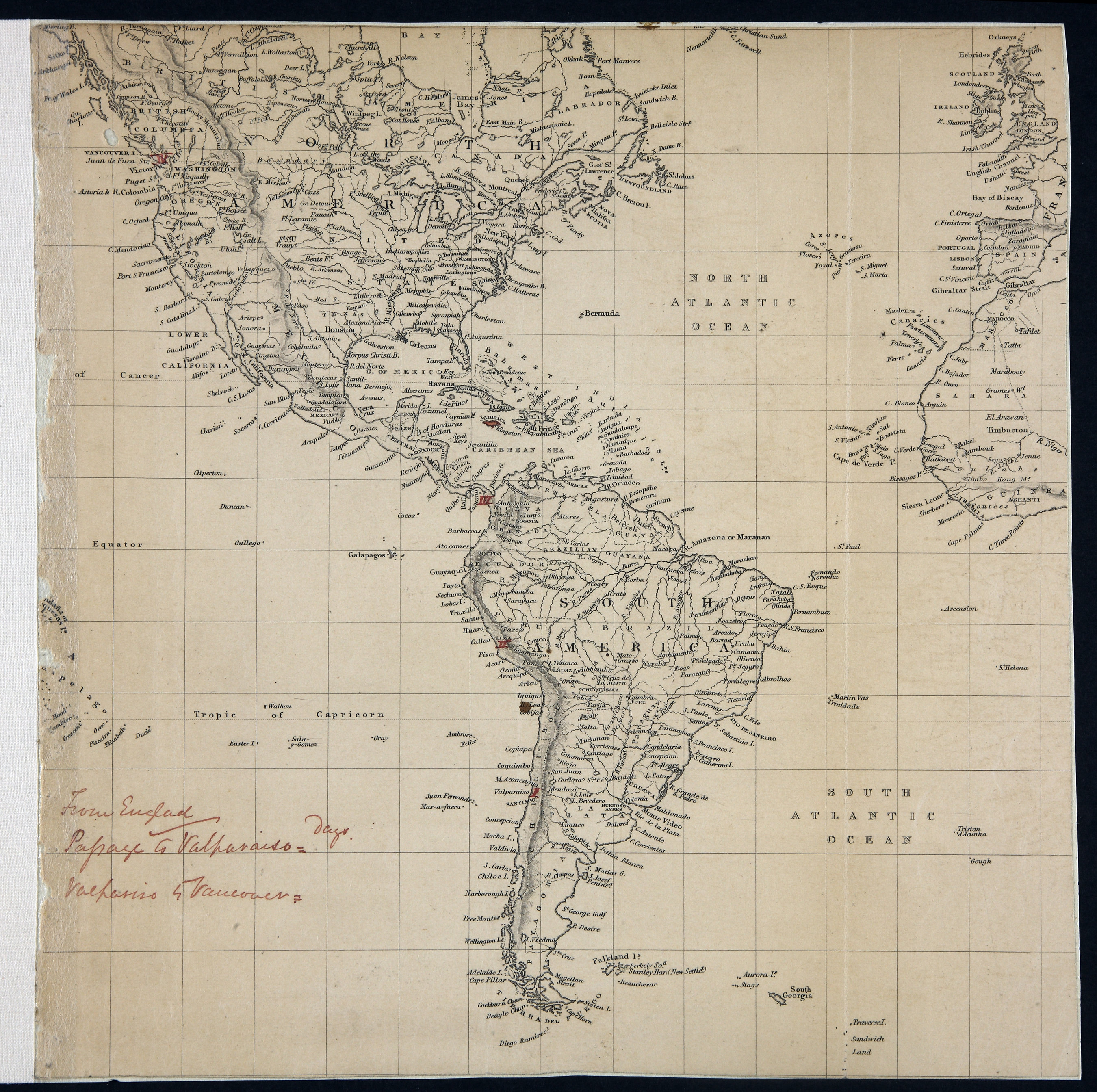
Title: Map showing America, the eastern Pacific and Atlantic Oceans, the British Isles, France, Spain and West Africa.
Title: America, the eastern Pacific and Atlantic Oceans, the British Isles, France, Spain and West Africa.
Author: Baynes, R. L. (Robert Lambert), 1796-1869
Subject: North America -- Maps; South America -- Maps; Central America -- Maps; Pacific Ocean -- Maps; Atlantic Ocean -- Maps; British Isles -- Maps; France -- Maps; Spain -- Maps; West Africa -- Maps; Great Britain. Royal Navy. British Pacific Fleet
Identifier (repository): MFQ
Identifier (repoNumber): 1
Identifier (repoVol): 632
Identifier (libFileName): MFQ1-632 (1)
Identifier (penfoldNum):
Identifier (doc_id): MFQ1-632 (1)
Date: 1859
Funder: Funded by a Canadian Council of Archives, Archival Community Digitization Program.
Publisher: National Archives of the UK.
Identifier (CONTENTdm): oai:contentdm.library.uvic.ca:collection5/116