Colonial Despatches
The colonial despatches of Vancouver Island and British Columbia 1846-1871
Sketch showing the position of a rock at Port Simpson (now Lax Kw'alaams), British Columbia (now in Canada) on which HMS Sparrowhawk struck on May 16 1866, with Fort Simpson, Finlayson Island and the track of the ship.
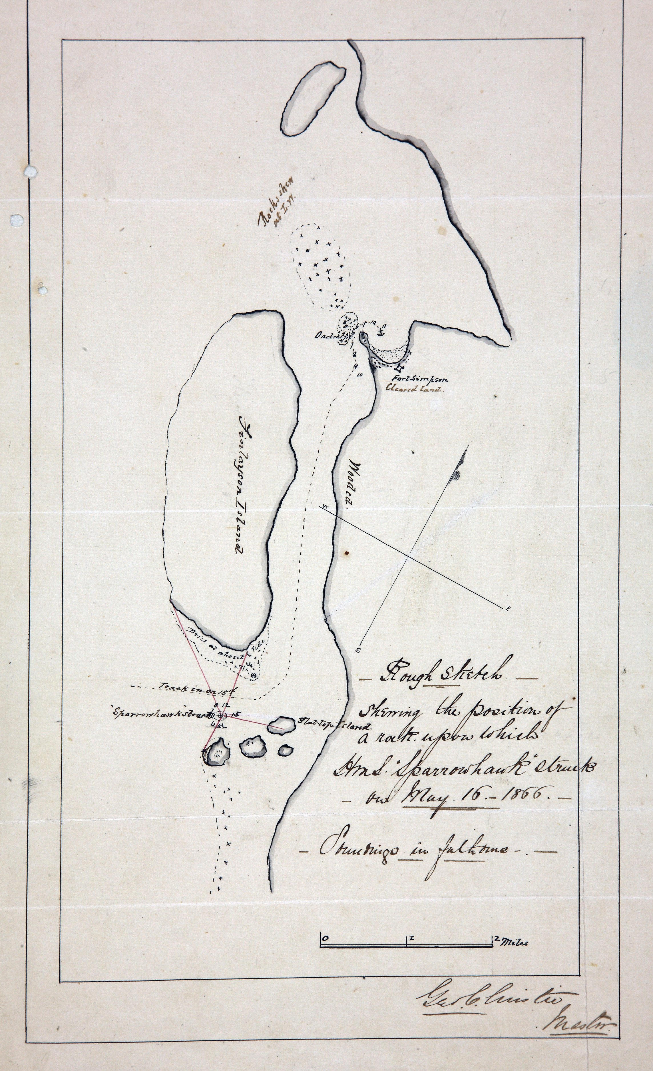
Title: Sketch showing the position of a rock at Port Simpson (now Lax Kw'alaams), British Columbia (now in Canada) on which HMS Sparrowhawk struck on May 16 1866, with Fort Simpson, Finlayson Island and the track of the ship.
Author: Christie, George
Subject: Port Simpson (B.C.) -- Maps; Nautical charts -- British Columbia -- Port Simpson; Sparrowhawk (Ship).
Identifier (repository): MFQ
Identifier (repoNumber): 1
Identifier (repoVol): 632
Identifier (libFileName): MFQ1-632 (6)
Identifier (penfoldNum):
Identifier (doc_id): MFQ1-632 (6)
Date: 1866
Funder: Funded by a Canadian Council of Archives, Archival Community Digitization Program.
Publisher: National Archives of the UK.