Colonial Despatches
The colonial despatches of Vancouver Island and British Columbia 1846-1871
Map of the Country from Lake Superior to the Pacific Ocean, showing the Western Boundary of Canada & the Eastern Boundary of British Columbia, also the Fertile Belt stretching from the Lake of the Woods to the Rocky Mountains.
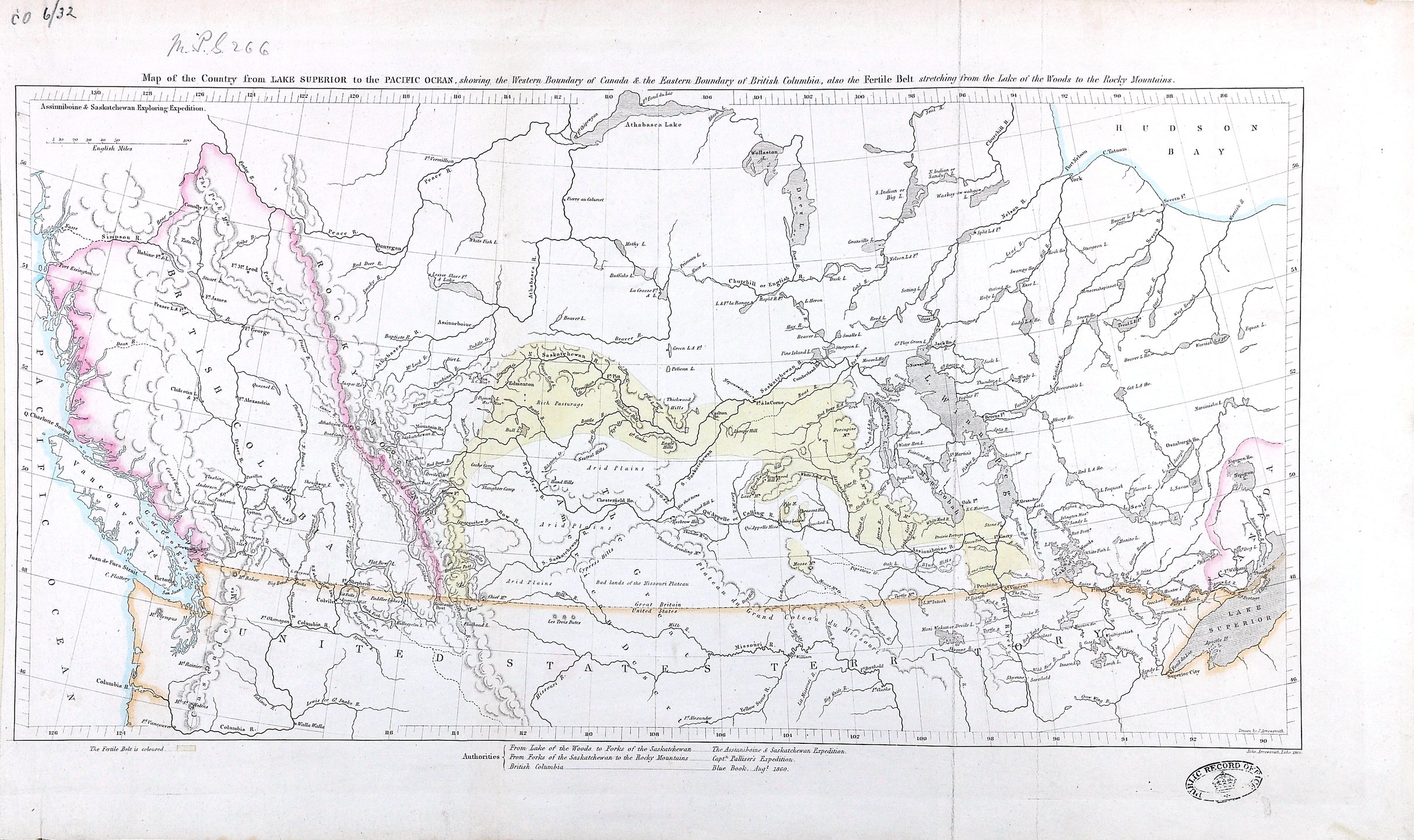
Title: Map of the Country from Lake Superior to the Pacific Ocean, showing the Western Boundary of Canada & the Eastern Boundary of British Columbia, also the Fertile Belt stretching from the Lake of the Woods to the Rocky Mountains.
Title: Lake Superior to the Pacific Ocean.
Author: Hind, Henry Youle, 1823-1908
Subject: Canada -- Maps; British Columbia -- Maps; Alberta -- Maps; Saskatchewan -- Maps; Manitoba -- Maps; Ontario -- Maps; Assiniboine and Saskatchewan Exploring Expedition (1858); British North American Exploring Expedition
Identifier (repository): MPG
Identifier (repoNumber): 1
Identifier (repoVol): 266
Identifier (libFileName): MPG1-266
Identifier (penfoldNum):
Identifier (doc_id): MPG 1/266
Date: 1860
Funder: Funded by a Canadian Council of Archives, Archival Community Digitization Program.
Publisher: National Archives of the UK.
Identifier (CONTENTdm): oai:contentdm.library.uvic.ca:collection5/260
57 15'N-45N/127 15'W-84W