Colonial Despatches
The colonial despatches of Vancouver Island and British Columbia 1846-1871
Map of parts of British Columbia, Alberta and the States of Washington, Idaho and Montana.
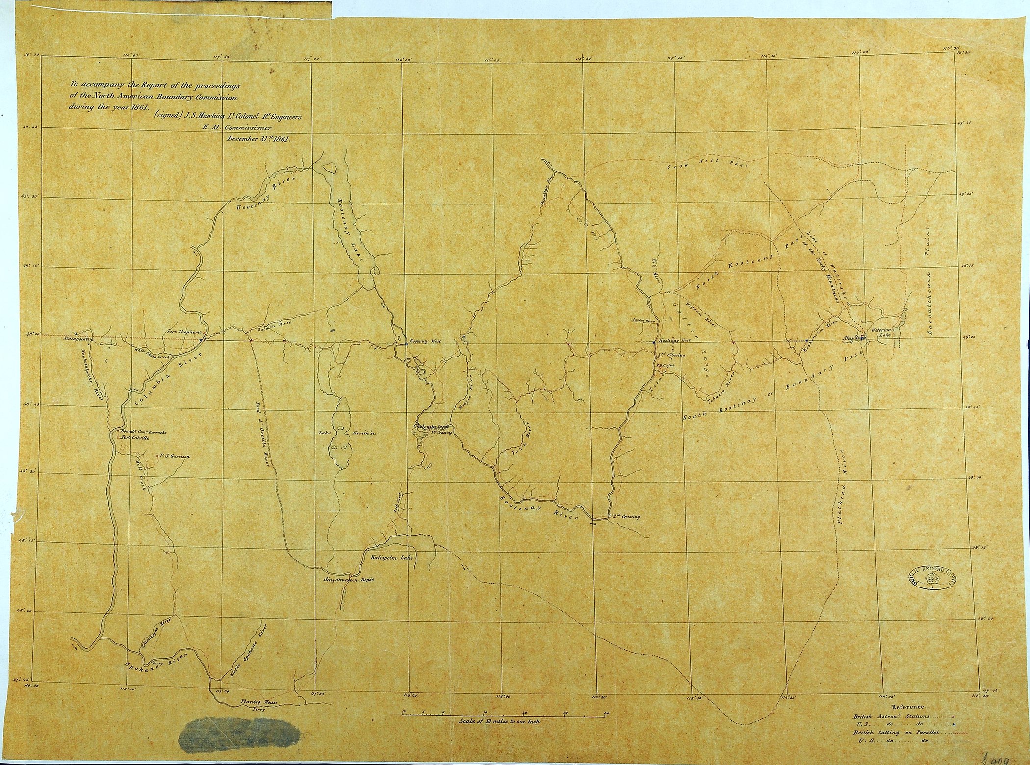
Title: Map of parts of British Columbia, Alberta and the States of Washington, Idaho and Montana.
Author: Hawkins, J. S. (John Summerfield), 1812-1895
Subject: North American Boundary Commission; British Columbia -- Maps; Alberta -- maps; Washington (State) -- Maps; Idaho -- Maps; Montana -- Maps.
Identifier (repository): MPG
Identifier (repoNumber): 1
Identifier (repoVol): 409
Identifier (libFileName): MPG1-409
Identifier (penfoldNum):
Identifier (doc_id): MPG 1/409
Date: 1861
Funder: Funded by a Canadian Council of Archives, Archival Community Digitization Program.
Publisher: National Archives of the UK.
Identifier (CONTENTdm): oai:contentdm.library.uvic.ca:collection5/269
50 30'N-47 43'N/118 30'W-113 30'W