Colonial Despatches
The colonial despatches of Vancouver Island and British Columbia 1846-1871
Provinces of British Columbia and Vancouver Island; with portions of the United States and Hudson's Bay Territories.
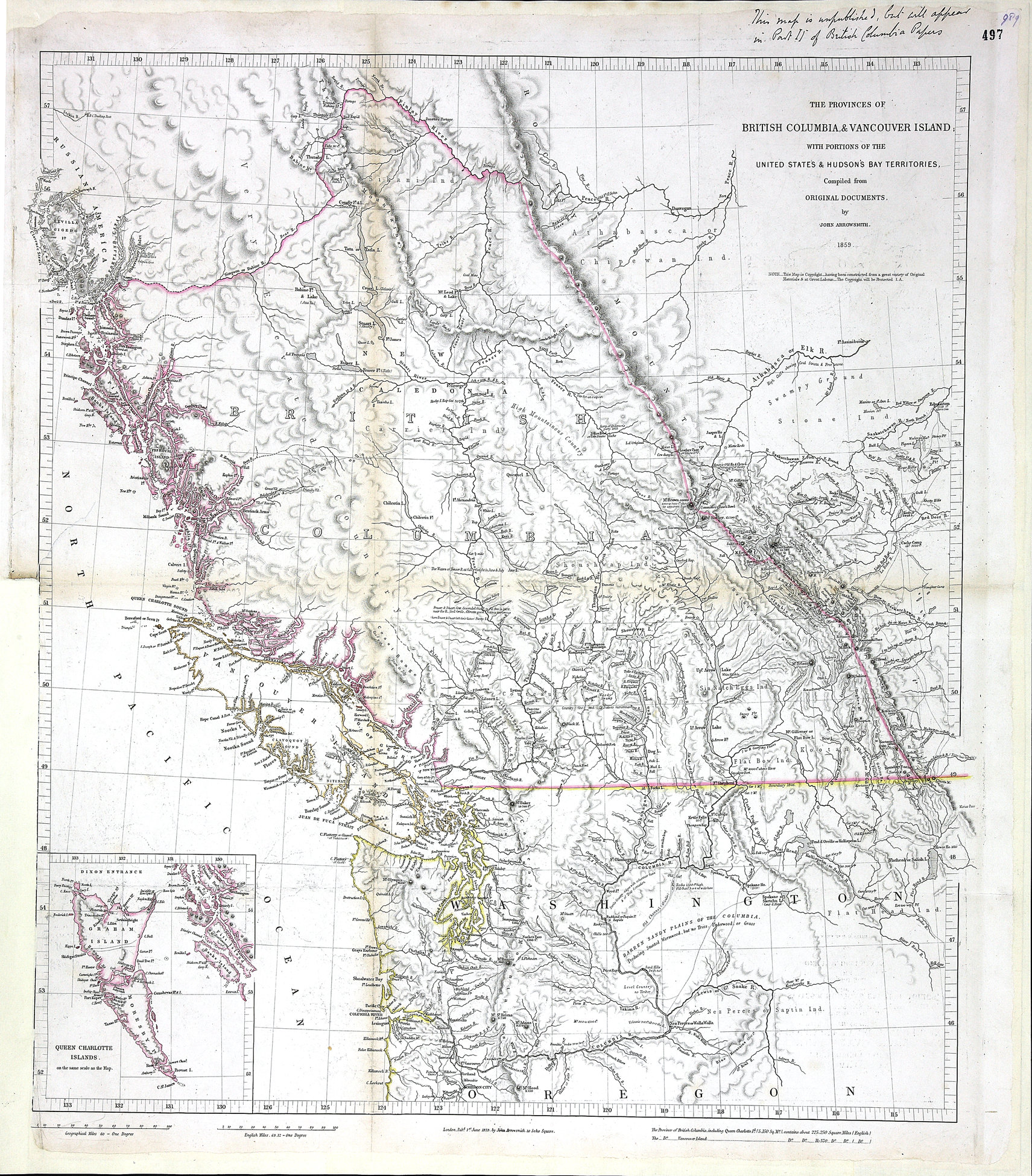
Title: Provinces of British Columbia and Vancouver Island; with portions of the United States and Hudson's Bay Territories.
Author: Arrowsmith, John, 1790-1873.
Subject: British Columbia -- Maps; Vancouver Island -- Maps; Haida Gwaii (B.C.) -- Maps; Washington (State) -- Maps; Oregon -- Maps; Indians of North America -- British Columbia; Hudsons Bay Company.
Subject: British Columbia, 1859
Identifier (repository): MPG
Identifier (repoNumber): 1
Identifier (repoVol): 646
Identifier (libFileName): MPG1-646
Identifier (penfoldNum): 387
Identifier (doc_id): MPG 1/646
Date: 1859
Funder: Funded by a Canadian Council of Archives, Archival Community Digitization Program.
Publisher: John Arrowsmith.
Publisher: National Archives of the UK.
Identifier (CONTENTdm): oai:contentdm.library.uvic.ca:collection5/280
57 30'N-45N/132 10'W-112 10'W