Colonial Despatches
The colonial despatches of Vancouver Island and British Columbia 1846-1871
Sketch map of the country north and east of Bute Inlet to the Chilanko, Chezech and Chilko Rivers.
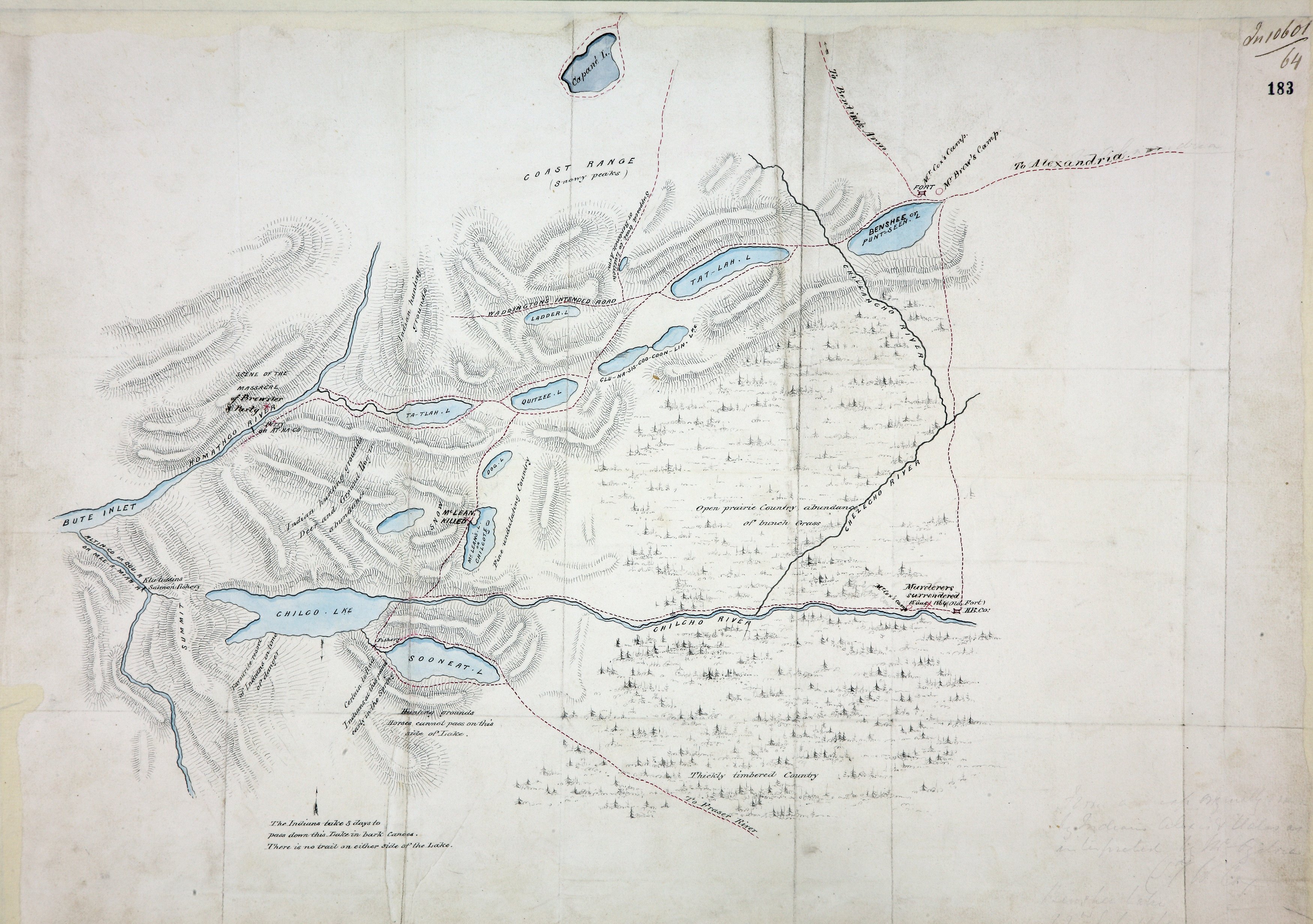
Title: Sketch map of the country north and east of Bute Inlet to the Chilanko, Chezech and Chilko Rivers.
Author: Cox, William George.
Subject: Chilcotin War, 1864 -- Maps; Chilcotin Plateau (B.C.) -- Maps; Chilcotin Indians
Subject: British Columbia, 1864
Identifier (repository): MPG
Identifier (repoNumber): 1
Identifier (repoVol): 654
Identifier (libFileName): MPG1-654 (1)
Identifier (penfoldNum): 416
Identifier (doc_id): MPG1-654 (1)
Date: 1864
Funder: Funded by a Canadian Council of Archives, Archival Community Digitization Program.
Publisher: National Archives of the UK.
Identifier (CONTENTdm): oai:contentdm.library.uvic.ca:collection5/304