Colonial Despatches
The colonial despatches of Vancouver Island and British Columbia 1846-1871
Geological sketch map of Nanaimo in Vancouver Island.
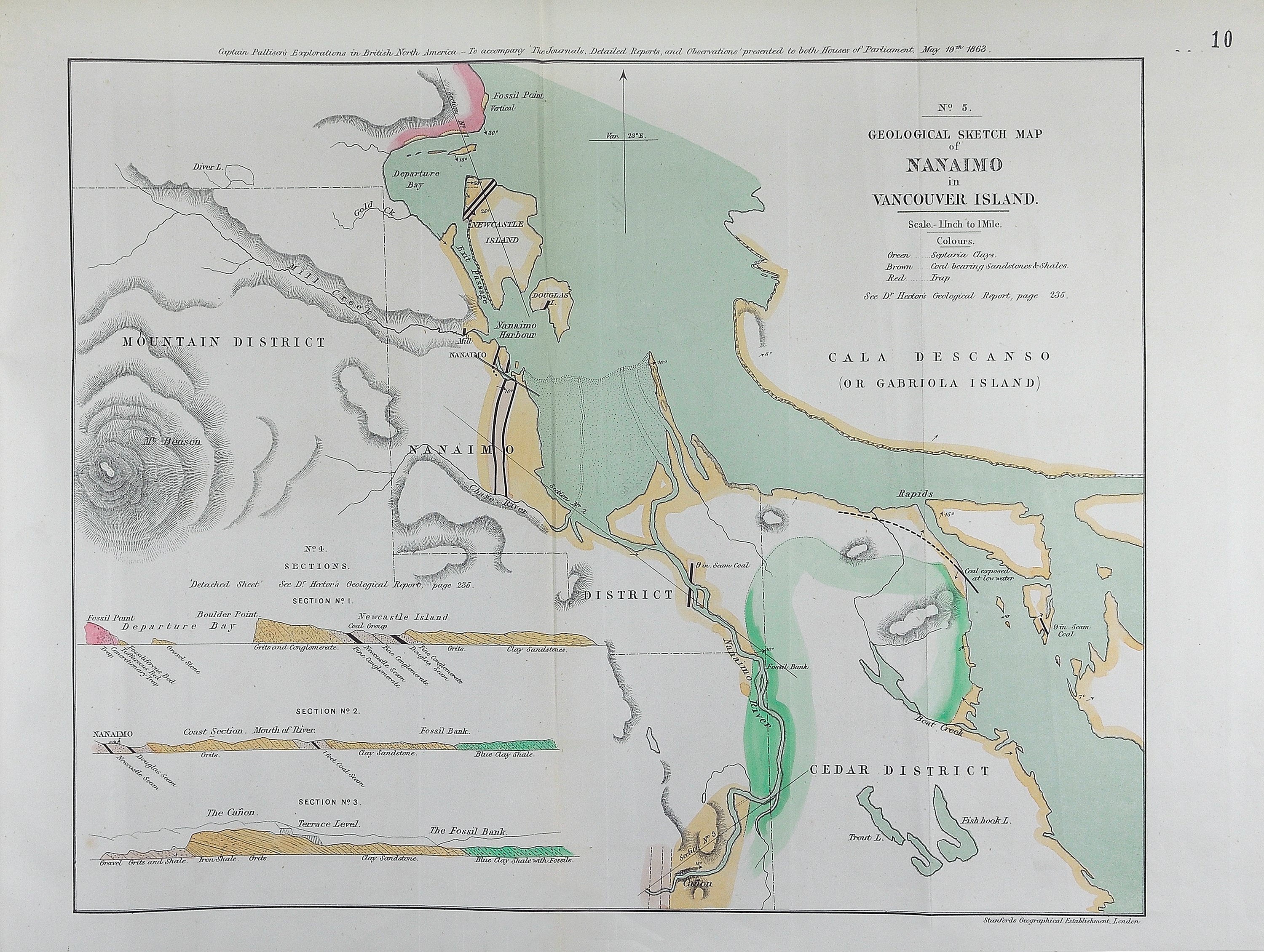
Exploration (1857-1860). Captain Palliser's general report and journal. [Nanaimo,
1863]. [Map] No. 5. Scale 1 inch to 1 mile. At top of map:
Captain Palliser's explorations in British North America - To accompany 'The journals, detailed reports, and observations' presented to both Houses of Parliament, May 18th 1863.Published by Stanford's Geographical Establishment, London. Also [Map] No. 4. Sections.
British North American Exploring Expedition, Geological sketch map of Nanaimo in Vancouver Island, 1863, Edward Stanford Ltd, CO6-36 (10). The Colonial Despatches of Vancouver Island and British Columbia 1846-1871, Edition 2.4, ed. James Hendrickson and the Colonial Despatches project. Victoria,
B.C.: University of Victoria. https://bcgenesis.uvic.ca/co_6-36-10_nanaimo_1863_palliser_exped.html.
Title: Geological sketch map of Nanaimo in Vancouver Island.
Title: Nanaimo.
Author: British North American Exploring Expedition
Subject: Nanaimo (B.C.) -- Maps; Vancouver Island (B.C.) -- Maps.
Subject: Nanaimo, 1863
Identifier (repository): CO
Identifier (repoNumber): 6
Identifier (repoVol): 3610
Identifier (libFileName): CO6-36 (10)
Identifier (penfoldNum): 530
Identifier (doc_id): CO6-36 (10)
Date: 1863
Funder: Funded by a Canadian Council of Archives, Archival Community Digitization Program.
Publisher: Edward Stanford Ltd.
Publisher: National Archives of the UK.
Identifier (CONTENTdm): oai:contentdm.library.uvic.ca:collection5/240