Colonial Despatches
The colonial despatches of Vancouver Island and British Columbia 1846-1871
Douglas, British Columbia, 1861.
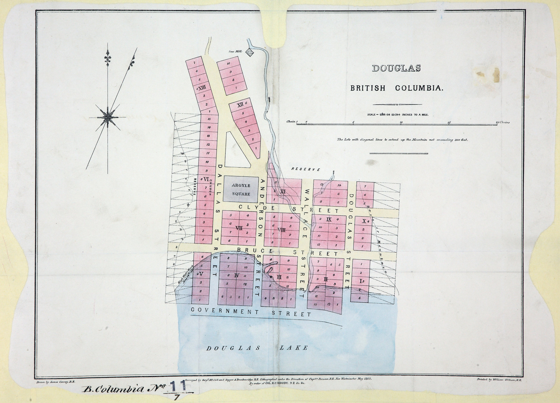
Plan of the Town of Douglas. Surveyed by Sergt. McColl and Sapper A. Breakenridge,
R.E. About 25 inches to 1 mile. New Westminster. [British Columbia, 1861; 1862].
Lithographed under the direction of Capt. Parson R.E., drawn by James Conroy R.E.,
printed by William Oldham R.E. Shows numbered lots, high water mark and saw mill.
McColl, William, d. 1864., Douglas, British Columbia, 1861, 1861, Great Britain. Army. Royal Engineers. Columbia Detachment, CO 700/BRITISH
COLUMBIA11/7. The Colonial Despatches of Vancouver Island and British Columbia 1846-1871, Edition 2.5, ed. James Hendrickson and the Colonial Despatches project. Victoria,
B.C.: University of Victoria. https://bcgenesis.uvic.ca/co_700-bc_11_7_douglas_1861.html.
Title: Douglas, British Columbia, 1861.
Author: McColl, William, d. 1864.
Subject: Douglas (B.C.) -- Maps; British Columbia -- Maps
Subject: British Columbia, 1861, 1862
Identifier (repository): CO
Identifier (repoNumber): 700
Identifier (repoVol): bc
Identifier (libFileName): CO700-BRITISH COLUMBIA11 (7)
Identifier (penfoldNum): 401
Identifier (doc_id): CO 700/BRITISH COLUMBIA11/7
Date: 1861
Funder: Funded by a Canadian Council of Archives, Archival Community Digitization Program.
Publisher: Great Britain. Army. Royal Engineers. Columbia Detachment.
Publisher: National Archives of the UK.