Colonial Despatches
The colonial despatches of Vancouver Island and British Columbia 1846-1871
Strait of Juan de Fuca
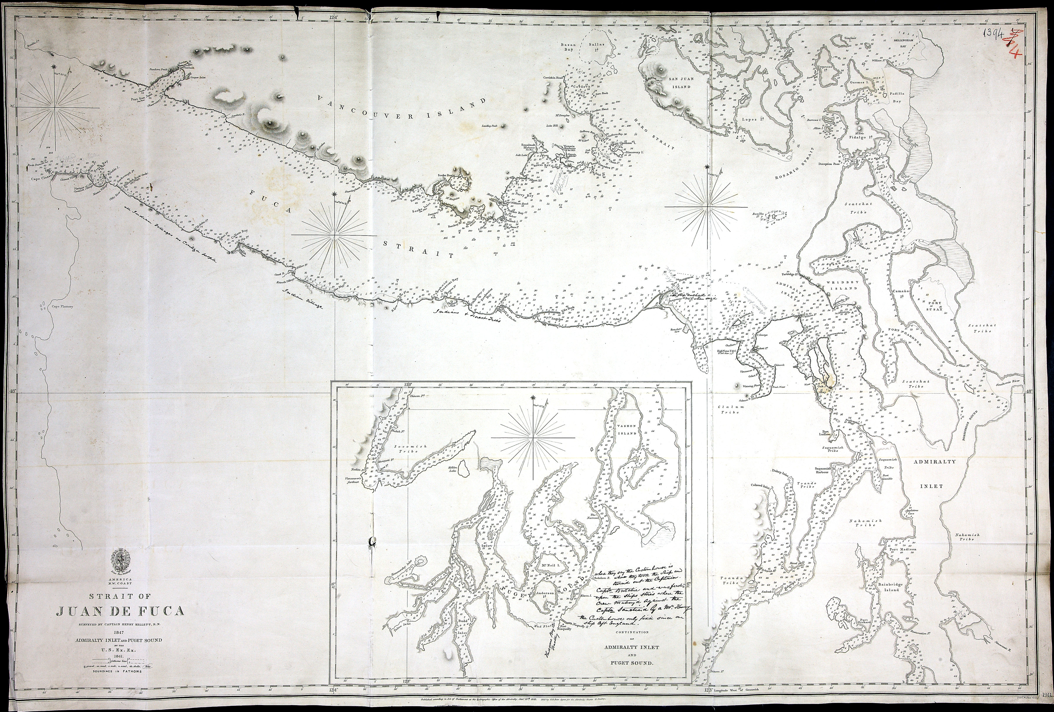
Strait of Juan de Fuca, survey by Capt Henry Kellett 1847. Admiralty Inlet & Puget
Sound by US Exploring Expedition 1841, with MS additions. Admiralty Chart 1911. About
3 sea miles to an inch. [Juan de Fuca, Strait, 1849]. J. & C. Walker, Sculpt. Soundings
in fathoms. Shows First Nations sites and territories.
where they say the Custom house is where they took the Ship and turn'd out the Captain.
Captn Butchie? and was feasting upon the ships store's where the crew mutiny'd against
the Captn sanction'd by a Mr. Keasey? the Custom house only fix'd since our ship left
England.
Great Britain. Hydrographic Office, Strait of Juan de Fuca, 1849, Great Britain. Hydrographic Office, FO 925/1394. The Colonial Despatches of Vancouver Island and British Columbia 1846-1871, Edition 2.4, ed. James Hendrickson and the Colonial Despatches project. Victoria,
B.C.: University of Victoria. https://bcgenesis.uvic.ca/fo_925-1394_1849_j_d_f_s.html.
Title: Strait of Juan de Fuca
Author: Great Britain. Hydrographic Office
Subject: Juan de Fuca Strait (B.C. and Wash.)--Maps; Admiralty Inlet (Wash.)--Maps; Puget Sound (Wash.)--Maps.
Subject: Juan de Fuca, Strait, 1849
Identifier (repository): FO
Identifier (repoNumber): 925
Identifier (repoVol): 1394
Identifier (libFileName): FO925-1394
Identifier (penfoldNum): 512
Identifier (doc_id): FO 925/1394
Date: 1849
Funder: Funded by a Canadian Council of Archives, Archival Community Digitization Program.
Publisher: Great Britain. Hydrographic Office
Publisher: National Archives of the UK.
Identifier (CONTENTdm): oai:contentdm.library.uvic.ca:collection5/174
48 35'N--47 30'N / 124 45'W--122 10'W