Colonial Despatches
The colonial despatches of Vancouver Island and British Columbia 1846-1871
Map of Oregon and Upper California, from the Surveys of John Charles Frémont And Other Authorities
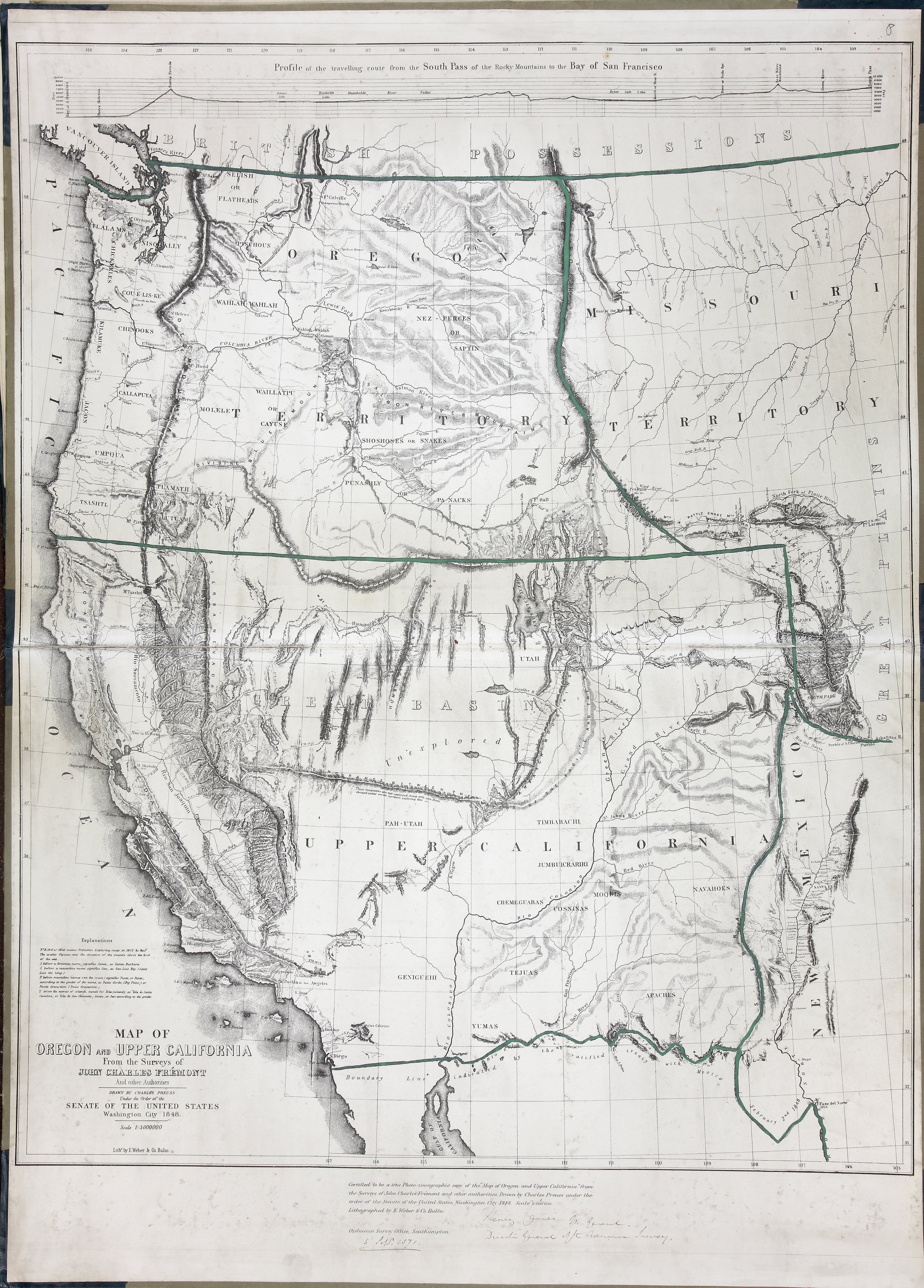
Certified to be a true Photozincographed copy of theMap of Oregon and Upper Californiafrom the Surveys of John Charles Frémont and other authorities. Drawn by Charles Preuss under the order of the Senate of the United States, Washington City 1848 Scale 1/3 000 000.
Title: Map of Oregon and Upper California, from the Surveys of John Charles Frémont And Other Authorities
Title: Profile of the travelling route from the South Pass of the Rocky Mountains to the Bay of San Francisco
Author: Charles Preuss
Subject: San Juan Boundary Dispute, 1846-1872
Subject: Rocky Mountains to Upper California; Oregon Territory; Missouri Territory
Identifier (repository): FO
Identifier (repoNumber): 925
Identifier (repoVol): 1647b
Identifier (libFileName): FO925-1647B (8)
Identifier (penfoldNum):
Identifier (doc_id): FO 925/1647B
Date: 1848
Funder: Funded by a Canadian Council of Archives, Archival Community Digitization Program.
Publisher: Ordnance Survey Office, Southampton
Publisher: National Archives of the UK.