Colonial Despatches
The colonial despatches of Vancouver Island and British Columbia 1846-1871
Sketch map of the country north and east of Bute Inlet to the Chilanko, Chezech and Chilko Rivers.
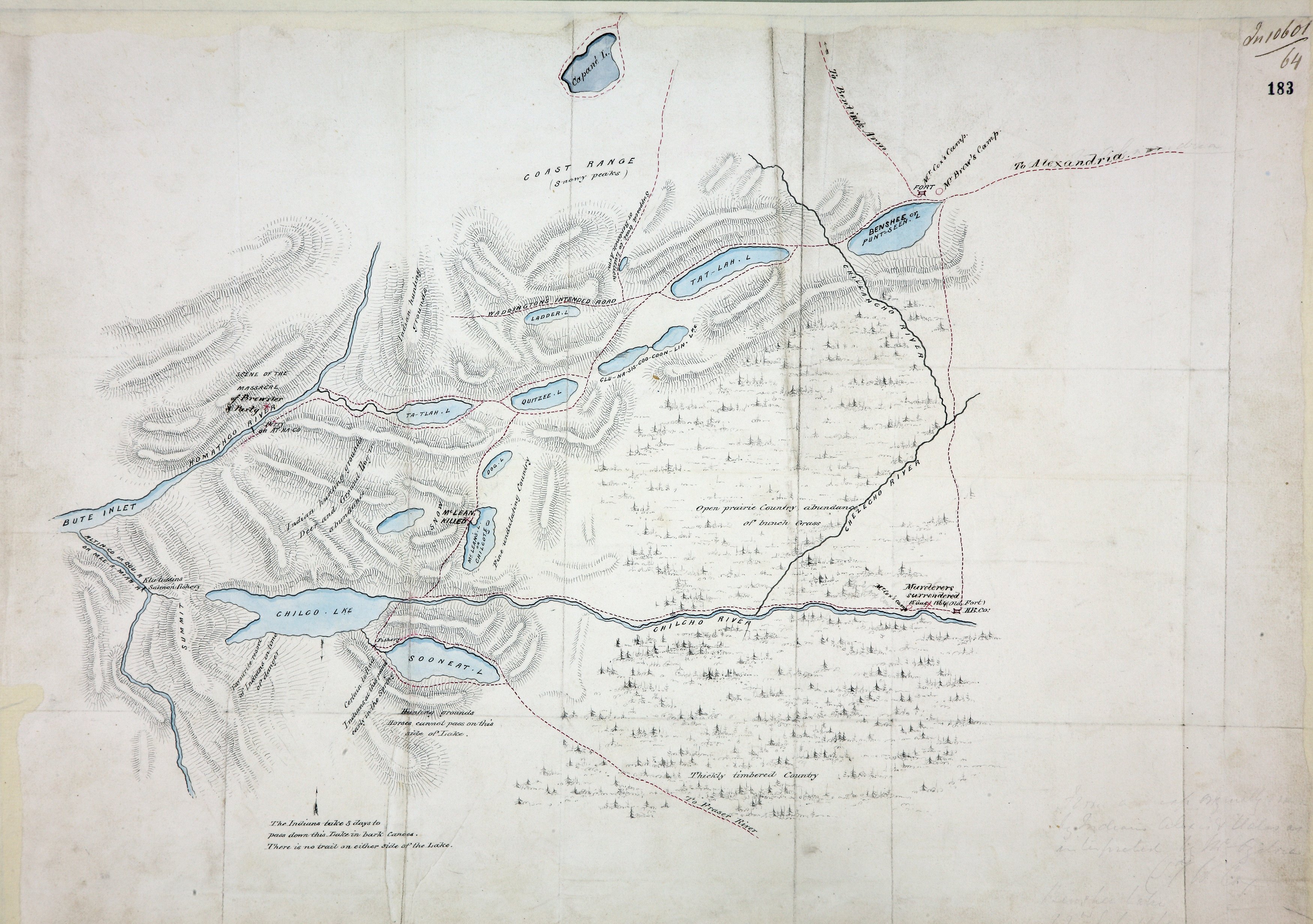
British Columbia. Sketch map of the country north and east of Bute Inlet to the Chilanko,
Chezech and Chilko Rivers, showing rivers, lakes, trails, forts and camps, scene of
the massacre of Mr Brewster and party and of the murderers' surrender. A note in faint
pencil in the lower right corner reads, 'From a map originally drawn by Indians Alexis
and [?Valos] as interpreted by Mr. Ogilvie'. (Signed) T W Cox. Benshee Lake, 22 July
1864. [British Columbia, 1864].
Cox, William George., Sketch map of the country north and east of Bute Inlet to the Chilanko, Chezech and
Chilko Rivers, 1864, National Archives of the UK, MPG1-654 (1). The Colonial Despatches of Vancouver Island and British Columbia 1846-1871, Edition 2.6, ed. James Hendrickson and the Colonial Despatches project. Victoria,
B.C.: University of Victoria. https://bcgenesis.uvic.ca/mpg_1-654_1_bc_east_chilcotin_1864.html.
Title: Sketch map of the country north and east of Bute Inlet to the Chilanko, Chezech and Chilko Rivers.
Author: Cox, William George.
Subject: Chilcotin War, 1864 -- Maps; Chilcotin Plateau (B.C.) -- Maps; Chilcotin Indians
Subject: British Columbia, 1864
Identifier (repository): MPG
Identifier (repoNumber): 1
Identifier (repoVol): 654
Identifier (libFileName): MPG1-654 (1)
Identifier (penfoldNum): 416
Identifier (doc_id): MPG1-654 (1)
Date: 1864
Funder: Funded by a Canadian Council of Archives, Archival Community Digitization Program.
Publisher: National Archives of the UK.