Colonial Despatches
The colonial despatches of Vancouver Island and British Columbia 1846-1871
Map or Tracing of Land at Nanaimo Vancouver Island Victoria V.I. 3 February 1863
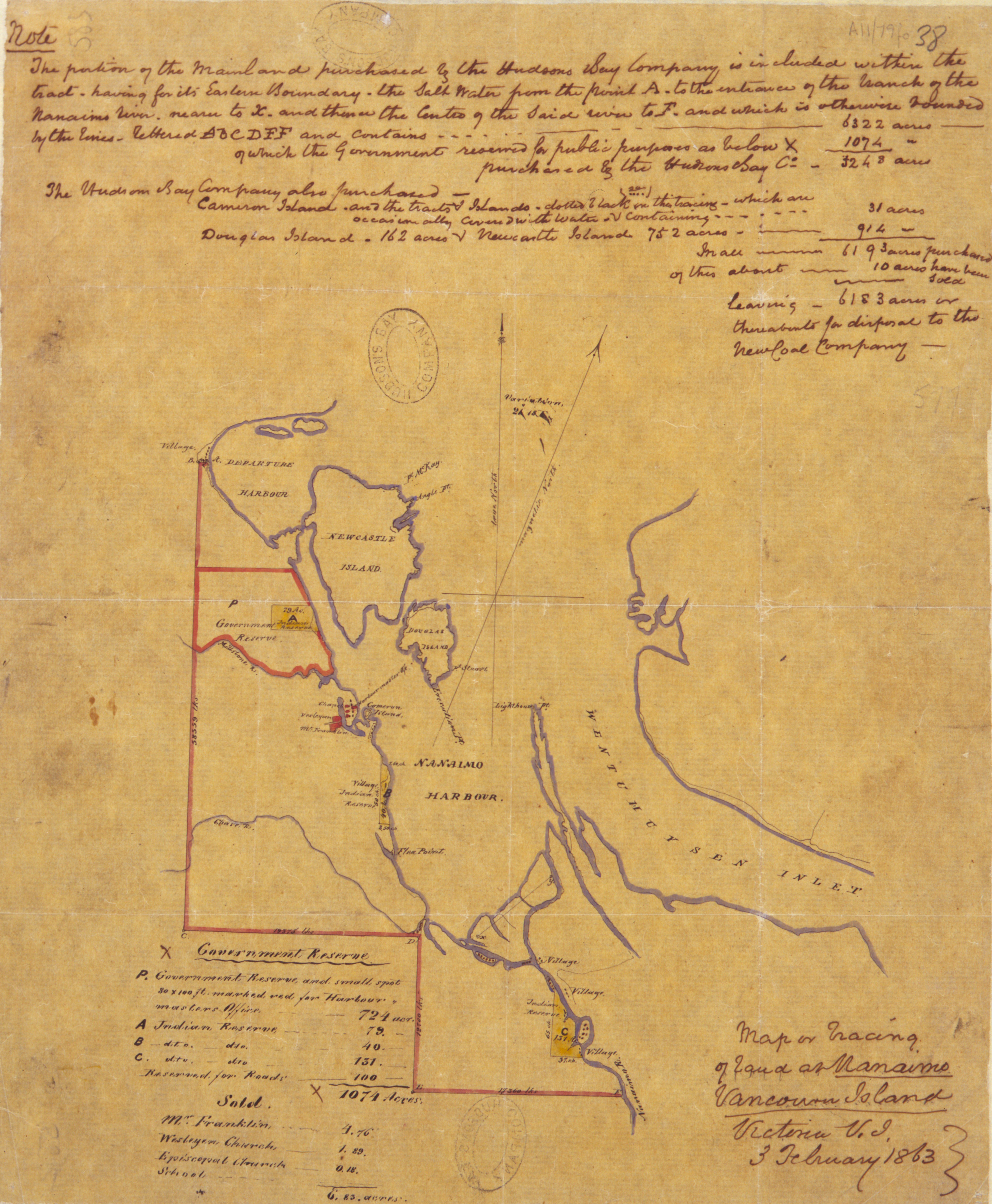
Item is a map. Village, Government Reserve, Millstone R., Chase R., Douglas Island,
Pt McKay, Angle Pt, . Pt., Stuart, Lighthouse Pt., Execution Pt., Harbourmaster Ofc.,
Chapel, Mt. Franklin, Vasleyan, Cameron Island, Indian Reserve, Flea Point, Departure
Harbour, Newcastle Island, Nanaimo Harbour, Wentumuysen Inlet, Nanaimo R. 32 x 26
cm
Unknown, Map or Tracing of Land at Nanaimo Vancouver Island Victoria V.I. 3 February 1863, 1863, Hudson's Bay Company Archives, A.11/79 fo. 38. The Colonial Despatches of Vancouver Island and British Columbia 1846-1871, Edition 2.6, ed. James Hendrickson and the Colonial Despatches project. Victoria,
B.C.: University of Victoria. https://bcgenesis.uvic.ca/A11-79_fo_38.html.
Title: Map or Tracing of Land at Nanaimo Vancouver Island Victoria V.I. 3 February 1863
Author: Unknown
Identifier (repository): HBC
Identifier (doc_id): A.11/79 fo. 38
Date: 1863
Publisher: Hudson's Bay Company Archives
Funder: Funded by a Canadian Council of Archives, Archival Community Digitization Program.