Colonial Despatches
The colonial despatches of Vancouver Island and British Columbia 1846-1871
Map gallery
| Title | Date | Description | |
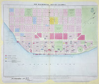 |
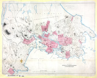
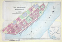
New Westminster, British Columbia, 1862. | 1862 |
Title: New Westminster, British Columbia, 1862. Author: Launders, James Benjamin, d. 1878. Subject: New Westminster (B.C.) -- Maps; City planning -- British Columbia -- New Westminster. Subject: British Columbia, 1861, 1862 Identifier (repository): CO Identifier (repoNumber): 700 Identifier (repoVol): bc Identifier (libFileName): CO700-BRITISH COLUMBIA11 (9) Identifier (penfoldNum): 401 Identifier (doc_id): CO700-BRITISH COLUMBIA11 (9) Date: 1862 Funder: Funded by a Canadian Council of Archives, Archival Community Digitization Program. Publisher: Great Britain. Army. Royal Engineers. Columbia Detachment. Publisher: National Archives of the UK. |
![Plan of Route from New Westminster to Fountain in British Columbia, by Lieut. H. S. Palmer, R.E., 1859. 4 miles to 1 inch. Author, Publisher, &c.: War Office, London. [British Columbia, 1859]](https://hcmc.uvic.ca/~coldesp/maps/maps_200/co_700-bc_8_1_new_west_to_fountain_1859.jpg) |
Plan of Route from New Westminster to Fountain in British Columbia, by Lieut. H. S. Palmer, R.E., 1859. 4 miles to 1 inch. Author, Publisher, &c.: War Office, London. [British Columbia, 1859] | 1859 |
Title: Plan of Route from New Westminster to Fountain in British Columbia, by Lieut. H. S. Palmer, R.E., 1859. 4 miles to 1 inch. Author, Publisher, &c.: War Office, London. [British Columbia, 1859] Identifier (repository): CO Identifier (repoNumber): 700 Identifier (repoVol): bc Identifier (libFileName): CO700-BRITISH COLUMBIA8 (1) Identifier (penfoldNum): 388 Identifier (doc_id): CO 700/BRITISH COLUMBIA8/1 Date: 1859 Funder: Funded by a Canadian Council of Archives, Archival Community Digitization Program. Publisher: National Archives of the UK. |
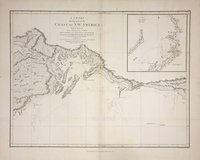 |
Chart shewing part of the coast of N.W. America, with the tracks of His Majesty's sloop Discovery and armed tender Chatham / ǂc commanded by George Vancouver, esqr. and prepared under his immediate inspection by Lieut. Joseph Baker, in which the continental shore has been correctly traced and determined from latd. 59⁰.45ʹ N. and longd. 219⁰.30ʹ E. to latd. 59⁰.56ʹ N. and longd. 212⁰.08ʹ E. at the periods shewn by the track ; engraved by T. Foot.Voyage of discovery to the North Pacific Ocean, and round the world. | 1798 |
Title: Chart shewing part of the coast of N.W. America, with the tracks of His Majesty's sloop Discovery and armed tender Chatham / ǂc commanded by George Vancouver, esqr. and prepared under his immediate inspection by Lieut. Joseph Baker, in which the continental shore has been correctly traced and determined from latd. 59⁰.45ʹ N. and longd. 219⁰.30ʹ E. to latd. 59⁰.56ʹ N. and longd. 212⁰.08ʹ E. at the periods shewn by the track ; engraved by T. Foot. Title: Voyage of discovery to the North Pacific Ocean, and round the world. Author: Vancouver, George, 1757-1798 Subject: Alaska -- Maps; Coasts -- Alaska -- Maps. Identifier (repository): FO Identifier (repoNumber): 925 Identifier (repoVol): 1386 Identifier (libFileName): FO925-1386 pt2 (11) Identifier (penfoldNum): Identifier (doc_id): FO 925/1386 Date: 1798 Funder: Funded by a Canadian Council of Archives, Archival Community Digitization Program. Publisher: J. Edwards & G. Robinson Publisher: National Archives of the UK. 62N-58 30'N/150W-140 30W |
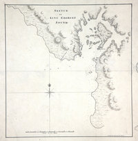 |
Sketch of King George's Sound (now Nootka Sound).Nootka Sound. | 1778 |
Title: Sketch of King George's Sound (now Nootka Sound). Title: Nootka Sound. Author: Roberts, Henry, Lieut. Subject: Nootka Sound (B.C.) -- Maps; Cook, James, 1728-1779 -- Journeys -- Maps. Subject: Nootka Sound, 1778 Identifier (repository): MPI Identifier (repoNumber): 1 Identifier (repoVol): 81 Identifier (libFileName): MPI1-81 (1) Identifier (penfoldNum): 541 Identifier (doc_id): MPI 1/81 Date: 1778 Funder: Funded by a Canadian Council of Archives, Archival Community Digitization Program. Publisher: National Archives of the UK. 49.350754 -126.948229 49.350754 -126.366117 49.754807 -126.366117 49.754807 -126.948229 49.350754 -126.948229 |
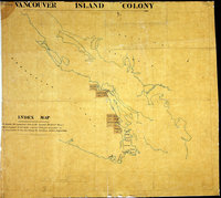 |
Index map: to explain the connection between the separate District Maps… | 1859 |
Title: Index map : to explain the connection between the separate District Maps… Subject: Vancouver Island (B.C.) -- Maps -- Indexes. Subject: Vancouver Island, 1859 Identifier (repository): MPG Identifier (repoNumber): 1 Identifier (repoVol): 249 Identifier (libFileName): MPG1-249 Identifier (penfoldNum): 569 Identifier (doc_id): MPG 1/249 Date: 1859 Funder: Funded by a Canadian Council of Archives, Archival Community Digitization Program. Publisher: National Archives of the UK. |
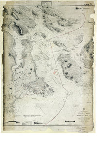 |
Haro Strait and Middle Channel. | 1861 |
Title: Haro Strait and Middle Channel. Author: Richards, G. H. (George Henry) Subject: Haro Strait (B.C. and Wash.)--Maps ; Nautical charts – Haro Strait (B.C. and Wash.) ; Victoria (B.C.)--Maps Subject: Haro Strait and Middle Channel, 1860, 1876, 1879 Identifier (repository): WO Identifier (repoNumber): 78 Identifier (repoVol): 2311 Identifier (libFileName): WO78-2311 (18) Identifier (penfoldNum): 480 Identifier (doc_id): WO 78/2311/18 Date: 1861 Funder: Funded by a Canadian Council of Archives, Archival Community Digitization Program. Publisher: Great Britain, Hydrographic Office Publisher: National Archives of the UK. |
 |
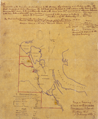
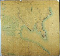
Quamichan District 1859.Vancouver Island Colony. Sketch Maps of Districts. | 1859 |
Title: Quamichan District 1859. Title: Vancouver Island Colony. Sketch Maps of Districts. Subject: Quamichan Region (B.C.) -- Maps; Vancouver Island (B.C.) -- Maps; Land use.. Subject: Vancouver Island, 1859 Identifier (repository): CO Identifier (repoNumber): 700 Identifier (repoVol): bc Identifier (libFileName): CO700-BRITISH COLUMBIA7 (6) Identifier (penfoldNum): 568 Identifier (doc_id): CO 700/BRITISH COLUMBIA7/6 Date: 1859 Funder: Funded by a Canadian Council of Archives, Archival Community Digitization Program. Publisher: Great Britain. War Office. Topographical Depot. Publisher: National Archives of the UK. |
 |
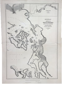
Map of the Districts of Victoria and Esquimalt in Vancouver Island.Districts of Victoria and Esquimalt in Vancouver Island. | 1854 |
Title: Map of the Districts of Victoria and Esquimalt in Vancouver Island. Title: Districts of Victoria and Esquimalt in Vancouver Island. Author: Arrowsmith, John, 1790-1873. Subject: Victoria (B.C.) -- Maps; Esquimalt (B.C.) -- Maps; Vancouver Island (B.C.) -- Maps; British Columiba -- History -- Maps; Indians of North America -- British Columbia -- Vancouver Island. Subject: Victoria and Esquimalt Districts, 1854 Identifier (repository): CO Identifier (repoNumber): 700 Identifier (repoVol): bc Identifier (libFileName): CO700-BRITISH COLUMBIA2 Identifier (penfoldNum): 590 Identifier (doc_id): CO 700/BRITISH COLUMBIA2 Date: 1854 Funder: Funded by a Canadian Council of Archives, Archival Community Digitization Program. Publisher: John Arrowsmith Publisher: National Archives of the UK. |
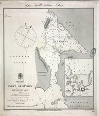 |
Port Simpson, 1853. | 1853 |
Title: Port Simpson, 1853. Author: Inskip (Master HMS Virago). Subject: Port Simpson (B.C.) -- Maps; Nautical charts -- British Columbia -- Port Simpson; Sparrowhawk (Ship). Identifier (repository): MFQ Identifier (repoNumber): 1 Identifier (repoVol): 632 Identifier (libFileName): MFQ1-632 (5) Identifier (penfoldNum): Identifier (doc_id): MFQ 1/632/5 Date: 1853 Funder: Funded by a Canadian Council of Archives, Archival Community Digitization Program. Publisher: Great Britain. Hydrographic Office. Publisher: National Archives of the UK. |
 |
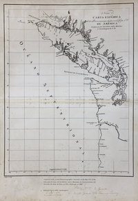
Carta reducida que comprehende parte de la Costa Septentrional de California, corregida y enmendata hasta la Boca del Estrecho de Fuca, y levantado el Plano el en la Espedicion que se hizo con la Balandra de S.M. nombrado la Princesa Rl al mando del Alferez de Navio de la Rl Armada Dn. Manuel Quimper en el ano de 1790.North America: Juan de Fuca Strait. | 1790 |
Title: Carta reducida que comprehende parte de la Costa Septentrional de California, corregida y enmendata hasta la Boca del Estrecho de Fuca, y levantado el Plano el en la Espedicion que se hizo con la Balandra de S.M. nombrado la Princesa Rl al mando del Alferez de Navio de la Rl Armada Dn. Manuel Quimper en el ano de 1790. Title: North America: Juan de Fuca Strait. Author: López de Haro, Gonzalo, d. 1823 Subject: Juan de Fuca Strait (B.C. and Wash.) -- Maps; Vancouver Island (B.C.) -- Maps; Nootka Sound (B.C.) -- Maps. Subject: Juan de Fuca, Strait, 1790 Identifier (repository): MPK Identifier (repoNumber): 1 Identifier (repoVol): 203 Identifier (libFileName): MPK1-203 (2) Identifier (penfoldNum): 497 Identifier (doc_id): MPK 1/203/2 Date: 1790 Funder: Funded by a Canadian Council of Archives, Archival Community Digitization Program. Publisher: National Archives of the UK. 50N-48N/122W-117W |
 |
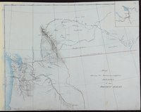
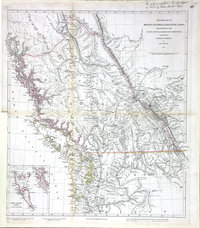
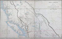
Map of part of British Columbia, showing proposed BoundariesBritish Columbia boundaries with Alaska. | 1858 |
Title: Map of part of British Columbia, showing proposed Boundaries Title: British Columbia boundaries with Alaska. Author: Wyld, James, 1812-1887 Subject: British Columbia -- Maps; British Columbia -- Boundaries -- Alaska -- Maps. Subject: British Columbia, 1858 Identifier (repository): CO Identifier (repoNumber): 700 Identifier (repoVol): bc Identifier (libFileName): CO700-BRITISH COLUMBIA4 Identifier (penfoldNum): 380 Identifier (doc_id): CO 700/BRITISH COLUMBIA4 Date: 1858 Funder: Funded by a Canadian Council of Archives, Archival Community Digitization Program. Publisher: National Archives of the UK. 65N-50N/140W-115W |
 |
Town of Victoria, V.I., sub-division of section no. 1 | 1863 |
Title: Town of Victoria, V.I., sub-division of section no. 1 Author: Tiedeman, H.O. Subject: City planning--British Columbia--Victoria--Maps.; Victoria (B.C.)--Maps Subject: Victoria, 1863 Identifier (repository): CO Identifier (repoNumber): 700 Identifier (repoVol): bc Identifier (libFileName): CO700-BRITISH COLUMBIA12 Identifier (penfoldNum): 581 Identifier (doc_id): CO700-BRITISH COLUMBIA12 Date: 1863 Funder: Funded by a Canadian Council of Archives, Archival Community Digitization Program. Publisher: Waterlow & Sons Publisher: National Archives of the UK. |
 |
Sketch of Nisqually and adjacent Plains on Puget's Sound.Nisqually, Puget Sound | 1845 |
Title: Sketch of Nisqually and adjacent Plains on Puget's Sound. Title: Nisqually, Puget Sound Author: Vavasour, M (Mervin), 1821-1866 Subject: Nisqually River Valley (Wash.) -- Maps; Nisqually River (Wash.) -- Maps; Fort Nisqually (Wash.) -- Maps; Puget Sound (Wash.) -- Maps Identifier (repository): MPHH Identifier (repoNumber): 1 Identifier (repoVol): 459 Identifier (libFileName): MPHH1-459 (4) Identifier (penfoldNum): Identifier (doc_id): MPHH 1/459/4 Date: 1845 Funder: Funded by a Canadian Council of Archives, Archival Community Digitization Program. Publisher: National Archives of the UK. |
 |
Sketch shewing the route (in red) from Red River to the Pacific Ocean. | 1845 |
Title: Sketch shewing the route (in red) from Red River to the Pacific Ocean. Author: Vavasour, M. (Mervin), 1821-1866 Subject: Canada, Western -- Maps; British Columbia -- Maps; West (U.S.) -- Maps. Identifier (repository): MPHH Identifier (repoNumber): 1 Identifier (repoVol): 459 Identifier (libFileName): MPHH1-459 (8) Identifier (penfoldNum): Identifier (doc_id): MPHH 1/459/8 Date: 1845 Funder: Funded by a Canadian Council of Archives, Archival Community Digitization Program. Publisher: National Archives of the UK. |
 |
Map or Tracing of Land at Nanaimo Vancouver Island Victoria V.I. 3 February 1863 | 1863 |
Title: Map or Tracing of Land at Nanaimo Vancouver Island Victoria V.I. 3 February 1863 Author: Unknown Identifier (repository): HBC Identifier (doc_id): A.11/79 fo. 38 Date: 1863 Publisher: Hudson's Bay Company Archives Funder: Funded by a Canadian Council of Archives, Archival Community Digitization Program. |
![Map of area either side of the boundary between British Columbia and the United States of America [recto].](https://hcmc.uvic.ca/~coldesp/maps/maps_200/mpk_1-78_2_boundary_columbia_to_sask_1861.jpg) |
Map of area either side of the boundary between British Columbia and the United States of America [recto]. | 1861 |
Title: Map of area either side of the boundary between British Columbia and the United States of America [recto]. Author: Hawkins, J. S. (John Summerfield), 1812-1895 Subject: British Columbia -- Maps; Washington (State) -- Maps; North American Boundary Commission. Identifier (repository): MPK Identifier (repoNumber): 1 Identifier (repoVol): 78 Identifier (libFileName): MPK1-78 (1); MPK1-78 (1a) Identifier (penfoldNum): Identifier (doc_id): MPK 1/78 Date: 1861 Funder: Funded by a Canadian Council of Archives, Archival Community Digitization Program. Publisher: National Archives of the UK. 50N-47 47'N/118 30'W-113 30'W |
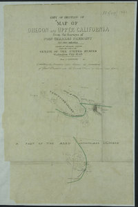 |
Copy of Section of ""Map of Oregon and Upper California From the Surveys of John Charles Fremont and other Authorities.Map of Oregon and Upper California From the Surveys of John Charles Fremont And other Authorities. | 1854 |
Title: Copy of Section of ""Map of Oregon and Upper California From the Surveys of John Charles Fremont and other Authorities. Title: Map of Oregon and Upper California From the Surveys of John Charles Fremont And other Authorities. Author: Preuss, Charles, 1803-1854 Subject: United States -- Boundaries -- Maps; Canada -- Boundaries -- Maps; North American Boundary Commission. Identifier (repository): MPK Identifier (repoNumber): 1 Identifier (repoVol): 77 Identifier (libFileName): MPK1-77 (8) Identifier (penfoldNum): Identifier (doc_id): MPK 1/77/8 Date: 1854 Funder: Funded by a Canadian Council of Archives, Archival Community Digitization Program. Publisher: National Archives of the UK. 49N/126W-122W |
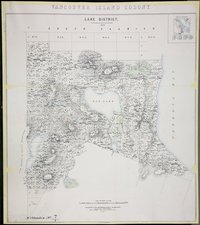 |
Lake District 1859.Vancouver Island Colony. Sketch Maps of Districts. | 1859 |
Title: Lake District 1859. Title: Vancouver Island Colony. Sketch Maps of Districts. Author: Great Britain. War Office. Topographical Depot Subject: Elk Lake (B.C.) -- Maps; Elk Lake Region (B.C.) -- Maps; British Columbia -- Elk Lake -- Maps; Vancouver Island -- Maps; Land use. Subject: Vancouver Island, 1859 Identifier (repository): CO Identifier (repoNumber): 700 Identifier (repoVol): bc Identifier (libFileName): CO700-BRITISH COLUMBIA7 (9) Identifier (penfoldNum): 568 Identifier (doc_id): CO 700/BRITISH COLUMBIA7/9 Date: 1859 Funder: Funded by a Canadian Council of Archives, Archival Community Digitization Program. Publisher: National Archives of the UK. |
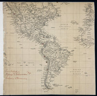 |
Map showing America, the eastern Pacific and Atlantic Oceans, the British Isles, France, Spain and West Africa.America, the eastern Pacific and Atlantic Oceans, the British Isles, France, Spain and West Africa. | 1859 |
Title: Map showing America, the eastern Pacific and Atlantic Oceans, the British Isles, France, Spain and West Africa. Title: America, the eastern Pacific and Atlantic Oceans, the British Isles, France, Spain and West Africa. Author: Baynes, R. L. (Robert Lambert), 1796-1869 Subject: North America -- Maps; South America -- Maps; Central America -- Maps; Pacific Ocean -- Maps; Atlantic Ocean -- Maps; British Isles -- Maps; France -- Maps; Spain -- Maps; West Africa -- Maps; Great Britain. Royal Navy. British Pacific Fleet Identifier (repository): MFQ Identifier (repoNumber): 1 Identifier (repoVol): 632 Identifier (libFileName): MFQ1-632 (1) Identifier (penfoldNum): Identifier (doc_id): MFQ1-632 (1) Date: 1859 Funder: Funded by a Canadian Council of Archives, Archival Community Digitization Program. Publisher: National Archives of the UK. |
 |
New Westminster, British Columbia, 1861. | 1861 |
Title: New Westminster, British Columbia, 1861. Author: Conroy, James. Subject: New Westminster (B.C.) -- Maps; City planning -- British Columbia -- New Westminster. Subject: British Columbia, 1861, 1862 Identifier (repository): CO Identifier (repoNumber): 700 Identifier (repoVol): bc Identifier (libFileName): CO700-BRITISH COLUMBIA11 (8) Identifier (penfoldNum): 401 Identifier (doc_id): CO 700/BRITISH COLUMBIA11/8 Date: 1861 Funder: Funded by a Canadian Council of Archives, Archival Community Digitization Program. Publisher: Great Britain. Army. Royal Engineers. Columbia Detachment. Publisher: National Archives of the UK. |
 |
Provinces of British Columbia and Vancouver Island; with portions of the United States and Hudson's Bay Territories. | 1864 |
Title: Provinces of British Columbia and Vancouver Island; with portions of the United States and Hudson's Bay Territories. Author: Arrowsmith, John, 1790-1873. Subject: British Columbia -- Maps; Washington (State) -- Maps; Haida Gwaii (B.C.) -- Maps; Alberta -- Maps; Indians of North America -- British Columbia; Indians of North America -- Alberta; Indians of North America -- Washington (State). Subject: British Columbia, Alberta, Washington, 1864 Identifier (repository): CO Identifier (repoNumber): 700 Identifier (repoVol): bc Identifier (libFileName): CO700-BRITISH COLUMBIA13 Identifier (penfoldNum): 417 Identifier (doc_id): CO700-BRITISH COLUMBIA13 Date: 1864 Funder: Funded by a Canadian Council of Archives, Archival Community Digitization Program. Publisher: Edward Stanford Ltd. Publisher: National Archives of the UK. |
 |
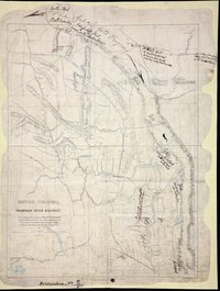
Thompson River District, from a Map in the possession of H. E. Gov. Douglas, C.B., made in 1835 by S. Black, Esq., Hudson's Bay Company's service. The positions of New Westminster, Douglas & Hope, are those determined by the Royal Engineers. | 1861 |
Title: Thompson River District, from a Map in the possession of H. E. Gov. Douglas, C.B., made in 1835 by S. Black, Esq., Hudson's Bay Company's service. The positions of New Westminster, Douglas & Hope, are those determined by the Royal Engineers. Author: Armstrong, Robert. Subject: Thompson River (B.C.) -- Maps; British Columbia -- Maps; Cariboo Region (B.C.) -- Maps; Cariboo (B.C. : Regional district) Subject: British Columbia, 1861 Identifier (repository): CO Identifier (repoNumber): 700 Identifier (repoVol): bc Identifier (libFileName): CO700-BRITISH COLUMBIA8 (5) Identifier (penfoldNum): 395 Identifier (doc_id): CO 700/BRITISH COLUMBIA8/5 Date: 1861 Funder: Funded by a Canadian Council of Archives, Archival Community Digitization Program. Publisher: Great Britain. Army. Royal Engineers. Columbia Detachment. Publisher: National Archives of the UK. 53N--49N / 123W--118W |
![San Juan Water Boundary (Arbitration) : list of maps sent to Admiral Prevost at Berlin on the 12th June 1872 [map 17] Carta esferica de los reconocimientos hechos en 1792 en la costa n.o. de America](https://hcmc.uvic.ca/~coldesp/maps/maps_200/fo_925-1650_pt_1_17_van_isl_1795.jpg) |
San Juan Water Boundary (Arbitration) : list of maps sent to Admiral Prevost at Berlin on the 12th June 1872 [map 17]Carta esferica de los reconocimientos hechos en 1792 en la costa n.o. de America | 1795 |
Title: San Juan Water Boundary (Arbitration) : list of maps sent to Admiral Prevost at Berlin on the 12th June 1872 [map 17] Title: Carta esferica de los reconocimientos hechos en 1792 en la costa n.o. de America Author: Alcalá-Galiano, Dionisio, 1760-1805; Valdes y Florez, Cayetano, 1767-1835 Subject: Juan de Fuca Strait (B.C. and Wash.)--Maps; Rosario Strait (Wash.)--Maps; Vancouver Island (B.C.)--Maps; Washington (State)--Maps; Canada--Boundaries--Maps; United States--Boundaries--Maps Subject: Juan de Fuca, Strait, 1795, 1872 Identifier (repository): FO Identifier (repoNumber): 925 Identifier (repoVol): 1650 Identifier (libFileName): FO925-1650 pt1 (17) Identifier (penfoldNum): 504 Identifier (doc_id): FO 925/1650 Date: 1795 Funder: Funded by a Canadian Council of Archives, Archival Community Digitization Program. Publisher: National Archives of the UK. 51 00'N--47 00'N / 125 00'W--115 00'W |
 |
Sketch map of part of British Columbia shewing trails and routes of communication. | 1860 |
Title: Sketch map of part of British Columbia shewing trails and routes of communication. Author: Launders, James Benjamin, d. 1878; Moody, R. C. (Richard Clement), 1813-1887 Subject: British Columbia, Southern -- Maps; Roads -- British Columbia, Southern -- Maps Subject: British Columbia, 1860 Identifier (repository): MPG Identifier (repoNumber): 1 Identifier (repoVol): 657 Identifier (libFileName): MPG1-657 Identifier (penfoldNum): 390 Identifier (doc_id): MPG 1/657 Date: 1860 Funder: Funded by a Canadian Council of Archives, Archival Community Digitization Program. Publisher: Great Britain. Army. Royal Engineers. Columbia Detachment. Publisher: National Archives of the UK. |
 |
Plan of Williams Creek, Caribou.Williams Creek | 1862 |
Title: Plan of Williams Creek, Caribou. Title: Williams Creek Subject: Williams Creek (B.C.) -- Maps; Gold mines and mining -- British Columbia -- Williams Creek; Gold mines and mining -- Cariboo Region (B.C.); Cariboo Region (B.C.) -- Gold discoveries; Mining claims -- British Columbia; Mining corporations -- British Columbia. Subject: Williams Creek, 1862 Identifier (repository): MPG Identifier (repoNumber): 1 Identifier (repoVol): 648 Identifier (libFileName): MPG1-648 (4) Identifier (penfoldNum): 592 Identifier (doc_id): MPG1-648 (4) Date: 1862 Funder: Funded by a Canadian Council of Archives, Archival Community Digitization Program. Publisher: National Archives of the UK. |
 |
Map of the subdivisions of Beckley Farm and the Lands South and West of James Bay, Victoria, Vancouver Island. 7th. January 1863.Beckley Farm | 1863 |
Title: Map of the subdivisions of Beckley Farm and the Lands South and West of James Bay, Victoria, Vancouver Island. 7th. January 1863. Title: Beckley Farm Subject: Victoria (B.C.) -- Maps; James Bay (Victoria, B.C.) -- Maps; Vancouver Island (B.C.) -- Victoria -- Maps; City planning -- British Columbia -- Victoria. Subject: Victoria, 1863 Identifier (repository): MPG Identifier (repoNumber): 1 Identifier (repoVol): 659 Identifier (libFileName): MPG1-659 Identifier (penfoldNum): 582 Identifier (doc_id): MPG1-659 Date: 1863 Funder: Funded by a Canadian Council of Archives, Archival Community Digitization Program. Publisher: National Archives of the UK. |
 |
Sketch map of the country north and east of Bute Inlet to the Chilanko, Chezech and Chilko Rivers. | 1864 |
Title: Sketch map of the country north and east of Bute Inlet to the Chilanko, Chezech and Chilko Rivers. Author: Cox, William George. Subject: Chilcotin War, 1864 -- Maps; Chilcotin Plateau (B.C.) -- Maps; Chilcotin Indians Subject: British Columbia, 1864 Identifier (repository): MPG Identifier (repoNumber): 1 Identifier (repoVol): 654 Identifier (libFileName): MPG1-654 (1) Identifier (penfoldNum): 416 Identifier (doc_id): MPG1-654 (1) Date: 1864 Funder: Funded by a Canadian Council of Archives, Archival Community Digitization Program. Publisher: National Archives of the UK. |
 |
Cape Flattery to Dixon entrance. | 1868 |
Title: Cape Flattery to Dixon entrance. Author: U.S. Coast and Geodetic Survey. Subject: Dixon Entrance (B.C. and Alaska) -- Maps; Nautical charts -- Dixon Entrance (B.C. and Alaska); Flattery, Cape (Wash.) -- Maps; Nautical charts -- Washington (State) -- Flattery, Cape; Pacific Coast (B.C.) -- Maps; Pacific Coast (Alaska) -- Maps; Alaska -- Boundaries -- Canada. Subject: British Columbia, 1868, 1886 Identifier (repository): CO Identifier (repoNumber): 700 Identifier (repoVol): canada Identifier (libFileName): CO700-CANADA144 (5) Identifier (penfoldNum): 425 Identifier (doc_id): CO700-CANADA144 (5) Date: 1868 Funder: Funded by a Canadian Council of Archives, Archival Community Digitization Program. Publisher: National Archives of the UK. 54N-48N/136W-122W |
 |
Map of British Columbia to the 56th Parallel North Latitude.British Columbia to the 56th Parallel North Latitude. | 1871 |
Title: Map of British Columbia to the 56th Parallel North Latitude. Title: British Columbia to the 56th Parallel North Latitude. Author: Trutch, Joseph W. (Joseph William), Sir, 1826-1904. Subject: British Columbia -- Maps; Washington (State) -- Maps; Alberta -- Maps; Alaska -- Maps. Subject: British Columbia, 1871 Identifier (repository): CO Identifier (repoNumber): 700 Identifier (repoVol): bc Identifier (libFileName): CO700-BRITISH COLUMBIA15 Identifier (penfoldNum): 430 Identifier (doc_id): CO700-BRITISH COLUMBIA15 Date: 1871 Funder: Funded by a Canadian Council of Archives, Archival Community Digitization Program. Publisher: Edward Stanford Ltd. Publisher: National Archives of the UK. |
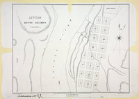 |
Lytton, British Columbia. | 1861 |
Title: Lytton, British Columbia. Author: McColl, William, d. 1864 Subject: Lytton (B.C.) -- Maps; City planning -- British Columiba -- Lytton. Subject: British Columbia, 1861, 1862 Identifier (repository): CO Identifier (repoNumber): 700 Identifier (repoVol): bc Identifier (libFileName): CO700-BRITISH COLUMBIA11 (4) Identifier (penfoldNum): 401 Identifier (doc_id): CO 700/BRITISH COLUMBIA11/4 Date: 1861 Funder: Funded by a Canadian Council of Archives, Archival Community Digitization Program. Publisher: Breat Britain. Army. Royal Engineers. Columbia Detachment. Publisher: National Archives of the UK. |
 |
British Columbia. Coast lines from Admiralty Charts, interior from Explorations by Royal Engineers and others up to 1862. North of Fraser River from Mr. Arrowsmith. East of Columbia River from Captain Palliser. | 1862 |
Title: British Columbia. Coast lines from Admiralty Charts, interior from Explorations by Royal Engineers and others up to 1862. North of Fraser River from Mr. Arrowsmith. East of Columbia River from Captain Palliser. Author: Conroy, James. Subject: British Columbia -- Maps; Vancouver Island (B.C.) -- Maps; Dioceses. Subject: British Columbia, 1862, 1864 Identifier (repository): MPG Identifier (repoNumber): 1 Identifier (repoVol): 656 Identifier (libFileName): MPG1-656 Identifier (penfoldNum): 410 Identifier (doc_id): MPG1-656 Date: 1862 Funder: Funded by a Canadian Council of Archives, Archival Community Digitization Program. Publisher: British Columbia. Dept. of Lands and Works. Publisher: National Archives of the UK. 57N-48N/133W-110W |
![San Juan boundary dispute maps [map A]. Map of de Haro 1790.](https://hcmc.uvic.ca/~coldesp/maps/maps_200/fo_925-1649-a_j_d_f_s_1790.jpg) |
San Juan boundary dispute maps [map A].Map of de Haro 1790. | 1790 |
Title: San Juan boundary dispute maps [map A]. Title: Map of de Haro 1790. Author: López de Haro, Gonzalo, d. 1823. Subject: Juan de Fuca, Strait of (B.C. and Wash.) -- Maps; Haro Strait (B.C. and Wash.) -- Maps; San Juan Boundary Dispute, 1846-1872 Subject: Juan de Fuca, Strait, 1790, 1873 Identifier (repository): FO Identifier (repoNumber): 925 Identifier (repoVol): 1649a Identifier (libFileName): FO925-1649 (a) Identifier (penfoldNum): 500 Identifier (doc_id): FO 925/1649 Date: 1790 Funder: Funded by a Canadian Council of Archives, Archival Community Digitization Program. Publisher: Harrison & Sons Lith. Publisher: National Archives of the UK. |
 |
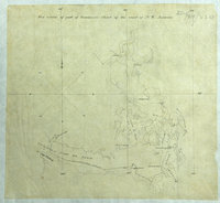
Sketch of the South East Corner of Vancouvers IslandA sketchmap enclosed with Douglas to Earl Grey, 25 June 1852, No. 5, 9099, CO 305/3, p. 118 | 1852 |
Title: Sketch of the South East Corner of Vancouvers Island Title: A sketchmap enclosed with Douglas to Earl Grey, 25 June 1852, No. 5, 9099, CO 305/3, p. 118 Identifier (repository): CO Identifier (repoNumber): 305 Identifier (repoVol): 3 Identifier (libFileName): Identifier (penfoldNum): Identifier (doc_id): CO 305/3 00123r Date: 1852 Funder: Funded by a Canadian Council of Archives, Archival Community Digitization Program. Publisher: National Archives of the UK. 48.387955 -123.249503 48.527305 -123.249503 48.527305 -123.491093 48.387955 -123.491093 |
![San Juan Water Boundary (Arbitration) : list of maps sent to Admiral Prevost at Berlin on the 12th June 1872 [map 8]](https://hcmc.uvic.ca/~coldesp/maps/maps_200/fo_925-1650_pt_1_8_1779.jpg) |
San Juan Water Boundary (Arbitration) : list of maps sent to Admiral Prevost at Berlin on the 12th June 1872 [map 8] | 1779 |
Title: San Juan Water Boundary (Arbitration) : list of maps sent to Admiral Prevost at Berlin on the 12th June 1872 [map 8] Subject: Pacific Coast (U.S.)--Maps; Pacific Coast (B.C.)--Maps; Canada--Boundaries--Maps; United States--Boundaries--Maps Subject: British Columbia, Washington, 1779, 1872 Identifier (repository): FO Identifier (repoNumber): 925 Identifier (repoVol): 1650 Identifier (libFileName): FO925-1650 pt1 (8) Identifier (penfoldNum): 356 Identifier (doc_id): FO 925/1650 Date: 1779 Funder: Funded by a Canadian Council of Archives, Archival Community Digitization Program. Publisher: National Archives of the UK. 45 -130.29 45 -120.29 50 -120.29 50 -130.29 45 -130.29 |
![San Juan Water Boundary (Arbitration) : list of maps sent to Admiral Prevost at Berlin on the 12th June 1872 [map 38] Haro and Rosario Straits](https://hcmc.uvic.ca/~coldesp/maps/maps_200/fo_925-1650_pt_2_38_1861.jpg) |
San Juan Water Boundary (Arbitration) : list of maps sent to Admiral Prevost at Berlin on the 12th June 1872 [map 38]Haro and Rosario Straits | 1861 |
Title: San Juan Water Boundary (Arbitration) : list of maps sent to Admiral Prevost at Berlin on the 12th June 1872 [map 38] Title: Haro and Rosario Straits Author: Richards, G.H. (George Henry) Subject: Haro Strait (B.C. and Wash.)--Maps; Rosario Strait (Wash.)--Maps; Georgia, Gulf of (B.C. and Wash.)--Maps; Canada-- Boundaries—Maps; United States—Boundaries—Maps Subject: Haro and Rosario Straits, 1859, 1868, 1872 Identifier (repository): FO Identifier (repoNumber): 925 Identifier (repoVol): 1650 Identifier (libFileName): FO925-1650 pt2 (38) Identifier (penfoldNum): 488 Identifier (doc_id): FO 925/1650 Date: 1861 Funder: Funded by a Canadian Council of Archives, Archival Community Digitization Program. Publisher: J. & C. Walker Publisher: National Archives of the UK. 49 15'N--48 05'N / 123 35'W--122 25'W |
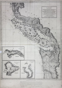 |
Chart shewing part of the coast of N.W. America : with the tracks of His Majesty's sloop Discovery and armed tender Chatham commanded by George Vancouver, esqr. and prepared under his immediate inspection by Lieut. Joseph Baker, in which the continental shore has been traced and determined from lat: 45⁰, 30ʹ N. and long. 236⁰, 12ʹ E. to lat: 52⁰, 15ʹ N. and long. 232⁰, 40ʹ E. at the different periods shewn by the tracks ; Warner, sculp. | 1798 |
Title: Chart shewing part of the coast of N.W. America : with the tracks of His Majesty's sloop Discovery and armed tender Chatham commanded by George Vancouver, esqr. and prepared under his immediate inspection by Lieut. Joseph Baker, in which the continental shore has been traced and determined from lat: 45⁰, 30ʹ N. and long. 236⁰, 12ʹ E. to lat: 52⁰, 15ʹ N. and long. 232⁰, 40ʹ E. at the different periods shewn by the tracks ; Warner, sculp. Author: Vancouver, George, 1757-1798 Subject: Juan de Fuca Strait (B.C. and Wash.) -- Maps; Vancouver Island (B.C.) -- Maps; San Juan Boundary Dispute, 1846-1872; Coasts -- British Columbia -- Maps; Coasts -- Washington (State) -- Maps . Subject: British Columbia, Washington, 1798, 1871 Identifier (repository): FO Identifier (repoNumber): 925 Identifier (repoVol): 1885 Identifier (libFileName): FO925-1885 Identifier (penfoldNum): 371 Identifier (doc_id): FO 925/1885 Date: 1798 Funder: Funded by a Canadian Council of Archives, Archival Community Digitization Program. Publisher: Great Britain. Ordnance Survey. Publisher: National Archives of the UK. 52 15'N-45 30'N/129 30'W-122 30'W. |
 |
Victoria District. Lot 24. Section XVIII | 1853 |
Title: Victoria District. Lot 24. Section XVIII Author: J.D. Pemberton Identifier (repository): HBC Identifier (doc_id): A.37/42 fos. 190b-191 Date: 1853 Publisher: Hudson's Bay Company Archives Funder: Funded by a Canadian Council of Archives, Archival Community Digitization Program. |
 |
Nass Bay.North America, west coast. British Columbia. Nass Bay. | 1872 |
Title: Nass Bay. Title: North America, west coast. British Columbia. Nass Bay. Author: Pender, Daniel R., d. 1891. Subject: Nass Bay (B.C.) -- Maps; Nautical charts -- British Columbia -- Nass Bay; Nass river (B.C.) -- Maps; Nautical charts -- British Columbia -- Nass River; Alaska -- Boundaries -- Canada Subject: Nass Bay, 1868, 1872 Identifier (repository): CO Identifier (repoNumber): 700 Identifier (repoVol): canada Identifier (libFileName): CO700-CANADA144 (17) Identifier (penfoldNum): 534 Identifier (doc_id): CO700-CANADA144 (17) Date: 1872 Funder: Funded by a Canadian Council of Archives, Archival Community Digitization Program. Publisher: Great Britain. Hydrographic Office. Publisher: National Archives of the UK. |
 |
Comiaken District 1859.Vancouver Island Colony. Sketch Maps of Districts. | 1859 |
Title: Comiaken District 1859. Title: Vancouver Island Colony. Sketch Maps of Districts. Subject: Vancouver Island (B.C.) -- Maps; Comiaken Region (B.C.) -- Maps; Land use. Subject: Vancouver Island, 1859 Identifier (repository): CO Identifier (repoNumber): 700 Identifier (repoVol): bc Identifier (libFileName): CO700-BRITISH COLUMBIA7 (7) Identifier (penfoldNum): 568 Identifier (doc_id): CO 700/BRITISH COLUMBIA7/7 Date: 1859 Funder: Funded by a Canadian Council of Archives, Archival Community Digitization Program. Publisher: Great Britain. War Office. Topographical Depot. Publisher: National Archives of the UK. |
 |
Thompson River District, from a Map in the possession of H. E. Gov. Douglas, C.B., made in 1835 by S. Black, Esq., Hudson's Bay Company's service. The positions of New Westminster, Douglas & Hope, are those determined by the Royal Engineers. | 1861 |
Title: Thompson River District, from a Map in the possession of H. E. Gov. Douglas, C.B., made in 1835 by S. Black, Esq., Hudson's Bay Company's service. The positions of New Westminster, Douglas & Hope, are those determined by the Royal Engineers. Author: Armstrong, Robert. Subject: Thompson River (B.C.) -- Maps; British Columbia -- Maps; Cariboo Region (B.C.) -- Maps; Cariboo (B.C. : Regional district) Subject: British Columbia, 1861 Identifier (repository): CO Identifier (repoNumber): 700 Identifier (repoVol): bc Identifier (libFileName): CO700-BRITISH COLUMBIA8 (5) Identifier (penfoldNum): 395 Identifier (doc_id): CO 700/BRITISH COLUMBIA8/5 Date: 1861 Funder: Funded by a Canadian Council of Archives, Archival Community Digitization Program. Publisher: Great Britain. Army. Royal Engineers. Columbia Detachment. Publisher: National Archives of the UK. 53N--49N / 123W--118W |
![San Juan Water Boundary (Arbitration) : list of maps sent to Admiral Prevost at Berlin on the 12th June 1872 [map 37] Part II n.w. America Vancouver Isln](https://hcmc.uvic.ca/~coldesp/maps/maps_200/fo_925-1650_pt_2_37_1775_1866.jpg) |
San Juan Water Boundary (Arbitration) : list of maps sent to Admiral Prevost at Berlin on the 12th June 1872 [map 37]Part II n.w. America Vancouver Isln | date_unknown |
Title: San Juan Water Boundary (Arbitration) : list of maps sent to Admiral Prevost at Berlin on the 12th June 1872 [map 37] Title: Part II n.w. America Vancouver Isln Author: Richards, G.H. (George Henry) Subject: Vancouver Island (B.C.)--Maps; Juan de Fuca Strait (B.C. and Wash.)--Maps; Haro Strait (B.C. and Wash.)--Maps; Rosario Strait (Wash.)--Maps; Canada--Boundaries--Maps; United States--Boundaries--Maps Identifier (repository): FO Identifier (repoNumber): 925 Identifier (repoVol): 1650 Identifier (libFileName): FO925-1650 pt2 (37) Identifier (penfoldNum): Identifier (doc_id): FO925-1650 pt2 (37) Date: date_unknown Funder: Funded by a Canadian Council of Archives, Archival Community Digitization Program. Publisher: National Archives of the UK. |
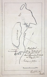 |
Sketch showing the position of a rock at Port Simpson (now Lax Kw'alaams), British Columbia (now in Canada) on which HMS Sparrowhawk struck on May 16 1866, with Fort Simpson, Finlayson Island and the track of the ship. | 1866 |
Title: Sketch showing the position of a rock at Port Simpson (now Lax Kw'alaams), British Columbia (now in Canada) on which HMS Sparrowhawk struck on May 16 1866, with Fort Simpson, Finlayson Island and the track of the ship. Author: Christie, George Subject: Port Simpson (B.C.) -- Maps; Nautical charts -- British Columbia -- Port Simpson; Sparrowhawk (Ship). Identifier (repository): MFQ Identifier (repoNumber): 1 Identifier (repoVol): 632 Identifier (libFileName): MFQ1-632 (6) Identifier (penfoldNum): Identifier (doc_id): MFQ1-632 (6) Date: 1866 Funder: Funded by a Canadian Council of Archives, Archival Community Digitization Program. Publisher: National Archives of the UK. |
![San Juan Boundary Arbitration atlas [map 5]. Archipelago of Arro, Gulf of Georgia, Ringgold's Channel and Straits of Fuca, Oregon Territory.](https://hcmc.uvic.ca/~coldesp/maps/maps_200/fo_925-1647b_5_1841.jpg) |
San Juan Boundary Arbitration atlas [map 5].Archipelago of Arro, Gulf of Georgia, Ringgold's Channel and Straits of Fuca, Oregon Territory. | 1841 |
Title: San Juan Boundary Arbitration atlas [map 5]. Title: Archipelago of Arro, Gulf of Georgia, Ringgold's Channel and Straits of Fuca, Oregon Territory. Author: United States Exploring Expedition (1838-1842) Subject: San Juan Boundary Dispute, 1846-1872; Juan de Fuca Strait (B.C. and Wash.)--Maps; Georgia, Strait of (B.C. and Wash.)--Maps; San Juan Islands (Wash.)--Maps; Gulf Islands (B.C.)--Maps; Pacific Coast (B.C.)--Maps; Pacific Coast (U.S.)--Maps; Canada--Boundaries--Maps; United States--Boundaries--Maps; Fraser River (B.C.); Nautical charts. Identifier (repository): FO Identifier (repoNumber): 925 Identifier (repoVol): 1647b Identifier (libFileName): FO925-1647B (5) Identifier (penfoldNum): Identifier (doc_id): FO 925/1647B Date: 1841 Funder: Funded by a Canadian Council of Archives, Archival Community Digitization Program. Publisher: Great Britain. Ordnance Survey. Publisher: National Archives of the UK. 49 00'N--48 00'N / 123 00'W--122 30'W |
 |
Shawnigan District, 1859. | 1859 |
Title: Shawnigan District, 1859. Subject: Shawnigan Region (B.C.) -- Maps; Shawnigan Lake (B.C.) -- Maps; Vancouver Island (B.C.) -- Maps. Subject: Vancouver Island, 1859 Identifier (repository): MPG Identifier (repoNumber): 1 Identifier (repoVol): 243 Identifier (libFileName): MPG1-243 Identifier (penfoldNum): 569 Identifier (doc_id): MPG 1/243 Date: 1859 Funder: Funded by a Canadian Council of Archives, Archival Community Digitization Program. Publisher: National Archives of the UK. |
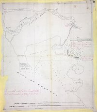 |
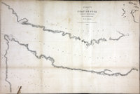
Chart of the west coast of North America either side of the forty-ninth parallel.West coast of North America. | 1857 |
Title: Chart of the west coast of North America either side of the forty-ninth parallel. Title: West coast of North America. Author: Roberts, J. Subject: British Columbia -- Maps; Washington (State) -- Maps; Georgia, Strait of (B.C. and Wash.) -- Maps; Fraser River (B.C.) -- Maps; North American Boundary Commission Subject: Georgia, Strait, 1857 Identifier (repository): MPK Identifier (repoNumber): 1 Identifier (repoVol): 66 Identifier (libFileName): MPK1-66 (1) Identifier (penfoldNum): 478 Identifier (doc_id): MPK 1/66/1 Date: 1857 Funder: Funded by a Canadian Council of Archives, Archival Community Digitization Program. Publisher: National Archives of the UK. 49 20'N-48 50'N/123 10'W-122 50'W |
 |
Map of parts of British Columbia, Alberta and the States of Washington, Idaho and Montana. | 1861 |
Title: Map of parts of British Columbia, Alberta and the States of Washington, Idaho and Montana. Author: Hawkins, J. S. (John Summerfield), 1812-1895 Subject: North American Boundary Commission; British Columbia -- Maps; Alberta -- maps; Washington (State) -- Maps; Idaho -- Maps; Montana -- Maps. Identifier (repository): MPG Identifier (repoNumber): 1 Identifier (repoVol): 409 Identifier (libFileName): MPG1-409 Identifier (penfoldNum): Identifier (doc_id): MPG 1/409 Date: 1861 Funder: Funded by a Canadian Council of Archives, Archival Community Digitization Program. Publisher: National Archives of the UK. 50 30'N-47 43'N/118 30'W-113 30'W |
 |
Chart shewing part of the coast of N.W. America : with the tracks of His Majesty's sloop Discovery and armed tender Chatham commanded by George Vancouver, esqr. and prepared under his immediate inspection by Lieut. Joseph Baker, in which the continental shore has been traced and determined from lat: 45⁰, 30ʹ N. and long. 236⁰, 12ʹ E. to lat: 52⁰, 15ʹ N. and long. 232⁰, 40ʹ E. at the different periods shewn by the tracks ; Warner, sculpVoyage of discovery to the North Pacific Ocean, and round the world. | 1798 |
Title: Chart shewing part of the coast of N.W. America : with the tracks of His Majesty's sloop Discovery and armed tender Chatham commanded by George Vancouver, esqr. and prepared under his immediate inspection by Lieut. Joseph Baker, in which the continental shore has been traced and determined from lat: 45⁰, 30ʹ N. and long. 236⁰, 12ʹ E. to lat: 52⁰, 15ʹ N. and long. 232⁰, 40ʹ E. at the different periods shewn by the tracks ; Warner, sculp Title: Voyage of discovery to the North Pacific Ocean, and round the world. Author: Vancouver, George, 1757-1798 Subject: Juan de Fuca Strait (B.C. and Wash.) -- Maps; Vancouver Island (B.C.) -- Maps; San Juan Boundary Dispute, 1846-1872; Coasts -- British Columbia -- Maps; Coasts -- Washington (State) -- Maps Subject: British Columbia, Washington, 1798 Identifier (repository): FO Identifier (repoNumber): 925 Identifier (repoVol): 1386 Identifier (libFileName): FO925-1386 pt1 (5) Identifier (penfoldNum): 366 Identifier (doc_id): FO 925/1386 Date: 1798 Funder: Funded by a Canadian Council of Archives, Archival Community Digitization Program. Publisher: J. Edwards & G. Robinson. Publisher: National Archives of the UK. 52 15'N-45 30'N/129 30'W-121 30'W. |
![San Juan Water Boundary (Arbitration) : list of maps sent to Admiral Prevost at Berlin on the 12th June 1872 [map 10] Carta reducida que comprehende parte de la costa septentrional de California; corregida y enmendada hasta la boca del estrecho de Fuca](https://hcmc.uvic.ca/~coldesp/maps/maps_200/fo_925-1650_pt_1_10_1790_1871_copy.jpg) |
San Juan Water Boundary (Arbitration) : list of maps sent to Admiral Prevost at Berlin on the 12th June 1872 [map 10]Carta reducida que comprehende parte de la costa septentrional de California; corregida y enmendada hasta la boca del estrecho de Fuca | 1790 1871 |
Title: San Juan Water Boundary (Arbitration) : list of maps sent to Admiral Prevost at Berlin on the 12th June 1872 [map 10] Title: Carta reducida que comprehende parte de la costa septentrional de California; corregida y enmendada hasta la boca del estrecho de Fuca Author: López de Haro, Gonzalo, d. 1823 Subject: Nautical charts--Juan de Fuca Strait (B.C. and Wash.); Canada--Boundaries--Maps; United States--Boundaries--Maps Subject: Juan de Fuca, Strait, 1790, 1871, 1872 Identifier (repository): FO Identifier (repoNumber): 925 Identifier (repoVol): 1650 Identifier (libFileName): FO925-1650 pt1 (10) Identifier (penfoldNum): 498 Identifier (doc_id): FO 925/1650 Date: 1790 Date: 1871 Funder: Funded by a Canadian Council of Archives, Archival Community Digitization Program. Publisher: National Archives of the UK. |
 |
Victoria & Pugetsound Districts Sheet No. 1 | 1851 |
Title: Victoria & Pugetsound Districts Sheet No. 1 Author: J.D. Pemberton Subject: Victoria (B.C.)--Maps; Oak Bay (B.C.)--Maps Subject: Victoria, British Columbia, 1851 Identifier (repository): CO Identifier (doc_id): G1/131 Date: 1851 Publisher: Hudson's Bay Company Archives Funder: Funded by a Canadian Council of Archives, Archival Community Digitization Program. 48N / 124W-123W |
 |
Index Map: to explain the connection between the separate District Maps (16 in number), 8 of which, coloured pink, are described in the communication to His Exellency the Governor dated July 22nd, 1859.Vancouver Island Colony. Sketch Maps of Districts. | 1859 |
Title: Index Map: to explain the connection between the separate District Maps (16 in number), 8 of which, coloured pink, are described in the communication to His Exellency the Governor dated July 22nd, 1859. Title: Vancouver Island Colony. Sketch Maps of Districts. Author: Great Britain. War Office. Topographical Depot Subject: Vancouver Island (B.C.) -- Maps -- Indexes Subject: Vancouver Island, 1859 Identifier (repository): CO Identifier (repoNumber): 700 Identifier (repoVol): bc Identifier (libFileName): CO700-BRITISH COLUMBIA7 (10) Identifier (penfoldNum): 568 Identifier (doc_id): CO 700/BRITISH COLUMBIA7/10 Date: 1859 Funder: Funded by a Canadian Council of Archives, Archival Community Digitization Program. Publisher: National Archives of the UK. |
 |
Cowichan District, 1859. | 1859 |
Title: Cowichan District, 1859. Subject: Cowichan Region (B.C.) -- Maps; Cowichan Bay (B.C.) -- Maps; Cowichan River Estuary (B.C.) -- Maps; Vancouver Island (B.C.) -- Maps; Land use. Subject: Vancouver Island, 1859 Identifier (repository): MPG Identifier (repoNumber): 1 Identifier (repoVol): 246 Identifier (libFileName): MPG1-246 Identifier (penfoldNum): 569 Identifier (doc_id): MPG 1/246 Date: 1859 Funder: Funded by a Canadian Council of Archives, Archival Community Digitization Program. Publisher: National Archives of the UK. |
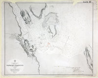 |
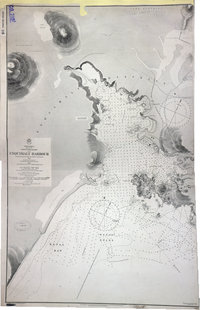
Nanaimo Harbour. | 1864 |
Title: Nanaimo Harbour. Author: Richards, G. H. Subject: Nanaimo (B.C.)--Maps ; Nautical charts--British Columbia ; Nanaimo (B.C.)--Harbor Subject: Nanaimo, 1864, 1878, 1879 Identifier (repository): WO Identifier (repoNumber): 78 Identifier (repoVol): 2311 Identifier (libFileName): WO78-2311 (24) Identifier (penfoldNum): 532 Identifier (doc_id): WO78-2311 (24) Date: 1864 Funder: Funded by a Canadian Council of Archives, Archival Community Digitization Program. Publisher: Great Britain, Hydrographic Office Publisher: National Archives of the UK. 49 10' |
 |
Straits of Juan de Fuca, Oregon Territory, from surveys of the U.S. Ex. Ex. and Spanish and English authorities | 1849 |
Title: Straits of Juan de Fuca, Oregon Territory, from surveys of the U.S. Ex. Ex. and Spanish and English authorities Author: United States Exploring Expedition (1838-1842) Subject: Juan de Fuca Strait (B.C. and Wash.)--Maps; Washington (State)--Maps; British Columbia--Maps Subject: Juan de Fuca, Strait, 1841, 1848 Identifier (repository): FO Identifier (repoNumber): 925 Identifier (repoVol): 1378j Identifier (libFileName): FO925-1378 Identifier (penfoldNum): 508 Identifier (doc_id): FO 925/1378 Date: 1849 Funder: Funded by a Canadian Council of Archives, Archival Community Digitization Program. Publisher: National Archives of the UK. 48 30'N--48 00'N / 124 30'W--123 30'W |
 |
Reduced map of a portion of British Columbia, compiled from the surveys and explorations of the Royal Navy and Royal Engineers at the camp New Westminster, 24 Nov 1859. | 1859 |
Title: Reduced map of a portion of British Columbia, compiled from the surveys and explorations of the Royal Navy and Royal Engineers at the camp New Westminster, 24 Nov 1859. Author: Arrowsmith, John, 1790-1873. Subject: British Columbia -- Maps; Washington (State) -- Maps; Douglas, James, Sir, 1803-1877 -- Travel. Subject: British Columbia, Washington, 1861 Identifier (repository): FO Identifier (repoNumber): 925 Identifier (repoVol): 1822 Identifier (libFileName): FO925-1822 Identifier (penfoldNum): 400 Identifier (doc_id): FO 925/1822 Date: 1859 Funder: Funded by a Canadian Council of Archives, Archival Community Digitization Program. Publisher: John Arrowsmith. Publisher: National Archives of the UK. 51N-49N/123W-118W |
![San Juan boundary dispute maps [map B]. Map of de Fuca Strait, 1791.](https://hcmc.uvic.ca/~coldesp/maps/maps_200/fo_925-1649-b_j_d_f_s_1791.jpg) |
San Juan boundary dispute maps [map B].Map of de Fuca Strait, 1791. | 1791 |
Title: San Juan boundary dispute maps [map B]. Title: Map of de Fuca Strait, 1791. Author: Eliza y Reventa, Francisco de, 1759-1825 Subject: San Juan Boundary Dispute, 1846-1872; Juan de Fuca Strait (B.C. and Wash.) -- Maps Subject: Juan de Fuca, Strait, 1791, 1873 Identifier (repository): FO Identifier (repoNumber): 925 Identifier (repoVol): 1649b Identifier (libFileName): FO925-1649 (b) Identifier (penfoldNum): 502 Identifier (doc_id): FO 925/1649 Date: 1791 Funder: Funded by a Canadian Council of Archives, Archival Community Digitization Program. Publisher: Harrison & Sons, Lith. Publisher: National Archives of the UK. 49N-48N |
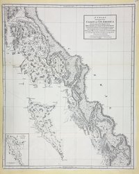 |
Chart shewing part of the Coast of N.W. America with the tracks of His Majesty's Sloop Discovery and Armed Tender Chatham, Commanded by George Vancouver Esq. and prepared under his immediate inspection by Lieut. Joseph Baker in which the continental shore has been correctly traced and determined from lat. 51 45ʹ N. and long. 232 08ʹ E. to lat. 57 30ʹ N. and long. 226 44ʹ E. at the periods shewn by the tracks ; Warner, sculp. Warner Sculp' | 1798 |
Title: Chart shewing part of the Coast of N.W. America with the tracks of His Majesty's Sloop Discovery and Armed Tender Chatham, Commanded by George Vancouver Esq. and prepared under his immediate inspection by Lieut. Joseph Baker in which the continental shore has been correctly traced and determined from lat. 51 45ʹ N. and long. 232 08ʹ E. to lat. 57 30ʹ N. and long. 226 44ʹ E. at the periods shewn by the tracks ; Warner, sculp. Warner Sculp' Author: Vancouver, George, 1757-1798 Subject: British Columbia -- Maps; Alaska -- Maps; Stewart (B.C.) -- Maps; Coasts -- Alaska -- Maps; Coasts -- British Columbia -- Maps; Northwest Coast of North America -- Historical geography. Identifier (repository): MPK Identifier (repoNumber): 1 Identifier (repoVol): 304 Identifier (libFileName): MPK1-304 (2) Identifier (penfoldNum): Identifier (doc_id): MPK 1/304/2 Date: 1798 Funder: Funded by a Canadian Council of Archives, Archival Community Digitization Program. Publisher: Julius Bien & Co. Publisher: National Archives of the UK. 57 30'N-51 45'N/134 30'W-126 30'W |
![San Juan Water Boundary (Arbitration) : list of maps sent to Admiral Prevost at Berlin on the 12th June 1872 [map 33] Washington Sound and approaches](https://hcmc.uvic.ca/~coldesp/maps/maps_200/fo_925-1650_pt_2_33_washington_sound_1866.jpg) |
San Juan Water Boundary (Arbitration) : list of maps sent to Admiral Prevost at Berlin on the 12th June 1872 [map 33]Washington Sound and approaches | 1866 |
Title: San Juan Water Boundary (Arbitration) : list of maps sent to Admiral Prevost at Berlin on the 12th June 1872 [map 33] Title: Washington Sound and approaches Author: U.S. Coast Survey; Alden, James, 1810-1877; Cuyler, R. M. (Richard M.); Davidson, George, 1825-1911; Lawson, J. S. Subject: Washington (Territory)--Maps; Juan de Fuca Strait (B.C. and Wash.)--Maps; Georgia, Gulf of (B.C. and Wash.)--Maps; Canada--Boundaries--Maps; United States--Boundaries--Maps Identifier (repository): FO Identifier (repoNumber): 925 Identifier (repoVol): 1650 Identifier (libFileName): FO925-1650 pt2 (33) Identifier (penfoldNum): Identifier (doc_id): FO925-1650 pt2 (33) Date: 1866 Funder: Funded by a Canadian Council of Archives, Archival Community Digitization Program. Publisher: National Archives of the UK. 49 10'N--48 00'N / 123 50'W--122 20'W |
![San Juan boundary dispute maps [map J]. Plano del Estrecho de Fuca reconocido por el Alferez de Navio de la Rl. Armada Dn. Manuel Quimper.](https://hcmc.uvic.ca/~coldesp/maps/maps_200/fo_925-1649-j_j_d_f_s_1790.jpg) |
San Juan boundary dispute maps [map J].Plano del Estrecho de Fuca reconocido por el Alferez de Navio de la Rl. Armada Dn. Manuel Quimper. | 1790 |
Title: San Juan boundary dispute maps [map J]. Title: Plano del Estrecho de Fuca reconocido por el Alferez de Navio de la Rl. Armada Dn. Manuel Quimper. Author: López de Haro, Gonzalo, d. 1823. Subject: San Juan Boundary Dispute, 1846-1872; Juan de Fuca, Strait of (B.C. and Wash.) -- Maps; Vancouver Island (B.C.) -- Maps; Washington (State) -- Maps. Subject: Juan de Fuca, Strait, 1790, 1873 Identifier (repository): FO Identifier (repoNumber): 925 Identifier (repoVol): 1649j Identifier (libFileName): FO925-1649 (j) Identifier (penfoldNum): 500 Identifier (doc_id): FO 925/1649 Date: 1790 Funder: Funded by a Canadian Council of Archives, Archival Community Digitization Program. Publisher: Harrison & Sons Lith. Publisher: National Archives of the UK. 48.928110 -125.105198 47.650868 -125.105198 47.650868 -122.688885 48.928110 -122.688885 48.928110 -125.105198 |
 |
Hope to Similkameen and Rock Creek. Lillooet to Kamloops and Okanagan Lake.Lillooet to Kamloops and Okanagan Lake. | 1862 |
Title: Hope to Similkameen and Rock Creek. Lillooet to Kamloops and Okanagan Lake. Title: Lillooet to Kamloops and Okanagan Lake. Author: Conroy, James Subject: British Columbia -- Maps; Okanagan Valley (B.C.) -- Maps; Dewdney Trail (B.C.) -- Maps; British Columbia, Southern -- Maps. Subject: British Columbia, 1862 Identifier (repository): CO Identifier (repoNumber): 700 Identifier (repoVol): bc Identifier (libFileName): CO700-BRITISH COLUMBIA11 (11) Identifier (penfoldNum): 405 Identifier (doc_id): CO700-BRITISH COLUMBIA11 (11) Date: 1862 Funder: Funded by a Canadian Council of Archives, Archival Community Digitization Program. Publisher: Great Britain. Army. Royal Engineers. Columbia Detachment. Publisher: National Archives of the UK. 50N-49N/122W-119W. |
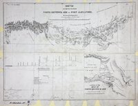 |
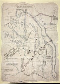
Sketch of the route from North Bentinck Arm to Fort Alexander.Route from North Bentinck Arm to Fort Alexander. | 1863 |
Title: Sketch of the route from North Bentinck Arm to Fort Alexander. Title: Route from North Bentinck Arm to Fort Alexander. Author: Palmer, H. Spencer (Henry Spencer), 1838-1893 Subject: British Columbia -- Maps; North Bentinck Arm (B.C.) -- Maps; Fort Alexandria National Historic Site (B.C.) -- Maps; Subject: British Columbia, 1862, 1863 Identifier (repository): CO Identifier (repoNumber): 700 Identifier (repoVol): bc Identifier (libFileName): CO700-BRITISH COLUMBIA8 (8) Identifier (penfoldNum): 407 Identifier (doc_id): CO700-BRITISH COLUMBIA8 (8) Date: 1863 Funder: Funded by a Canadian Council of Archives, Archival Community Digitization Program. Publisher: Great Britain. Army. Royal Engineers. Columbia Detachment. Publisher: National Archives of the UK. 52N--51N / 127W--123W. |
 |
Carta Esferica de los Reconocimientos hechos en la Costa N. O. de America en 1791 y 92 por las Goletas sutil, y Mexicana y otros Buques de S.M. | 1792 |
Title: Carta Esferica de los Reconocimientos hechos en la Costa N. O. de America en 1791 y 92 por las Goletas sutil, y Mexicana y otros Buques de S.M. Author: Cardano, José Maria. Subject: Juan de Fuca Strait (B.C. and Wash.) -- Maps; Vancouver Island (B.C.) -- Maps; San Juan Boundary Dispute, 1846-1872 Subject: British Columbia, Washington, 1792, 1871 Identifier (repository): CO Identifier (repoNumber): 700 Identifier (repoVol): canada Identifier (libFileName): CO700-CANADA125 (2) Identifier (penfoldNum): 358 Identifier (doc_id): CO 700/CANADA125/1 Date: 1792 Funder: Funded by a Canadian Council of Archives, Archival Community Digitization Program. Publisher: Great Britain. Ordnance Survey Publisher: National Archives of the UK. 51 20'N-44 10'N/124W-116W |
 |
Archipelago of Arro, Gulf of Georgia, Ringgold's Channel and Straits of Fuca, Oregon Territory | 1841 |
Title: Archipelago of Arro, Gulf of Georgia, Ringgold's Channel and Straits of Fuca, Oregon Territory Author: United States Exploring Expedition (1838-1842) Subject: Juan de Fuca Strait (B.C. and Wash.)--Maps; Georgia, Strait of (B.C. and Wash.)--Maps; San Juan Islands (Wash.)--Maps; Gulf Islands (B.C.)--Maps Subject: British Columbia, 1841, 1871 Identifier (repository): FO Identifier (repoNumber): 925 Identifier (repoVol): 1872 Identifier (libFileName): FO925-1872 Identifier (penfoldNum): 375 Identifier (doc_id): FO 925/1872 Date: 1841 Funder: Funded by a Canadian Council of Archives, Archival Community Digitization Program. Publisher: Ordnance Survey Office Publisher: National Archives of the UK. 49 00'N--48 00'N / 123 00'W--122 30'W |
 |
British Columbia. Coast lines from Admiralty Charts, interior from Explorations by Royal Engineers and others up to 1862. North of Fraser River from Mr. Arrowsmith. East of Columbia River from Captain Palliser. | 1862 |
Title: British Columbia. Coast lines from Admiralty Charts, interior from Explorations by Royal Engineers and others up to 1862. North of Fraser River from Mr. Arrowsmith. East of Columbia River from Captain Palliser. Author: Conroy, James. Subject: British Columbia -- Maps; Vancouver Island (B.C.) -- Maps; Dioceses. Identifier (repository): MPG Identifier (repoNumber): 1 Identifier (repoVol): 650 Identifier (libFileName): MPG1-650 (1) Identifier (penfoldNum): Identifier (doc_id): MPG1-650 (1) Date: 1862 Funder: Funded by a Canadian Council of Archives, Archival Community Digitization Program. Publisher: British Columbia. Dept. of Lands and Works. Publisher: National Archives of the UK. 57N-48N/133W-110W |
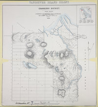 |
Cranberry District 1859 (Rough sketch)Vancouver Island Colony. Sketch Maps of Districts. | 1859 |
Title: Cranberry District 1859 (Rough sketch) Title: Vancouver Island Colony. Sketch Maps of Districts. Subject: Vancouver Island (B.C.) -- Maps. Subject: Vancouver Island, 1859 Identifier (repository): CO Identifier (repoNumber): 700 Identifier (repoVol): bc Identifier (libFileName): CO700-BRITISH COLUMBIA7 (2) Identifier (penfoldNum): 568 Identifier (doc_id): CO 700/BRITISH COLUMBIA7/2 Date: 1859 Funder: Funded by a Canadian Council of Archives, Archival Community Digitization Program. Publisher: Great Britain. War Office. Topographical Depot. Publisher: National Archives of the UK. |
 |
Haro and Rosario Straits.North America, west coast, Haro and Rosario Straits. | 1865 |
Title: Haro and Rosario Straits. Title: North America, west coast, Haro and Rosario Straits. Author: Richards, G. H. (George Henry) Subject: Nautical charts -- Haro Strait (B.C. and Wash.); Nautical charts -- British Columbia -- Gulf Islands; Nautical charts -- Washington (State) -- Rosario Strait; Nautical charts -- Washington (State) -- San Juan Islands; San Juan Boundary Dispute, 1846-1872. Subject: Haro and Rosario Straits, 1859, 1871 Identifier (repository): CO Identifier (repoNumber): 700 Identifier (repoVol): canada Identifier (libFileName): CO700-CANADA125 (6) Identifier (penfoldNum): 489 Identifier (doc_id): CO700-CANADA125 (6) Date: 1865 Funder: Funded by a Canadian Council of Archives, Archival Community Digitization Program. Publisher: Great Britain. Hydrographic Service. Publisher: National Archives of the UK. 49 19'N-N 48 5'/ 123 39'W-122 25'W. |
 |
Provinces of British Columbia and Vancouver Island; with portions of the United States and Hudson's Bay Territories. | 1859 |
Title: Provinces of British Columbia and Vancouver Island; with portions of the United States and Hudson's Bay Territories. Author: Arrowsmith, John, 1790-1873. Subject: British Columbia -- Maps; Vancouver Island -- Maps; Haida Gwaii (B.C.) -- Maps; Washington (State) -- Maps; Oregon -- Maps; Indians of North America -- British Columbia; Hudsons Bay Company. Subject: British Columbia, 1859 Identifier (repository): MPG Identifier (repoNumber): 1 Identifier (repoVol): 646 Identifier (libFileName): MPG1-646 Identifier (penfoldNum): 387 Identifier (doc_id): MPG 1/646 Date: 1859 Funder: Funded by a Canadian Council of Archives, Archival Community Digitization Program. Publisher: John Arrowsmith. Publisher: National Archives of the UK. 57 30'N-45N/132 10'W-112 10'W |
 |
Plan of Fort Victoria, Vancouver's Island, Cammusan HarbourFort Victoria, Vancouver Island. | 1845 |
Title: Plan of Fort Victoria, Vancouver's Island, Cammusan Harbour Title: Fort Victoria, Vancouver Island. Author: Vavasour, M (Mervin), 1821-1866 Subject: Victoria (B.C.) -- History; Fortification -- British Columbia -- Victoria (B.C.); Architectural drawings. Subject: Victoria, 1845 Identifier (repository): MPHH Identifier (repoNumber): 1 Identifier (repoVol): 459 Identifier (libFileName): MPHH1-459 (5) Identifier (penfoldNum): 575 Identifier (doc_id): MPHH 1/459/5 Date: 1845 Funder: Funded by a Canadian Council of Archives, Archival Community Digitization Program. Publisher: National Archives of the UK. |
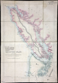 |
Vancouvers IslandVancouver Island | 1848 |
Title: Vancouvers Island Title: Vancouver Island Author: Wyld, James, 1812-1887 Subject: Vancouver Island (B.C.)--Maps Subject: Vancouver Island, 1848, 1861 Identifier (repository): FO Identifier (repoNumber): 925 Identifier (repoVol): 1479 Identifier (libFileName): FO925-1479 Identifier (penfoldNum): 561 Identifier (doc_id): FO 925/1479 Date: 1848 Funder: Funded by a Canadian Council of Archives, Archival Community Digitization Program. Publisher: James Wyld Publisher: National Archives of the UK. 51 00'N--49 00'N / 125 00'W--122 00W |
 |
Plan of reserve of 1300 acres at Fort Victoria | Nov. 25, 1851 |
Title: Plan of reserve of 1300 acres at Fort Victoria Identifier (repository): HBC Identifier (doc_id): A.11/73 fo. 215b Date: Nov. 25, 1851 Publisher: Hudson's Bay Company Archives Funder: Funded by a Canadian Council of Archives, Archival Community Digitization Program. |
![San Juan Water Boundary (Arbitration) : list of maps sent to Admiral Prevost at Berlin on the 12th June 1872 [map 9] Plano del estrecho de Fuca](https://hcmc.uvic.ca/~coldesp/maps/maps_200/fo_925-1650_pt_1_9_1790_1871_copy.jpg) |
San Juan Water Boundary (Arbitration) : list of maps sent to Admiral Prevost at Berlin on the 12th June 1872 [map 9]Plano del estrecho de Fuca | 1790 1871 |
Title: San Juan Water Boundary (Arbitration) : list of maps sent to Admiral Prevost at Berlin on the 12th June 1872 [map 9] Title: Plano del estrecho de Fuca Author: López de Haro, Gonzalo, d. 1823 Subject: Juan de Fuca Strait (B.C. and Wash.)--Maps; Canada--Boundaries--Maps; United States--Boundaries--Maps Subject: Juan de Fuca, Strait, 1790, 1872 Identifier (repository): FO Identifier (repoNumber): 925 Identifier (repoVol): 1650 Identifier (libFileName): FO925-1650 pt1 (9) Identifier (penfoldNum): 499 Identifier (doc_id): FO 925/1650 Date: 1790 Date: 1871 Funder: Funded by a Canadian Council of Archives, Archival Community Digitization Program. Publisher: National Archives of the UK. |
![San Juan Boundary Arbitration atlas [map 7]. Strait of Juan de Fuca](https://hcmc.uvic.ca/~coldesp/maps/maps_200/fo_925-1647b_7_1866.jpg) |
San Juan Boundary Arbitration atlas [map 7].Strait of Juan de Fuca | 1866 |
Title: San Juan Boundary Arbitration atlas [map 7]. Title: Strait of Juan de Fuca Author: Kellett, Henry, 1806-1875. Subject: San Juan Boundary Dispute, 1846-1872; Juan de Fuca, Strait of (B.C. and Wash.) -- Maps; Nautical charts -- Juan de Fuca, Strait of (B.C. and Wash.); Puget Sound (Wash.) -- Maps; Nautical charts -- Puget Sound (Wash.); Nautical charts -- Haro Strait (B.C. and Wash.); Nautical charts -- Rosario Strait (Wash.); Flattery, Cape (Wash.); Indians of North America -- British Columbia; Indians of North America -- Washington (State). Subject: Juan de Fuca, Strait, 1849, 1871 Identifier (repository): FO Identifier (repoNumber): 925 Identifier (repoVol): 1647b Identifier (libFileName): FO925-1647B (7) Identifier (penfoldNum): 516 Identifier (doc_id): FO925-1647B (7) Date: 1866 Funder: Funded by a Canadian Council of Archives, Archival Community Digitization Program. Publisher: Great Britain. Hydrographic Office Publisher: National Archives of the UK. 48 35'N--47 30'N / 124 45'W--122 10'W |
 |
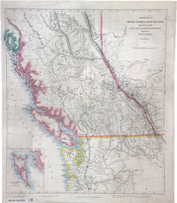
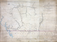
Sketch map of part of the British possessions to the west of the Rocky Mountains.British Possessions to the West of the Rocky Mountains. | 1858 |
Title: Sketch map of part of the British possessions to the west of the Rocky Mountains. Title: British Possessions to the West of the Rocky Mountains. Author: Great Britain. Army. Royal Engineers. Columbia Detachment; Elphinstone, Howard Crawfurd, Sir, 1829-1890; James, H., 1803-1877. Subject: British Columbia -- Maps; British Columbia -- History; British Columbia -- Agriculture; Indians of North America -- British Columbia. Subject: British Columbia, 1858 Identifier (repository): FO Identifier (repoNumber): 925 Identifier (repoVol): 1381 Identifier (libFileName): FO925-1381 Identifier (penfoldNum): 382 Identifier (doc_id): FO 925/1381 Date: 1858 Funder: Funded by a Canadian Council of Archives, Archival Community Digitization Program. Publisher: Great Britain. War Office. Topographical Depot. Publisher: National Archives of the UK. 48N-54N/128W-112W |
![San Juan boundary dispute maps [map E]. Map of Duflot de Mofras, 1844.](https://hcmc.uvic.ca/~coldesp/maps/maps_200/fo_925-1649-e_bc_washington_1844.jpg) |
San Juan boundary dispute maps [map E].Map of Duflot de Mofras, 1844. | 1844 |
Title: San Juan boundary dispute maps [map E]. Title: Map of Duflot de Mofras, 1844. Author: Duflot de Mofras, Eugène, 1810-1884 Subject: San Juan Boundary Dispute, 1846-1872; Juan de Fuca, Strait of (B.C. and Wash.) -- Maps; Vancouver Island (B.C.) -- Maps; Subject: British Columbia, 1844, 1873 Identifier (repository): FO Identifier (repoNumber): 925 Identifier (repoVol): 1649e Identifier (libFileName): FO925-1649 (e) Identifier (penfoldNum): 376 Identifier (doc_id): FO 925/1649 Date: 1844 Funder: Funded by a Canadian Council of Archives, Archival Community Digitization Program. Publisher: Harrison & Sons Lith. Publisher: National Archives of the UK. 52N-47N |
![San Juan Water Boundary (Arbitration) : list of maps sent to Admiral Prevost at Berlin on the 12th June 1872 [map 26] Vancouver Island and the Gulf of Georgia](https://hcmc.uvic.ca/~coldesp/maps/maps_200/fo_925-1650_pt_2_26_van_isl_1849.jpg) |
San Juan Water Boundary (Arbitration) : list of maps sent to Admiral Prevost at Berlin on the 12th June 1872 [map 26]Vancouver Island and the Gulf of Georgia | 1849 |
Title: San Juan Water Boundary (Arbitration) : list of maps sent to Admiral Prevost at Berlin on the 12th June 1872 [map 26] Title: Vancouver Island and the Gulf of Georgia Author: Vancouver, George, 1757-1798; Alcalá-Galiano, Dionisio, 1760-1805; Valdes y Florez, Cayetano, 1767-1835; Kellett, Henry, 1806-1875; Great Britain. Hydrographic Office Subject: Georgia, Gulf of (B.C. and Wash.)--Maps; Vancouver Island (B.C.)--Maps; Canada--Boundaries--Maps; United States--Boundaries--Maps Subject: Vancouver Island, 1849, 1872 Identifier (repository): FO Identifier (repoNumber): 925 Identifier (repoVol): 1650 Identifier (libFileName): FO925-1650 pt2 (26) Identifier (penfoldNum): 564 Identifier (doc_id): FO 925/1650 Date: 1849 Funder: Funded by a Canadian Council of Archives, Archival Community Digitization Program. Publisher: National Archives of the UK. 51 00'N--48 00'N / 130 00'W--122 00'W |
![San Juan Water Boundary (Arbitration) : list of maps sent to Admiral Prevost at Berlin on the 12th June 1872 [map 13] Carta esferica de la parte de la costa no. de America comprehendida entre la entrada de Juan de Fuca, y la salida de las goletas con algunos canales interiores arreglada segun los resultados de las operaciones hechas por los comandantes y oficiales de las goletas sutil y mexicana desde 5 de Junio a 31 de Agosto de 1792](https://hcmc.uvic.ca/~coldesp/maps/maps_200/fo_925-1650_pt_1_13_j_d_f_s_1792.jpg) |
San Juan Water Boundary (Arbitration) : list of maps sent to Admiral Prevost at Berlin on the 12th June 1872 [map 13]Carta esferica de la parte de la costa no. de America comprehendida entre la entrada de Juan de Fuca, y la salida de las goletas con algunos canales interiores arreglada segun los resultados de las operaciones hechas por los comandantes y oficiales de las goletas sutil y mexicana desde 5 de Junio a 31 de Agosto de 1792 | 1792 |
Title: San Juan Water Boundary (Arbitration) : list of maps sent to Admiral Prevost at Berlin on the 12th June 1872 [map 13] Title: Carta esferica de la parte de la costa no. de America comprehendida entre la entrada de Juan de Fuca, y la salida de las goletas con algunos canales interiores arreglada segun los resultados de las operaciones hechas por los comandantes y oficiales de las goletas sutil y mexicana desde 5 de Junio a 31 de Agosto de 1792 Subject: Nautical charts--Juan de Fuca Strait (B.C. and Wash.); Nautical charts--Rosario Strait (Wash.) Subject: British Columbia, Washington, 1792, 1872 Identifier (repository): FO Identifier (repoNumber): 925 Identifier (repoVol): 1650 Identifier (libFileName): FO925-1650 pt1 (13) Identifier (penfoldNum): 362 Identifier (doc_id): FO 925/1650 Date: 1792 Funder: Funded by a Canadian Council of Archives, Archival Community Digitization Program. Publisher: National Archives of the UK. 50 00'N--47 05'N |
![San Juan Water Boundary (Arbitration) : list of maps sent to Admiral Prevost at Berlin on the 12th June 1872 [map 34] Vancouvers Island](https://hcmc.uvic.ca/~coldesp/maps/maps_200/fo_925-1650_pt_2_34_van_isl_1775_1866.jpg) |
San Juan Water Boundary (Arbitration) : list of maps sent to Admiral Prevost at Berlin on the 12th June 1872 [map 34]Vancouvers Island | date_unknown |
Title: San Juan Water Boundary (Arbitration) : list of maps sent to Admiral Prevost at Berlin on the 12th June 1872 [map 34] Title: Vancouvers Island Subject: Vancouver Island (B.C.)--Maps; Pacific Coast (B.C.)--Maps; Pacific Coast (U.S.)--Maps; Canada--Boundaries--Maps; United States--Boundaries--Maps Subject: Vancouver Island, 1848, 1861, 1872 Identifier (repository): FO Identifier (repoNumber): 925 Identifier (repoVol): 1650 Identifier (libFileName): FO925-1650 pt2 (34) Identifier (penfoldNum): 562 Identifier (doc_id): FO925-1650 pt2 (34) Date: date_unknown Funder: Funded by a Canadian Council of Archives, Archival Community Digitization Program. Publisher: James Wyld Publisher: National Archives of the UK. 51 00N--49 00N / 127 00W--124 00'W |
![San Juan Water Boundary (Arbitration) : list of maps sent to Admiral Prevost at Berlin on the 12th June 1872 [map 12] Carta que comprehende](https://hcmc.uvic.ca/~coldesp/maps/maps_200/fo_925-1650_pt_1_12_j_d_f_s_light_1791.jpg) |
San Juan Water Boundary (Arbitration) : list of maps sent to Admiral Prevost at Berlin on the 12th June 1872 [map 12]Carta que comprehende | 1791 |
Title: San Juan Water Boundary (Arbitration) : list of maps sent to Admiral Prevost at Berlin on the 12th June 1872 [map 12] Title: Carta que comprehende Subject: Vancouver Island (B.C.) --Maps; Juan de Fuca Strait (B.C. and Wash.)--Maps; Rosario Strait (Wash.)--Maps; Canada--Boundaries--Maps; United States--Boundaries--Maps Identifier (repository): FO Identifier (repoNumber): 925 Identifier (repoVol): 1650 Identifier (libFileName): FO925-1650 pt1 (12) Identifier (penfoldNum): Identifier (doc_id): FO 925/1650 Date: 1791 Funder: Funded by a Canadian Council of Archives, Archival Community Digitization Program. Publisher: National Archives of the UK. |
 |
Esquimalt Harbour.Vancouver Island. Esquimalt Harbour. | 1861 |
Title: Esquimalt Harbour. Title: Vancouver Island. Esquimalt Harbour. Author: Great Britain. Hydrographic Office Subject: Esquimalt (B.C.) -- Maps; Esquimalt Harbour (B.C.) -- Maps; Nautical charts -- British Columbia -- Esquimalt; Harbors -- British Columbia -- Esquimalt. Subject: Esquimalt, 1861, 1903 Identifier (repository): CO Identifier (repoNumber): 700 Identifier (repoVol): bc Identifier (libFileName): CO700-BRITISH COLUMBIA25 Identifier (penfoldNum): 458 Identifier (doc_id): CO 700/BRITISH COLUMBIA25 Date: 1861 Funder: Funded by a Canadian Council of Archives, Archival Community Digitization Program. Publisher: National Archives of the UK. |
![San Juan Water Boundary (Arbitration) : list of maps sent to Admiral Prevost at Berlin on the 12th June 1872 [map 30] Diagram of a portion of Oregon Territory](https://hcmc.uvic.ca/~coldesp/maps/maps_200/fo_925-1650_pt_2_29_oregon_territory_1852.jpg) |
San Juan Water Boundary (Arbitration) : list of maps sent to Admiral Prevost at Berlin on the 12th June 1872 [map 30]Diagram of a portion of Oregon Territory | 1852 |
Title: San Juan Water Boundary (Arbitration) : list of maps sent to Admiral Prevost at Berlin on the 12th June 1872 [map 30] Title: Diagram of a portion of Oregon Territory Identifier (repository): FO Identifier (repoNumber): 925 Identifier (repoVol): 1650 Identifier (libFileName): FO925-1650 pt2 (29) Identifier (penfoldNum): Identifier (doc_id): FO 925/1650 Date: 1852 Funder: Funded by a Canadian Council of Archives, Archival Community Digitization Program. Publisher: Surveyor General's Office, Oregon City Publisher: National Archives of the UK. |
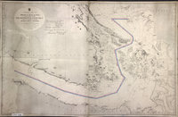 |
Strait of Juan de Fuca and the channels between the continent & Vancouver Id., showing the boundary line between British & American possessions. | 1872 |
Title: Strait of Juan de Fuca and the channels between the continent & Vancouver Id., showing the boundary line between British & American possessions. Author: Powel, E. J. Subject: Juan de Fuca Strait (B.C. and Wash.) -- Maps; Georgia, Strait of (B.C. and Wash.) -- Maps; Vancouver Island (B.C.) -- Maps; Nautical charts -- Georgia, Strait of (B.C. and Wash.); Nautical charts -- Juan de Fuca Strait (B.C. and Wash.); Nautical charts – Haro Strait (B.C. and Wash.); San Juan Boundary Dispute, 1846-1872 Subject: Juan de Fuca, Strait, 1872, 1873 Identifier (repository): CO Identifier (repoNumber): 700 Identifier (repoVol): canada Identifier (libFileName): CO700-CANADA125 (11) Identifier (penfoldNum): 523 Identifier (doc_id): CO700-CANADA125 (11) Date: 1872 Funder: Funded by a Canadian Council of Archives, Archival Community Digitization Program. Publisher: Great Britain. Hydrographic Office. Publisher: National Archives of the UK. 49 05'N-48 05'N/124 50'W-122 25'W |
 |
Reconnaissance of Canal de Haro & Strait of Rosario and approaches &c &c.Canal de Haro & Strait of Rosario. | 1854 |
Title: Reconnaissance of Canal de Haro & Strait of Rosario and approaches &c &c. Title: Canal de Haro & Strait of Rosario. Author: United States Coast Survey Subject: Haro Strait (B.C. and Wash.) -- Maps; Rosario Strait (Wash.) -- Maps; Georgia, Strait of (B.C. and Wash.) -- Maps; Juan de Fuca Strait (B.C. and Wash.) -- Maps; Boundaries -- British Columbia; Boundaries -- United States. Subject: Haro and Rosario Straits, 1854, 1858 Identifier (repository): MPK Identifier (repoNumber): 1 Identifier (repoVol): 58 Identifier (libFileName): MPK1-58 Identifier (penfoldNum): 483 Identifier (doc_id): MPK 1/58 Date: 1854 Funder: Funded by a Canadian Council of Archives, Archival Community Digitization Program. Publisher: National Archives of the UK. |
 |
Facsimile of part of Vancouver's chart of the coast of N.W. America.Facsimile of part of chart of the coast of N.W. America. | 1854 |
Title: Facsimile of part of Vancouver's chart of the coast of N.W. America. Title: Facsimile of part of chart of the coast of N.W. America. Author: Vancouver, George, 1757-1798 Subject: Vancouver, George, 1757-1798 -- Journeys -- Maps; Georgia, Strait of (B.C. and Wash.) -- Maps; Haro Strait (B.C. and Wash.) -- Maps; Juan de Fuca Strait (B.C. and Wash.) -- Maps; Flattery, Cape (Wash.) -- Maps; Howe Sound (B.C.) -- Maps. Subject: British Columbia, Washington, 1798, 1854 Identifier (repository): MPK Identifier (repoNumber): 1 Identifier (repoVol): 77 Identifier (libFileName): MPK1-77 (6) Identifier (penfoldNum): 367 Identifier (doc_id): MPK 1/77/6 Date: 1854 Funder: Funded by a Canadian Council of Archives, Archival Community Digitization Program. Publisher: National Archives of the UK. 49N/124W-122W |
 |
Victoria HarbourAmerica N.W. Coast Vancouver Island | 1848 |
Title: Victoria Harbour Title: America N.W. Coast Vancouver Island Author: Kellett, Henry, 1806-1875 Subject: British Columbia--Victoria--Maps; Victoria (B.C.)--Harbor Subject: Victoria, 1848 Identifier (repository): FO Identifier (repoNumber): 925 Identifier (repoVol): 1807 Identifier (libFileName): FO925-1807 Identifier (penfoldNum): 576 Identifier (doc_id): FO 925/1807 Date: 1848 Funder: Funded by a Canadian Council of Archives, Archival Community Digitization Program. Publisher: Great Britain. Hydrographic Office. Publisher: National Archives of the UK. |
 |
Vancouver Island and adjacent shores of British Columbia. | 1865 |
Title: Vancouver Island and adjacent shores of British Columbia. Author: Richards, G. H. (George Henry) Subject: Vancouver Island (B.C.) -- Maps; British Columbia -- Coasts -- Maps; Nautical charts -- British Columbia; Nautical charts -- Juan de Fuca Strait (B.C. and Wash.). Subject: Vancouver Island, 1859-65, 1871 Identifier (repository): FO Identifier (repoNumber): 925 Identifier (repoVol): 1810 Identifier (libFileName): FO925-1810 Identifier (penfoldNum): 570 Identifier (doc_id): FO925-1810 Date: 1865 Funder: Funded by a Canadian Council of Archives, Archival Community Digitization Program. Publisher: Great Britain. Hydrographic Office Publisher: National Archives of the UK. 51 24'N-47 54'N/130 27'W-121 32'W. |
![San Juan Water Boundary (Arbitration) : list of maps sent to Admiral Prevost at Berlin on the 12th June 1872 [map 7] Carta de las costas reconocidas al norueste de la California](https://hcmc.uvic.ca/~coldesp/maps/maps_200/fo_925-1650_pt_1_7_1775.jpg) |
San Juan Water Boundary (Arbitration) : list of maps sent to Admiral Prevost at Berlin on the 12th June 1872 [map 7]Carta de las costas reconocidas al norueste de la California | 1775 |
Title: San Juan Water Boundary (Arbitration) : list of maps sent to Admiral Prevost at Berlin on the 12th June 1872 [map 7] Title: Carta de las costas reconocidas al norueste de la California Subject: Pacific Coast (B.C.)--Maps; Pacific Coast (U.S.)--Maps; Canada--Boundaries--Maps; United States--Boundaries--Maps Subject: British Columbia, Washington, 1775, 1872 Identifier (repository): FO Identifier (repoNumber): 925 Identifier (repoVol): 1650 Identifier (libFileName): FO925-1650 pt1 (7) Identifier (penfoldNum): 355 Identifier (doc_id): FO 925/1650 Date: 1775 Funder: Funded by a Canadian Council of Archives, Archival Community Digitization Program. Publisher: National Archives of the UK. 45 -130.215827 45 -122.985618 51.101850 -122.985618 51.101850 -130.215827 45 -130.215827 |
 |
Alaska : copy of part of Vancouver's chart of the coast of southern Alaska. | 1862 |
Title: Alaska : copy of part of Vancouver's chart of the coast of southern Alaska. Author: Vancouver, George, 1757-1798 Subject: Alaska--Boundaries--British Columbia--Maps; British Columbia--Boundaries--Alaska--Maps; Stikine River (B.C. and Alaska) -- Maps. Identifier (repository): MPG Identifier (repoNumber): 1 Identifier (repoVol): 648 Identifier (libFileName): MPG1-648 (3) Identifier (penfoldNum): Identifier (doc_id): MPG1-648 (3) Date: 1862 Funder: Funded by a Canadian Council of Archives, Archival Community Digitization Program. Publisher: National Archives of the UK. |
![Stekin River [c. 1860] Stikine River.](https://hcmc.uvic.ca/~coldesp/maps/maps_200/co_700-bc_8_4_stikine_river_1860.jpg) |
Stekin River [c. 1860]Stikine River. | c. 1862 |
Title: Stekin River [c. 1862] Title: Stikine River. Subject: Stikine River (B.C. and Alaska) -- Maps; Mining -- British Columbia -- Maps; Gold mines and mining -- British Columbia -- Maps. Subject: Stikine River, 1862 Identifier (repository): CO Identifier (repoNumber): 700 Identifier (repoVol): bc Identifier (libFileName): CO700-BRITISH COLUMBIA8 (4) Identifier (penfoldNum): 552 Identifier (doc_id): CO 700/BRITISH COLUMBIA8/4 Date: c. 1862 Funder: Funded by a Canadian Council of Archives, Archival Community Digitization Program. Publisher: National Archives of the UK. |
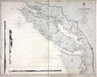 |
Vancouver Island and the Gulf of Georgia.Vancouver Island and the Strait of Georgia. | 1856 |
Title: Vancouver Island and the Gulf of Georgia. Title: Vancouver Island and the Strait of Georgia. Author: Vancouver, George, 1757-1798; Alcalá-Galiano, Dionisio, 1760-1805; Valdés Flores Bazán y Peón, Cayetano, 1767-1835; Kellett, Henry, 1806-1875; Cook, James, 1728-1779; United States Coast Survey; J. & C. Walker (Firm) Subject: Vancouver Island (B.C.) -- Maps; Georgia, Strait of (B.C. and Wash.) -- Maps; Rosario Strait (Wash.) -- Maps; Haro Strait (B. C. and Wash.) -- Maps; Nautical charts -- British Columbia; Indians of North America -- British Columbia. Subject: Vancouver Island, 1849, 1856 Identifier (repository): FO Identifier (repoNumber): 925 Identifier (repoVol): 1383 Identifier (libFileName): FO925-1383 Identifier (penfoldNum): 563 Identifier (doc_id): FO 925/1383 Date: 1856 Funder: Funded by a Canadian Council of Archives, Archival Community Digitization Program. Publisher: Great Britain. Hydrographic Office Publisher: National Archives of the UK. 51N-47 10'N/130W-122W |
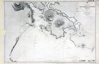 |
Esquimalt & Victoria HarboursNorth America, West Coast, Vancouver Island, Esquimalt and Victoria Harbours, surveyed by Capt. G. H. Richards, R.N., and the Officers of H.M.S. Hecate 1861-2. | 1862 |
Title: Esquimalt & Victoria Harbours Title: North America, West Coast, Vancouver Island, Esquimalt and Victoria Harbours, surveyed by Capt. G. H. Richards, R.N., and the Officers of H.M.S. Hecate 1861-2. Author: Richards, G. H. (George Henry) Subject: Victoria (B.C.)--Maps ; Esquimalt (B.C.)--Maps ; Nautical charts--British Columbia ; Coast defenses--Canada--History Subject: Esquimalt and Victoria, 1864, 1876, 1879 Identifier (repository): WO Identifier (repoNumber): 78 Identifier (repoVol): 2311 Identifier (libFileName): WO78-2311 (20) Identifier (penfoldNum): 459 Identifier (doc_id): WO78-2311 (20) Date: 1862 Funder: Funded by a Canadian Council of Archives, Archival Community Digitization Program. Publisher: Great Britain. Hydrographic Office Publisher: National Archives of the UK. |
![San Juan Water Boundary (Arbitration) : list of maps sent to Admiral Prevost at Berlin on the 12th June 1872 [map 31] Reconnaissance of canal de Haro & strait of Rosario and approaches](https://hcmc.uvic.ca/~coldesp/maps/maps_200/fo_925-1650_pt_2_31_haro_and_rosario_1854.jpg) |
San Juan Water Boundary (Arbitration) : list of maps sent to Admiral Prevost at Berlin on the 12th June 1872 [map 31]Reconnaissance of canal de Haro & strait of Rosario and approaches | 1854 |
Title: San Juan Water Boundary (Arbitration) : list of maps sent to Admiral Prevost at Berlin on the 12th June 1872 [map 31] Title: Reconnaissance of canal de Haro & strait of Rosario and approaches Author: U.S. Coast Survey; Davidson, George, 1825-1911; Knight, Robt. T. (Robert T.); Bartle, R. F.; Ricketts, James J. Subject: Haro Strait (B.C. and Wash.)--Maps; Rosario Strait (Wash.)--Maps; Juan de Fuca Strait (B.C. and Wash.)--Maps; Vancouver Island (B.C.) --Maps; Canada--Boundaries--Maps; United States--Boundaries--Maps Subject: Haro and Rosario Straits, 1854, 1858, 1872 Identifier (repository): FO Identifier (repoNumber): 925 Identifier (repoVol): 1650 Identifier (libFileName): FO925-1650 pt2 (31) Identifier (penfoldNum): 485 Identifier (doc_id): FO 925/1650 Date: 1854 Funder: Funded by a Canadian Council of Archives, Archival Community Digitization Program. Publisher: R. T. Knight Publisher: National Archives of the UK. 49 10'N--48 00'N / 123 50'W--122 20'W |
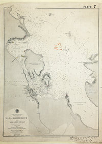 |
Nanaimo Harbour and Departure Bay. | 1862 |
Title: Nanaimo Harbour and Departure Bay. Author: Richards, G. H. (George Henry) Subject: Nanaimo (B.C.)--Maps ; Nautical charts--British Columbia ; Nanaimo (B.C.)--Harbor ; Departure Bay (B.C.) Subject: Nanaimo, 1860, 1878, 1879 Identifier (repository): WO Identifier (repoNumber): 78 Identifier (repoVol): 2311 Identifier (libFileName): WO78-2311 (22) Identifier (penfoldNum): 527 Identifier (doc_id): WO78-2311 (22) Date: 1862 Funder: Funded by a Canadian Council of Archives, Archival Community Digitization Program. Publisher: Great Britain, Hydrographic Office Publisher: National Archives of the UK. |
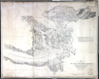 |
Map showing the line of boundary between the United States and British possessions. : from the point where the 49th parallel of north latitude strikes the western coast of the continent "to the middle of the channel which separates the continent from Vancouver's Island and thence southerly through the middle of said channel" &c. to Fuca's Straits, in accordance with Treaty of June 15th, 1846. | 1871 |
Title: Map showing the line of boundary between the United States and British possessions. : from the point where the 49th parallel of north latitude strikes the western coast of the continent "to the middle of the channel which separates the continent from Vancouver's Island and thence southerly through the middle of said channel" &c. to Fuca's Straits, in accordance with Treaty of June 15th, 1846. Author: Bowen & Co. Subject: Northwest boundary of the United States -- Maps; Canada -- Boundaries -- United States -- Maps; United States -- Boundaries -- Canada -- Maps; British Columbia -- Boundaries -- Washington (State) -- Maps; Washington (State) -- Boundaries -- British Columbia -- Maps; San Juan Boundary Dispute, 1846-1872. Subject: British Columbia, 1871 Identifier (repository): FO Identifier (repoNumber): 925 Identifier (repoVol): 1653 Identifier (libFileName): FO925-1653 Identifier (penfoldNum): 429 Identifier (doc_id): FO925-1653 Date: 1871 Funder: Funded by a Canadian Council of Archives, Archival Community Digitization Program. Publisher: United States. Government Printing Office Publisher: National Archives of the UK. 49N-48N/124W-122W |
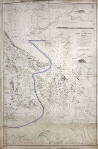 |
Haro and Rosario Straits | 1865 |
Title: Haro and Rosario Straits Author: Richards, G.H. (George Henry); Kellett, Henry, 1806-1875; Powell, F.J.; Great Britain. Hydrographic Office Subject: Haro Strait (B.C. and Wash.)--Maps; Rosario Strait (Wash.)--Maps; San Juan Island (Wash.)--Maps; Boundaries Subject: Haro and Rosario Straits, 1859, 1871 Identifier (repository): FO Identifier (repoNumber): 925 Identifier (repoVol): 1654 Identifier (libFileName): FO925-1654 Identifier (penfoldNum): 493 Identifier (doc_id): FO925-1654 Date: 1865 Funder: Funded by a Canadian Council of Archives, Archival Community Digitization Program. Publisher: J. and C. Walker Publisher: National Archives of the UK. 49 15'N--48 05'N / 123 55'W--122 25'W |
![San Juan boundary dispute maps [map H]. Carta que comprehende los interiores y veril de la costa desde los 48 de latitude N. hasta los 50 (1791)](https://hcmc.uvic.ca/~coldesp/maps/maps_200/fo_925-1649-h_j_d_f_s_1791.jpg) |
San Juan boundary dispute maps [map H].Carta que comprehende los interiores y veril de la costa desde los 48 de latitude N. hasta los 50 (1791) | 1791 |
Title: San Juan boundary dispute maps [map H]. Title: Carta que comprehende los interiores y veril de la costa desde los 48 de latitude N. hasta los 50 (1791) Author: Eliza y Reventa, Francisco de, 1759-1825 Subject: San Juan Boundary Dispute, 1846-1872; Juan de Fuca, Strait of (B.C. and Wash.) -- Maps; Vancouver Island (B.C.) -- Maps; Washington (State) -- Maps; Haro Strait (B.C. and Wash.) -- Maps; Rosario Strait (Wash.) -- Maps. Subject: Juan de Fuca, Strait, 1791, 1873 Identifier (repository): FO Identifier (repoNumber): 925 Identifier (repoVol): 1649h Identifier (libFileName): FO925-1649 (h) Identifier (penfoldNum): 503 Identifier (doc_id): FO 925/1649 Date: 1791 Funder: Funded by a Canadian Council of Archives, Archival Community Digitization Program. Publisher: National Archives of the UK. |
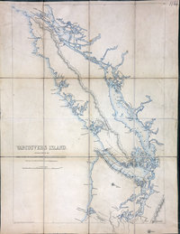 |
Vancouvers IslandVancouver Island | 1848 |
Title: Vancouvers Island Title: Vancouver Island Author: Wyld, James, 1812-1887 Subject: Vancouver Island (B.C.)--Maps Subject: Vancouver Island, 1848 Identifier (repository): FO Identifier (repoNumber): 925 Identifier (repoVol): 1864 Identifier (libFileName): FO925-1864 Identifier (penfoldNum): 560 Identifier (doc_id): FO 925/1864 Date: 1848 Funder: Funded by a Canadian Council of Archives, Archival Community Digitization Program. Publisher: James Wyld Publisher: National Archives of the UK. 50 00'N--49 00'N / 125 00'W--122 00'W |
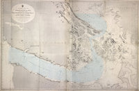 |
Strait of Juan de Fuca and the channels between the continent & Vancouver Id. showing the boundary line between British & American possessions.Strait of Juan de Fuca. | 1872 |
Title: Strait of Juan de Fuca and the channels between the continent & Vancouver Id. showing the boundary line between British & American possessions. Title: Strait of Juan de Fuca. Author: Powell, E. J. Subject: Vancouver Island (B.C.) -- Maps; Juan de Fuca, Strait of (B.C. and Wash.) -- Maps; Nautical charts -- Juan de Fuca, Strait of (B.C. and Wash.); Puget Sound (Wash.) -- Maps; Nautical charts -- Puget Sound (Wash.); Nautical charts -- Haro Strait (B.C. and Wash.); Nautical charts -- Rosario Strait (Wash.); Nautical charts -- Georgia, Strait of (B.C. and Wash.); Flattery, Cape (Wash.); San Juan Boundary Dispute, 1846-1872. Subject: Juan de Fuca, Strait, 1872 Identifier (repository): FO Identifier (repoNumber): 925 Identifier (repoVol): 1652 Identifier (libFileName): FO925-1652 Identifier (penfoldNum): 522 Identifier (doc_id): FO925-1652 Date: 1872 Funder: Funded by a Canadian Council of Archives, Archival Community Digitization Program. Publisher: Great Britain. Hydrographic Office Publisher: National Archives of the UK. 49 05'N--48 05'N / 124 50'W--122 25'W |
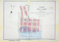 |
Douglas, British Columbia, 1861. | 1861 |
Title: Douglas, British Columbia, 1861. Author: McColl, William, d. 1864. Subject: Douglas (B.C.) -- Maps; British Columbia -- Maps Subject: British Columbia, 1861, 1862 Identifier (repository): CO Identifier (repoNumber): 700 Identifier (repoVol): bc Identifier (libFileName): CO700-BRITISH COLUMBIA11 (7) Identifier (penfoldNum): 401 Identifier (doc_id): CO 700/BRITISH COLUMBIA11/7 Date: 1861 Funder: Funded by a Canadian Council of Archives, Archival Community Digitization Program. Publisher: Great Britain. Army. Royal Engineers. Columbia Detachment. Publisher: National Archives of the UK. |
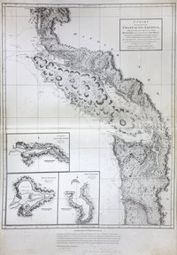 |
Chart shewing part of the coast of N.W. America : with the tracks of His Majesty's sloop Discovery and armed tender Chatham commanded by George Vancouver, esqr. and prepared under his immediate inspection by Lieut. Joseph Baker, in which the continental shore has been traced and determined from lat: 45⁰,30ʹ N. and long. 236⁰,12ʹ E. to lat: 52⁰,15ʹ N. and long. 232⁰,40ʹ E. at the different periods shewn by the tracks ; Warner, sculp | 1798 |
Title: Chart shewing part of the coast of N.W. America : with the tracks of His Majesty's sloop Discovery and armed tender Chatham commanded by George Vancouver, esqr. and prepared under his immediate inspection by Lieut. Joseph Baker, in which the continental shore has been traced and determined from lat: 45⁰,30ʹ N. and long. 236⁰,12ʹ E. to lat: 52⁰,15ʹ N. and long. 232⁰,40ʹ E. at the different periods shewn by the tracks ; Warner, sculp Author: Vancouver, George, 1757-1798 Subject: Juan de Fuca Strait (B.C. and Wash.) -- Maps; Vancouver Island (B.C.) -- Maps; San Juan Boundary Dispute, 1846-1872; Coasts -- British Columbia -- Maps; Coasts -- Washington (State) -- Maps Subject: British Columbia, Washington, 1798, 1871 Identifier (repository): CO Identifier (repoNumber): 700 Identifier (repoVol): canada Identifier (libFileName): CO700-CANADA125 (4) Identifier (penfoldNum): 369 Identifier (doc_id): CO 700/CANADA125/1 Date: 1798 Funder: Funded by a Canadian Council of Archives, Archival Community Digitization Program. Publisher: Great Britain. Ordnance Survey. Publisher: National Archives of the UK. 52 15'N-45 30'N/129 30'W-122 30'W. |
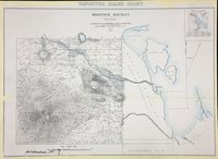 |
Mountain District 1859 (Rough sketch).Vancouver Island Colony. Sketch Maps of Districts. | 1859 |
Title: Mountain District 1859 (Rough sketch). Title: Vancouver Island Colony. Sketch Maps of Districts. Subject: Vancouver Island (B.C.) -- Maps. Subject: Vancouver Island, 1859 Identifier (repository): CO Identifier (repoNumber): 700 Identifier (repoVol): bc Identifier (libFileName): CO700-BRITISH COLUMBIA7 (1) Identifier (penfoldNum): 568 Identifier (doc_id): CO 700/BRITISH COLUMBIA7/1 Date: 1859 Funder: Funded by a Canadian Council of Archives, Archival Community Digitization Program. Publisher: Great Britain. War Office. Topographical Depot. Publisher: National Archives of the UK. |
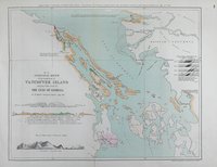 |
Geological sketch of the south east of Vancouver Island and part of the coast of the Gulf of Georgia.South east of Vancouver Island and part of the coast of the Gulf of Georgia. | 1863 |
Title: Geological sketch of the south east of Vancouver Island and part of the coast of the Gulf of Georgia. Title: South east of Vancouver Island and part of the coast of the Gulf of Georgia. Author: British North American Exploring Expedition Subject: Vancouver Island (B.C.) -- Maps; Georgia, Strait of (B.C. and Wash.) -- Maps; Gulf Islands (B.C.) -- Maps; British North American Exploring Expedition; British Columbia -- Discovery and exploration. Subject: British Columbia, 1863 Identifier (repository): CO Identifier (repoNumber): 6 Identifier (repoVol): 369 Identifier (libFileName): CO6-36 (9) Identifier (penfoldNum): 413 Identifier (doc_id): CO6-36 (9) Date: 1863 Funder: Funded by a Canadian Council of Archives, Archival Community Digitization Program. Publisher: Edward Stanford Ltd. Publisher: National Archives of the UK. 48N / 124W-123W |
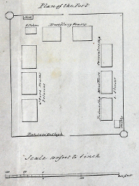 |
Sketch of Cammusan Harbour, Vancouvers Island, showing the position of Fort Victoria.Cammusan Harbour (Victoria Harbour), British Columbia. | 1846 |
Title: Sketch of Cammusan Harbour, Vancouvers Island, showing the position of Fort Victoria. Title: Cammusan Harbour (Victoria Harbour), British Columbia. Author: Vavasour, M (Mervin), 1821-1866 Subject: Victoria Harbour (B.C.) -- Maps; Nautical charts -- British Columbia -- Victoria; Harbors - British Columbia -- Victoria; Victoria (B.C.) -- History.. Subject: Vancouver Island, 1846 Identifier (repository): MPK Identifier (repoNumber): 1 Identifier (repoVol): 59 Identifier (libFileName): MPK1-59 (10) Identifier (penfoldNum): 556 Identifier (doc_id): MPK 1/59/10 Date: 1846 Funder: Funded by a Canadian Council of Archives, Archival Community Digitization Program. Publisher: National Archives of the UK. 48.450407 -123.413000 48.411488 -123.413000 48.411488 -123.365744 48.450407 -123.365744 |
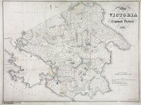 |
Map of Victoria and part of Esquimalt Districts, 1861. | 1861 |
Title: Map of Victoria and part of Esquimalt Districts, 1861. Subject: Victoria (B.C.) -- Maps; Esquimalt (B.C.) -- Maps; Vancouver Island -- Maps. Subject: Victoria and Esquimalt Districts, 1861 Identifier (repository): CO Identifier (repoNumber): 700 Identifier (repoVol): bc Identifier (libFileName): CO700-BRITISH COLUMBIA10 Identifier (penfoldNum): 591 Identifier (doc_id): CO 700/BRITISH COLUMBIA10 Date: 1861 Funder: Funded by a Canadian Council of Archives, Archival Community Digitization Program. Publisher: Day & Son. Publisher: National Archives of the UK. |
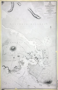 |
Vancouver Island. Victoria Harbour.Victoria Harbour. | 1859 |
Title: Vancouver Island. Victoria Harbour. Title: Victoria Harbour. Author: Great Britain. Hydrographic Office Subject: Victoria (B.C.) -- Maps; Victoria Harbour (B.C.) -- Maps; Harbors -- British Columbia -- Victoria; Nautical charts -- British Columbia -- Victoria; Indians of North America -- British Columbia -- Victoria. Subject: Victoria, 1861, 1907 Identifier (repository): CO Identifier (repoNumber): 700 Identifier (repoVol): bc Identifier (libFileName): CO700-BRITISH COLUMBIA30 Identifier (penfoldNum): 580 Identifier (doc_id): CO 700/BRITISH COLUMBIA30 Date: 1859 Funder: Funded by a Canadian Council of Archives, Archival Community Digitization Program. Publisher: National Archives of the UK. |
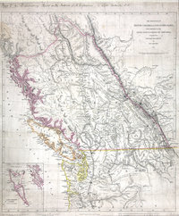 |
Provinces of British Columbia and Vancouver Island; with portions of the United States and Hudson's Bay Territories. | 1859 |
Title: Provinces of British Columbia and Vancouver Island; with portions of the United States and Hudson's Bay Territories. Author: Arrowsmith, John, 1790-1873. Subject: British Columbia -- Maps; Washington (State) -- Maps; Haida Gwaii (B.C.) -- Maps; Alberta -- Maps; Indians of North America -- British Columbia; Indians of North America -- Alberta; Indians of North America -- Washington (State); British North American Exploring Expedition. Subject: British Columbia, 1859 Identifier (repository): MR Identifier (repoNumber): 1 Identifier (repoVol): 1093 Identifier (libFileName): MR1-109-3 Identifier (penfoldNum): 385 Identifier (doc_id): MR 1/109/3 Date: 1859 Funder: Funded by a Canadian Council of Archives, Archival Community Digitization Program. Publisher: John Arrowsmith Publisher: National Archives of the UK. |
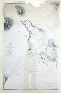 |
Esquimalt Harbour. | 1860 |
Title: Esquimalt Harbour. Author: Richards, G. H. (George Henry) Subject: Esquimalt (B.C.)--Maps ; Esquimalt Harbour (B.C.) -- Maps; Harbors -- British Columbia -- Esquimalt ; Nautical charts -- British Columbia -- Esquimalt Subject: Esquimalt, 1861, 1876, 1879 Identifier (repository): WO Identifier (repoNumber): 78 Identifier (repoVol): 2311 Identifier (libFileName): WO78-2311 (21) Identifier (penfoldNum): 457 Identifier (doc_id): WO 78/2311/21 Date: 1860 Funder: Funded by a Canadian Council of Archives, Archival Community Digitization Program. Publisher: Great Britain, Hydrographic Office Publisher: National Archives of the UK. |
![San Juan Water Boundary (Arbitration) : list of maps sent to Admiral Prevost at Berlin on the 12th June 1872 [map 24] Victoria Harbour](https://hcmc.uvic.ca/~coldesp/maps/maps_200/fo_925-1650_pt_1_24_vic_harbour_1847.jpg) |
San Juan Water Boundary (Arbitration) : list of maps sent to Admiral Prevost at Berlin on the 12th June 1872 [map 24]Victoria Harbour | 1847 |
Title: San Juan Water Boundary (Arbitration) : list of maps sent to Admiral Prevost at Berlin on the 12th June 1872 [map 24] Title: Victoria Harbour Author: Kellett, Henry, 1806-1875 Subject: Victoria Harbour (B.C.)--Maps; Canada--Boundaries--Maps; United States--Boundaries--Maps Subject: Victoria, 1848, 1872 Identifier (repository): FO Identifier (repoNumber): 925 Identifier (repoVol): 1650 Identifier (libFileName): FO925-1650 pt1 (24) Identifier (penfoldNum): 577 Identifier (doc_id): FO 925/1650 Date: 1847 Funder: Funded by a Canadian Council of Archives, Archival Community Digitization Program. Publisher: J. & C. Walker Publisher: National Archives of the UK. |
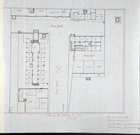 |
Plan of New Westminster Gaol Jany. 1871.Plan of New Westminster Jail, Jan. 1871. | 1871 |
Title: Plan of New Westminster Gaol Jany. 1871. Title: Plan of New Westminster Jail, Jan. 1871. Subject: Prisons -- British Columbia -- New Westminster; Prisons -- Design and construction; New Westminster (B.C.) -- Prisons. Subject: New Westminster, 1871 Identifier (repository): MPG Identifier (repoNumber): 1 Identifier (repoVol): 655 Identifier (libFileName): MPG1-655 Identifier (penfoldNum): 536 Identifier (doc_id): MPG1-655 Date: 1871 Funder: Funded by a Canadian Council of Archives, Archival Community Digitization Program. Publisher: National Archives of the UK. |
![Sketch of Scott's Bay on the N.W. Coast of America. Lat. 50 38N. Long. 128 35W. [and] Sketch of Friendly Bay in Nootka Sound. Lat. 49 37N. Long. 126 48 W. Variation 18 E. Sketch of Friendly Bay in Nootka Sound. Lat. 49 37N. Long. 126 48 W. Variation 18 E.](https://hcmc.uvic.ca/~coldesp/maps/maps_200/co_700-america_north_and_south_51_23_scotts_bay_friendly_bay_1789.jpg) |
Sketch of Scott's Bay on the N.W. Coast of America. Lat. 50 38N. Long. 128 35W. [and] Sketch of Friendly Bay in Nootka Sound. Lat. 49 37N. Long. 126 48 W. Variation 18 E.Sketch of Friendly Bay in Nootka Sound. Lat. 49 37N. Long. 126 48 W. Variation 18 E. | 1789 |
Title: Sketch of Scott's Bay on the N.W. Coast of America. Lat. 50 38N. Long. 128 35W. [and] Sketch of Friendly Bay in Nootka Sound. Lat. 49 37N. Long. 126 48 W. Variation 18 E. Title: Sketch of Friendly Bay in Nootka Sound. Lat. 49 37N. Long. 126 48 W. Variation 18 E. Subject: Cape Scott (B.C.) -- Maps; Nootka Sound (B.C.) -- Maps; Indians of North America -- British Columbia -- Vancouver Island. Subject: British Columbia, 1786-1789 Identifier (repository): CO Identifier (repoNumber): 700 Identifier (repoVol): america Identifier (libFileName): CO700-AMERICA NORTH and SOUTH51 (23) Identifier (penfoldNum): 357 Identifier (doc_id): CO 700/AMERICA NORTH AND SOUTH51 Date: 1789 Funder: Funded by a Canadian Council of Archives, Archival Community Digitization Program. Publisher: Dalrymple, Alexander, 1737-1808 Publisher: National Archives of the UK. |
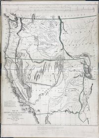 |
Map of Oregon and Upper California, from the Surveys of John Charles Frémont And Other AuthoritiesProfile of the travelling route from the South Pass of the Rocky Mountains to the Bay of San Francisco | 1848 |
Title: Map of Oregon and Upper California, from the Surveys of John Charles Frémont And Other Authorities Title: Profile of the travelling route from the South Pass of the Rocky Mountains to the Bay of San Francisco Author: Charles Preuss Subject: San Juan Boundary Dispute, 1846-1872 Subject: Rocky Mountains to Upper California; Oregon Territory; Missouri Territory Identifier (repository): FO Identifier (repoNumber): 925 Identifier (repoVol): 1647b Identifier (libFileName): FO925-1647B (8) Identifier (penfoldNum): Identifier (doc_id): FO 925/1647B Date: 1848 Funder: Funded by a Canadian Council of Archives, Archival Community Digitization Program. Publisher: Ordnance Survey Office, Southampton Publisher: National Archives of the UK. |
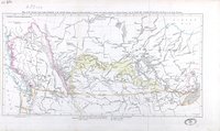 |
Map of the Country from Lake Superior to the Pacific Ocean, showing the Western Boundary of Canada & the Eastern Boundary of British Columbia, also the Fertile Belt stretching from the Lake of the Woods to the Rocky Mountains.Lake Superior to the Pacific Ocean. | 1860 |
Title: Map of the Country from Lake Superior to the Pacific Ocean, showing the Western Boundary of Canada & the Eastern Boundary of British Columbia, also the Fertile Belt stretching from the Lake of the Woods to the Rocky Mountains. Title: Lake Superior to the Pacific Ocean. Author: Hind, Henry Youle, 1823-1908 Subject: Canada -- Maps; British Columbia -- Maps; Alberta -- Maps; Saskatchewan -- Maps; Manitoba -- Maps; Ontario -- Maps; Assiniboine and Saskatchewan Exploring Expedition (1858); British North American Exploring Expedition Identifier (repository): MPG Identifier (repoNumber): 1 Identifier (repoVol): 266 Identifier (libFileName): MPG1-266 Identifier (penfoldNum): Identifier (doc_id): MPG 1/266 Date: 1860 Funder: Funded by a Canadian Council of Archives, Archival Community Digitization Program. Publisher: National Archives of the UK. 57 15'N-45N/127 15'W-84W |
![San Juan Water Boundary (Arbitration) : list of maps sent to Admiral Prevost at Berlin on the 12th June 1872 [map 14] Carta esferica de los reconocimientos hechos en 1792 en la costa n.o. de America para examinar le entrada de Juan de Fuca, y la internacion de sus canales navegables](https://hcmc.uvic.ca/~coldesp/maps/maps_200/fo_925-1650_pt_1_14_j_d_f_s_1795.jpg) |
San Juan Water Boundary (Arbitration) : list of maps sent to Admiral Prevost at Berlin on the 12th June 1872 [map 14]Carta esferica de los reconocimientos hechos en 1792 en la costa n.o. de America para examinar le entrada de Juan de Fuca, y la internacion de sus canales navegables | 1795 |
Title: San Juan Water Boundary (Arbitration) : list of maps sent to Admiral Prevost at Berlin on the 12th June 1872 [map 14] Title: Carta esferica de los reconocimientos hechos en 1792 en la costa n.o. de America para examinar le entrada de Juan de Fuca, y la internacion de sus canales navegables Author: Alcalá-Galiano, Dionisio, 1760-1805; Valdes y Florez, Cayetano, 1767-1835 Subject: Nautical charts -- Juan de Fuca Strait (B.C. and Wash.); Canada--Boundaries--Maps; United States--Boundaries--Maps Subject: British Columbia, 1795, 1872 Identifier (repository): FO Identifier (repoNumber): 925 Identifier (repoVol): 1650 Identifier (libFileName): FO925-1650 pt1 (14) Identifier (penfoldNum): 364 Identifier (doc_id): FO 925/1650 Date: 1795 Funder: Funded by a Canadian Council of Archives, Archival Community Digitization Program. Publisher: Th. Mettke Publisher: National Archives of the UK. 51 10'N--47 00'N / 123 10'W--115 00'W |
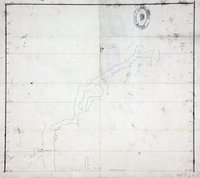 |
Outline chart of the coast of Burke Channel, with the northern part of FitzHugh Sound.Burke Channel, with the northern part of FitzHugh Sound. | 1792 |
Title: Outline chart of the coast of Burke Channel, with the northern part of FitzHugh Sound. Title: Burke Channel, with the northern part of FitzHugh Sound. Subject: Burke Channel (B.C.) -- Maps; Fitz Hugh Sound (B.C.) -- Maps; British Columbia -- Maps Subject: Burke Channel, 1792 Identifier (repository): MPG Identifier (repoNumber): 1 Identifier (repoVol): 557 Identifier (libFileName): MPG1-557 (2) Identifier (penfoldNum): 453 Identifier (doc_id): MPG 1/557/2 Date: 1792 Funder: Funded by a Canadian Council of Archives, Archival Community Digitization Program. Publisher: National Archives of the UK. 52 30'N-51 39N |
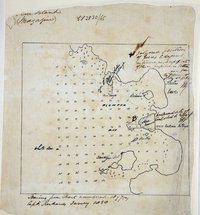 |
Tracing from Admiralty chart 1897(a) showing Plumper Bay, Thetis Cove, Esquimalt, Vancouver Island.Plumper Bay, Thetis Cove, Esquimalt, Vancouver Island. | 1858 |
Title: Tracing from Admiralty chart 1897(a) showing Plumper Bay, Thetis Cove, Esquimalt, Vancouver Island. Title: Plumper Bay, Thetis Cove, Esquimalt, Vancouver Island. Author: Richards, G. H. (George Henry) Subject: Nautical charts -- British Columbia -- Plumper Bay; Plumper Bay (B.C.) -- Maps; Thetis Cove (B.C.) -- Maps; Esquimalt (B.C.) -- Maps. Identifier (repository): MFQ Identifier (repoNumber): 1 Identifier (repoVol): 632 Identifier (libFileName): MFQ1-632 (4) Identifier (penfoldNum): Identifier (doc_id): MFQ 1/632/4 Date: 1858 Funder: Funded by a Canadian Council of Archives, Archival Community Digitization Program. Publisher: National Archives of the UK. |
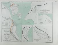 |
Plan of Nanaimo shewing the coal mines from records and surveys of the Honourable Hudson Bay Company and original observations.Plan of Nanaimo showing the coal mines. | 1860 |
Title: Plan of Nanaimo shewing the coal mines from records and surveys of the Honourable Hudson Bay Company and original observations. Title: Plan of Nanaimo showing the coal mines. Author: British North American Exploring Expedition Subject: Coal mines and mining -- British Columbia -- Nanaimo -- Maps; Nanaimo (B.C.) -- Maps; Vancouver Island (B.C.) -- Maps. Subject: Nanaimo, 1860, 1863 Identifier (repository): CO Identifier (repoNumber): 6 Identifier (repoVol): 3610a Identifier (libFileName): CO6-36 (10a) Identifier (penfoldNum): 528 Identifier (doc_id): CO 6/36 Date: 1860 Funder: Funded by a Canadian Council of Archives, Archival Community Digitization Program. Publisher: Edward Stanford Ltd. Publisher: National Archives of the UK. |
![San Juan boundary dispute maps [map C]. Map of Vancouver, 1798.](https://hcmc.uvic.ca/~coldesp/maps/maps_200/fo_925-1649-c_1798_j_d_f_s.jpg) |
San Juan boundary dispute maps [map C].Map of Vancouver, 1798. | 1798 |
Title: San Juan boundary dispute maps [map C]. Title: Map of Vancouver, 1798. Author: Vancouver, George, 1757-1798 Subject: San Juan Boundary Dispute, 1846-1872; Juan de Fuca, Strait of (B.C. and Wash.) -- Maps; Haro Strait (B.C. and Wash.) -- Maps; Georgia, Strait of (B.C. and Wash.) -- Maps; British columbia -- Maps; Washington (State) -- Maps. Subject: Juan de Fuca, Strait, 1798, 1873 Identifier (repository): FO Identifier (repoNumber): 925 Identifier (repoVol): 1649c Identifier (libFileName): FO925-1649 (c) Identifier (penfoldNum): 507 Identifier (doc_id): FO 925/1649 Date: 1798 Funder: Funded by a Canadian Council of Archives, Archival Community Digitization Program. Publisher: Harrison & Sons Lith. Publisher: National Archives of the UK. 50 15'N-47 15'N |
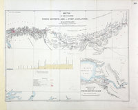 |
Sketch of the route from North Bentinck Arm to Fort Alexander.North Bentinck Arm to Fort Alexander. | 1862 |
Title: Sketch of the route from North Bentinck Arm to Fort Alexander. Title: North Bentinck Arm to Fort Alexander. Author: Palmer, H. Spencer (Henry Spencer), 1838-1893. Subject: British Columbia -- Maps; North Bentinck Arm (B.C.) -- Maps; Fort Alexandria National Historic Site (B.C.) -- Maps. Subject: British Columbia, 1862, 1863 Identifier (repository): MPG Identifier (repoNumber): 1 Identifier (repoVol): 652 Identifier (libFileName): MPG1-652 (2) Identifier (penfoldNum): 408 Identifier (doc_id): MPG1-652 (2) Date: 1862 Funder: Funded by a Canadian Council of Archives, Archival Community Digitization Program. Publisher: British Columbia. Dept. of Lands and Works. Publisher: National Archives of the UK. 52N-51N/127W-123W |
![San Juan boundary dispute maps [map G]. Map of W. Sturgis, 1845.](https://hcmc.uvic.ca/~coldesp/maps/maps_200/fo_925-1649-g_bc_washington_1845.jpg) |
San Juan boundary dispute maps [map G].Map of W. Sturgis, 1845. | 1845 |
Title: San Juan boundary dispute maps [map G]. Title: Map of W. Sturgis, 1845. Author: Sturgis, William, 1782-1863 Subject: San Juan Boundary Dispute, 1846-1872; Juan de Fuca, Strait of (B.C. and Wash.) -- Maps; Vancouver Island (B.C.) -- Maps; Washington (State) -- Maps. Subject: British Columbia, 1845, 1873 Identifier (repository): FO Identifier (repoNumber): 925 Identifier (repoVol): 1649g Identifier (libFileName): FO925-1649 (g) Identifier (penfoldNum): 378 Identifier (doc_id): FO 925/1649 Date: 1845 Funder: Funded by a Canadian Council of Archives, Archival Community Digitization Program. Publisher: Harrison & Sons Lith. Publisher: National Archives of the UK. |
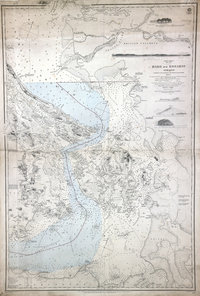 |
Haro and Rosario Straits.North America, west coast, Haro and Rosario Straits. | 1859 |
Title: Haro and Rosario Straits. Title: North America, west coast, Haro and Rosario Straits. Author: Richards, G. H. (George Henry) Subject: Nautical charts -- Haro Strait (B.C. and Wash.); Nautical charts -- British Columbia -- Gulf Islands; Nautical charts -- Washington (State) -- Rosario Strait; Nautical charts -- Washington (State) -- San Juan Islands; San Juan Boundary Dispute, 1846-1872. Subject: Haro and Rosario Straits, 1859, 1871, 1872 Identifier (repository): FO Identifier (repoNumber): 925 Identifier (repoVol): 1959 Identifier (libFileName): FO925-1959 pt2 Identifier (penfoldNum): 519 Identifier (doc_id): FO 925/1959 Date: 1859 Funder: Funded by a Canadian Council of Archives, Archival Community Digitization Program. Publisher: Great Britain. Hydrographic Service. Publisher: National Archives of the UK. 49 19'N-N 48 5'/ 123 39'W-122 25'W. |
![San Juan Water Boundary (Arbitration) : list of maps sent to Admiral Prevost at Berlin on the 12th June 1872 [map 23] Becher and Pedder Bays](https://hcmc.uvic.ca/~coldesp/maps/maps_200/fo_925-1650_pt_1_23_becher_and_peddr_bays_1848.jpg) |
San Juan Water Boundary (Arbitration) : list of maps sent to Admiral Prevost at Berlin on the 12th June 1872 [map 23]Becher and Pedder Bays | 1848 |
Title: San Juan Water Boundary (Arbitration) : list of maps sent to Admiral Prevost at Berlin on the 12th June 1872 [map 23] Title: Becher and Pedder Bays Author: Kellett, Henry, 1806-1875 Subject: Bays--British Columbia--Vancouver Island--Maps Identifier (repository): FO Identifier (repoNumber): 925 Identifier (repoVol): 1650 Identifier (libFileName): FO925-1650 pt1 (23) Identifier (penfoldNum): 452 Identifier (doc_id): FO 925/1650 Date: 1848 Funder: Funded by a Canadian Council of Archives, Archival Community Digitization Program. Publisher: National Archives of the UK. 48.364744 -123.664616 48.364744 -123.474097 48.288621 -123.664616 48.288621 -123.474097 |
![San Juan Water Boundary (Arbitration) : list of maps sent to Admiral Prevost at Berlin on the 12th June 1872 [map 36] Part of the Strait of Georgia with the channels leading into the Strait of Fuca](https://hcmc.uvic.ca/~coldesp/maps/maps_200/fo_925-1650_pt_1_19_1841.jpg) |
San Juan Water Boundary (Arbitration) : list of maps sent to Admiral Prevost at Berlin on the 12th June 1872 [map 36]Part of the Strait of Georgia with the channels leading into the Strait of Fuca | 1841 |
Title: San Juan Water Boundary (Arbitration) : list of maps sent to Admiral Prevost at Berlin on the 12th June 1872 [map 36] Title: Part of the Strait of Georgia with the channels leading into the Strait of Fuca Subject: Georgia, Strait of (B.C. and Wash.)--Maps; Juan de Fuca Strait (B.C. and Wash.)--Maps Identifier (repository): FO Identifier (repoNumber): 925 Identifier (repoVol): 1650 Identifier (libFileName): FO925-1650 pt1 (19) Identifier (penfoldNum): Identifier (doc_id): FO 925/1650 Date: 1841 Funder: Funded by a Canadian Council of Archives, Archival Community Digitization Program. Publisher: National Archives of the UK. |
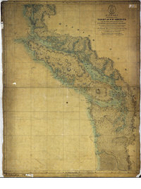 |
Chart shewing part of the coast of N.W. America : with the tracks of His Majesty's sloop Discovery and armed tender Chatham commanded by George Vancouver, esqr. and prepared under his immediate inspection by Lieut. Joseph Baker, in which the continental shore has been traced and determined from lat: 45⁰, 30ʹ N. and long. 236⁰, 12ʹ E. to lat: 52⁰, 15ʹ N. and long. 232⁰, 40ʹ E. at the different periods shewn by the tracks ; Warner, sculpChart showing part of the Coast of N. W. America. | 1798 |
Title: Chart shewing part of the coast of N.W. America : with the tracks of His Majesty's sloop Discovery and armed tender Chatham commanded by George Vancouver, esqr. and prepared under his immediate inspection by Lieut. Joseph Baker, in which the continental shore has been traced and determined from lat: 45⁰, 30ʹ N. and long. 236⁰, 12ʹ E. to lat: 52⁰, 15ʹ N. and long. 232⁰, 40ʹ E. at the different periods shewn by the tracks ; Warner, sculp Title: Chart showing part of the Coast of N. W. America. Author: Baker, Joseph, 1768-1817 Subject: Juan de Fuca Strait (B.C. and Wash.) -- Maps; Vancouver Island (B.C.) -- Maps; San Juan Boundary Dispute, 1846-1872; Coasts -- British Columbia -- Maps; Coasts -- Washington (State) -- Maps. Subject: British Columbia, Washington, 1798 Identifier (repository): CO Identifier (repoNumber): 700 Identifier (repoVol): bc Identifier (libFileName): CO700-BRITISH COLUMBIA1 Identifier (penfoldNum): 365 Identifier (doc_id): CO 700/BRITISH COLUMBIA1 Date: 1798 Funder: Funded by a Canadian Council of Archives, Archival Community Digitization Program. Publisher: J. Edwards & G. Robinson Publisher: National Archives of the UK. |
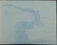 |
Sketch of Cammusan Harbour south end of Vancouver's Island, Straits of De Fuca shewing position of Fort Victoria & soundings.Cammusan Harbour (Victoria Harbour), British Columbia. | 1845 |
Title: Sketch of Cammusan Harbour south end of Vancouver's Island, Straits of De Fuca shewing position of Fort Victoria & soundings. Title: Cammusan Harbour (Victoria Harbour), British Columbia. Author: Vavasour, M (Mervin), 1821-1866 Subject: Victoria Harbour (B.C.) -- Maps; Nautical charts -- British Columbia -- Victoria; Harbors - British Columbia -- Victoria. Subject: Vancouver Island, 1845 Identifier (repository): MPHH Identifier (repoNumber): 1 Identifier (repoVol): 459 Identifier (libFileName): MPHH1-459 (3) Identifier (penfoldNum): 555 Identifier (doc_id): MPHH 1/459/3 Date: 1845 Funder: Funded by a Canadian Council of Archives, Archival Community Digitization Program. Publisher: National Archives of the UK. |
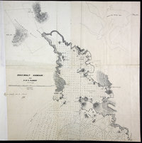 |
Esquimalt Harbour from HMS Plumper. | 1859 |
Title: Esquimalt Harbour from HMS Plumper. Author: Gowlland, John Thomas Ewing (1838 - 1874); Subject: Esquimalt (B.C.) -- Maps; Esquimalt Harbour (B.C.); Nautical charts -- British Columbia -- Esquimalt; Indians of North America -- British Columbia -- Esquimalt. Subject: Esquimalt, 1859 Identifier (repository): MFQ Identifier (repoNumber): 1 Identifier (repoVol): 632 Identifier (libFileName): MFQ1-632 (2) Identifier (penfoldNum): 456 Identifier (doc_id): MFQ 1/632/2 Date: 1859 Funder: Funded by a Canadian Council of Archives, Archival Community Digitization Program. Publisher: National Archives of the UK. |
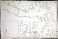 |
Strait of Juan de Fuca | 1849 |
Title: Strait of Juan de Fuca Author: Great Britain. Hydrographic Office Subject: Juan de Fuca Strait (B.C. and Wash.)--Maps; Admiralty Inlet (Wash.)--Maps; Puget Sound (Wash.)--Maps. Subject: Juan de Fuca, Strait, 1849 Identifier (repository): FO Identifier (repoNumber): 925 Identifier (repoVol): 1394 Identifier (libFileName): FO925-1394 Identifier (penfoldNum): 512 Identifier (doc_id): FO 925/1394 Date: 1849 Funder: Funded by a Canadian Council of Archives, Archival Community Digitization Program. Publisher: Great Britain. Hydrographic Office Publisher: National Archives of the UK. 48 35'N--47 30'N / 124 45'W--122 10'W |
![San Juan Water Boundary (Arbitration) : list of maps sent to Admiral Prevost at Berlin on the 12th June 1872 [map 15] Carta esferica de los reconocimientos hechos en 1792 en la costa n.o. de America](https://hcmc.uvic.ca/~coldesp/maps/maps_200/fo_925-1650_pt_1_15_j_d_f_s_14_and_additions_1795.jpg) |
San Juan Water Boundary (Arbitration) : list of maps sent to Admiral Prevost at Berlin on the 12th June 1872 [map 15]Carta esferica de los reconocimientos hechos en 1792 en la costa n.o. de America | 1795 |
Title: San Juan Water Boundary (Arbitration) : list of maps sent to Admiral Prevost at Berlin on the 12th June 1872 [map 15] Title: Carta esferica de los reconocimientos hechos en 1792 en la costa n.o. de America Author: Alcalá-Galiano, Dionisio, 1760-1805; Valdes, D. Cayetano Subject: Juan de Fuca Strait (B.C. and Wash.)--Maps; Rosario Strait (Wash.)--Maps; Vancouver Island (B.C.)--Maps; Pacific Coast (B.C.)--Maps; Pacific Coast (U.S.)--Maps; Canada--Boundaries--Maps; United States--Boundaries--Maps Subject: Juan de Fuca, Strait, 1795, 1872 Identifier (repository): FO Identifier (repoNumber): 925 Identifier (repoVol): 1650 Identifier (libFileName): FO925-1650 pt1 (15) Identifier (penfoldNum): 506 Identifier (doc_id): FO 925/1650 Date: 1795 Funder: Funded by a Canadian Council of Archives, Archival Community Digitization Program. Publisher: National Archives of the UK. 51 00'N--47 00'N / 125 00'W--115 00'W |
![San Juan Water Boundary (Arbitration) : list of maps sent to Admiral Prevost at Berlin on the 12th June 1872 [map 11] Carta que comprehende los interiores y veril de la costa desde los 48' de latitud n. hasta los 50' examinados escrupulosamente por el Feniente de Navio de la Rl. Armada Dn. Franco. de Eliza Comandante del Paquebot de S.M. Sn. Carlos del porte de 16 canones, y Goleta Sta. Saturnina (alias la Orcasitas)](https://hcmc.uvic.ca/~coldesp/maps/maps_200/fo_925-1650_pt_1_11_j_d_f_s_dark_1791.jpg) |
San Juan Water Boundary (Arbitration) : list of maps sent to Admiral Prevost at Berlin on the 12th June 1872 [map 11]Carta que comprehende los interiores y veril de la costa desde los 48' de latitud n. hasta los 50' examinados escrupulosamente por el Feniente de Navio de la Rl. Armada Dn. Franco. de Eliza Comandante del Paquebot de S.M. Sn. Carlos del porte de 16 canones, y Goleta Sta. Saturnina (alias la Orcasitas) | 1791 |
Title: San Juan Water Boundary (Arbitration) : list of maps sent to Admiral Prevost at Berlin on the 12th June 1872 [map 11] Title: Carta que comprehende los interiores y veril de la costa desde los 48' de latitud n. hasta los 50' examinados escrupulosamente por el Feniente de Navio de la Rl. Armada Dn. Franco. de Eliza Comandante del Paquebot de S.M. Sn. Carlos del porte de 16 canones, y Goleta Sta. Saturnina (alias la Orcasitas) Subject: Juan de Fuca Strait (B.C. and Wash.)--Maps; Rosario Strait (Wash.)--Maps; Vancouver Island (B.C.)--Maps; Canada--Boundaries--Maps; United States--Boundaries--Maps Subject: Juan de Fuca, Strait, 1791, 1872 Identifier (repository): FO Identifier (repoNumber): 925 Identifier (repoVol): 1650 Identifier (libFileName): FO925-1650 pt1 (11) Identifier (penfoldNum): 501 Identifier (doc_id): FO 925/1650 Date: 1791 Funder: Funded by a Canadian Council of Archives, Archival Community Digitization Program. Publisher: National Archives of the UK. |
![San Juan Water Boundary (Arbitration) : list of maps sent to Admiral Prevost at Berlin on the 12th June 1872 [map 16] Carta esferica de los reconocimientos hechos en la costa no. de America desde la parte en que empiezan a angostar](https://hcmc.uvic.ca/~coldesp/maps/maps_200/fo_925-1650_pt_1_16_nootka_sound_1795.jpg) |
San Juan Water Boundary (Arbitration) : list of maps sent to Admiral Prevost at Berlin on the 12th June 1872 [map 16]Carta esferica de los reconocimientos hechos en la costa no. de America desde la parte en que empiezan a angostar | 1795 |
Title: San Juan Water Boundary (Arbitration) : list of maps sent to Admiral Prevost at Berlin on the 12th June 1872 [map 16] Title: Carta esferica de los reconocimientos hechos en la costa no. de America desde la parte en que empiezan a angostar Subject: Nautical charts-- Juan de Fuca Strait (B.C. and Wash.)--Maps; Canada--Boundaries--Maps; United States--Boundaries--Maps Identifier (repository): FO Identifier (repoNumber): 925 Identifier (repoVol): 1650 Identifier (libFileName): FO925-1650 pt1 (16) Identifier (penfoldNum): Identifier (doc_id): FO 925/1650 Date: 1795 Funder: Funded by a Canadian Council of Archives, Archival Community Digitization Program. Publisher: National Archives of the UK. 51 30'N--49 35'N / 123 25'W--118 25'W |
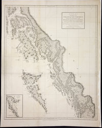 |
Chart shewing part of the Coast of N.W. America with the tracks of His Majesty's Sloop Discovery and Armed Tender Chatham, Commanded by George Vancouver Esq. and prepared under his immediate inspection by Lieut. Joseph Baker in which the continental shore has been correctly traced and determined from lat. 51 45ʹ N. and long. 232 08ʹ E. to lat. 57 30ʹ N. and long. 226 44ʹ E. at the periods shewn by the tracks ; Warner, sculp.Voyage of discovery to the North Pacific Ocean, and round the world. | 1798 |
Title: Chart shewing part of the Coast of N.W. America with the tracks of His Majesty's Sloop Discovery and Armed Tender Chatham, Commanded by George Vancouver Esq. and prepared under his immediate inspection by Lieut. Joseph Baker in which the continental shore has been correctly traced and determined from lat. 51 45ʹ N. and long. 232 08ʹ E. to lat. 57 30ʹ N. and long. 226 44ʹ E. at the periods shewn by the tracks ; Warner, sculp. Title: Voyage of discovery to the North Pacific Ocean, and round the world. Author: Vancouver, George, 1757-1798 Subject: British Columbia -- Maps; Alaska -- Maps; Stewart (B.C.) -- Maps; Coasts -- Alaska -- Maps; Coasts -- British Columbia -- Maps; Northwest Coast of North America -- Historical geography; Nautical charts. Identifier (repository): FO Identifier (repoNumber): 925 Identifier (repoVol): 1386 Identifier (libFileName): FO925-1386 pt1 (7) Identifier (penfoldNum): Identifier (doc_id): FO 925/1386 Date: 1798 Funder: Funded by a Canadian Council of Archives, Archival Community Digitization Program. Publisher: J. Edwards & G. Robinson Publisher: National Archives of the UK. 57 30'N-51 45'N/134 30'W-126 30'W |
![Vancouver's Island. Puget Sound Company's Farms [roughly sketched]](https://hcmc.uvic.ca/~coldesp/maps/maps_200/F25-1_fo_39.jpg) |
Vancouver's Island. Puget Sound Company's Farms [roughly sketched] | 1858 |
Title: Vancouver's Island. Puget Sound Company's Farms [roughly sketched] Author: A.G. Dallas Identifier (repository): HBC Identifier (doc_id): F.25/1 fo. 39 Date: 1858 Publisher: Hudson's Bay Company Archives Funder: Funded by a Canadian Council of Archives, Archival Community Digitization Program. |
![San Juan Water Boundary (Arbitration) : list of maps sent to Admiral Prevost at Berlin on the 12th June 1872 [map 30] Diagram of a portion of Oregon Territory](https://hcmc.uvic.ca/~coldesp/maps/maps_200/fo_925-1650_pt_2_30_oregon_territory_nw_1852.jpg) |
San Juan Water Boundary (Arbitration) : list of maps sent to Admiral Prevost at Berlin on the 12th June 1872 [map 30]Diagram of a portion of Oregon Territory | 1852 |
Title: San Juan Water Boundary (Arbitration) : list of maps sent to Admiral Prevost at Berlin on the 12th June 1872 [map 30] Title: Diagram of a portion of Oregon Territory Author: Creston, B. Subject: Washington (State)--Maps Identifier (repository): FO Identifier (repoNumber): 925 Identifier (repoVol): 1650 Identifier (libFileName): FO925-1650 pt2 (30) Identifier (penfoldNum): Identifier (doc_id): FO 925/1650 Date: 1852 Funder: Funded by a Canadian Council of Archives, Archival Community Digitization Program. Publisher: Surveyor General's Office, Oregon City Publisher: National Archives of the UK. 49 00'N--47 00'N / 124 00'W--122 00'W |
![San Juan boundary dispute maps [map L]. Carta esferica de los reconocimientos hechos en 1792 en la costa n.o. de America para examinar la entrada de Juan de Fuca, y la internacion de sus canales navagables.](https://hcmc.uvic.ca/~coldesp/maps/maps_200/fo_925-1649-l_j_d_f_s_1795.jpg) |
San Juan boundary dispute maps [map L].Carta esferica de los reconocimientos hechos en 1792 en la costa n.o. de America para examinar la entrada de Juan de Fuca, y la internacion de sus canales navagables. | 1795 |
Title: San Juan boundary dispute maps [map L]. Title: Carta esferica de los reconocimientos hechos en 1792 en la costa n.o. de America para examinar la entrada de Juan de Fuca, y la internacion de sus canales navagables. Author: Alcalá-Galiano, Dionisio, 1760-1805. Subject: San Juan Boundary Dispute, 1846-1872; Juan de Fuca, Strait of (B.C. and Wash.) -- Maps; Vancouver Island (B.C.) -- Maps; Washington (State) -- Maps. Subject: Juan de Fuca, Strait, 1795, 1873 Identifier (repository): FO Identifier (repoNumber): 925 Identifier (repoVol): 1649l Identifier (libFileName): FO925-1649 (l) Identifier (penfoldNum): 505 Identifier (doc_id): FO 925/1649 Date: 1795 Funder: Funded by a Canadian Council of Archives, Archival Community Digitization Program. Publisher: Harrison & Sons Lith. Publisher: National Archives of the UK. 51 15'N-47N/125 20'W-115W |
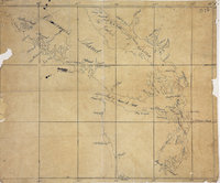 |
Map of part of Vancouver Island, the Gulf of Georgia and supposed Strait of Juan de FucaVancouver Island | 1848 |
Title: Map of part of Vancouver Island, the Gulf of Georgia and supposed Strait of Juan de Fuca Title: Vancouver Island Subject: Vancouver Island (B.C.)--Maps; Georgia, Gulf of (B.C. and Wash.)--Maps; Juan de Fuca Strait (B.C. and Wash.)--Maps Subject: Vancouver Island, 1848 Identifier (repository): FO Identifier (repoNumber): 925 Identifier (repoVol): 1374 Identifier (libFileName): FO925-1374 Identifier (penfoldNum): 558 Identifier (doc_id): FO 925/1374 Date: 1848 Funder: Funded by a Canadian Council of Archives, Archival Community Digitization Program. Publisher: National Archives of the UK. 50 00'N--47 00'N / 127 00'W--121 00'W |
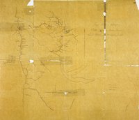 |
Rough Sketch of Part of British Columbia traced from Lieut. Palmer's plan of Cariboo District.Cariboo District. | 1863 |
Title: Rough Sketch of Part of British Columbia traced from Lieut. Palmer's plan of Cariboo District. Title: Cariboo District. Author: Palmer, H. Spencer (Henry Spencer), 1838-1893 Subject: Cariboo Region (B.C.) -- Maps; Fraser River (B.C.); Quesnel (B.C.); Gold mines and mining -- British Columbia. Subject: British Columbia, 1863 Identifier (repository): MPG Identifier (repoNumber): 1 Identifier (repoVol): 653 Identifier (libFileName): MPG1-653 Identifier (penfoldNum): 415 Identifier (doc_id): MPG1-653 Date: 1863 Funder: Funded by a Canadian Council of Archives, Archival Community Digitization Program. Publisher: National Archives of the UK. |
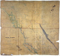 |
British Columbia, showing carriage roads completed, in progress, and proposed. | 1861 |
Title: British Columbia, showing carriage roads completed, in progress, and proposed. Subject: British Columbia -- Maps; Roads -- British Columbia -- Maps. Subject: British Columbia, 1861 Identifier (repository): CO Identifier (repoNumber): 700 Identifier (repoVol): bc Identifier (libFileName): CO700-BRITISH COLUMBIA11 (1) Identifier (penfoldNum): 402 Identifier (doc_id): CO 700/BRITISH COLUMBIA11/1 Date: 1861 Funder: Funded by a Canadian Council of Archives, Archival Community Digitization Program. Publisher: National Archives of the UK. 62N-50N/140W-115W |
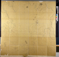 |
Map of the Victoria District Vancouver's Island | 1850 |
Title: Victoria District Vancouver's Island Author: W. Colquhoun. Grant Identifier (repository): HBC Identifier (doc_id): G1/256 Date: 1850 Publisher: Hudson's Bay Company Archives Funder: Funded by a Canadian Council of Archives, Archival Community Digitization Program. |
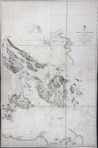 |
Haro and Rosario StraitsNorth America, West coast, Haro and Rosario Straits | 1859 |
Title: Haro and Rosario Straits Title: North America, West coast, Haro and Rosario Straits Author: Richards, G. H. (George Henry) Subject: Nautical charts -- Haro Strait (B.C. and Wash.); Nautical charts -- British Columbia -- Gulf Islands; Nautical charts -- Washington (State) -- Rosario Strait; Haro Strait (B.C. and Wash.)--Maps; Rosario Strait (Wash.)--Maps Subject: Haro and Rosario Straits, 1859 Identifier (repository): FO Identifier (repoNumber): 925 Identifier (repoVol): 1384 Identifier (libFileName): FO925-1384 Identifier (penfoldNum): 486 Identifier (doc_id): FO 925/1384 Date: 1859 Funder: Funded by a Canadian Council of Archives, Archival Community Digitization Program. Publisher: Great Britain, Hydrographic Office Publisher: National Archives of the UK. 49 15'N--48 05'N / 123 35'W--122 25'W |
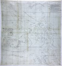 |
Reconnaissance of Canal de Haro & Strait of Rosario and approaches.Canal de Haro & Strait of Rosario. | 1857 |
Title: Reconnaissance of Canal de Haro & Strait of Rosario and approaches. Title: Canal de Haro & Strait of Rosario. Author: United States Coast Survey Subject: Haro Strait (B.C. and Wash.) -- Maps; Rosario Strait (Wash.) -- Maps; Georgia, Strait of (B.C. and Wash.) -- Maps; Juan de Fuca Strait (B.C. and Wash.) -- Maps; Boundaries -- British Columbia; Boundaries -- United States; North American Boundary Commission. Subject: Haro and Rosario Straits, 1854, 1857 Identifier (repository): MPK Identifier (repoNumber): 1 Identifier (repoVol): 66 Identifier (libFileName): MPK1-66 (2) Identifier (penfoldNum): 482 Identifier (doc_id): MPK 1/66/2 Date: 1857 Funder: Funded by a Canadian Council of Archives, Archival Community Digitization Program. Publisher: National Archives of the UK. 49 10'N-48 10'N/123 50'W-122 20'W |
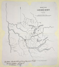 |
Sketch of Cariboo Mines, 1862. | 1862 |
Title: Sketch of Cariboo Mines, 1862. Author: Black, F. Subject: Cariboo Region (B.C.) -- Maps; Gold mines and mining -- British Columbia. Subject: British Columbia, 1862 Identifier (repository): CO Identifier (repoNumber): 700 Identifier (repoVol): bc Identifier (libFileName): CO700-BRITISH COLUMBIA11 (12) Identifier (penfoldNum): 406 Identifier (doc_id): CO700-BRITISH COLUMBIA11 (12) Date: 1862 Funder: Funded by a Canadian Council of Archives, Archival Community Digitization Program. Publisher: National Archives of the UK. |
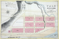 |
Yale, British Columbia, 1861. | 1861 |
Title: Yale, British Columbia, 1861. Author: Armstrong, Robert Subject: Yale (B.C.) -- Maps; British Columbia -- Maps; City planning -- British Columbia -- Yale Subject: British Columbia, 1861, 1862 Identifier (repository): CO Identifier (repoNumber): 700 Identifier (repoVol): bc Identifier (libFileName): CO700-BRITISH COLUMBIA11 (6) Identifier (penfoldNum): 401 Identifier (doc_id): CO 700/BRITISH COLUMBIA11/6 Date: 1861 Funder: Funded by a Canadian Council of Archives, Archival Community Digitization Program. Publisher: Great Britain. Army. Royal Engineers. Columbia Detachment. Publisher: National Archives of the UK. |
 |
British Columbia, 1862. Coast lines from Admiralty charts, interior from explorations by Royal Engineers and others up to 1862. North of Fraser River from Mr. Arrowsmith, East of Columbia River from Captain Palliser. | 1862 |
Title: British Columbia, 1862. Coast lines from Admiralty charts, interior from explorations by Royal Engineers and others up to 1862. North of Fraser River from Mr. Arrowsmith, East of Columbia River from Captain Palliser. Author: Conroy, James. Subject: British Columbia -- Maps; Gold mines and mining -- British Columbia -- Maps. Subject: British Columbia, 1862 Identifier (repository): CO Identifier (repoNumber): 700 Identifier (repoVol): bc Identifier (libFileName): CO700-BRITISH COLUMBIA11 (10) Identifier (penfoldNum): 404 Identifier (doc_id): CO700-BRITISH COLUMBIA11 (10) Date: 1862 Funder: Funded by a Canadian Council of Archives, Archival Community Digitization Program. Publisher: British Columbia. Dept. of Lands and Works. Publisher: National Archives of the UK. 57N-48N/131W-110W |
 |
British Columbia. Coast lines from Admiralty Charts, interior from Explorations by Royal Engineers and others up to 1862. North of Fraser River from Mr. Arrowsmith. East of Columbia River from Captain Palliser. | 1862 |
Title: British Columbia. Coast lines from Admiralty Charts, interior from Explorations by Royal Engineers and others up to 1862. North of Fraser River from Mr. Arrowsmith. East of Columbia River from Captain Palliser. Author: Conroy, James. Subject: British Columbia -- Maps; Vancouver Island (B.C.) -- Maps. Subject: British Columbia, 1862, 1864 Identifier (repository): MPG Identifier (repoNumber): 1 Identifier (repoVol): 650 Identifier (libFileName): MPG1-650 (2) Identifier (penfoldNum): 409 Identifier (doc_id): MPG1-650 (2) Date: 1862 Funder: Funded by a Canadian Council of Archives, Archival Community Digitization Program. Publisher: British Columbia. Dept. of Lands and Works. Publisher: National Archives of the UK. 57N-48N/133W-110W |
 |
Diagram of a Portion of Oregon Territory | 1852 |
Title: Diagram of a Portion of Oregon Territory Subject: San Juan Boundary Dispute, 1846-1872 Subject: Oregon Territory; Southern Vancouver Island Identifier (repository): FO Identifier (repoNumber): 925 Identifier (repoVol): 1647b Identifier (libFileName): FO925-1647B (9) Identifier (penfoldNum): Identifier (doc_id): FO 925/1647B Date: 1852 Funder: Funded by a Canadian Council of Archives, Archival Community Digitization Program. Publisher: Surveyor General's Office, Oregon City Publisher: Ordnance Survey Office, Southampton Publisher: National Archives of the UK. |
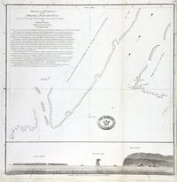 |
Sketch of the entrance of the Strait of Juan de Fuca : Lat. 48 37' N. Long. 124 54' W. : Variation observed 19Entrance of the Strait of Juan de Fuca | 1790 |
Title: Sketch of the entrance of the Strait of Juan de Fuca : Lat. 48 37' N. Long. 124 54' W. : Variation observed 19 Title: Entrance of the Strait of Juan de Fuca Author: Duncan, Charles, fl. 1782-96 Subject: Juan de Fuca Strait (B.C. and Wash.) -- Maps; Flattery, Cape (Wash.) -- Maps. Indians of North America -- Washington (State) Subject: Juan de Fuca, Strait, 1788, 1790 Identifier (repository): CO Identifier (repoNumber): 700 Identifier (repoVol): america Identifier (libFileName): CO700-AMERICA NORTH and SOUTH51 (26) Identifier (penfoldNum): 496 Identifier (doc_id): CO 700/AMERICA NORTH AND SOUTH51 Date: 1790 Funder: Funded by a Canadian Council of Archives, Archival Community Digitization Program. Publisher: Dalrymple, Alexander, 1737-1808 Publisher: National Archives of the UK. |
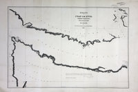 |
Straits of Juan de Fuca, Oregon Territory. From surveys of the U.S. Ex. Ex. and Spanish and English authorities | 1841 |
Title: Straits of Juan de Fuca, Oregon Territory. From surveys of the U.S. Ex. Ex. and Spanish and English authorities Author: Great Britain. Ordnance Survey. Subject: Juan de Fuca Strait (B.C. and Wash.)--Maps Subject: Juan de Fuca, Strait, 1841, 1871 Identifier (repository): FO Identifier (repoNumber): 925 Identifier (repoVol): 1873 Identifier (libFileName): FO925-1873 Identifier (penfoldNum): 510 Identifier (doc_id): FO 925/1873 Date: 1841 Funder: Funded by a Canadian Council of Archives, Archival Community Digitization Program. Publisher: Great Britain. Ordnance Survey Office, Southampton Publisher: National Archives of the UK. |
![San Juan Water Boundary (Arbitration) : list of maps sent to Admiral Prevost at Berlin on the 12th June 1872 [map 32] Map of the gold regions of the Frazer River and the Washington Territory on the western coast of America; Map of the gold regions of the Fraser River and the Washington Territory on the western coast of America](https://hcmc.uvic.ca/~coldesp/maps/maps_200/fo_925-1650_pt_2_32_gold_regions_1858.jpg) |
San Juan Water Boundary (Arbitration) : list of maps sent to Admiral Prevost at Berlin on the 12th June 1872 [map 32]Map of the gold regions of the Frazer River and the Washington Territory on the western coast of America; Map of the gold regions of the Fraser River and the Washington Territory on the western coast of America | 1858 |
Title: San Juan Water Boundary (Arbitration) : list of maps sent to Admiral Prevost at Berlin on the 12th June 1872 [map 32] Title: Map of the gold regions of the Frazer River and the Washington Territory on the western coast of America; Map of the gold regions of the Fraser River and the Washington Territory on the western coast of America Author: Wyld, James, 1812-1887 Subject: Fraser River (B.C.)--Maps; Washington (State)--Maps; Gold mines and mining--British Columbia--Fraser River--Maps; Gold mines and mining--Washington (State)--Maps; Gold ores--British Columbia--Fraser River--Maps; Gold ores--Washington (State)--Maps; Identifier (repository): FO Identifier (repoNumber): 925 Identifier (repoVol): 1650 Identifier (libFileName): FO925-1650 pt2 (32) Identifier (penfoldNum): Identifier (doc_id): FO 925/1650 Date: 1858 Funder: Funded by a Canadian Council of Archives, Archival Community Digitization Program. Publisher: James Wyld Publisher: National Archives of the UK. 51 00'N--46 00'N / 125 00'W--118 00'W |
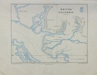 |
Monthly Sanitary Report for January 1860 Royal Engineers British Columbia 11pp and Annual report for the year ending 31st Dec. | 1860 |
Title: Monthly Sanitary Report for January 1860 Royal Engineers British Columbia 11pp and Annual report for the year ending 31st Dec. Author: Launders, James Benjamin, d. 1878. Identifier (repository): WO Identifier (repoNumber): 334 Identifier (repoVol): 127 Identifier (libFileName): WO334-127 (1) - WO334-127 (43) Identifier (penfoldNum): Identifier (doc_id): WO 334/127 Date: 1860 Funder: Funded by a Canadian Council of Archives, Archival Community Digitization Program. Publisher: Great Britain. Army. Royal Engineers. Columbia Detachment. Publisher: National Archives of the UK. |
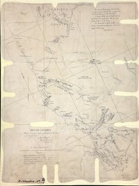 |
Sketch of trail from Lytton and Lillooet to Alexandria and the Cariboo District. | 1861 |
Title: Sketch of trail from Lytton and Lillooet to Alexandria and the Cariboo District. Author: Begbie, Matthew Baillie, Sir, 1819-1894 Subject: British Columbia -- Maps; Lytton (B.C.) -- Maps; Lillooet (B.C.) -- Maps; Cariboo Region (B.C.) -- Maps; Fort Alexandria National Historic Site (B.C.) -- Maps. Subject: British Columbia, 1861 Identifier (repository): CO Identifier (repoNumber): 700 Identifier (repoVol): bc Identifier (libFileName): CO700-BRITISH COLUMBIA8 (7) Identifier (penfoldNum): 397 Identifier (doc_id): CO 700/BRITISH COLUMBIA8/7 Date: 1861 Funder: Funded by a Canadian Council of Archives, Archival Community Digitization Program. Publisher: National Archives of the UK. 53N--51N / 122W--121W |
 |
Map of part of Vancouver's Island, the Gulf of Georgia and supposed Strait of Juan de FucaVancouver Island | 1848 |
Title: Map of part of Vancouver's Island, the Gulf of Georgia and supposed Strait of Juan de Fuca Title: Vancouver Island Subject: Vancouver Island (B.C.)--Maps; Georgia, Gulf of (B.C. and Wash.)--Maps; Juan de Fuca Strait (B.C. and Wash.)--Maps Subject: Vancouver Island, 1848 Identifier (repository): FO Identifier (repoNumber): 925 Identifier (repoVol): 1375 Identifier (libFileName): FO925-1375 Identifier (penfoldNum): 557 Identifier (doc_id): FO 925/1375 Date: 1848 Funder: Funded by a Canadian Council of Archives, Archival Community Digitization Program. Publisher: National Archives of the UK. 50 00'N--47 00'N / 126 00'W--122 00'W |
![Saanich District [and] South Saanich District, 1855. The South Eastern Districts of Vancouver Island.](https://hcmc.uvic.ca/~coldesp/maps/maps_200/mpg_1-241_van_isl_1855_top_but_separate.jpg) |
Saanich District [and] South Saanich District, 1855.The South Eastern Districts of Vancouver Island. | 1855 |
Title: Saanich District [and] South Saanich District, 1855. Title: The South Eastern Districts of Vancouver Island. Author: Pemberton, J. Despard (Joseph Despard), 1821-1893. Subject: Vancouver Island (B.C.) -- Maps; Saanich (B.C.) -- Maps; Saanich Peninsula (B.C.) -- Maps; North Saanich (B.C.) -- Maps; Central Saanich (B.C.) -- Maps. Subject: Vancouver Island, 1855 Identifier (repository): MPG Identifier (repoNumber): 1 Identifier (repoVol): 241 Identifier (libFileName): MPG1-241 Identifier (penfoldNum): 567 Identifier (doc_id): MPG 1/241 Date: 1855 Funder: Funded by a Canadian Council of Archives, Archival Community Digitization Program. Publisher: John Arrowsmith. Publisher: National Archives of the UK. |
 |
Vancouver Island: Chart of HMS Scout 9-12 August 1866 showing her grounding off Nootka Island while 'conveying H.E. the Governor round the Id. to visit the Indian & other settlements'. | 1866 |
Title: Vancouver Island: Chart of HMS Scout 9-12 August 1866 showing her grounding off Nootka Island while conveying H.E. the Governor round the Id. to visit the Indian & other settlements Subject: Vancouver Island; Nootka Sound; HMS Scout Identifier (repository): MFQ Identifier (repoNumber): 1 Identifier (repoVol): 632 Identifier (libFileName): MFQ1-632 (8) Identifier (penfoldNum): Identifier (doc_id): MFQ1-632 (8) Date: 1866 Funder: Funded by a Canadian Council of Archives, Archival Community Digitization Program. Publisher: National Archives of the UK. |
 |
Map of Vancouver Island and the adjacent coasts.Vancouver Island and the adjacent coasts. | 1853 |
Title: Map of Vancouver Island and the adjacent coasts. Title: Vancouver Island and the adjacent coasts. Author: Arrowsmith, John, 1790-1873 Subject: Vancouver Island (B.C.)--Maps; Pacific Coast (B.C.)--Maps; Victoria (B.C.)--Maps; British Columbia--Yuquot--Maps Subject: Vancouver Island, 1853 Identifier (repository): FO Identifier (repoNumber): 925 Identifier (repoVol): 1238 Identifier (libFileName): FO925-1238 Identifier (penfoldNum): 565 Identifier (doc_id): FO 925/1238 Date: 1853 Funder: Funded by a Canadian Council of Archives, Archival Community Digitization Program. Publisher: John Arrowsmith Publisher: National Archives of the UK. 52 00'N--48 00'N / 129 00'W--122 00'W |
 |
Strait of Juan de Fuca | 1858 |
Title: Strait of Juan de Fuca Author: Kellett, Henry, 1806-1875. Subject: Juan de Fuca, Strait of (B.C. and Wash.) -- Maps; Nautical charts -- Juan de Fuca, Strait of (B.C. and Wash.); Puget Sound (Wash.) -- Maps; Nautical charts -- Puget Sound (Wash.); Nautical charts -- Haro Strait (B.C. and Wash.); Nautical charts -- Rosario Strait (Wash.); Flattery, Cape (Wash.); San Juan Boundary Dispute, 1846-1872. Subject: Juan de Fuca, Strait, 1849, 1871, 1872 Identifier (repository): FO Identifier (repoNumber): 925 Identifier (repoVol): 1959 Identifier (libFileName): FO925-1959 pt2 Identifier (penfoldNum): 519 Identifier (doc_id): FO 925/1959 Date: 1858 Funder: Funded by a Canadian Council of Archives, Archival Community Digitization Program. Publisher: Great Britain. Hydrographic Office Publisher: National Archives of the UK. 48 35'N--47 30'N / 124 45'W--122 10'W |
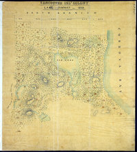 |
Lake District, 1859. | 1859 |
Title: Lake District, 1859. Subject: Elk Lake Region (B.C.) -- Maps; Elk Lake (B.C.) -- Maps; Vancouver Island (B.C.) -- Elk Lake-- Maps; Land use. Subject: Vancouver Island, 1859 Identifier (repository): MPG Identifier (repoNumber): 1 Identifier (repoVol): 245 Identifier (libFileName): MPG1-245 Identifier (penfoldNum): 569 Identifier (doc_id): MPG 1/245 Date: 1859 Funder: Funded by a Canadian Council of Archives, Archival Community Digitization Program. Publisher: National Archives of the UK. |
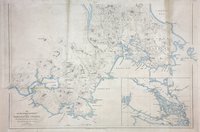 |
South eastern districts of Vancouver Island. | 1855 |
Title: South eastern districts of Vancouver Island. Author: Pemberton, J. Despard (Joseph Despard), 1821-1893. Subject: Vancouver Island (B.C.) -- Maps; Vancouver Island, Southeastern (B.C.) -- Maps; Indians of North America -- British Columbia -- Vancouver Island. Subject: Vancouver Island, 1855 Identifier (repository): MPG Identifier (repoNumber): 1 Identifier (repoVol): 242 Identifier (libFileName): MPG1-242 Identifier (penfoldNum): 567 Identifier (doc_id): MPG 1/242 Date: 1855 Funder: Funded by a Canadian Council of Archives, Archival Community Digitization Program. Publisher: John Arrowsmith. Publisher: National Archives of the UK. |
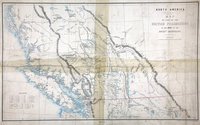 |
Sketch map of part of the British possessions to the west of the Rocky Mountains.British Possessions to the West of the Rocky Mountains. | 1858 |
Title: Sketch map of part of the British possessions to the west of the Rocky Mountains. Title: British Possessions to the West of the Rocky Mountains. Author: Great Britain. Army. Royal Engineers. Columbia Detachment; Elphinstone, Howard Crawfurd, Sir, 1829-1890; James, H., 1803-1877. Subject: British Columbia -- Maps; British Columbia -- History; British Columbia -- Agriculture; Indians of North America -- British Columbia. Subject: British Columbia, 1858 Identifier (repository): MPG Identifier (repoNumber): 1 Identifier (repoVol): 136 Identifier (libFileName): MPG1-136 Identifier (penfoldNum): 383 Identifier (doc_id): MPG 1/136 Date: 1858 Funder: Funded by a Canadian Council of Archives, Archival Community Digitization Program. Publisher: Great Britain. War Office. Topographical Depot. Publisher: National Archives of the UK. 48N-54N/128W-112W |
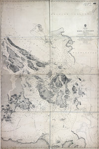 |
Haro and Rosario Straits | 1859 |
Title: Haro and Rosario Straits Author: Richards, G.H. (George Henry) Subject: Haro Strait (B.C. and Wash.)--Maps; Rosario Strait (Wash.)--Maps Subject: Haro and Rosario Straits, 1859, 1871 Identifier (repository): FO Identifier (repoNumber): 925 Identifier (repoVol): 1252 Identifier (libFileName): FO925-1252 Identifier (penfoldNum): 494 Identifier (doc_id): FO 925/1252 Date: 1859 Funder: Funded by a Canadian Council of Archives, Archival Community Digitization Program. Publisher: Great Britain. Hydrographic Office Publisher: National Archives of the UK. 49 15'N--48 05'N / 123 35'W--122 25'W |
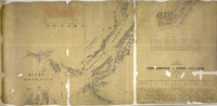 |
Port Simpson to Nass Village, from the Admiralty survey of 1868N.W. America, British Columbia | 1868 |
Title: Port Simpson to Nass Village, from the Admiralty survey of 1868 Title: N.W. America, British Columbia Author: Cameron, D. R. (Donald Roderick), 1834-1905 Subject: British Columbia--Port Simpson--Maps; British Columbia--Nass River--Maps' British Columbia--Kincolith--Maps; Alaska--Boundaries--Canada--Maps; Canada--Boundaries--Alaska--Maps Subject: Nass, River, 1868, 1886 Identifier (repository): CO Identifier (repoNumber): 700 Identifier (repoVol): canada Identifier (libFileName): CO700-CANADA144 (25) Identifier (penfoldNum): 535 Identifier (doc_id): CO700-CANADA144 (25) Date: 1868 Funder: Funded by a Canadian Council of Archives, Archival Community Digitization Program. Publisher: Great Britain. Colonial Office Publisher: National Archives of the UK. |
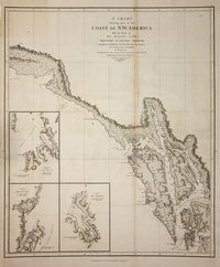 |
Chart shewing part of the coast of N.W. America. With the tracks of His Majesty's Sloop Discovery and Armed Tender Chatham. Commanded by George Vancouver, Esqr. and prepared under his immediate inspection by Lieut. Joseph Baker, in which the continental shore has been correctly traced and determined from lat. 57⁰,07ʹ 1/2 N. and long. 227⁰,00ʹ E. to lat. 59⁰,59ʹ N. and long. 219⁰,00ʹ E. at the periods shewn by the track ; engraved by T. Foot.Voyage of discovery to the North Pacific Ocean, and round the world. | 1798 |
Title: Chart shewing part of the coast of N.W. America. With the tracks of His Majesty's Sloop Discovery and Armed Tender Chatham. Commanded by George Vancouver, Esqr. and prepared under his immediate inspection by Lieut. Joseph Baker, in which the continental shore has been correctly traced and determined from lat. 57⁰,07ʹ 1/2 N. and long. 227⁰,00ʹ E. to lat. 59⁰,59ʹ N. and long. 219⁰,00ʹ E. at the periods shewn by the track ; engraved by T. Foot. Title: Voyage of discovery to the North Pacific Ocean, and round the world. Author: Vancouver, George, 1757-1798 Subject: Alaska -- Maps; Coasts -- Alaska -- Maps. Identifier (repository): FO Identifier (repoNumber): 925 Identifier (repoVol): 1386 Identifier (libFileName): FO925-1386 pt2 (12) Identifier (doc_id): FO 925/1386 Date: 1798 Funder: Funded by a Canadian Council of Archives, Archival Community Digitization Program. Publisher: J. Edwards & G. Robinson Publisher: National Archives of the UK. 61N-56N/141W-133W |
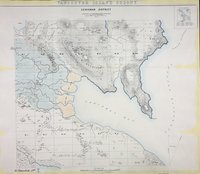 |
Cowichan District 1859.Vancouver Island Colony. Sketch Maps of Districts. | 1859 |
Title: Cowichan District 1859. Title: Vancouver Island Colony. Sketch Maps of Districts. Subject: Cowichan Region (B.C.) -- Maps; Cowichan Bay (B.C.) -- Maps; Cowichan River Estuary (B.C.) -- Maps; Vancouver Island (B.C.) -- Maps; Land use. Subject: Vancouver Island, 1859 Identifier (repository): CO Identifier (repoNumber): 700 Identifier (repoVol): bc Identifier (libFileName): CO700-BRITISH COLUMBIA7 (5) Identifier (penfoldNum): 568 Identifier (doc_id): CO 700/BRITISH COLUMBIA7/5 Date: 1859 Funder: Funded by a Canadian Council of Archives, Archival Community Digitization Program. Publisher: Great Britain. War Office. Topographical Depot. Publisher: National Archives of the UK. |
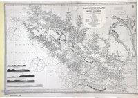 |
Vancouver Island and adjacent shores of British Columbia. | 1865 |
Title: Vancouver Island and adjacent shores of British Columbia. Author: Richards, G. H. (George Henry) Subject: Vancouver Island (B.C.) -- Maps; British Columbia -- Coasts -- Maps; Nautical charts -- British Columbia; Nautical charts -- Juan de Fuca Strait (B.C. and Wash.); Indians of North America -- British Columbia. Subject: Vancouver Island, 1859-65, 1908 Identifier (repository): CO Identifier (repoNumber): 700 Identifier (repoVol): bc Identifier (libFileName): CO700-BRITISH COLUMBIA34 Identifier (penfoldNum): 571 Identifier (doc_id): CO700-BRITISH COLUMBIA34 Date: 1865 Funder: Funded by a Canadian Council of Archives, Archival Community Digitization Program. Publisher: Great Britain. Hydrographic Office Publisher: National Archives of the UK. 51 24'N-47 54'N/130 27'W-121 32'W. |
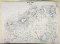 |
Somenos District 1859.Vancouver Island Colony. Sketch Maps of Districts. | 1859 |
Title: Somenos District 1859. Title: Vancouver Island Colony. Sketch Maps of Districts. Subject: Somenos Region (B.C.) -- Maps; Vancouver Island -- Maps. Subject: British Columbia, 1859 Identifier (repository): CO Identifier (repoNumber): 700 Identifier (repoVol): bc Identifier (libFileName): CO700-BRITISH COLUMBIA7 (4) Identifier (penfoldNum): 568 Identifier (doc_id): CO 700/BRITISH COLUMBIA7/4 Date: 1859 Funder: Funded by a Canadian Council of Archives, Archival Community Digitization Program. Publisher: Great Britain. War Office. Topographical Depot. Publisher: National Archives of the UK. |
![San Juan Water Boundary (Arbitration) : list of maps sent to Admiral Prevost at Berlin on the 12th June 1872 [map 22] Sooke Inlet](https://hcmc.uvic.ca/~coldesp/maps/maps_200/fo_925-1650_pt_1_22_sooke_inlet_1847.jpg) |
San Juan Water Boundary (Arbitration) : list of maps sent to Admiral Prevost at Berlin on the 12th June 1872 [map 22]Sooke Inlet | 1847 |
Title: San Juan Water Boundary (Arbitration) : list of maps sent to Admiral Prevost at Berlin on the 12th June 1872 [map 22] Title: Sooke Inlet Author: Kellett, Henry, 1806-1875 Subject: Inlets--British Columbia--Maps; Juan de Fuca Strait (B.C. and Wash.)--Maps; Subject: Sooke Inlet, 1848, 1872 Identifier (repository): FO Identifier (repoNumber): 925 Identifier (repoVol): 1650 Identifier (libFileName): FO925-1650 pt1 (22) Identifier (penfoldNum): 551 Identifier (doc_id): FO 925/1650 Date: 1847 Funder: Funded by a Canadian Council of Archives, Archival Community Digitization Program. Publisher: J. & C. Walker Publisher: National Archives of the UK. |
![San Juan boundary dispute maps [map F]. Map of Wilkes, 1845.](https://hcmc.uvic.ca/~coldesp/maps/maps_200/fo_925-1649-f_bc_washington_1845.jpg) |
San Juan boundary dispute maps [map F].Map of Wilkes, 1845. | 1845 |
Title: San Juan boundary dispute maps [map F]. Title: Map of Wilkes, 1845. Author: Wilkes, Charles, 1798-1877 Subject: San Juan Boundary Dispute, 1846-1872; Vancouver Island (B.C.) -- Maps; Juan de Fuca, Strait of (B.C. and Wash.) -- Maps; Washington (State) -- Maps. Subject: British Columbia, 1845, 1873 Identifier (repository): FO Identifier (repoNumber): 925 Identifier (repoVol): 1649f Identifier (libFileName): FO925-1649 (f) Identifier (penfoldNum): 377 Identifier (doc_id): FO 925/1649 Date: 1845 Funder: Funded by a Canadian Council of Archives, Archival Community Digitization Program. Publisher: Harrison & Sons Lith. Publisher: National Archives of the UK. 50N-48N |
![San Juan Boundary Arbitration atlas [map 6]. Haro and Rosario Straits.](https://hcmc.uvic.ca/~coldesp/maps/maps_200/fo_925-1647b_6_haro_and_rosario_ss_1859_1871_1865.jpg) |
San Juan Boundary Arbitration atlas [map 6].Haro and Rosario Straits. | 1865 |
Title: San Juan Boundary Arbitration atlas [map 6]. Title: Haro and Rosario Straits. Author: Richards, G. H. (George Henry) Subject: San Juan Boundary Dispute, 1846-1872; Haro Strait (B.C. and Wash.) -- Maps; Rosario Strati (Wash.) -- Maps; Nautical charts -- Haro Strait (B.C. and Wash.); Nautical charts -- British Columbia -- Gulf Islands; Nautical charts -- Washington (State) -- Rosario Strait; Nautical charts -- Washington (State) -- San Juan Islands; Subject: Haro and Rosario Straits, 1859, 1871 Identifier (repository): FO Identifier (repoNumber): 925 Identifier (repoVol): 1647b Identifier (libFileName): FO925-1647B (6) Identifier (penfoldNum): 492 Identifier (doc_id): FO925-1647B (6) Date: 1865 Funder: Funded by a Canadian Council of Archives, Archival Community Digitization Program. Publisher: Great Britain. Hydrographic Service. Publisher: National Archives of the UK. 49 19'N-N 48 5'/ 123 39'W-122 25'W. |
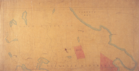 |
Map of the District of Victoria &c. in Vancouver Id. No. 1 | 1864 |
Title: Map of the District of Victoria &c. in Vancouver Id. No. 1 Author: Unknown Identifier (repository): HBC Identifier (doc_id): A.11/80 fo. 423 Date: 1864 Publisher: Hudson's Bay Company Archives Funder: Funded by a Canadian Council of Archives, Archival Community Digitization Program. |
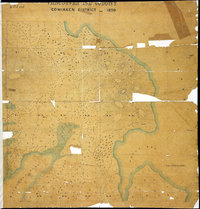 |
Comiaken District, 1859. | 1859 |
Title: Comiaken District, 1859. Subject: Vancouver Island (B.C.) -- Maps; Comiaken Region(B.C.) -- Maps; Land use. Subject: Vancouver Island, 1859 Identifier (repository): MPG Identifier (repoNumber): 1 Identifier (repoVol): 248 Identifier (libFileName): MPG1-248 Identifier (penfoldNum): 569 Identifier (doc_id): MPG 1/248 Date: 1859 Funder: Funded by a Canadian Council of Archives, Archival Community Digitization Program. Publisher: National Archives of the UK. |
![San Juan Water Boundary (Arbitration) : list of maps sent to Admiral Prevost at Berlin on the 12th June 1872 [map 35] Sections upon various parallels between Vancouver Id. & Oregon](https://hcmc.uvic.ca/~coldesp/maps/maps_200/fo_925-1650_pt_2_35_sections_of_ss_1775_1866.jpg) |
San Juan Water Boundary (Arbitration) : list of maps sent to Admiral Prevost at Berlin on the 12th June 1872 [map 35]Sections upon various parallels between Vancouver Id. & Oregon | date_unknown |
Title: San Juan Water Boundary (Arbitration) : list of maps sent to Admiral Prevost at Berlin on the 12th June 1872 [map 35] Title: Sections upon various parallels between Vancouver Id. & Oregon Subject: Vancouver Island (B.C.)--Maps; Washington (State)--Maps; Haro Strait (B.C. and Wash.)--Maps; Rosario Strait (Wash.)--Maps; Juan de Fuca Strait (B.C. and Wash.)--Maps; Canada--Boundaries--Maps; United States--Boundaries--Maps Subject: British Columbia, Washington, 1860, 1872 Identifier (repository): FO Identifier (repoNumber): 925 Identifier (repoVol): 1650 Identifier (libFileName): FO925-1650 pt2 (35) Identifier (penfoldNum): 394 Identifier (doc_id): FO925-1650 pt2 (35) Date: date_unknown Funder: Funded by a Canadian Council of Archives, Archival Community Digitization Program. Publisher: National Archives of the UK. |
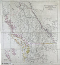 |
Provinces of British Columbia and Vancouver Island; with portions of the United States and Hudson's Bay Territories.British Columbia and Vancouver Island. | 1859 |
Title: Provinces of British Columbia and Vancouver Island; with portions of the United States and Hudson's Bay Territories. Title: British Columbia and Vancouver Island. Author: Arrowsmith, John, 1790-1873. Subject: British Columbia -- Maps; Vancouver Island -- Maps; Haida Gwaii (B.C.) -- Maps; Washington (State) -- Maps; Oregon -- Maps; Indians of North America -- British Columbia; Hudsons Bay Company. Subject: British Columbia, Alberta, Washington, 1859 Identifier (repository): CO Identifier (repoNumber): 700 Identifier (repoVol): bc Identifier (libFileName): CO700-BRITISH COLUMBIA6 Identifier (penfoldNum): 386 Identifier (doc_id): CO 700/BRITISH COLUMBIA6 Date: 1859 Funder: Funded by a Canadian Council of Archives, Archival Community Digitization Program. Publisher: John Arrowsmith. Publisher: National Archives of the UK. 57 30'N-45N/132 10'W-112 10'W |
![San Juan Boundary Arbitration atlas [map 4]. Chart of Admiralty Inlet, Puget Sound, and Hoods Canal, Oregon Territory by the U.S. Ex. Ex. 1841](https://hcmc.uvic.ca/~coldesp/maps/maps_200/fo_925-1647b_4_1841.jpg) |
San Juan Boundary Arbitration atlas [map 4].Chart of Admiralty Inlet, Puget Sound, and Hoods Canal, Oregon Territory by the U.S. Ex. Ex. 1841 | 1841 |
Title: San Juan Boundary Arbitration atlas [map 4]. Title: Chart of Admiralty Inlet, Puget Sound, and Hoods Canal, Oregon Territory by the U.S. Ex. Ex. 1841 Author: United States Exploring Expedition (1838-1842) Subject: San Juan Boundary Dispute, 1846-1872; Admiralty Inlet (Wash.) -- Maps; Hood Canal (Wash.) -- Maps; Puget Sound (Wash.) -- Maps; Pacific Coast (B.C.)--Maps; Pacific Coast (U.S.)--Maps; Canada--Boundaries--Maps; United States--Boundaries--Maps; Nautical charts. Identifier (repository): FO Identifier (repoNumber): 925 Identifier (repoVol): 1647b Identifier (libFileName): FO925-1647B (4) Identifier (penfoldNum): Identifier (doc_id): FO 925/1647B Date: 1841 Funder: Funded by a Canadian Council of Archives, Archival Community Digitization Program. Publisher: Great Britain. Ordnance Survey. Publisher: National Archives of the UK. 48 08'N-47N/122 48'W-123 54'W |
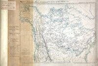 |
Map of North America. | 1857 |
Title: Map of North America. Author: Arrowsmith, John, 1790-1873. Subject: Canada -- Maps; Alaska -- Maps; North America -- Maps; Hudson's Bay Company; British North American Exploring Expedition Identifier (repository): MR Identifier (repoNumber): 1 Identifier (repoVol): 1091 Identifier (libFileName): MR1-109-1 Identifier (penfoldNum): Identifier (doc_id): MR 1/109/1 Date: 1857 Funder: Funded by a Canadian Council of Archives, Archival Community Digitization Program. Publisher: John Arrowsmith Publisher: National Archives of the UK. 65N-35N/130W-70W |
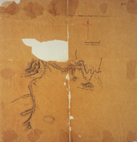 |
Survey of Telegraph Creek and upper part of Shuswap River near Tete Jaune Cache, May 1865 | 1865 |
Title: Survey of Telegraph Creek and upper part of Shuswap River near Tete Jaune Cache, May 1865 Author: J.W. McKay Identifier (repository): HBC Identifier (doc_id): E.15/13 fo. 42 Date: 1865 Publisher: Hudson's Bay Company Archives Funder: Funded by a Canadian Council of Archives, Archival Community Digitization Program. |
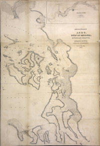 |
Archipelago of Arro, Gulf of Georgia, Ringgold's Channel and Straits of Fuca, Oregon Territory | 1841 |
Title: Archipelago of Arro, Gulf of Georgia, Ringgold's Channel and Straits of Fuca, Oregon Territory Author: United States Exploring Expedition (1838-1842) Subject: Juan de Fuca Strait (B.C. and Wash.)--Maps; Georgia, Strait of (B.C. and Wash.)--Maps; San Juan Islands (Wash.)--Maps; Gulf Islands (B.C.)--Maps Subject: British Columbia, 1841, 1848 Identifier (repository): FO Identifier (repoNumber): 925 Identifier (repoVol): 1377 Identifier (libFileName): FO925-1377 Identifier (penfoldNum): 373 Identifier (doc_id): FO 925/1377 Date: 1841 Funder: Funded by a Canadian Council of Archives, Archival Community Digitization Program. Publisher: National Archives of the UK. 49 00'N--48 00'N / 123 00'W--122 30'W |
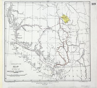 |
Skeleton map of part of British Columbia. | 1863 |
Title: Skeleton map of part of British Columbia. Author: Turnbull, James Subject: British Columbia -- Maps Subject: British Columbia, 1863 Identifier (repository): MPG Identifier (repoNumber): 1 Identifier (repoVol): 652 Identifier (libFileName): MPG1-652 (1) Identifier (penfoldNum): 412 Identifier (doc_id): MPG1-652 (1) Date: 1863 Funder: Funded by a Canadian Council of Archives, Archival Community Digitization Program. Publisher: British Columbia. Dept. of Lands and Works. Publisher: National Archives of the UK. 54N-48N/129W-119W |
![[Plan of the town of Victoria, 1860].](https://hcmc.uvic.ca/~coldesp/maps/maps_200/mpg_1-250_vic_1860.jpg) |
[Plan of the town of Victoria, 1860]. | 1860 |
Title: [Plan of the town of Victoria, 1860]. Subject: City planning -- British Columbia -- Victoria; Victoria (B.C.) -- History; Victoria (B.C.) -- Buildings, structures, etc. Subject: Victoria, 1860 Identifier (repository): MPG Identifier (repoNumber): 1 Identifier (repoVol): 250 Identifier (libFileName): MPG1-250 Identifier (penfoldNum): 578 Identifier (doc_id): MPG 1/250 Date: 1860 Funder: Funded by a Canadian Council of Archives, Archival Community Digitization Program. Publisher: National Archives of the UK. |
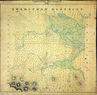 |
Quamichan District, 1859. | 1859 |
Title: Quamichan District, 1859. Subject: Vancouver Island (B.C.) -- Maps; Quamichan Region (B.C.) -- Maps; Land use. Subject: Vancouver Island, 1859 Identifier (repository): MPG Identifier (repoNumber): 1 Identifier (repoVol): 247 Identifier (libFileName): MPG1-247 Identifier (penfoldNum): 569 Identifier (doc_id): MPG 1/247 Date: 1859 Funder: Funded by a Canadian Council of Archives, Archival Community Digitization Program. Publisher: National Archives of the UK. |
![Chart of the Coast of NW America and Islands adjacent North Westward of the Gulf of Georgia as explored by His Majesty's Ships Discovery and Chatham in the Months of July & August 1792.', covering Queen Charlotte Sound from the sea to Cape Mudge. Scale: 1 inch to about 4½ miles. Compass indicator. Longitude is shown east from Greenwich. [Queen Charlotte Sound, 1792]](https://hcmc.uvic.ca/~coldesp/maps/maps_200/mpg_1-557_3_queen_charlotte_sound_1792.jpg) |
Chart of the Coast of NW America and Islands adjacent North Westward of the Gulf of Georgia as explored by His Majesty's Ships Discovery and Chatham in the Months of July & August 1792.', covering Queen Charlotte Sound from the sea to Cape Mudge. Scale: 1 inch to about 4½ miles. Compass indicator. Longitude is shown east from Greenwich. [Queen Charlotte Sound, 1792] | 1792 |
Title: Chart of the Coast of NW America and Islands adjacent North Westward of the Gulf of Georgia as explored by His Majesty's Ships Discovery and Chatham in the Months of July & August 1792.', covering Queen Charlotte Sound from the sea to Cape Mudge. Scale: 1 inch to about 4½ miles. Compass indicator. Longitude is shown east from Greenwich. [Queen Charlotte Sound, 1792] Subject: Queen Charlotte Sound -- Maps; Broughton's Archipelago -- Maps; Johnstone's Passage -- Maps. Subject: Queen Charlotte Sound, 1792 Identifier (repository): MPG Identifier (repoNumber): 1 Identifier (repoVol): 557 Identifier (libFileName): MPG1-557 (3) Identifier (penfoldNum): 549 Identifier (doc_id): MPG 1/557/3 Date: 1792 Funder: Funded by a Canadian Council of Archives, Archival Community Digitization Program. Publisher: National Archives of the UK. |
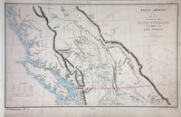 |
Sketch map of part of the British possessions to the west of the Rocky Mountains.British Possessions to the West of the Rocky Mountains. | 1858 |
Title: Sketch map of part of the British possessions to the west of the Rocky Mountains. Title: British Possessions to the West of the Rocky Mountains. Author: Great Britain. Army. Royal Engineers. Columbia Detachment.; Elphinstone, Howard Crawfurd, Sir, 1829-1890; James, H., 1803-1877. Subject: British Columbia -- Maps; British Columbia -- History; British Columbia -- Agriculture; Indians of North America -- British Columbia. Subject: British Columbia, 1858 Identifier (repository): CO Identifier (repoNumber): 700 Identifier (repoVol): bc Identifier (libFileName): CO700-BRITISH COLUMBIA5 Identifier (penfoldNum): 381 Identifier (doc_id): CO 700/BRITISH COLUMBIA5 Date: 1858 Funder: Funded by a Canadian Council of Archives, Archival Community Digitization Program. Publisher: Great Britain. War Office. Topographical Depot. Publisher: National Archives of the UK. 48N-54N/128W-112W |
![San Juan Boundary Arbitration atlas [map 3]. Straits of Juan de Fuca, Oregon Territory, from surveys of the U.S. Ex. Ex. and Spanish and English authorities.](https://hcmc.uvic.ca/~coldesp/maps/maps_200/fo_925-1647b_3_1841.jpg) |
San Juan Boundary Arbitration atlas [map 3].Straits of Juan de Fuca, Oregon Territory, from surveys of the U.S. Ex. Ex. and Spanish and English authorities. | 1841 |
Title: San Juan Boundary Arbitration atlas [map 3]. Title: Straits of Juan de Fuca, Oregon Territory, from surveys of the U.S. Ex. Ex. and Spanish and English authorities. Author: United States Exploring Expedition (1838-1842) Subject: San Juan Boundary Dispute, 1846-1872; Pacific Coast (B.C.)--Maps; Pacific Coast (U.S.)--Maps; Canada--Boundaries--Maps; United States--Boundaries--Maps; Juan de Fuca Strait (B.C. and Wash.)--Maps; Washington (State)--Maps; British Columbia--Maps Subject: Juan de Fuca, Strait, 1841, 1871 Identifier (repository): FO Identifier (repoNumber): 925 Identifier (repoVol): 1647b Identifier (libFileName): FO925-1647B (3) Identifier (penfoldNum): 509 Identifier (doc_id): FO 925/1647B Date: 1841 Funder: Funded by a Canadian Council of Archives, Archival Community Digitization Program. Publisher: Great Britain. Ordnance Survey. Publisher: National Archives of the UK. 48 30'N--48 00'N / 124 30'W--123 30'W |
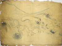 |
Map showing Haro Strait and Cordova Bay | 1852 |
Title: Map showing Haro Strait and Cordova Bay Author: J.D. Pemberton Identifier (repository): HBC Identifier (doc_id): G1/130 Date: 1852 Publisher: Hudson's Bay Company Archives Funder: Funded by a Canadian Council of Archives, Archival Community Digitization Program. |
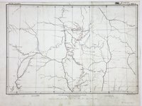 |
Northern British Columbia.British Columbia, Sheet 5'. | 1863 |
Title: Northern British Columbia. Title: British Columbia, Sheet 5'. Author: Conroy, James Subject: British Columbia, Northern -- Maps; Chilcotin Plateau (B.C.) -- Maps; Cariboo Region (B.C.) -- Maps; Indians of North America -- British Columbia. Subject: British Columbia, 1863 Identifier (repository): MPG Identifier (repoNumber): 1 Identifier (repoVol): 654 Identifier (libFileName): MPG1-654 (2) Identifier (penfoldNum): 411 Identifier (doc_id): MPG1-654 (2) Date: 1863 Funder: Funded by a Canadian Council of Archives, Archival Community Digitization Program. Publisher: Great Britain. Army. Royal Engineers. Columbia Detachment. Publisher: National Archives of the UK. 53 40'N-50 50'N/126 20'W-118 20'W |
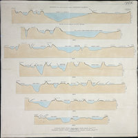 |
Sections upon various parallels between Vancouver Island and Oregon. |
Title: Sections upon various parallels between Vancouver Island and Oregon. Subject: Georgia, Strait of (B.C. and Wash.) -- Maps; Haro Strait (B.C. and Wash.) -- Maps; Rosario Strait (Wash.) Subject: British Columbia, Washington, 1860, 1872 Identifier (repository): FO Identifier (repoNumber): 925 Identifier (repoVol): 1968 Identifier (libFileName): FO925-1968 Identifier (penfoldNum): 393 Identifier (doc_id): FO925-1968 Date: Funder: Funded by a Canadian Council of Archives, Archival Community Digitization Program. Publisher: National Archives of the UK. 49N-48 25'N |
|
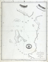 |
Sketch of Ahouset. Lat. 49 12N. Long. 126 12W. (Variation estimated 19 40 E.)Sketch of Ahousat. | 1789 |
Title: Sketch of Ahouset. Lat. 49 12N. Long. 126 12W. (Variation estimated 19 40 E.) Title: Sketch of Ahousat. Author: Duncan, Charles, fl. 1782-96 Subject: Ahousat (B.C.) -- Maps. Vancouver Island (B.C.) -- Maps. Subject: British Columbia, 1786-1789 Identifier (repository): CO Identifier (repoNumber): 700 Identifier (repoVol): america Identifier (libFileName): CO700-AMERICA NORTH and SOUTH51 (24) Identifier (penfoldNum): 357 Identifier (doc_id): CO 700/AMERICA NORTH AND SOUTH51 Date: 1789 Funder: Funded by a Canadian Council of Archives, Archival Community Digitization Program. Publisher: Dalrymple, Alexander, 1737-1808 Publisher: National Archives of the UK. 49.060095 -126.334223 49.060095 -125.970322 49.416950 -125.970322 49.416950 -126.334223 49.060095 -126.334223 |
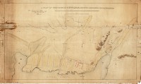 |
A Plan of the Town of Victoria Shewing Proposed Improvements | 1852 |
Title: Plan of the Town of Victoria Shewing Proposed Improvements Author: J.D. Pemberton Identifier (repository): HBC Identifier (doc_id): G1/138 Date: 1852 Publisher: Hudson's Bay Company Archives Funder: Funded by a Canadian Council of Archives, Archival Community Digitization Program. |
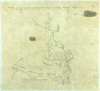 |
Facsimile of a part of chart of coast of N.W. America by George Vancouver Esqr'. | 1854 |
Title: Facsimile of a part of chart of coast of N.W. America by George Vancouver Esqr'. Author: Vancouver, George, 1757-1798 Subject: Vancouver, George, 1757-1798 -- Journeys -- Maps; Georgia, Strait of (B.C. and Wash.) -- Maps; Haro Strait (B.C. and Wash.) -- Maps; Juan de Fuca Strait (B.C. and Wash.) -- Maps; Flattery, Cape (Wash.) -- Maps; Howe Sound (B.C.) -- Maps. Subject: British Columbia, Washington, 1798, 1854 Identifier (repository): MPK Identifier (repoNumber): 1 Identifier (repoVol): 77 Identifier (libFileName): MPK1-77 (4) Identifier (penfoldNum): 367 Identifier (doc_id): MPK 1/77/4 Date: 1854 Funder: Funded by a Canadian Council of Archives, Archival Community Digitization Program. Publisher: National Archives of the UK. 49N/124W-122W |
![Map of area either side of the boundary between British Columbia and the United States of America [verso].](https://hcmc.uvic.ca/~coldesp/maps/maps_200/mpk_1-78_1_boundary_columbia_to_sask_1861.jpg) |
Map of area either side of the boundary between British Columbia and the United States of America [verso]. | 1861 |
Title: Map of area either side of the boundary between British Columbia and the United States of America [verso]. Author: Hawkins, J. S. (John Summerfield), 1812-1895 Subject: British Columbia -- Maps; Washington (State) -- Maps; North American Boundary Commission. Identifier (repository): MPK Identifier (repoNumber): 1 Identifier (repoVol): 78 Identifier (libFileName): MPK1-78 (1); MPK1-78 (1a) Identifier (penfoldNum): Identifier (doc_id): MPK 1/78 Date: 1861 Funder: Funded by a Canadian Council of Archives, Archival Community Digitization Program. Publisher: National Archives of the UK. |
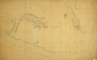 |
Map showing part of Vancouver Island, between Straits of Juan de Fuca and Cowichan Harbour. | 1857 |
Title: Map showing part of Vancouver Island, between Straits of Juan de Fuca and Cowichan Harbour. Author: J.D. Pemberton Subject: Victoria Region (B.C.)--Maps; Vancouver Island, Southeastern (B.C.)--Maps; Vancouver Island (B.C.)--Discovery and exploration--Maps Identifier (repository): HBC Identifier (doc_id): G1/135 Date: 1857 Funder: Funded by a Canadian Council of Archives, Archival Community Digitization Program. Publisher: Hudson's Bay Company Archives 48N / 124W-123W--> |
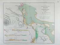 |
Geological sketch map of Nanaimo in Vancouver Island.Nanaimo. | 1863 |
Title: Geological sketch map of Nanaimo in Vancouver Island. Title: Nanaimo. Author: British North American Exploring Expedition Subject: Nanaimo (B.C.) -- Maps; Vancouver Island (B.C.) -- Maps. Subject: Nanaimo, 1863 Identifier (repository): CO Identifier (repoNumber): 6 Identifier (repoVol): 3610 Identifier (libFileName): CO6-36 (10) Identifier (penfoldNum): 530 Identifier (doc_id): CO6-36 (10) Date: 1863 Funder: Funded by a Canadian Council of Archives, Archival Community Digitization Program. Publisher: Edward Stanford Ltd. Publisher: National Archives of the UK. |
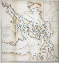 |
Reconnaissance of Canal de Haro & Strait of Rosario and approaches.Canal de Haro & Strait of Rosario. | 1854 |
Title: Reconnaissance of Canal de Haro & Strait of Rosario and approaches. Title: Canal de Haro & Strait of Rosario. Author: United States Coast Survey Subject: Haro Strait (B.C. and Wash.) -- Maps; Rosario Strait (Wash.) -- Maps; Georgia, Strait of (B.C. and Wash.) -- Maps; Juan de Fuca Strait (B.C. and Wash.) -- Maps; Puget sound (Wash.) -- Maps; Boundaries -- British Columbia; Boundaries -- United States; Nautical charts -- Georgia, Strait of (B.C. and Wash.); Nautical charts -- Washington (State) -- Puget Sound; Nautical charts -- Juan de Fuca Strait (B.C. and Wash.); North American Boundary Commission. Subject: Haro and Rosario Straits, 1854, 1858 Identifier (repository): MPK Identifier (repoNumber): 1 Identifier (repoVol): 82 Identifier (libFileName): MPK1-82 Identifier (penfoldNum): 484 Identifier (doc_id): MPK 1/82 Date: 1854 Funder: Funded by a Canadian Council of Archives, Archival Community Digitization Program. Publisher: United States Coast Survey Publisher: National Archives of the UK. 49 10'N-48 10'N/123 50'W-122 20'W |
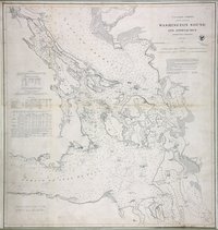 |
Washington Sound and Approaches, Washington Territory. | 1866 |
Title: Washington Sound and Approaches, Washington Territory. Author: United States Coast Survey Subject: Washington (State) -- Maps; British Columbia -- Maps; Georgia, Strait of (B.C. and Wash.) -- Maps; Juan de Fuca Strait (B.C. and Wash.) -- Maps; Nautical charts -- Georgia, Strait of (B.C. and Wash.); Nautical charts -- Washington (State) -- San Juan Islands; Nautical charts -- Juan de Fuca Strait (B.C. and Wash.); Nautical charts -- Haro Strait (B.C. and Wash.); Nautical charts -- British Columbia -- Gulf Islands. Identifier (repository): MPK Identifier (repoNumber): 1 Identifier (repoVol): 88 Identifier (libFileName): MPK1-88 Identifier (penfoldNum): Identifier (doc_id): MPK1-88 Date: 1866 Funder: Funded by a Canadian Council of Archives, Archival Community Digitization Program. Publisher: United States Coast Survey Publisher: National Archives of the UK. 49 10'N-48N/123 50'W-122 20'W |
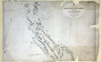 |
Cape Caution to Port Simpson including Hecate Strait and part of Queen Charlotte Islands | 1870 |
Title: Cape Caution to Port Simpson including Hecate Strait and part of Queen Charlotte Islands Author: Pender, Daniel R., d. 1891. Subject: British Columbia--Maps ; Nautical charts--British Columbia ; Hecate Strait (B.C.)--Maps ; Skeena-Queen Charlotte (B.C.)--Maps Subject: British Columbia, 1867-1870, 1879 Identifier (repository): WO Identifier (repoNumber): 78 Identifier (repoVol): 2311 Identifier (libFileName): WO78-2311 (26) Identifier (penfoldNum): 422 Identifier (doc_id): WO78-2311 (26) Date: 1870 Funder: Funded by a Canadian Council of Archives, Archival Community Digitization Program. Publisher: Great Britain. Hydrographic Office Publisher: National Archives of the UK. 54 40'N--53 00'N / 131 55'W--127 30'W |
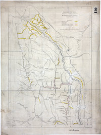 |
British Columbia, reduced copy of the map referred to in the despatch of Governor Douglas of 16 July 1861. | 1861 |
Title: British Columbia, reduced copy of the map referred to in the despatch of Governor Douglas of 16 July 1861. Author: Arrowsmith, John, 1790-1873. Subject: British Columbia -- Maps; Gold mines and mining -- British Columbia -- Maps; Roads -- British Columbia -- Maps Subject: British Columbia, 1861 Identifier (repository): FO Identifier (repoNumber): 925 Identifier (repoVol): 1821 Identifier (libFileName): FO925-1821 Identifier (penfoldNum): 398 Identifier (doc_id): FO 925/1821 Date: 1861 Funder: Funded by a Canadian Council of Archives, Archival Community Digitization Program. Publisher: John Arrowsmith Publisher: National Archives of the UK. 54N-49N/123W-118W |
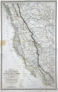 |
Carte de la côte de l'Amérique sur l'océan Pacifique septentrional : comprenant le territoire de l'Orégon, les Californies, la Mer Vermeille, partie des territoires de la compagnie de la Baie d'Hudson et de l'Amérique Russe.Exploration du territoire de l'Orégon, des Californies et de la mer Vermeille, exécutée pendant les années 1840, 1841 et 1842. | 1844 |
Title: Carte de la côte de l'Amérique sur l'océan Pacifique septentrional : comprenant le territoire de l'Orégon, les Californies, la Mer Vermeille, partie des territoires de la compagnie de la Baie d'Hudson et de l'Amérique Russe. Title: Exploration du territoire de l'Orégon, des Californies et de la mer Vermeille, exécutée pendant les années 1840, 1841 et 1842. Author: Duflot de Mofras, Eugène, 1810-1884 Subject: Northwest Coast of North America -- Maps; Canada -- Maps; British Columbia -- Maps; Alaska -- Maps; Washington (State) -- Maps; Oregon -- Maps; California -- Maps; Mexico -- Maps; Hudsons Bay Company. Identifier (repository): FO Identifier (repoNumber): 925 Identifier (repoVol): 1388 Identifier (libFileName): FO925-1388 Identifier (penfoldNum): Identifier (doc_id): FO 925/1388 Date: 1844 Funder: Funded by a Canadian Council of Archives, Archival Community Digitization Program. Publisher: Arthur Bertrand Publisher: National Archives of the UK. 60N-17N/145W-89W |
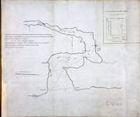 |
Sketch of Cammusan Harbour, Vancouvers Island, showing the position of Fort Victoria.Cammusan Harbour (Victoria Harbour), British Columbia. | 1846 |
Title: Sketch of Cammusan Harbour, Vancouvers Island, showing the position of Fort Victoria. Title: Cammusan Harbour (Victoria Harbour), British Columbia. Author: Vavasour, M (Mervin), 1821-1866 Subject: Victoria Harbour (B.C.) -- Maps; Nautical charts -- British Columbia -- Victoria; Harbors - British Columbia -- Victoria; Victoria (B.C.) -- History.. Subject: Vancouver Island, 1846 Identifier (repository): MPK Identifier (repoNumber): 1 Identifier (repoVol): 59 Identifier (libFileName): MPK1-59 (10) Identifier (penfoldNum): 556 Identifier (doc_id): MPK 1/59/10 Date: 1846 Funder: Funded by a Canadian Council of Archives, Archival Community Digitization Program. Publisher: National Archives of the UK. 48.450407 -123.413000 48.411488 -123.413000 48.411488 -123.365744 48.450407 -123.365744 |
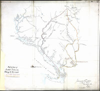 |
Bute Inlet and Fraser River routes from the mouth of the Quesnel River to Victoria on Vancouver Island.British Columbia showing the Bute Inlet and Fraser River routes. | 1865 |
Title: Bute Inlet and Fraser River routes from the mouth of the Quesnel River to Victoria on Vancouver Island. Title: British Columbia showing the Bute Inlet and Fraser River routes. Author: Churchill, James D. Subject: British Columbia -- Maps; Bute Inlet (B.C.) -- Maps; Fraser River (B.C.) -- Maps; Roads -- British Columbia. Subject: British Columbia, 1865 Identifier (repository): MPG Identifier (repoNumber): 1 Identifier (repoVol): 649 Identifier (libFileName): MPG1-649 Identifier (penfoldNum): 418 Identifier (doc_id): MPG1-649 Date: 1865 Funder: Funded by a Canadian Council of Archives, Archival Community Digitization Program. Publisher: National Archives of the UK. |
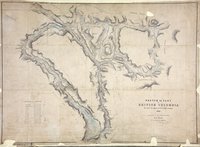 |
Sketch of part of British Columbia | 1859 |
Title: Sketch of part of British Columbia Author: Mayne, R. C. (Richard Charles), 1835-1892 Subject: British Columbia -- Maps; Harrison Lake (B.C.) -- Maps; Fraser Canyon (B.C.) -- Maps; Indians of North America -- British Columbia -- Maps. Subject: British Columbia, 1859 Identifier (repository): CO Identifier (repoNumber): 700 Identifier (repoVol): bc Identifier (libFileName): CO700-BRITISH COLUMBIA8 (2) Identifier (penfoldNum): 389 Identifier (doc_id): CO 700/BRITISH COLUMBIA8/2 Date: 1859 Funder: Funded by a Canadian Council of Archives, Archival Community Digitization Program. Publisher: Great Britain. War Office. Topographical Depot Publisher: National Archives of the UK. |
![San Juan Water Boundary (Arbitration) : list of maps sent to Admiral Prevost at Berlin on the 12th June 1872 [map 39] Strait of Juan de Fuca](https://hcmc.uvic.ca/~coldesp/maps/maps_200/fo_925-1650_pt_2_39_end_1866.jpg) |
San Juan Water Boundary (Arbitration) : list of maps sent to Admiral Prevost at Berlin on the 12th June 1872 [map 39]Strait of Juan de Fuca | 1866 |
Title: San Juan Water Boundary (Arbitration) : list of maps sent to Admiral Prevost at Berlin on the 12th June 1872 [map 39] Title: Strait of Juan de Fuca Author: Richards, G.H. (George Henry) Subject: Juan de Fuca Strait (B.C. and Wash.)--Maps; Haro Strait (B.C. and Wash.)--Maps; Rosario Strait (Wash.)--Maps; Puget Sound (Wash.)--Maps; Washington (Territory)--Maps; Vancouver Island (B.C.)--Maps; Canada--Boundaries--Maps; United States--Boundaries--Maps Subject: Juan de Fuca, Strait, 1849, 1872 Identifier (repository): FO Identifier (repoNumber): 925 Identifier (repoVol): 1650 Identifier (libFileName): FO925-1650 pt2 (39) Identifier (penfoldNum): 520 Identifier (doc_id): FO925-1650 pt2 (39) Date: 1866 Funder: Funded by a Canadian Council of Archives, Archival Community Digitization Program. Publisher: J. & C. Walker Publisher: National Archives of the UK. 48 35'N--47 30'N / 124 45'W--122 10'W |
![San Juan Water Boundary (Arbitration) : list of maps sent to Admiral Prevost at Berlin on the 12th June 1872 [map 21] Port San Juan](https://hcmc.uvic.ca/~coldesp/maps/maps_200/fo_925-1650_pt_1_21_1847.jpg) |
San Juan Water Boundary (Arbitration) : list of maps sent to Admiral Prevost at Berlin on the 12th June 1872 [map 21]Port San Juan | 1847 |
Title: San Juan Water Boundary (Arbitration) : list of maps sent to Admiral Prevost at Berlin on the 12th June 1872 [map 21] Title: Port San Juan Author: Kellett, Henry, 1806-1875 Subject: Juan de Fuca Strait (B.C. and Wash.)--Maps; Canada--Boundaries—Maps; United States--Boundaries--Maps Subject: Juan de Fuca, Strait, 1848, 1872 Identifier (repository): FO Identifier (repoNumber): 925 Identifier (repoVol): 1650 Identifier (libFileName): FO925-1650 pt1 (21) Identifier (penfoldNum): 511 Identifier (doc_id): FO 925/1650 Date: 1847 Funder: Funded by a Canadian Council of Archives, Archival Community Digitization Program. Publisher: J. & C. Walker Publisher: National Archives of the UK. |
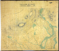 |
Somenos District, 1859.Somenos District, 1859. | 1859 |
Title: Somenos District, 1859. Title: Somenos District, 1859. Subject: Vancouver Island (B.C.) -- Maps; Somenos Region (B.C.) -- Maps. Subject: Vancouver Island, 1859 Identifier (repository): MPG Identifier (repoNumber): 1 Identifier (repoVol): 244 Identifier (libFileName): MPG1-244 Identifier (penfoldNum): 569 Identifier (doc_id): MPG 1/244 Date: 1859 Funder: Funded by a Canadian Council of Archives, Archival Community Digitization Program. Publisher: National Archives of the UK. |
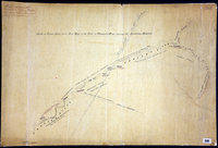 |
Sketch of Fraser's River, from Fort Hope to the forks of Thompson's River, showing the Auriferous districts. | 1858 |
Title: Sketch of Fraser's River, from Fort Hope to the forks of Thompson's River, showing the Auriferous districts. Author: Douglas, James, Sir, 1803-1877 Subject: Fraser River (B.C.) -- Maps; Thompson river (B.C.) -- Maps; Gold mines and mining -- British Columbia; Indians of North America -- British Columbia. Subject: Fraser River, 1858 Identifier (repository): FO Identifier (repoNumber): 925 Identifier (repoVol): 1808 Identifier (libFileName): FO925-1808 Identifier (penfoldNum): 477 Identifier (doc_id): FO 925/1808 Date: 1858 Funder: Funded by a Canadian Council of Archives, Archival Community Digitization Program. Publisher: National Archives of the UK. |
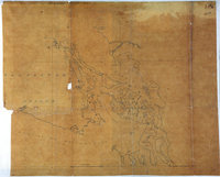 |
South-east coast of Vancouver Island and the islands between the Gulf of Georgia and the Juan de Fuca Strait.Vancouver Island and the islands between the Gulf of Georgia and the Juan de Fuca Strait. | 1854 |
Title: South-east coast of Vancouver Island and the islands between the Gulf of Georgia and the Juan de Fuca Strait. Title: Vancouver Island and the islands between the Gulf of Georgia and the Juan de Fuca Strait. Subject: Vancouver Island (B.C.) -- Maps; Georgia, Strait of (B.C. and Wash.) -- Maps; Juan de Fuca Strait (B.C. and Wash.) -- Maps; Haro Strait (B.C. and Wash.) -- Maps; Rosario Strait (Wash.) -- Maps. Subject: British Columbia, Washington, 1854 Identifier (repository): MPK Identifier (repoNumber): 1 Identifier (repoVol): 77 Identifier (libFileName): MPK1-77 (3) Identifier (penfoldNum): 379 Identifier (doc_id): MPK 1/77/3 Date: 1854 Funder: Funded by a Canadian Council of Archives, Archival Community Digitization Program. Publisher: National Archives of the UK. 49N-48N/124W-122W |
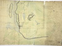 |
Eye Sketch of the Plains &c about Nisqually at the Head of Pugets Sound.Sketch of Nisqually and adjacent Plains on Puget's Sound. | 1846 |
Title: Eye Sketch of the Plains &c about Nisqually at the Head of Pugets Sound. Title: Sketch of Nisqually and adjacent Plains on Puget's Sound. Author: Vavasour, M (Mervin), 1821-1866 Subject: Nisqually River Valley (Wash.) -- Maps; Nisqually River (Wash.) -- Maps; Fort Nisqually (Wash.) -- Maps; Puget Sound (Wash.) -- Maps Identifier (repository): MPK Identifier (repoNumber): 1 Identifier (repoVol): 59 Identifier (libFileName): MPK1-59 (11) Identifier (penfoldNum): Identifier (doc_id): MPK 1/59/11 Date: 1846 Funder: Funded by a Canadian Council of Archives, Archival Community Digitization Program. Publisher: National Archives of the UK. |
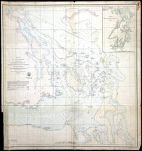 |
Reconnaissance of Canal de Haro and Strait of Rosario, and approaches. | 1854 |
Title: Reconnaissance of Canal de Haro and Strait of Rosario, and approaches. Author: United States Coast Survey Subject: Haro Strait (B.C. and Wash.) -- Maps; Rosario Strait (Wash.) -- Maps; Georgia, Strait of (B.C. and Wash.) -- Maps; Juan de Fuca Strait (B.C. and Wash.) -- Maps; Puget sound (Wash.) -- Maps; Nautical charts -- Georgia, Strait of (B.C. and Wash.); Nautical charts -- Washington (State) -- Puget Sound; Nautical charts -- Juan de Fuca Strait (B.C. and Wash.). Subject: Haro and Rosario Straits, 1854 Identifier (repository): FO Identifier (repoNumber): 925 Identifier (repoVol): 1395 Identifier (libFileName): FO925-1395 Identifier (penfoldNum): 481 Identifier (doc_id): FO 925/1395 Date: 1854 Funder: Funded by a Canadian Council of Archives, Archival Community Digitization Program. Publisher: United States Coast Survey Publisher: National Archives of the UK. 49 10'N-48 10'N/123 50'W-122 20'W |
![San Juan Water Boundary (Arbitration) : list of maps sent to Admiral Prevost at Berlin on the 12th June 1872 [map 36] Part of the Strait of Georgia with the channels leading into the Strait of Fuca](https://hcmc.uvic.ca/~coldesp/maps/maps_200/fo_925-1650_pt_2_36_s_of_georgia_1858.jpg) |
San Juan Water Boundary (Arbitration) : list of maps sent to Admiral Prevost at Berlin on the 12th June 1872 [map 36]Part of the Strait of Georgia with the channels leading into the Strait of Fuca | 1858 |
Title: San Juan Water Boundary (Arbitration) : list of maps sent to Admiral Prevost at Berlin on the 12th June 1872 [map 36] Title: Part of the Strait of Georgia with the channels leading into the Strait of Fuca Subject: Georgia, Strait of (B.C. and Wash.)--Maps; Juan de Fuca Strait (B.C. and Wash.)--Maps Identifier (repository): FO Identifier (repoNumber): 925 Identifier (repoVol): 1650 Identifier (libFileName): FO925-1650 pt2 (36) Identifier (penfoldNum): 384 Identifier (doc_id): FO 925/1650 Date: 1858 Funder: Funded by a Canadian Council of Archives, Archival Community Digitization Program. Publisher: National Archives of the UK. |
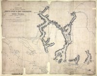 |
Sketch of the Country between Jervis Inlet and Port Pemberton, in British Columbia.Jervis Inlet and Port Pemberton. | 1860 |
Title: Sketch of the Country between Jervis Inlet and Port Pemberton, in British Columbia. Title: Jervis Inlet and Port Pemberton. Author: Mayne, R. C. (Richard Charles), 1835-1892 Subject: Jervis Inlet (B.C.) -- Maps; Pemberton (B.C.) -- Maps; British Columbia -- Maps; Subject: British Columbia, 1860 Identifier (repository): CO Identifier (repoNumber): 700 Identifier (repoVol): bc Identifier (libFileName): CO700-BRITISH COLUMBIA8 (3) Identifier (penfoldNum): 391 Identifier (doc_id): CO 700/BRITISH COLUMBIA8/3 Date: 1860 Funder: Funded by a Canadian Council of Archives, Archival Community Digitization Program. Publisher: Great Britain. War Office. Topographical Depot. Publisher: National Archives of the UK. 50 30'N--49 05'N / 124 50'W--122 40'W. |
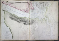 |
Strait of Juan de Fuca surveyed by Captain Henry Kellett, R.N., 1847, Haro & Rosario Straits by Captain G.H. Richards, R.N. 1858, Admiralty Inlet and Puget Sound by the United States exploring expedition, 1841, coast south of Cape Flattery by the same in 1853.Strait of Juan de Fuca. | 1865 |
Title: Strait of Juan de Fuca surveyed by Captain Henry Kellett, R.N., 1847, Haro & Rosario Straits by Captain G.H. Richards, R.N. 1858, Admiralty Inlet and Puget Sound by the United States exploring expedition, 1841, coast south of Cape Flattery by the same in 1853. Title: Strait of Juan de Fuca. Author: Kellett, Henry, 1806-1875. Subject: Juan de Fuca, Strait of (B.C. and Wash.) -- Maps; Nautical charts -- Juan de Fuca, Strait of (B.C. and Wash.); Puget Sound (Wash.) -- Maps; Nautical charts -- Puget Sound (Wash.); Nautical charts -- Haro Strait (B.C. and Wash.); Nautical charts -- Rosario Strait (Wash.); San Juan Boundary Dispute, 1846-1872. Subject: Juan de Fuca, Strait, 1849, 1871 Identifier (repository): CO Identifier (repoNumber): 700 Identifier (repoVol): canada Identifier (libFileName): CO700-CANADA125 (8) Identifier (penfoldNum): 514 Identifier (doc_id): CO700-CANADA125 (8) Date: 1865 Funder: Funded by a Canadian Council of Archives, Archival Community Digitization Program. Publisher: Great Britain. Hydrographic Office Publisher: National Archives of the UK. 48 38'N-47 30'N/124 49'W-123 10'W. |
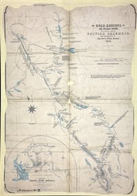 |
Gold Regions of the Fraser River and Cariboo Country, British Columbia, from reconnaissance by the Honourable Judge Begbie, 1861.Fraser River District. | 1861 |
Title: Gold Regions of the Fraser River and Cariboo Country, British Columbia, from reconnaissance by the Honourable Judge Begbie, 1861. Title: Fraser River District. Author: Begbie, Matthew Baillie, Sir, 1819-1894 Subject: Fraser River (B.C.) -- Maps; Cariboo Region (B.C.) -- Maps; Gold mines and mining -- British Columbia; Subject: British Columbia, 1861 Identifier (repository): CO Identifier (repoNumber): 700 Identifier (repoVol): bc Identifier (libFileName): CO700-BRITISH COLUMBIA8 (6) Identifier (penfoldNum): 396 Identifier (doc_id): CO 700/BRITISH COLUMBIA8/6 Date: 1861 Funder: Funded by a Canadian Council of Archives, Archival Community Digitization Program. Publisher: National Archives of the UK. |
![San Juan Water Boundary (Arbitration) : list of maps sent to Admiral Prevost at Berlin on the 12th June 1872 [map 25] Strait of Juan de Fuca](https://hcmc.uvic.ca/~coldesp/maps/maps_200/fo_925-1650_pt_2_25_j_d_f_s_1847.jpg) |
San Juan Water Boundary (Arbitration) : list of maps sent to Admiral Prevost at Berlin on the 12th June 1872 [map 25]Strait of Juan de Fuca | 1847 |
Title: San Juan Water Boundary (Arbitration) : list of maps sent to Admiral Prevost at Berlin on the 12th June 1872 [map 25] Title: Strait of Juan de Fuca Author: Kellett, Henry, 1806-1875 Subject: Juan de Fuca Strait (B.C. and Wash.)--Maps; Haro Strait (B.C. and Wash.)--Maps; Rosario Strait (Wash.)--Maps; Admiralty Inlet (Wash.)--Maps; Puget Sound (Wash.)--Maps; Vancouver Island (B.C.)--Maps; Canada--Boundaries--Maps; United States--Boundaries--Maps Subject: Juan de Fuca, Strait, 1849, 1872 Identifier (repository): FO Identifier (repoNumber): 925 Identifier (repoVol): 1650 Identifier (libFileName): FO925-1650 pt2 (25) Identifier (penfoldNum): 520 Identifier (doc_id): FO 925/1650 Date: 1847 Funder: Funded by a Canadian Council of Archives, Archival Community Digitization Program. Publisher: J. & C. Walker Publisher: National Archives of the UK. 48 35'N--47 30'N / 124 45'W--122 10'W |
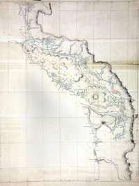 |
Map of Vancouver Island and the adjacent coast from King's Island to the mouth of the Columbia River | 1848 |
Title: Map of Vancouver Island and the adjacent coast from King's Island to the mouth of the Columbia River Subject: Vancouver Island (B.C.)--Maps; Pacific Coast (B.C.)--Maps Subject: Vancouver Island, 1848 Identifier (repository): FO Identifier (repoNumber): 925 Identifier (repoVol): 1373 Identifier (libFileName): FO925-1373 Identifier (penfoldNum): 559 Identifier (doc_id): FO 925/1373 Date: 1848 Funder: Funded by a Canadian Council of Archives, Archival Community Digitization Program. Publisher: National Archives of the UK. 52 00'N--46 00'N / 231 00'W--238 00'W |
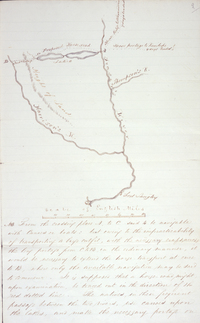 |
Sketch map accompanying Suggestions for the exploration of a new route of communication by which…the transport of the supplies and returns to and from the Districts of New Caledonia and Thompson's River might be advantageously caried on in connexion with Fort Langley and the new establishment of Victoria |
1845 |
Title: Sketch map accompanying Suggestions for the exploration of a new route of communication by which…the transport of the supplies and returns to and from the Districts of New Caledonia and Thompson's River might be advantageously carried on in connexion with Fort Langley and the new establishment of Victoria Author: Alexander C. Anderson Identifier (repository): HBC Identifier (doc_id): B.5/z/1 fo. 2 Date: 1845 Publisher: Hudson's Bay Company Archives Funder: Funded by a Canadian Council of Archives, Archival Community Digitization Program. |
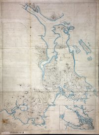 |
South-eastern districts of Vancouver Island.South-Eastern Vancouver Island. | 1855 |
Title: South-eastern districts of Vancouver Island. Title: South-Eastern Vancouver Island. Author: Pemberton, J. Despard (Joseph Despard), 1821-1893. Subject: Vancouver Island (B.C.) -- Maps; Juan de Fuca Strait (B.C. and Wash.) -- Maps; Indians of North America -- British Columbia -- Vancouver Island. Subject: Vancouver Island, 1855 Identifier (repository): CO Identifier (repoNumber): 700 Identifier (repoVol): bc Identifier (libFileName): CO700-BRITISH COLUMBIA3 Identifier (penfoldNum): 566 Identifier (doc_id): CO 700/BRITISH COLUMBIA3 Date: 1855 Funder: Funded by a Canadian Council of Archives, Archival Community Digitization Program. Publisher: John Arrowsmith Publisher: National Archives of the UK. |
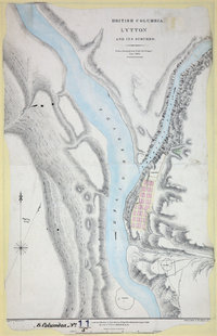 |
Lytton and its Suburbs, 1860. | 1861 |
Title: Lytton and its Suburbs, 1860. Author: McColl, William, d. 1864 Subject: Lytton (B.C.) -- Maps; Fraser River (B.C.) -- Maps; British Columbia -- Maps Subject: British Columbia, 1861, 1862 Identifier (repository): CO Identifier (repoNumber): 700 Identifier (repoVol): bc Identifier (libFileName): CO700-BRITISH COLUMBIA11 (5) Identifier (penfoldNum): 401 Identifier (doc_id): CO 700/BRITISH COLUMBIA11/5 Date: 1861 Funder: Funded by a Canadian Council of Archives, Archival Community Digitization Program. Publisher: Great Britain. Army. Royal Engineers. Columbia Detachment. Publisher: National Archives of the UK. |
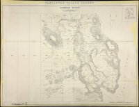 |
Shawnigan District 1859.Vancouver Island Colony. Sketch Maps of Districts. | 1859 |
Title: Shawnigan District 1859. Title: Vancouver Island Colony. Sketch Maps of Districts. Author: Cooke, A. C. Subject: Shawnigan Region (B.C.) -- Maps; Shawnigan Lake (B.C.) -- Maps; Vancouver Island (B.C.) -- Maps. Subject: Vancouver Island, 1859 Identifier (repository): CO Identifier (repoNumber): 700 Identifier (repoVol): bc Identifier (libFileName): CO700-BRITISH COLUMBIA7 (8) Identifier (penfoldNum): 568 Identifier (doc_id): CO 700/BRITISH COLUMBIA7/8 Date: 1859 Funder: Funded by a Canadian Council of Archives, Archival Community Digitization Program. Publisher: Great Britain -- War Office -- Topographical Depot Publisher: National Archives of the UK. |
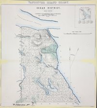 |
Cedar District 1859 (Rough sketch).Vancouver Island Colony. Sketch Maps of Districts. | 1859 |
Title: Cedar District 1859 (Rough sketch). Title: Vancouver Island Colony. Sketch Maps of Districts. Subject: Vancouver Island (B.C.) -- Maps. Subject: Vancouver Island, 1859 Identifier (repository): CO Identifier (repoNumber): 700 Identifier (repoVol): bc Identifier (libFileName): CO700-BRITISH COLUMBIA7 (3) Identifier (penfoldNum): 568 Identifier (doc_id): CO 700/BRITISH COLUMBIA7/3 Date: 1859 Funder: Funded by a Canadian Council of Archives, Archival Community Digitization Program. Publisher: Great Britain. War Office. Topographical Depot. Publisher: National Archives of the UK. |
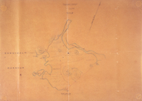 |
Esquimalt District Lot 27 Section II | 1854 |
Title: Esquimalt District Lot 27 Section II Author: J.D. Pemberton Identifier (repository): HBC Identifier (doc_id): A.37/42 fo.189 Date: 1854 Publisher: Hudson's Bay Company Archives Funder: Funded by a Canadian Council of Archives, Archival Community Digitization Program. |
![San Juan boundary dispute maps [map D]. Map of the Sutil, y Mexicana, 1792.](https://hcmc.uvic.ca/~coldesp/maps/maps_200/fo_925-1649-d_bc_washington_1792.jpg) |
San Juan boundary dispute maps [map D].Map of the Sutil, y Mexicana, 1792. | 1792 |
Title: San Juan boundary dispute maps [map D]. Title: Map of the Sutil, y Mexicana, 1792. Author: Cardano, José Maria. Subject: San Juan Boundary Dispute, 1846-1872 ; Juan de Fuca Strait (B.C. and Wash.) -- Maps; Vancouver Island (B.C.) -- Maps. Subject: British Columbia, Washington, 1792, 1873 Identifier (repository): FO Identifier (repoNumber): 925 Identifier (repoVol): 1649d Identifier (libFileName): FO925-1649 (d) Identifier (penfoldNum): 363 Identifier (doc_id): FO 925/1649 Date: 1792 Funder: Funded by a Canadian Council of Archives, Archival Community Digitization Program. Publisher: Harrison & Sons Lith. Publisher: National Archives of the UK. 51N-47N |
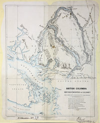 |
New Westminster to Lillooet, from a general Map in preparation by Royal Engineers. | 1861 |
Title: New Westminster to Lillooet, from a general Map in preparation by Royal Engineers. Author: Armstrong, Robert Subject: British Columbia -- Maps; Highway planning -- British Columbia Subject: British Columbia, 1861 Identifier (repository): CO Identifier (repoNumber): 700 Identifier (repoVol): bc Identifier (libFileName): CO700-BRITISH COLUMBIA11 (2) Identifier (penfoldNum): 399 Identifier (doc_id): CO 700/BRITISH COLUMBIA11/2 Date: 1861 Funder: Funded by a Canadian Council of Archives, Archival Community Digitization Program. Publisher: Great Britain. Army. Royal Engineers. Columbia Detachment. Publisher: National Archives of the UK. 50N-49N/124W-122W |
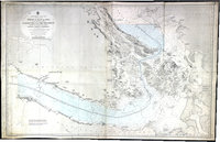 |
Strait of Juan de Fuca and the channels between Vancouver Id. & the continent, showing the boundary line between British & American possessions | 1872 |
Title: Strait of Juan de Fuca and the channels between Vancouver Id. & the continent, showing the boundary line between British & American possessions Author: Powell, E. J. Subject: Vancouver Island (B.C.)--Maps; Juan de Fuca, Strait of (B.C. and Wash.) -- Maps; Nautical charts -- Juan de Fuca, Strait of (B.C. and Wash.); Puget Sound (Wash.) -- Maps; Nautical charts -- Puget Sound (Wash.); Nautical charts -- Haro Strait (B.C. and Wash.); Nautical charts -- Rosario Strait (Wash.); Nautical charts -- Georgia, Strait of (B.C. and Wash.); Flattery, Cape (Wash.); San Juan Boundary Dispute, 1846-1872. Subject: Juan de Fuca, Strait, 1873 Identifier (repository): FO Identifier (repoNumber): 925 Identifier (repoVol): 1651 Identifier (libFileName): FO925-1651 Identifier (penfoldNum): 525 Identifier (doc_id): FO925-1651 Date: 1872 Funder: Funded by a Canadian Council of Archives, Archival Community Digitization Program. Publisher: Great Britain. Hydrographic Office Publisher: National Archives of the UK. 49 05'N--48 05'N / 124 50'W--122 25'W |
![San Juan Boundary Arbitration atlas [map 10]. Sections upon various parallels between Vancouver Island and Oregon.](https://hcmc.uvic.ca/~coldesp/maps/maps_200/fo_925-1647b_10_1871.jpg) |
San Juan Boundary Arbitration atlas [map 10].Sections upon various parallels between Vancouver Island and Oregon. | 1860 |
Title: San Juan Boundary Arbitration atlas [map 10]. Title: Sections upon various parallels between Vancouver Island and Oregon. Subject: Georgia, Strait of (B.C. and Wash.) -- Maps; Haro Strait (B.C. and Wash.) -- Maps; Rosario Strait (Wash.) Subject: British Columbia, Washington, 1860, 1872 Identifier (repository): FO Identifier (repoNumber): 925 Identifier (repoVol): 1647b Identifier (libFileName): FO925-1647B (10) Identifier (penfoldNum): 392 Identifier (doc_id): FO925-1647B (10) Date: 1860 Funder: Funded by a Canadian Council of Archives, Archival Community Digitization Program. Publisher: National Archives of the UK. 49N-48 25'N |
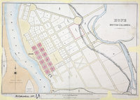 |
Hope, British Columbia. | 1861 |
Title: Hope, British Columbia. Author: McColl, William, d. 1864 Subject: Hope (B.C.) -- Maps; City planning -- British Columbia -- Hope. Subject: British Columbia, 1861, 1862 Identifier (repository): CO Identifier (repoNumber): 700 Identifier (repoVol): bc Identifier (libFileName): CO700-BRITISH COLUMBIA11 (3) Identifier (penfoldNum): 401 Identifier (doc_id): CO 700/BRITISH COLUMBIA11/3 Date: 1861 Funder: Funded by a Canadian Council of Archives, Archival Community Digitization Program. Publisher: Great Britain. Army. Royal Engineers. Columbia Detachment. Publisher: National Archives of the UK. |
![San Juan Water Boundary (Arbitration) : list of maps sent to Admiral Prevost at Berlin on the 12th June 1872 [map 20] Esquimalt Harbour](https://hcmc.uvic.ca/~coldesp/maps/maps_200/fo_925-1650_pt_1_20_1847.jpg) |
San Juan Water Boundary (Arbitration) : list of maps sent to Admiral Prevost at Berlin on the 12th June 1872 [map 20]Esquimalt Harbour | 1847 |
Title: San Juan Water Boundary (Arbitration) : list of maps sent to Admiral Prevost at Berlin on the 12th June 1872 [map 20] Title: Esquimalt Harbour Author: Wood, James Subject: Harbors--British Columbia--Esquimalt--Maps Identifier (repository): FO Identifier (repoNumber): 925 Identifier (repoVol): 1650 Identifier (libFileName): FO925-1650 pt1 (20) Identifier (penfoldNum): 455 Identifier (doc_id): FO 925/1650 Date: 1847 Funder: Funded by a Canadian Council of Archives, Archival Community Digitization Program. Publisher: National Archives of the UK. |
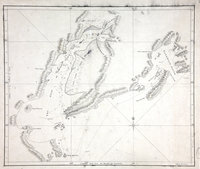 |
Sketch of the Gulf of Good Hope (now Cook Inlet) and Sandwich Sound (now Prince William Sound)Cook Inlet and Prince William Sound. | 1778 |
Title: Sketch of the Gulf of Good Hope (now Cook Inlet) and Sandwich Sound (now Prince William Sound) Title: Cook Inlet and Prince William Sound. Author: Roberts, Henry, Lieut. Subject: Cook Inlet (Alaska); Prince William Sound (Alaska); -- Maps; Cook, James, 1728-1779 -- Journeys -- Maps. Subject: Cook Inlet and Prince William Sound, 1778 Identifier (repository): MPI Identifier (repoNumber): 1 Identifier (repoVol): 81 Identifier (libFileName): MPI1-81 (2) Identifier (doc_id): MPI 1/81 Date: 1778 Funder: Funded by a Canadian Council of Archives, Archival Community Digitization Program. Publisher: National Archives of the UK. |
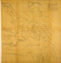 |
Plan to illustrate 'Memorandum respecting the Island of San Juan'. Great Britain. Foreign Office. 1859.San Juan Islands and surrounding area. | 1857 |
Title: Plan to illustrate 'Memorandum respecting the Island of San Juan'. Great Britain. Foreign Office. 1859. Title: San Juan Islands and surrounding area. Author: United States Coast Survey Subject: San Juan Boundary Dispute, 1846-1872; San Juan Islands (Wash.) -- Maps; Georgia, Strait of (B.C. and Wash.) -- Maps; Gulf Islands (B.C.) -- Maps; Vancouver Island (B.C.) -- Maps; Canada -- Boundaries -- United States. Identifier (repository): MFQ Identifier (repoNumber): 1 Identifier (repoVol): 217 Identifier (libFileName): MFQ1-217 Identifier (penfoldNum): Identifier (doc_id): MFQ 1/217 Date: 1857 Funder: Funded by a Canadian Council of Archives, Archival Community Digitization Program. Publisher: National Archives of the UK. |
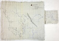 |
British Columbia, showing carriage roads completed, in progress, and proposed. | 1862 |
Title: British Columbia, showing carriage roads completed, in progress, and proposed. Subject: British Columbia -- Maps; Roads -- British Columbia -- Maps. Subject: British Columbia, 1862 Identifier (repository): MPG Identifier (repoNumber): 1 Identifier (repoVol): 648 Identifier (libFileName): MPG1-648 (1) Identifier (penfoldNum): 403 Identifier (doc_id): MPG1-648 (1) Date: 1862 Funder: Funded by a Canadian Council of Archives, Archival Community Digitization Program. Publisher: National Archives of the UK. 57N-48N/151W-114W |
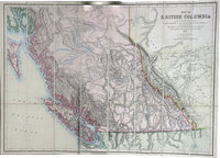 |
Map of British Columbia to the 56th Parallel North Latitude.British Columbia to the 56th Parallel North Latitude. | 1871 |
Title: Map of British Columbia to the 56th Parallel North Latitude. Title: British Columbia to the 56th Parallel North Latitude. Author: Trutch, Joseph W. (Joseph William), Sir, 1826-1904; Subject: British Columbia -- Maps; Alberta -- Maps Subject: British Columbia, 1871 Identifier (repository): FO Identifier (repoNumber): 925 Identifier (repoVol): 1237 Identifier (libFileName): FO925-1237 Identifier (penfoldNum): 431 Identifier (doc_id): FO925-1237 Date: 1871 Funder: Funded by a Canadian Council of Archives, Archival Community Digitization Program. Publisher: Edward Stanford Ltd. Publisher: National Archives of the UK. 56 00'N--48 00'N / 131 00'W--113 00'W |
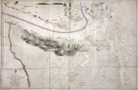 |
Strait of Juan de Fuca. | 1849 |
Title: Strait of Juan de Fuca. Author: Kellett, Henry, 1806-1875. Subject: Juan de Fuca, Strait of (B.C. and Wash.) -- Maps; Nautical charts -- Juan de Fuca, Strait of (B.C. and Wash.); Puget Sound (Wash.) -- Maps; Nautical charts -- Puget Sound (Wash.); Nautical charts -- Haro Strait (B.C. and Wash.); Nautical charts -- Rosario Strait (Wash.); Flattery, Cape (Wash.); San Juan Boundary Dispute, 1846-1872. Subject: Juan de Fuca, Strait, 1849, 1871 Identifier (repository): FO Identifier (repoNumber): 925 Identifier (repoVol): 1655 Identifier (libFileName): FO925-1655 Identifier (penfoldNum): 518 Identifier (doc_id): FO925-1655 Date: 1849 Funder: Funded by a Canadian Council of Archives, Archival Community Digitization Program. Publisher: Great Britain. Hydrographic Office Publisher: National Archives of the UK. 48 35'N--47 30'N / 124 45'W--122 10'W |
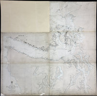 |
Strait of Juan de Fuca | 1858 |
Title: Strait of Juan de Fuca Author: Great Britain. Hydrographic Office. Subject: Juan de Fuca Strait (B.C. and Wash.)--Maps; Puget Sound (Wash.)--Maps; Admiralty Inlet (Wash.)--Maps Subject: Juan de Fuca, Strait and Gulf of Georgia, 1849, 1858 Identifier (repository): FO Identifier (repoNumber): 925 Identifier (repoVol): 1385 Identifier (libFileName): FO925-1385 Identifier (penfoldNum): 513 Identifier (doc_id): FO 925/1385 Date: 1858 Funder: Funded by a Canadian Council of Archives, Archival Community Digitization Program. Publisher: Great Britain. Hydrographic Office. Publisher: National Archives of the UK. 48 35'N--47 30'N / 124 45'W--122 10'W |
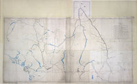 |
British Columbia, showing discoveries of gold and silver, explorers' routes, etc. | 1865 |
Title: British Columbia, showing discoveries of gold and silver, explorers' routes, etc. Subject: British Columbia -- Maps; Gold mines and mining -- British Columbia -- Maps; Silver mines and mining -- British Columbia -- Maps; British Columbia -- Exploration and discovery -- Maps. Subject: British Columbia, Alberta, 1865 Identifier (repository): CO Identifier (repoNumber): 700 Identifier (repoVol): bc Identifier (libFileName): CO700-BRITISH COLUMBIA14 Identifier (penfoldNum): 419 Identifier (doc_id): CO700-BRITISH COLUMBIA14 Date: 1865 Funder: Funded by a Canadian Council of Archives, Archival Community Digitization Program. Publisher: British Columbia. Dept. of Lands and Works. Publisher: National Archives of the UK. 52N-49N/125W-114W |