Colonial Despatches
The colonial despatches of Vancouver Island and British Columbia 1846-1871
Sketch of Ahouset. Lat. 49 12N. Long. 126 12W. (Variation estimated 19 40 E.)
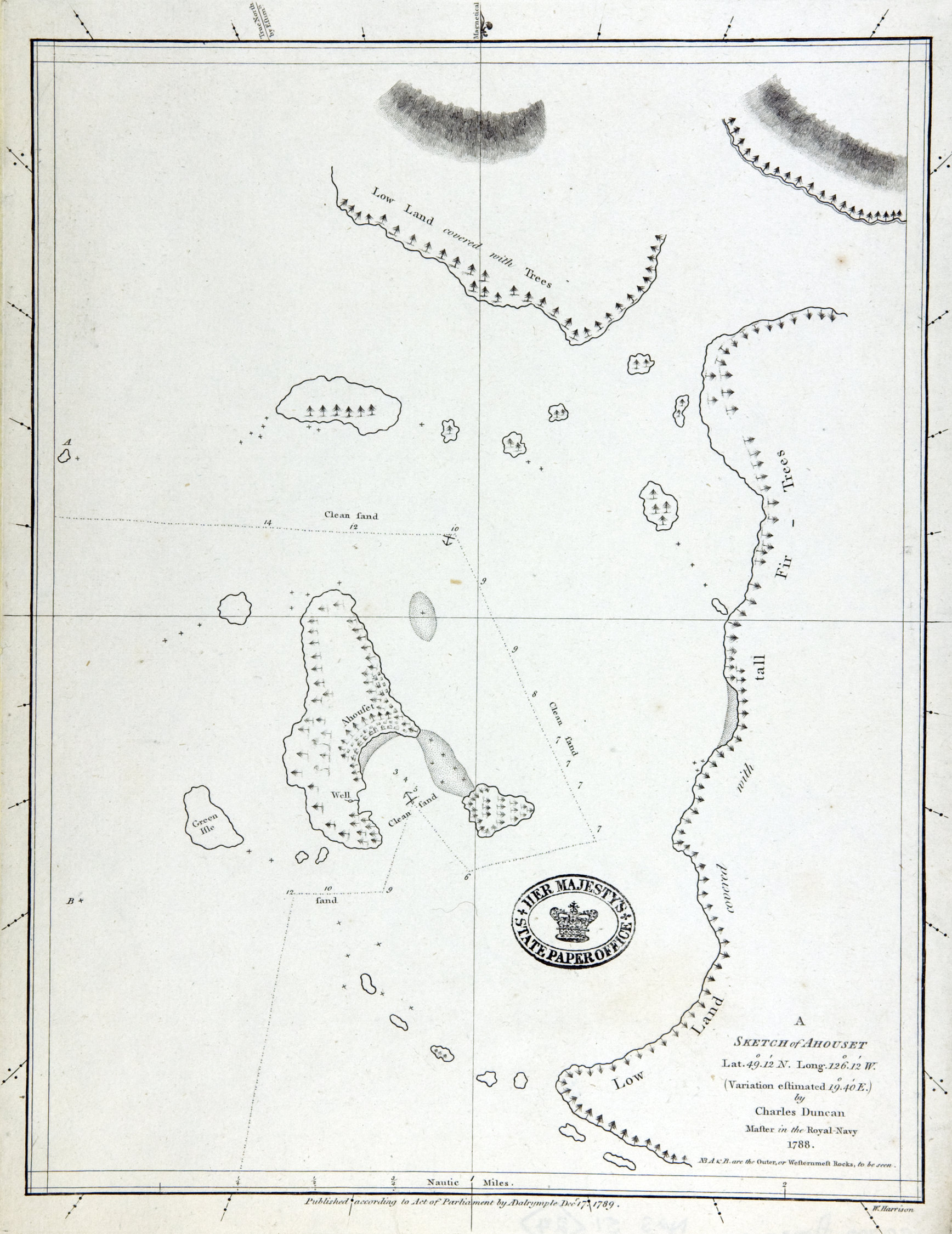
Plans of Ports and Harbours on the North West Coast of America. Published by A. Dalrymple,
London. [British Columbia, 1786-1789]. By Charles Duncan, Master in the Royal Navy,
1788. Engraver William Harrison. Published Dec. 17th, 1789.
Duncan, Charles, fl. 1782-96, Sketch of Ahouset. Lat. 49 12N. Long. 126 12W. (Variation estimated 19 40 E.), 1789, Dalrymple, Alexander, 1737-1808, CO 700/AMERICA NORTH AND SOUTH51. The Colonial Despatches of Vancouver Island and British Columbia 1846-1871, Edition 2.6, ed. James Hendrickson and the Colonial Despatches project. Victoria,
B.C.: University of Victoria. https://bcgenesis.uvic.ca/co_700-america_north_and_south_51_24_ahouset_1789.html.
Title: Sketch of Ahouset. Lat. 49 12N. Long. 126 12W. (Variation estimated 19 40 E.)
Title: Sketch of Ahousat.
Author: Duncan, Charles, fl. 1782-96
Subject: Ahousat (B.C.) -- Maps. Vancouver Island (B.C.) -- Maps.
Subject: British Columbia, 1786-1789
Identifier (repository): CO
Identifier (repoNumber): 700
Identifier (repoVol): america
Identifier (libFileName): CO700-AMERICA NORTH and SOUTH51 (24)
Identifier (penfoldNum): 357
Identifier (doc_id): CO 700/AMERICA NORTH AND SOUTH51
Date: 1789
Funder: Funded by a Canadian Council of Archives, Archival Community Digitization Program.
Publisher: Dalrymple, Alexander, 1737-1808
Publisher: National Archives of the UK.
49.060095 -126.334223 49.060095 -125.970322 49.416950 -125.970322 49.416950 -126.334223 49.060095 -126.334223