Colonial Despatches
The colonial despatches of Vancouver Island and British Columbia 1846-1871
Map of Victoria and part of Esquimalt Districts, 1861.
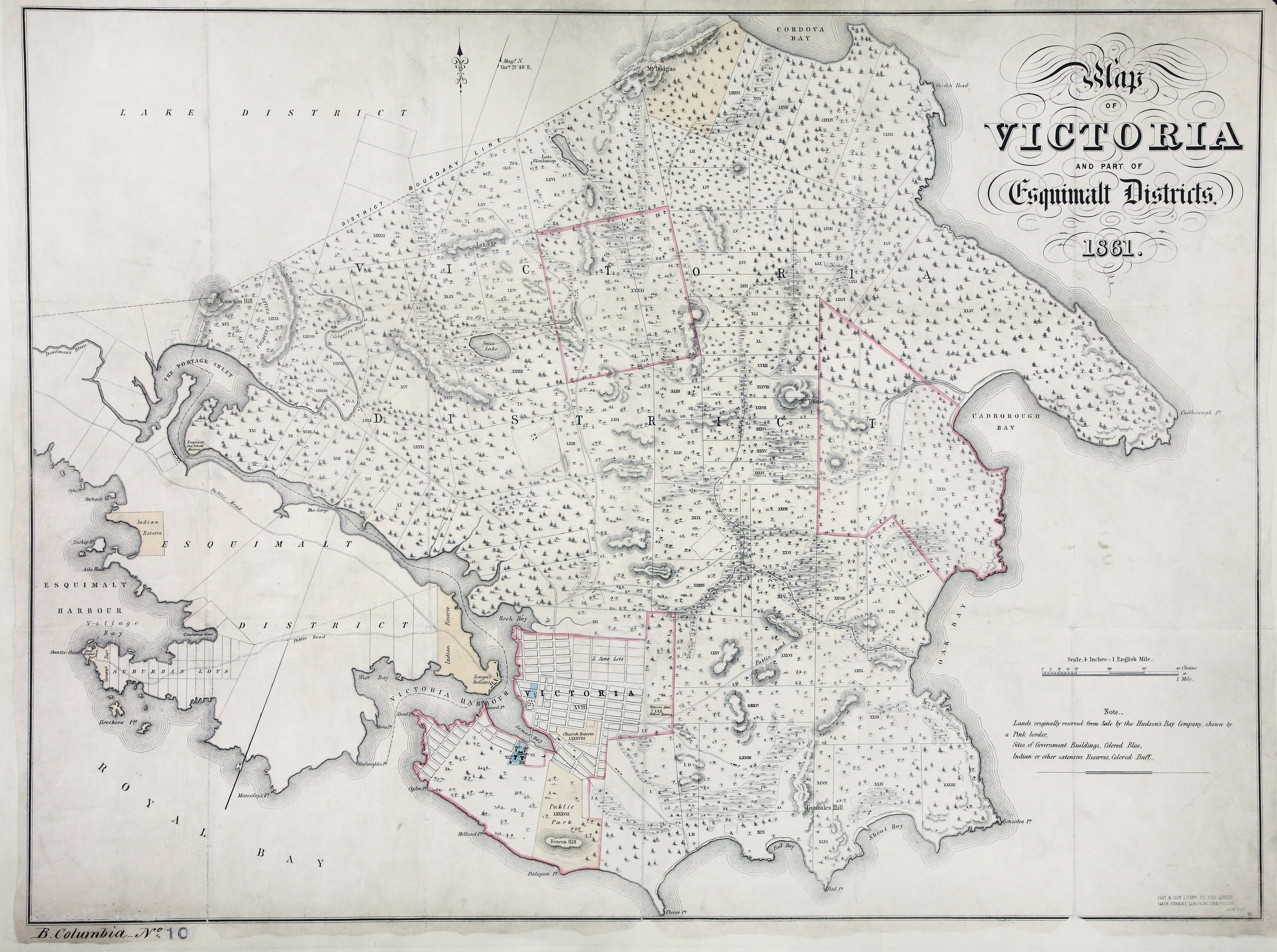
Map of Victoria and part of Esquimalt Districts, 1861…4 inches to 1 mile. London.
[Victoria and Esquimalt Districts, 1861]. Published by Day & Son, Lithrs. to the Queen,
Gate Street Lincolns-Inn Fields, London. Reference key. Shows
Lands originally reserved from sale by the Hudson's Bay Company, government buildings, Indian or other extensive Reserves,some streams and wetlands, and generalized vegetation.
Map of Victoria and part of Esquimalt Districts, 1861, 1861, Day & Son, CO 700/BRITISH COLUMBIA10. The Colonial Despatches of Vancouver Island and British Columbia 1846-1871, Edition 2.6, ed. James Hendrickson and the Colonial Despatches project. Victoria,
B.C.: University of Victoria. https://bcgenesis.uvic.ca/co_700-bc_10_vic_and_esqui_1861.html.
Title: Map of Victoria and part of Esquimalt Districts, 1861.
Subject: Victoria (B.C.) -- Maps; Esquimalt (B.C.) -- Maps; Vancouver Island -- Maps.
Subject: Victoria and Esquimalt Districts, 1861
Identifier (repository): CO
Identifier (repoNumber): 700
Identifier (repoVol): bc
Identifier (libFileName): CO700-BRITISH COLUMBIA10
Identifier (penfoldNum): 591
Identifier (doc_id): CO 700/BRITISH COLUMBIA10
Date: 1861
Funder: Funded by a Canadian Council of Archives, Archival Community Digitization Program.
Publisher: Day & Son.
Publisher: National Archives of the UK.