Colonial Despatches
The colonial despatches of Vancouver Island and British Columbia 1846-1871
Lytton and its Suburbs, 1860.
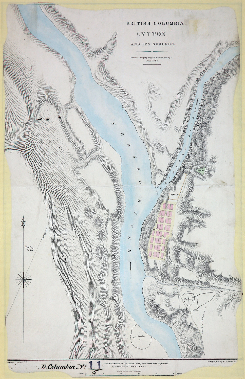
Plan of the Town of Lytton and its Suburbs. From a Survey by Sergt. W. McColl, R.E.,
June, 1860. 6 inches to 1 mile. New Westminster. [British Columbia, 1861; 1862].Under
the direction of Capt. Parsons R.E., lithographed by William Oldham, R.E., drawn
by C. Sinnett R.E. Shows townsite, cemetery, First Nations reserve, water supply line,
gardens, etc.
McColl, William, d. 1864, Lytton and its Suburbs, 1860, 1861, Great Britain. Army. Royal Engineers. Columbia Detachment, CO 700/BRITISH
COLUMBIA11/5. The Colonial Despatches of Vancouver Island and British Columbia 1846-1871, Edition 2.6, ed. James Hendrickson and the Colonial Despatches project. Victoria,
B.C.: University of Victoria. https://bcgenesis.uvic.ca/co_700-bc_11_5_lytton_1861.html.
Title: Lytton and its Suburbs, 1860.
Author: McColl, William, d. 1864
Subject: Lytton (B.C.) -- Maps; Fraser River (B.C.) -- Maps; British Columbia -- Maps
Subject: British Columbia, 1861, 1862
Identifier (repository): CO
Identifier (repoNumber): 700
Identifier (repoVol): bc
Identifier (libFileName): CO700-BRITISH COLUMBIA11 (5)
Identifier (penfoldNum): 401
Identifier (doc_id): CO 700/BRITISH COLUMBIA11/5
Date: 1861
Funder: Funded by a Canadian Council of Archives, Archival Community Digitization Program.
Publisher: Great Britain. Army. Royal Engineers. Columbia Detachment.
Publisher: National Archives of the UK.