Colonial Despatches
The colonial despatches of Vancouver Island and British Columbia 1846-1871
Yale, British Columbia, 1861.
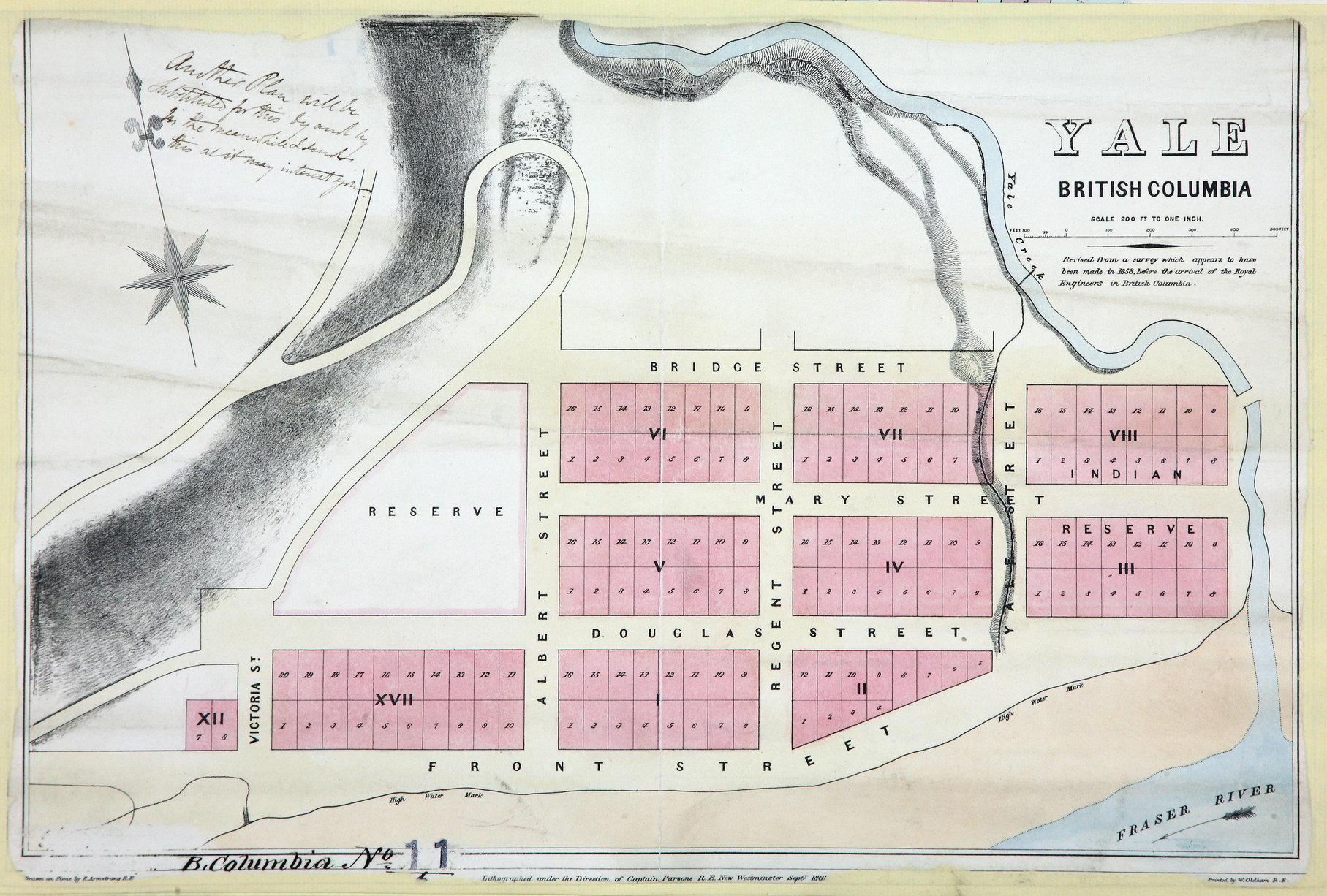
Plan of the Town of Yale. 200 feet to 1 inch. New Westminster. [British Columbia,
1861; 1862]. Lithographed under direction of Captain Parsons R.E., drawn on stone
by R. Armstrong R.E., printed by W. Olham, R.E.
Revised from a survey which appears to have been made in 1858, before the arrival of the Royal Engineers in British Columbia.Shows numbered lots and First Nations reserve land. Manuscript note by Parsons (?), upper left corner.
Armstrong, Robert, Yale, British Columbia, 1861, 1861, Great Britain. Army. Royal Engineers. Columbia Detachment, CO 700/BRITISH
COLUMBIA11/6. The Colonial Despatches of Vancouver Island and British Columbia 1846-1871, Edition 2.6, ed. James Hendrickson and the Colonial Despatches project. Victoria,
B.C.: University of Victoria. https://bcgenesis.uvic.ca/co_700-bc_11_6_yale_1861.html.
Title: Yale, British Columbia, 1861.
Author: Armstrong, Robert
Subject: Yale (B.C.) -- Maps; British Columbia -- Maps; City planning -- British Columbia -- Yale
Subject: British Columbia, 1861, 1862
Identifier (repository): CO
Identifier (repoNumber): 700
Identifier (repoVol): bc
Identifier (libFileName): CO700-BRITISH COLUMBIA11 (6)
Identifier (penfoldNum): 401
Identifier (doc_id): CO 700/BRITISH COLUMBIA11/6
Date: 1861
Funder: Funded by a Canadian Council of Archives, Archival Community Digitization Program.
Publisher: Great Britain. Army. Royal Engineers. Columbia Detachment.
Publisher: National Archives of the UK.