Colonial Despatches
The colonial despatches of Vancouver Island and British Columbia 1846-1871
New Westminster, British Columbia, 1861.
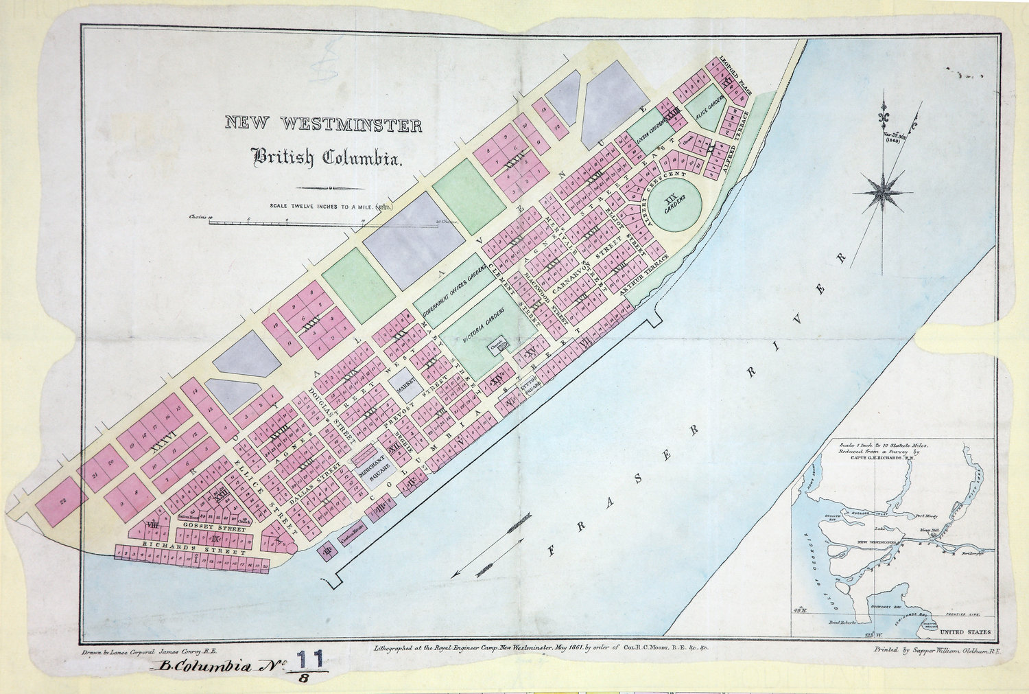
Plan of the Town of New Westminster 12 inches to 1 mile. New Westminster. [British
Columbia, 1861; 1862]. Drawn by Lance Corporal James Conroy, R.E. Lithographed at
the Royal Engineer camp, New Westminster, May 1861, by order of Col. R. C. Moody R.E..
Printed by Sapper William Oldham, R.E.. Inset map shows New Westminster's location
in a broader area. Scale of inset map 1 inch to 10 miles, reduced from a survey by
Capt. G. N. Richards. Shows numbered lots, street names, gardens, etc.
Conroy, James., New Westminster, British Columbia, 1861, 1861, Great Britain. Army. Royal Engineers. Columbia Detachment, CO 700/BRITISH
COLUMBIA11/8. The Colonial Despatches of Vancouver Island and British Columbia 1846-1871, Edition 2.6, ed. James Hendrickson and the Colonial Despatches project. Victoria,
B.C.: University of Victoria. https://bcgenesis.uvic.ca/co_700-bc_11_8_new_west_1861.html.
Title: New Westminster, British Columbia, 1861.
Author: Conroy, James.
Subject: New Westminster (B.C.) -- Maps; City planning -- British Columbia -- New Westminster.
Subject: British Columbia, 1861, 1862
Identifier (repository): CO
Identifier (repoNumber): 700
Identifier (repoVol): bc
Identifier (libFileName): CO700-BRITISH COLUMBIA11 (8)
Identifier (penfoldNum): 401
Identifier (doc_id): CO 700/BRITISH COLUMBIA11/8
Date: 1861
Funder: Funded by a Canadian Council of Archives, Archival Community Digitization Program.
Publisher: Great Britain. Army. Royal Engineers. Columbia Detachment.
Publisher: National Archives of the UK.