Colonial Despatches
The colonial despatches of Vancouver Island and British Columbia 1846-1871
Provinces of British Columbia and Vancouver Island; with portions of the United States and Hudson's Bay Territories.
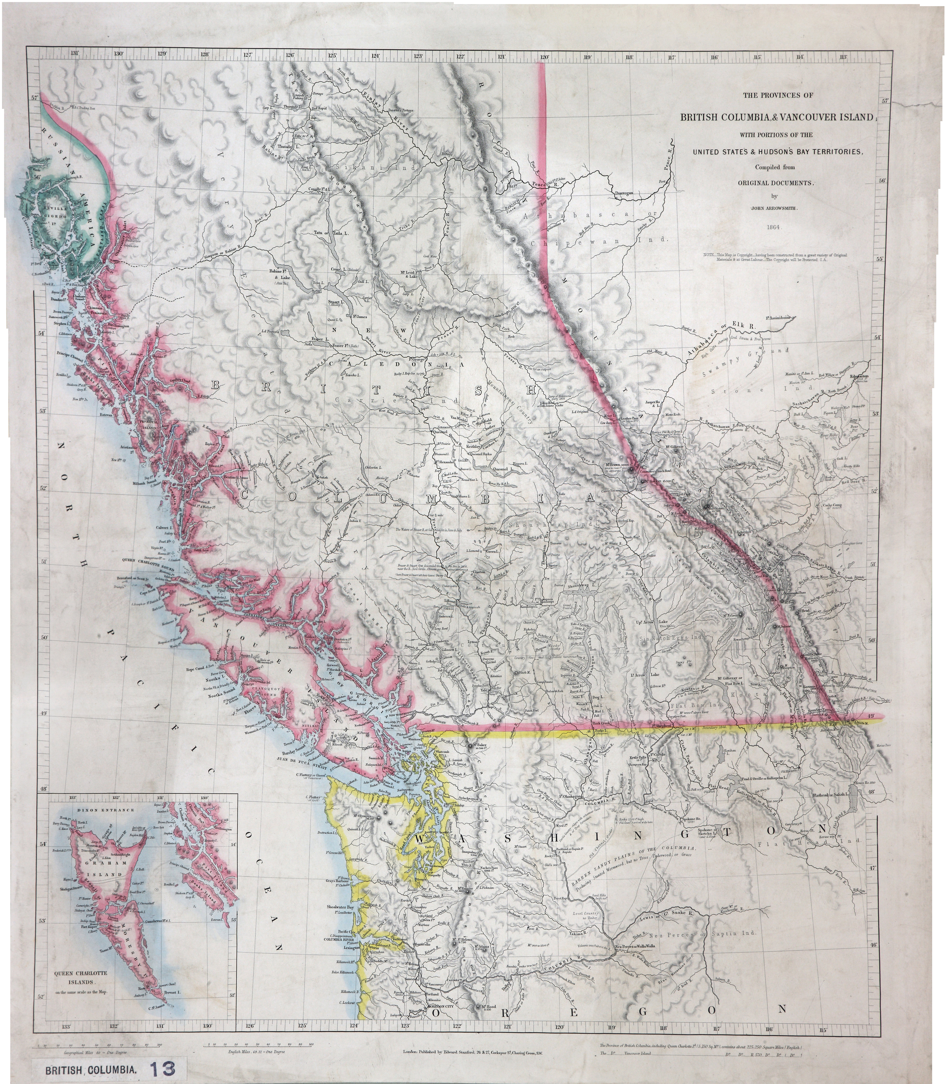
Title: Provinces of British Columbia and Vancouver Island; with portions of the United States and Hudson's Bay Territories.
Author: Arrowsmith, John, 1790-1873.
Subject: British Columbia -- Maps; Washington (State) -- Maps; Haida Gwaii (B.C.) -- Maps; Alberta -- Maps; Indians of North America -- British Columbia; Indians of North America -- Alberta; Indians of North America -- Washington (State).
Subject: British Columbia, Alberta, Washington, 1864
Identifier (repository): CO
Identifier (repoNumber): 700
Identifier (repoVol): bc
Identifier (libFileName): CO700-BRITISH COLUMBIA13
Identifier (penfoldNum): 417
Identifier (doc_id): CO700-BRITISH COLUMBIA13
Date: 1864
Funder: Funded by a Canadian Council of Archives, Archival Community Digitization Program.
Publisher: Edward Stanford Ltd.
Publisher: National Archives of the UK.