Colonial Despatches
The colonial despatches of Vancouver Island and British Columbia 1846-1871
Esquimalt Harbour.
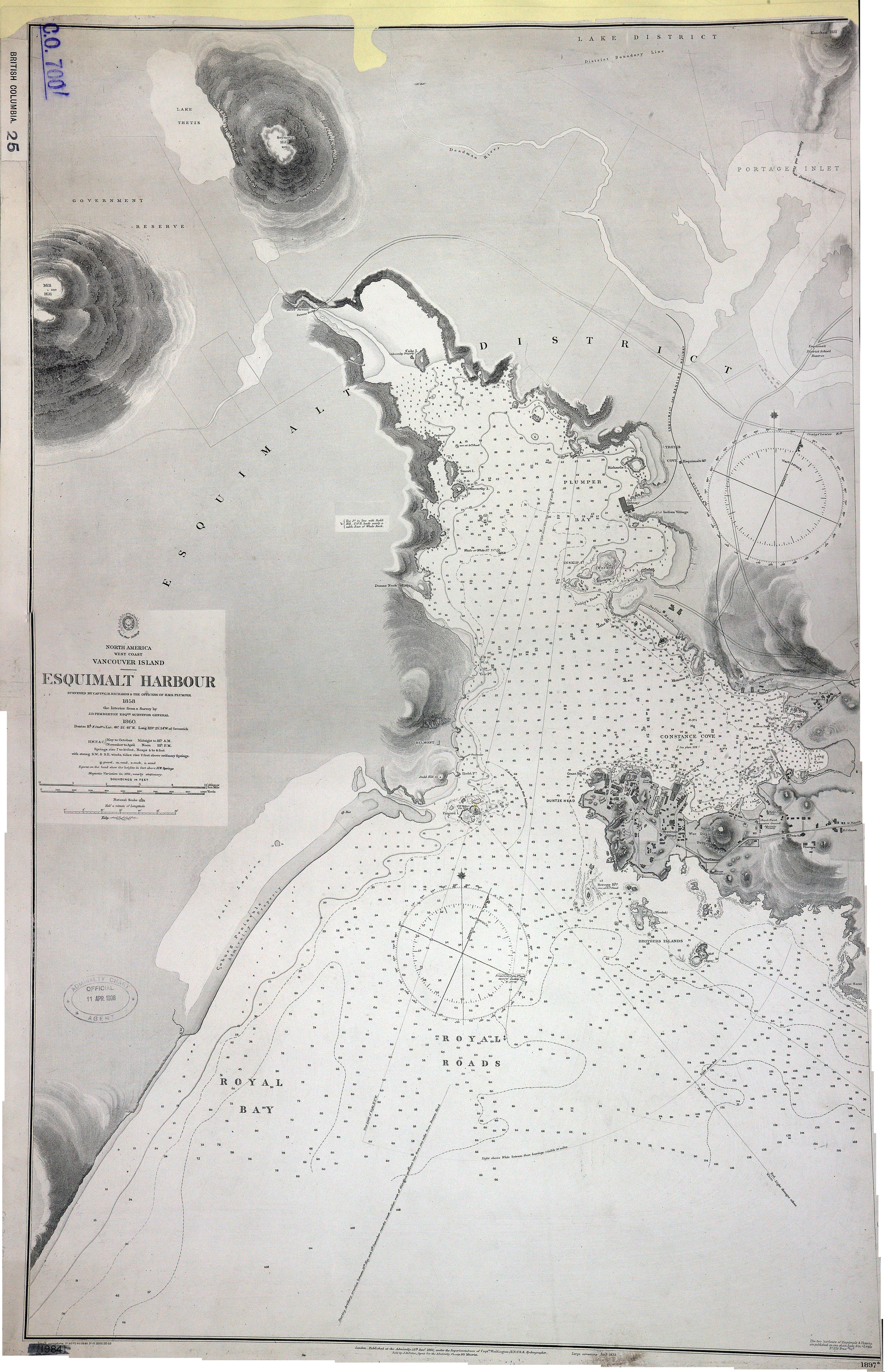
Vancouver Island. Esquimalt Harbour. Surveyed by Captn. G.H. Richards and the Officers
of H.M.S. Plumper, 1858. About 8 inches to 1 mile. Author, Publisher, &c.: Admiralty (No. 1897a) London.
[Esquimalt, 1861; 1903]. At head of title: North America, west coast. Relief shown
by bathymetry, soundings in feet, and hachures. Includes nautical features, streets,
and footprints of significant buildings. First published 1861, updated and corrected.
Latest date on map 1911.
Great Britain. Hydrographic Office, Esquimalt Harbour, 1861, National Archives of the UK, CO 700/BRITISH COLUMBIA25. The Colonial Despatches of Vancouver Island and British Columbia 1846-1871, Edition 2.6, ed. James Hendrickson and the Colonial Despatches project. Victoria,
B.C.: University of Victoria. https://bcgenesis.uvic.ca/co_700-bc_25_esqui_harbour_1861.html.
Title: Esquimalt Harbour.
Title: Vancouver Island. Esquimalt Harbour.
Author: Great Britain. Hydrographic Office
Subject: Esquimalt (B.C.) -- Maps; Esquimalt Harbour (B.C.) -- Maps; Nautical charts -- British Columbia -- Esquimalt; Harbors -- British Columbia -- Esquimalt.
Subject: Esquimalt, 1861, 1903
Identifier (repository): CO
Identifier (repoNumber): 700
Identifier (repoVol): bc
Identifier (libFileName): CO700-BRITISH COLUMBIA25
Identifier (penfoldNum): 458
Identifier (doc_id): CO 700/BRITISH COLUMBIA25
Date: 1861
Funder: Funded by a Canadian Council of Archives, Archival Community Digitization Program.
Publisher: National Archives of the UK.