Colonial Despatches
The colonial despatches of Vancouver Island and British Columbia 1846-1871
Map of the Districts of Victoria and Esquimalt in Vancouver Island.
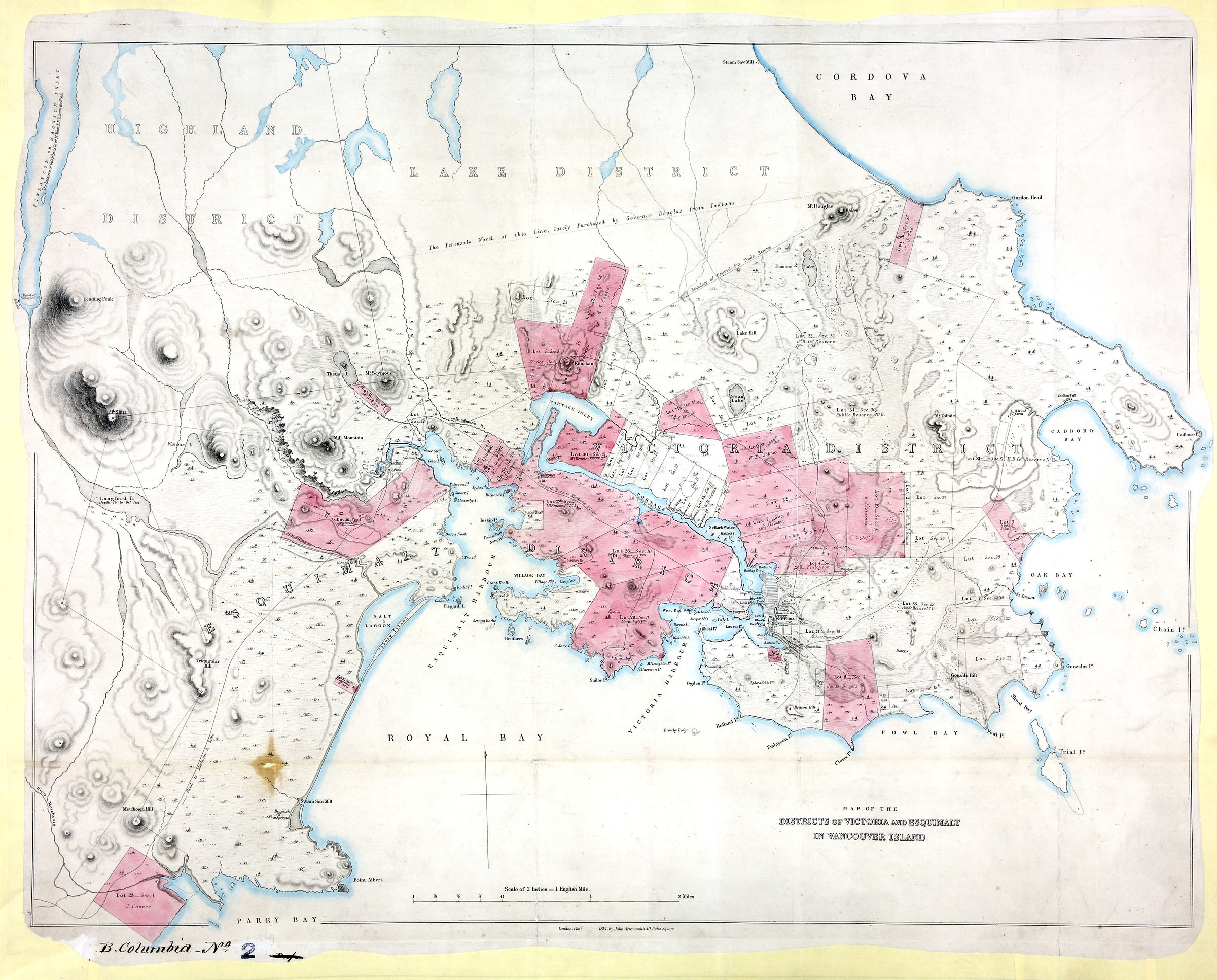
Title: Map of the Districts of Victoria and Esquimalt in Vancouver Island.
Title: Districts of Victoria and Esquimalt in Vancouver Island.
Author: Arrowsmith, John, 1790-1873.
Subject: Victoria (B.C.) -- Maps; Esquimalt (B.C.) -- Maps; Vancouver Island (B.C.) -- Maps; British Columiba -- History -- Maps; Indians of North America -- British Columbia -- Vancouver Island.
Subject: Victoria and Esquimalt Districts, 1854
Identifier (repository): CO
Identifier (repoNumber): 700
Identifier (repoVol): bc
Identifier (libFileName): CO700-BRITISH COLUMBIA2
Identifier (penfoldNum): 590
Identifier (doc_id): CO 700/BRITISH COLUMBIA2
Date: 1854
Funder: Funded by a Canadian Council of Archives, Archival Community Digitization Program.
Publisher: John Arrowsmith
Publisher: National Archives of the UK.