Colonial Despatches
The colonial despatches of Vancouver Island and British Columbia 1846-1871
South-eastern districts of Vancouver Island.
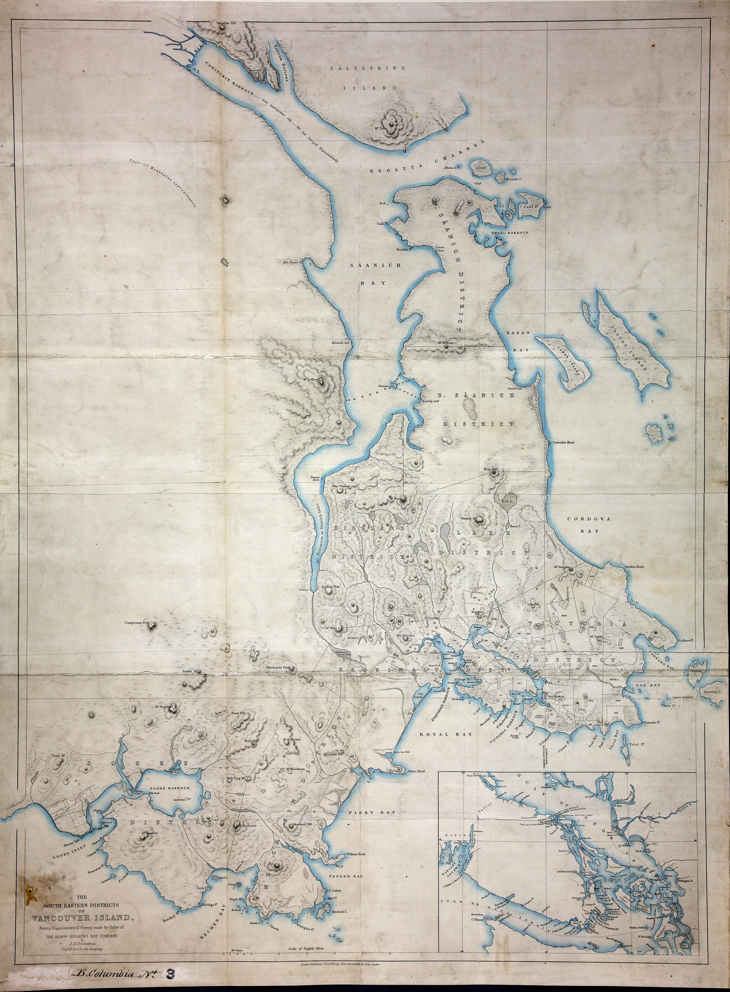
The South-Eastern Districts of Vancouver Island, from a Trigonometrical Survey made
by the Honble. Hudsons Bay Company, by J. D. Pemberton, Engr. and Survr. to the Company.
Published 2nd October, 1855. By John Arrowsmith, London. 1 mile to 1 inch. [Vancouver
Island, 1855]. Show First nations locations. Inset map shows Strait of Jaun de Fuca
and Gulf of Georgia.
Pemberton, J. Despard (Joseph Despard), 1821-1893., South-eastern districts of Vancouver Island, 1855, John Arrowsmith, CO 700/BRITISH COLUMBIA3. The Colonial Despatches of Vancouver Island and British Columbia 1846-1871, Edition 2.6, ed. James Hendrickson and the Colonial Despatches project. Victoria,
B.C.: University of Victoria. https://bcgenesis.uvic.ca/co_700-bc_3_2_van_isl_1855.html.
Title: South-eastern districts of Vancouver Island.
Title: South-Eastern Vancouver Island.
Author: Pemberton, J. Despard (Joseph Despard), 1821-1893.
Subject: Vancouver Island (B.C.) -- Maps; Juan de Fuca Strait (B.C. and Wash.) -- Maps; Indians of North America -- British Columbia -- Vancouver Island.
Subject: Vancouver Island, 1855
Identifier (repository): CO
Identifier (repoNumber): 700
Identifier (repoVol): bc
Identifier (libFileName): CO700-BRITISH COLUMBIA3
Identifier (penfoldNum): 566
Identifier (doc_id): CO 700/BRITISH COLUMBIA3
Date: 1855
Funder: Funded by a Canadian Council of Archives, Archival Community Digitization Program.
Publisher: John Arrowsmith
Publisher: National Archives of the UK.