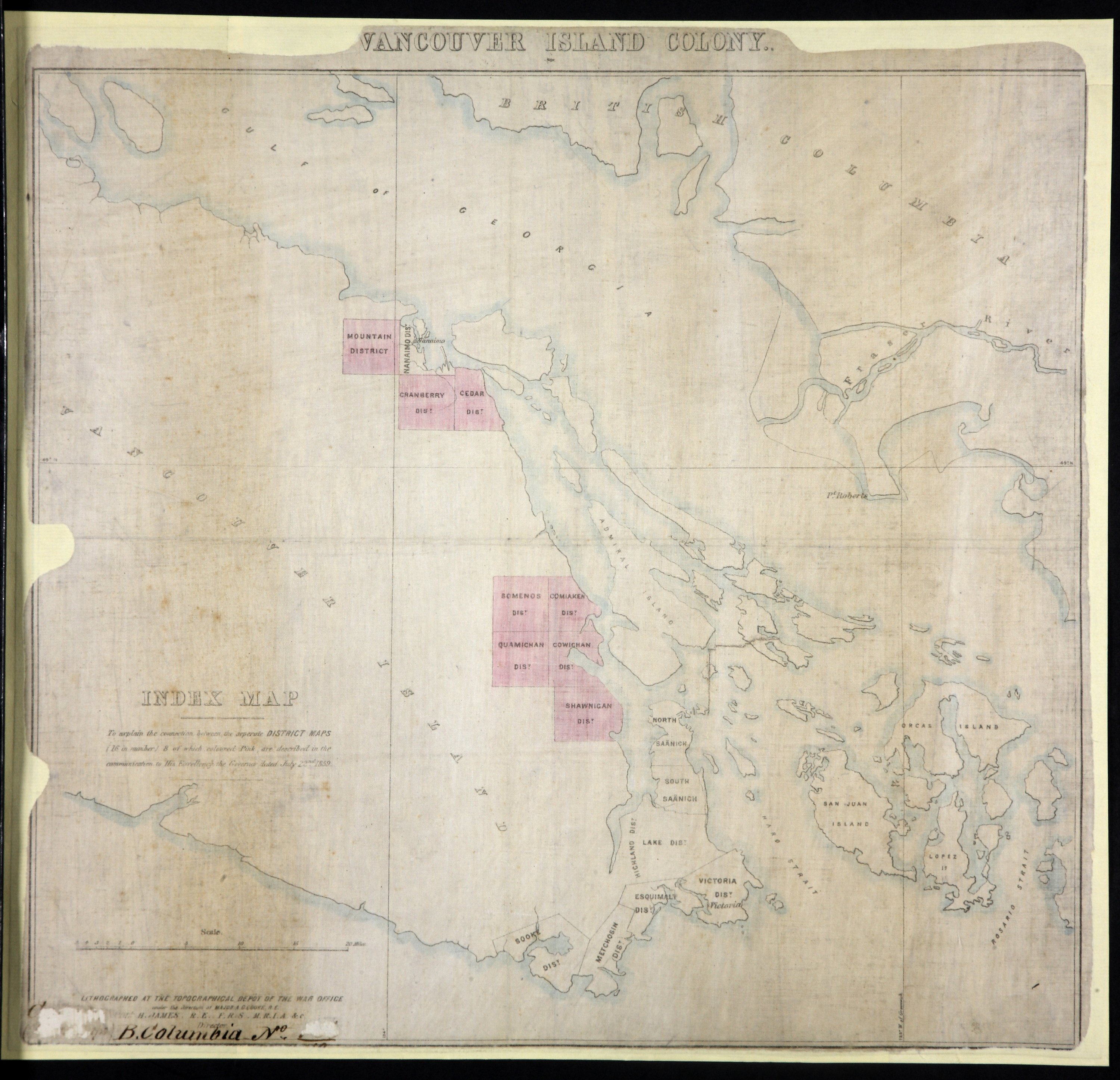
Index Map: to explain the connection between the separate District Maps (16 in number), 8 of which, coloured pink, are described in the communication to His Exellency the Governor dated July 22nd, 1859.

Index Map: to explain the connection between the separate District Maps (16 in number), 8 of which, coloured pink, are described in the communication to His Exellency the Governor dated July 22nd, 1859.
Vancouver Island Colony. Sketch Maps of Districts. Lithographed at the Topographical Dept of the War Office, London, 1859: Index Map. [Vancouver Island, 1859]
Great Britain. War Office. Topographical Depot, Index Map: to explain the connection between the separate District Maps (16 in number), 8 of which, coloured pink, are described in the communication to His Exellency the Governor dated July 22nd, 1859, 1859, National Archives of the UK, CO 700/BRITISH COLUMBIA7/10. The Colonial Despatches of Vancouver Island and British Columbia 1846-1871, Edition 2.4, ed. James Hendrickson and the Colonial Despatches project. Victoria, B.C.: University of Victoria. https://bcgenesis.uvic.ca/co_700-bc_7_10_end_van_isl_colony_1859.html.

Title: Index Map: to explain the connection between the separate District Maps (16 in number), 8 of which, coloured pink, are described in the communication to His Exellency the Governor dated July 22nd, 1859.

Title: Vancouver Island Colony. Sketch Maps of Districts.

Author: Great Britain. War Office. Topographical Depot

Subject: Vancouver Island (B.C.) -- Maps -- Indexes

Subject: Vancouver Island, 1859

Identifier (repository): CO

Identifier (repoNumber): 700

Identifier (repoVol): bc

Identifier (libFileName): CO700-BRITISH COLUMBIA7 (10)

Identifier (penfoldNum): 568

Identifier (doc_id): CO 700/BRITISH COLUMBIA7/10

Date: 1859

Funder: Funded by a Canadian Council of Archives, Archival Community Digitization Program.

Publisher: National Archives of the UK.
Identifier (CONTENTdm): oai:contentdm.library.uvic.ca:collection5/1

Great Britain. War Office. Topographical Depot, Index Map: to explain the connection between the separate District Maps (16 in number), 8 of which, coloured pink, are described in the communication to His Exellency the Governor dated July 22nd, 1859, 1859, National Archives of the UK, CO 700/BRITISH COLUMBIA7/10. The Colonial Despatches of Vancouver Island and British Columbia 1846-1871, Edition 2.4, ed. James Hendrickson and the Colonial Despatches project. Victoria, B.C.: University of Victoria. https://bcgenesis.uvic.ca/co_700-bc_7_10_end_van_isl_colony_1859.html.
Last modified: 2022-12-15 13:24:22 -0800 (Thu, 15 Dec 2022) (SVN revision: 5648)