Sketch of the route from North Bentinck Arm to Fort Alexander.

Sketch of the route from North Bentinck Arm to Fort Alexander.
Sketch of the Route from North Bentinck Arm to Fort Alexander, by Lieut. H. S. Palmer, R.E., to accompany Report of 24th November, 1862. [New Westminster]. 10 miles to 1 inch. Drawn by Charles Sinnett R.E. Prepared by the Royal Engineers at the Office of Lands and Works, New Westminster, by order of Col. R.C. Moody…Feb. 1863. Lith. by W. Oldham. [British Columbia, 1862; 1863][Inset: sketch of the Head of North Bentinck Arm. 1 mile to 2 inches]. Map includes a reference key and shows partial elevation of trail (vertical scale 5000 ft to 1 inch). Descriptive text.
Palmer, H. Spencer (Henry Spencer), 1838-1893, Sketch of the route from North Bentinck Arm to Fort Alexander, 1862-1863, Great Britain. Army. Royal Engineers. Columbia Detachment, CO700-BRITISH COLUMBIA8 (8). The Colonial Despatches of Vancouver Island and British Columbia 1846-1871, Edition 2.4, ed. James Hendrickson and the Colonial Despatches project. Victoria, B.C.: University of Victoria. https://bcgenesis.uvic.ca/co_700-bc_8_8_end_bc_1862_1863.html.

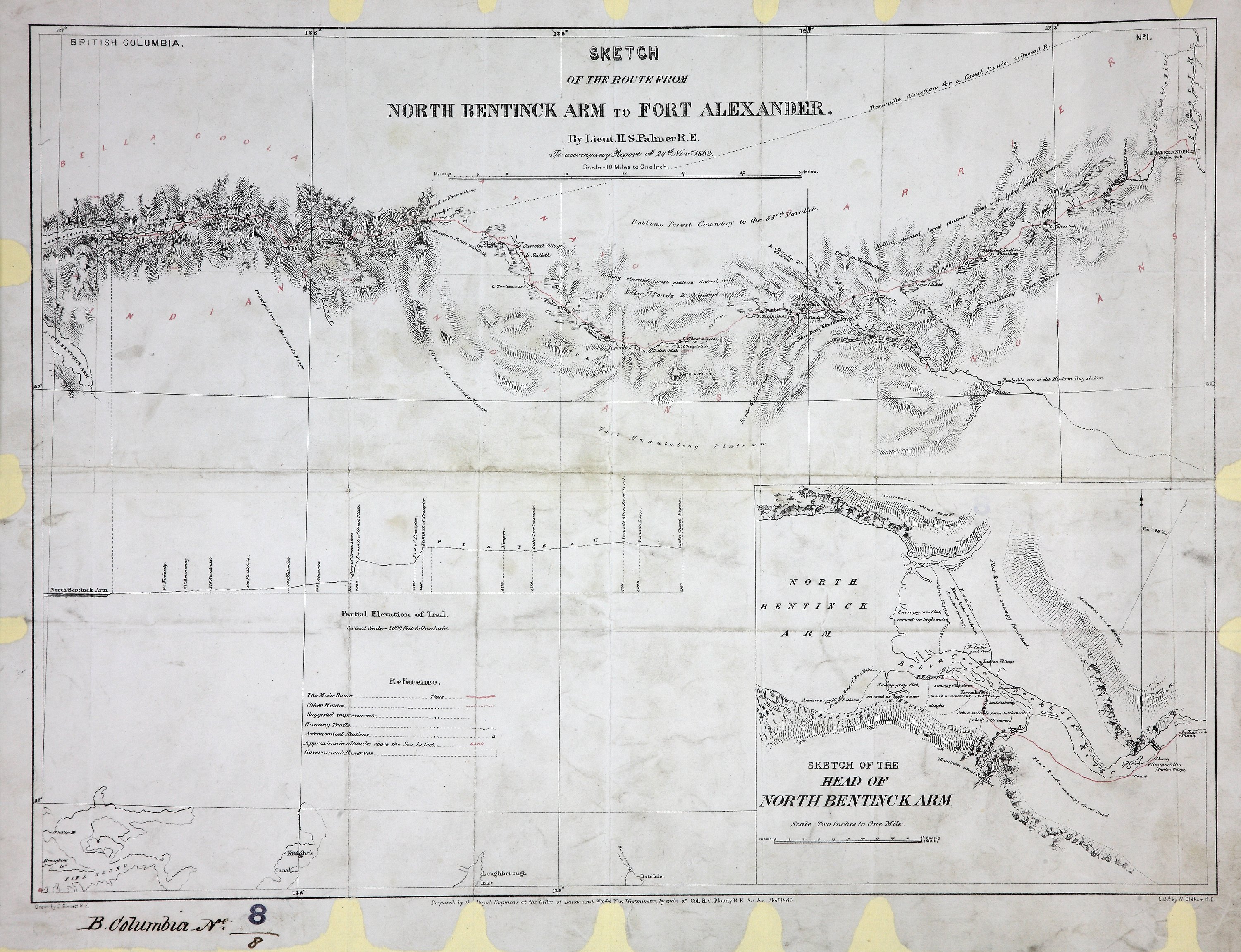
Title: Sketch of the route from North Bentinck Arm to Fort Alexander.

Title: Route from North Bentinck Arm to Fort Alexander.

Author: Palmer, H. Spencer (Henry Spencer), 1838-1893

Subject: British Columbia -- Maps; North Bentinck Arm (B.C.) -- Maps; Fort Alexandria National Historic Site (B.C.) -- Maps;

Subject: British Columbia, 1862, 1863

Identifier (repository): CO

Identifier (repoNumber): 700

Identifier (repoVol): bc

Identifier (libFileName): CO700-BRITISH COLUMBIA8 (8)

Identifier (penfoldNum): 407

Identifier (doc_id): CO700-BRITISH COLUMBIA8 (8)

Date: 1863

Funder: Funded by a Canadian Council of Archives, Archival Community Digitization Program.

Publisher: Great Britain. Army. Royal Engineers. Columbia Detachment.

Publisher: National Archives of the UK.

Identifier (CONTENTdm): oai:contentdm.library.uvic.ca:collection5/33

52N--51N / 127W--123W.