Colonial Despatches
The colonial despatches of Vancouver Island and British Columbia 1846-1871
Nass Bay.
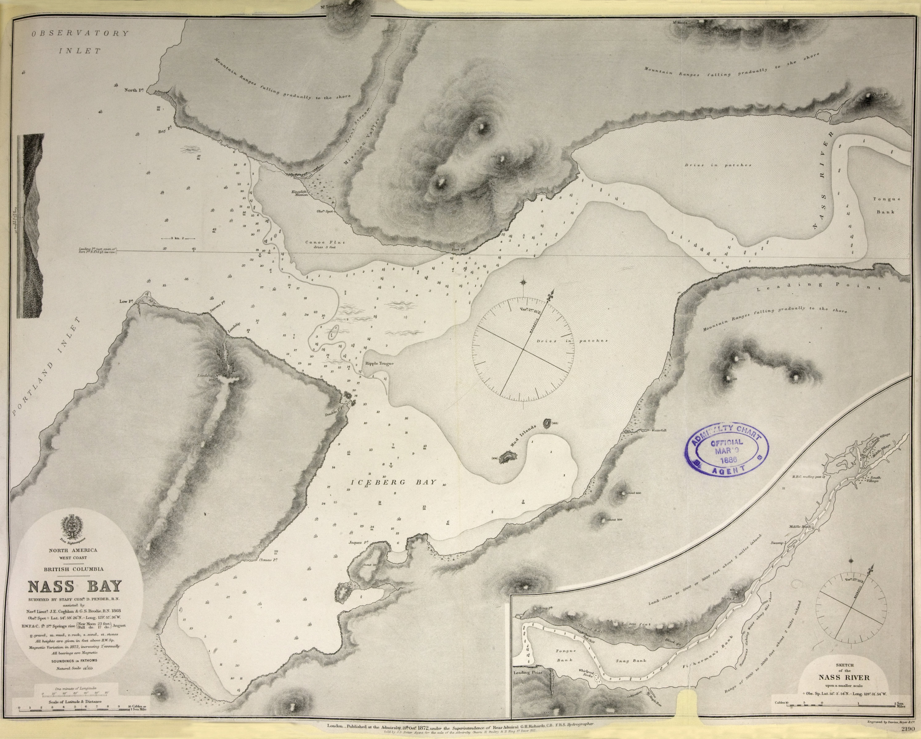
Title: Nass Bay.
Title: North America, west coast. British Columbia. Nass Bay.
Author: Pender, Daniel R., d. 1891.
Subject: Nass Bay (B.C.) -- Maps; Nautical charts -- British Columbia -- Nass Bay; Nass river (B.C.) -- Maps; Nautical charts -- British Columbia -- Nass River; Alaska -- Boundaries -- Canada
Subject: Nass Bay, 1868, 1872
Identifier (repository): CO
Identifier (repoNumber): 700
Identifier (repoVol): canada
Identifier (libFileName): CO700-CANADA144 (17)
Identifier (penfoldNum): 534
Identifier (doc_id): CO700-CANADA144 (17)
Date: 1872
Funder: Funded by a Canadian Council of Archives, Archival Community Digitization Program.
Publisher: Great Britain. Hydrographic Office.
Publisher: National Archives of the UK.