Colonial Despatches
The colonial despatches of Vancouver Island and British Columbia 1846-1871
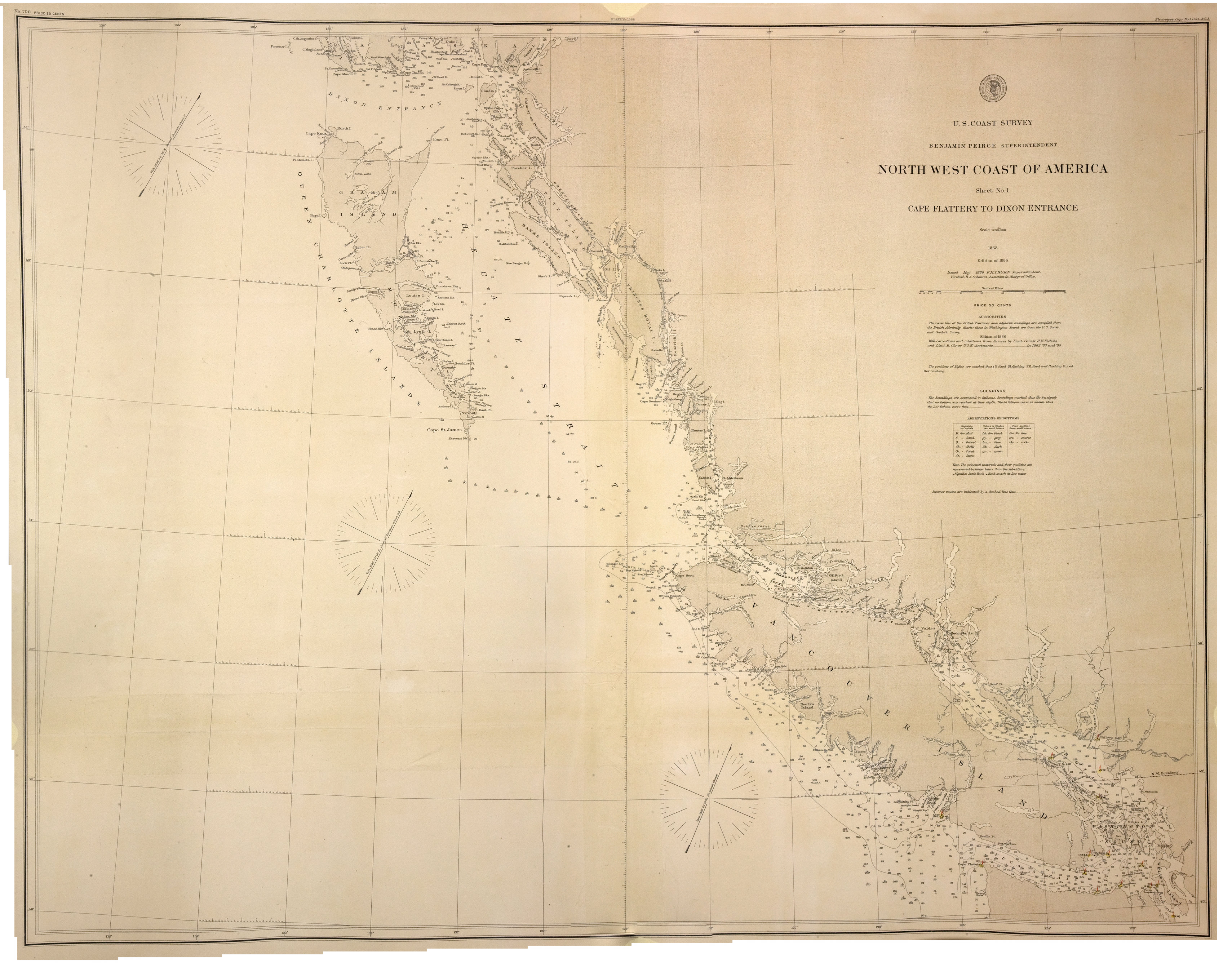
Cape Flattery to Dixon entrance.
With corrections and additions from surveys by Lieut. Comdr. H.E. Nichols and Lieut. R. Clover, U.S.N. assistants…in 1882, '83 and '85.Relief shown by hachures and spot heights. Depths shown by soundings in fathoms, and isolines.
Title: Cape Flattery to Dixon entrance.
Author: U.S. Coast and Geodetic Survey.
Subject: Dixon Entrance (B.C. and Alaska) -- Maps; Nautical charts -- Dixon Entrance (B.C. and Alaska); Flattery, Cape (Wash.) -- Maps; Nautical charts -- Washington (State) -- Flattery, Cape; Pacific Coast (B.C.) -- Maps; Pacific Coast (Alaska) -- Maps; Alaska -- Boundaries -- Canada.
Subject: British Columbia, 1868, 1886
Identifier (repository): CO
Identifier (repoNumber): 700
Identifier (repoVol): canada
Identifier (libFileName): CO700-CANADA144 (5)
Identifier (penfoldNum): 425
Identifier (doc_id): CO700-CANADA144 (5)
Date: 1868
Funder: Funded by a Canadian Council of Archives, Archival Community Digitization Program.
Publisher: National Archives of the UK.
54N-48N/136W-122W