Colonial Despatches
The colonial despatches of Vancouver Island and British Columbia 1846-1871
Map of British Columbia to the 56th Parallel North Latitude.
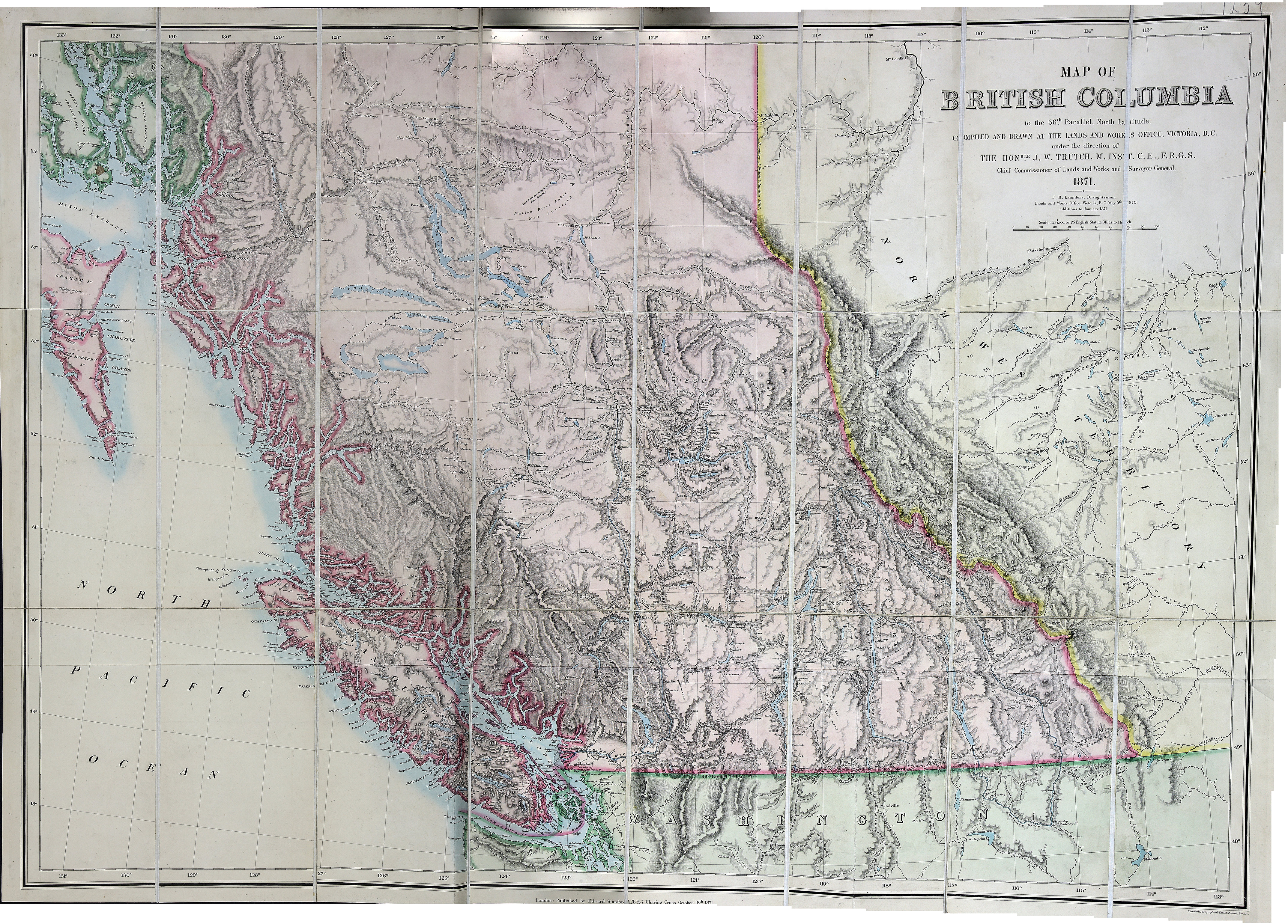
Map of British Columbia to the 56 degrees N, compiled and drawn at the lands and works
office, Victoria, British Columbia, under the direction of the Honble J.W. Trutch,
1871. J. B. Launders, draughtsman…May 9th 1870, additions to January 1871. Scale
1:1,584,000. E. Stanford, London. [British Columbia, 1871]. Shows parts of Western
Alberta. Relief shown by hachures.
Trutch, Joseph W. (Joseph William), Sir, 1826-1904;, Map of British Columbia to the 56th Parallel North Latitude, 1871, Edward Stanford Ltd, FO925-1237. The Colonial Despatches of Vancouver Island and British Columbia 1846-1871, Edition 2.6, ed. James Hendrickson and the Colonial Despatches project. Victoria,
B.C.: University of Victoria. https://bcgenesis.uvic.ca/fo_925-1237_1871.html.
Title: Map of British Columbia to the 56th Parallel North Latitude.
Title: British Columbia to the 56th Parallel North Latitude.
Author: Trutch, Joseph W. (Joseph William), Sir, 1826-1904;
Subject: British Columbia -- Maps; Alberta -- Maps
Subject: British Columbia, 1871
Identifier (repository): FO
Identifier (repoNumber): 925
Identifier (repoVol): 1237
Identifier (libFileName): FO925-1237
Identifier (penfoldNum): 431
Identifier (doc_id): FO925-1237
Date: 1871
Funder: Funded by a Canadian Council of Archives, Archival Community Digitization Program.
Publisher: Edward Stanford Ltd.
Publisher: National Archives of the UK.
56 00'N--48 00'N / 131 00'W--113 00'W