Colonial Despatches
The colonial despatches of Vancouver Island and British Columbia 1846-1871
Map of Vancouver Island and the adjacent coasts.
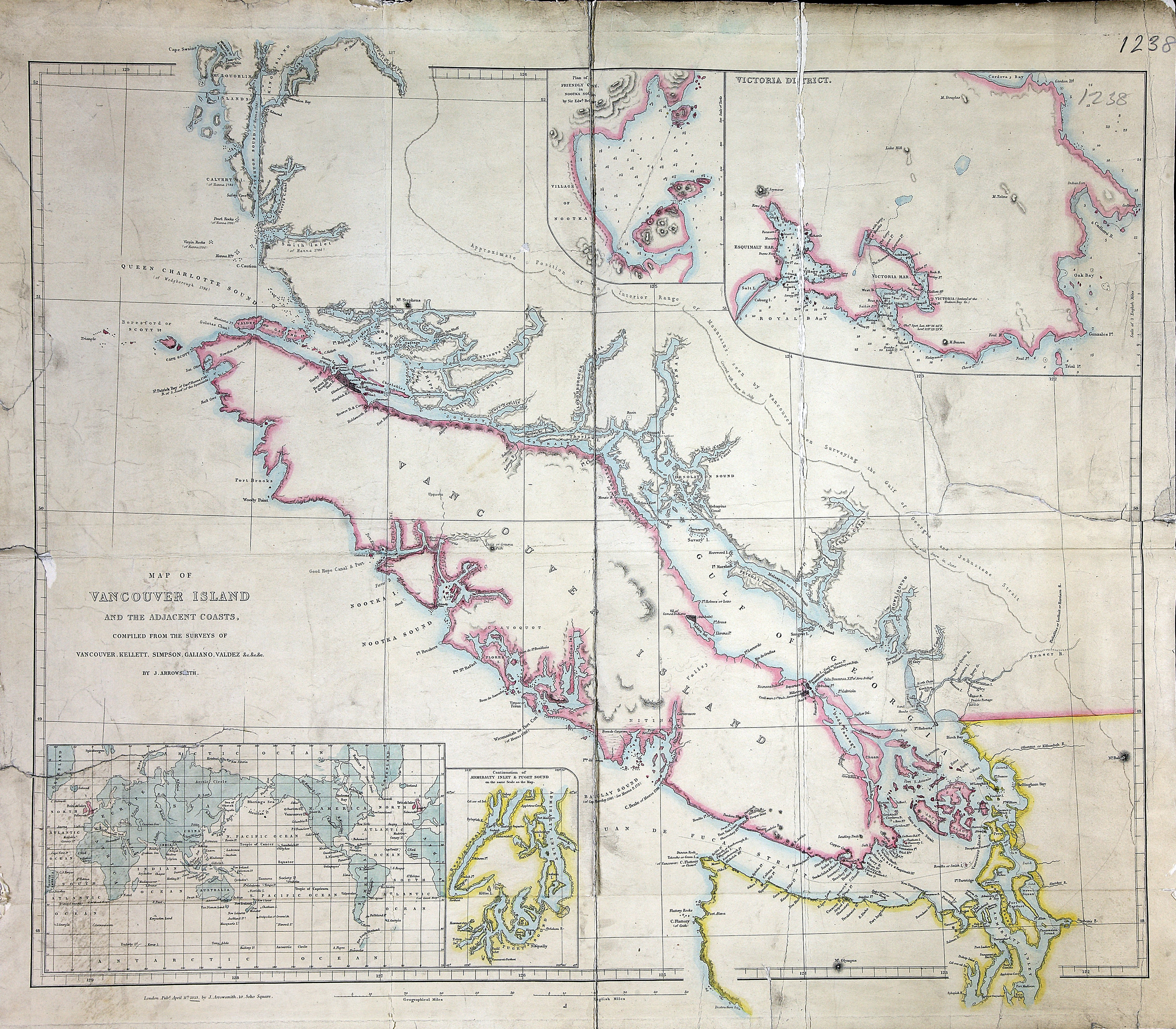
Map of Vancouver Island and the adjacent coast, compiled from the surveys of Vancouver,
Kellett, Simpson, Galiano, Valdez, etc. by J. Arrowsmith. About 15 miles to an inch.
Insets: Plan of Friendly Cove in Nootka Sound; Victoria District; continuation of
Admiralty Inlet & Puget Sound; world map showing Great Britain and Vancouver Island
in pink. J. Arrowsmith, London. [Vancouver Island, 1853]
Arrowsmith, John, 1790-1873, Map of Vancouver Island and the adjacent coasts, 1853, John Arrowsmith, FO 925/1238. The Colonial Despatches of Vancouver Island and British Columbia 1846-1871, Edition 2.6, ed. James Hendrickson and the Colonial Despatches project. Victoria,
B.C.: University of Victoria. https://bcgenesis.uvic.ca/fo_925-1238_van_isl_1853.html.
Title: Map of Vancouver Island and the adjacent coasts.
Title: Vancouver Island and the adjacent coasts.
Author: Arrowsmith, John, 1790-1873
Subject: Vancouver Island (B.C.)--Maps; Pacific Coast (B.C.)--Maps; Victoria (B.C.)--Maps; British Columbia--Yuquot--Maps
Subject: Vancouver Island, 1853
Identifier (repository): FO
Identifier (repoNumber): 925
Identifier (repoVol): 1238
Identifier (libFileName): FO925-1238
Identifier (penfoldNum): 565
Identifier (doc_id): FO 925/1238
Date: 1853
Funder: Funded by a Canadian Council of Archives, Archival Community Digitization Program.
Publisher: John Arrowsmith
Publisher: National Archives of the UK.
52 00'N--48 00'N / 129 00'W--122 00'W