Colonial Despatches
The colonial despatches of Vancouver Island and British Columbia 1846-1871
Map of Vancouver Island and the adjacent coast from King's Island to the mouth of the Columbia River
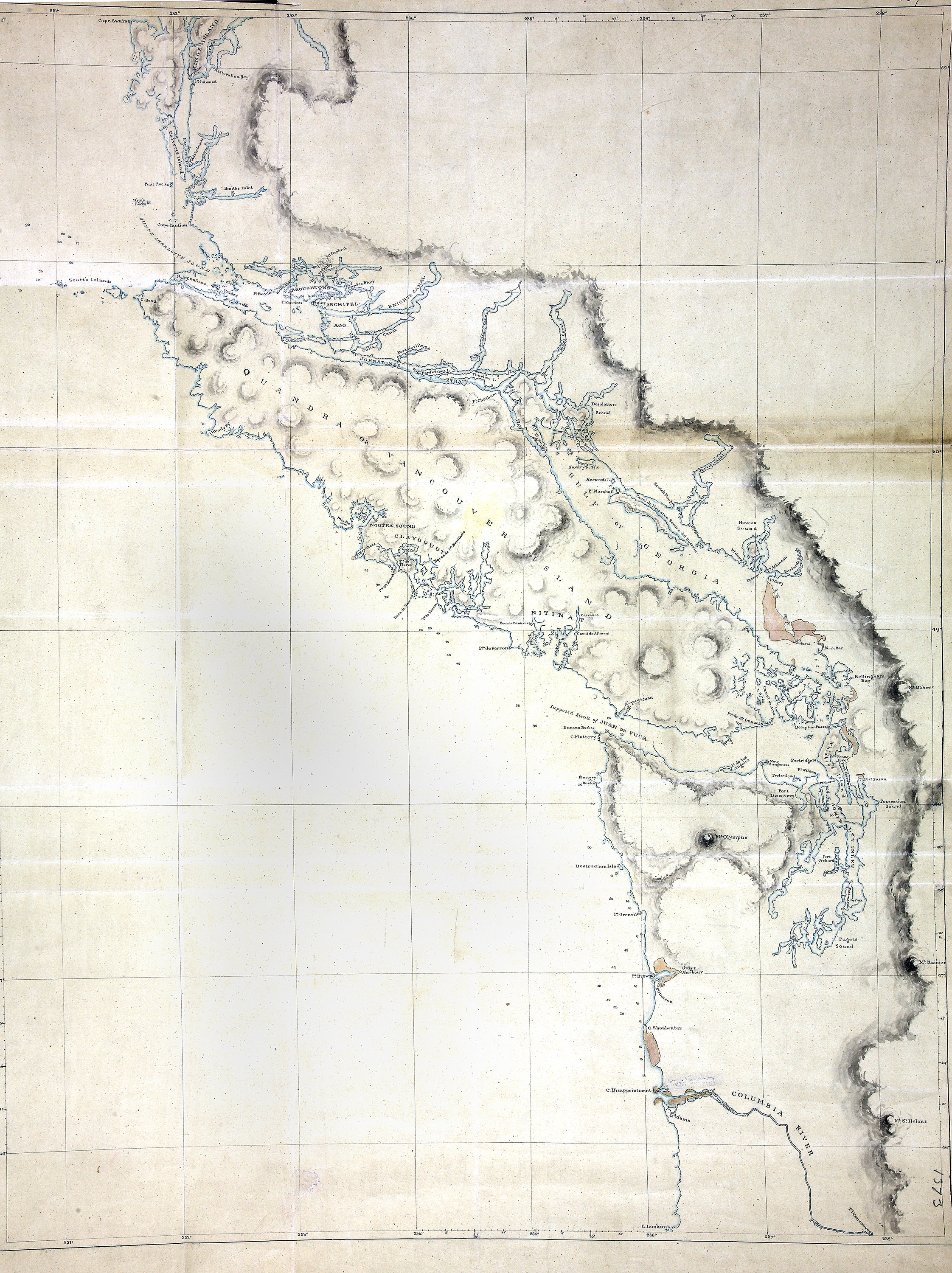
Map of Vancouver Island and the adjacent coast from King's Island to the mouth of
the Columbia River. Original. 14 sea miles to an inch. In Mr Bancroft's letter of
3 Nov 1848. [Vancouver Island, 1848]. Title supplied by cataloguer.
Map of Vancouver Island and the adjacent coast from King's Island to the mouth of
the Columbia River, 1848, National Archives of the UK, FO 925/1373. The Colonial Despatches of Vancouver Island and British Columbia 1846-1871, Edition 2.6, ed. James Hendrickson and the Colonial Despatches project. Victoria,
B.C.: University of Victoria. https://bcgenesis.uvic.ca/fo_925-1373_van_isl_1848.html.
Title: Map of Vancouver Island and the adjacent coast from King's Island to the mouth of the Columbia River
Subject: Vancouver Island (B.C.)--Maps; Pacific Coast (B.C.)--Maps
Subject: Vancouver Island, 1848
Identifier (repository): FO
Identifier (repoNumber): 925
Identifier (repoVol): 1373
Identifier (libFileName): FO925-1373
Identifier (penfoldNum): 559
Identifier (doc_id): FO 925/1373
Date: 1848
Funder: Funded by a Canadian Council of Archives, Archival Community Digitization Program.
Publisher: National Archives of the UK.
52 00'N--46 00'N / 231 00'W--238 00'W