Colonial Despatches
The colonial despatches of Vancouver Island and British Columbia 1846-1871
Archipelago of Arro, Gulf of Georgia, Ringgold's Channel and Straits of Fuca, Oregon Territory
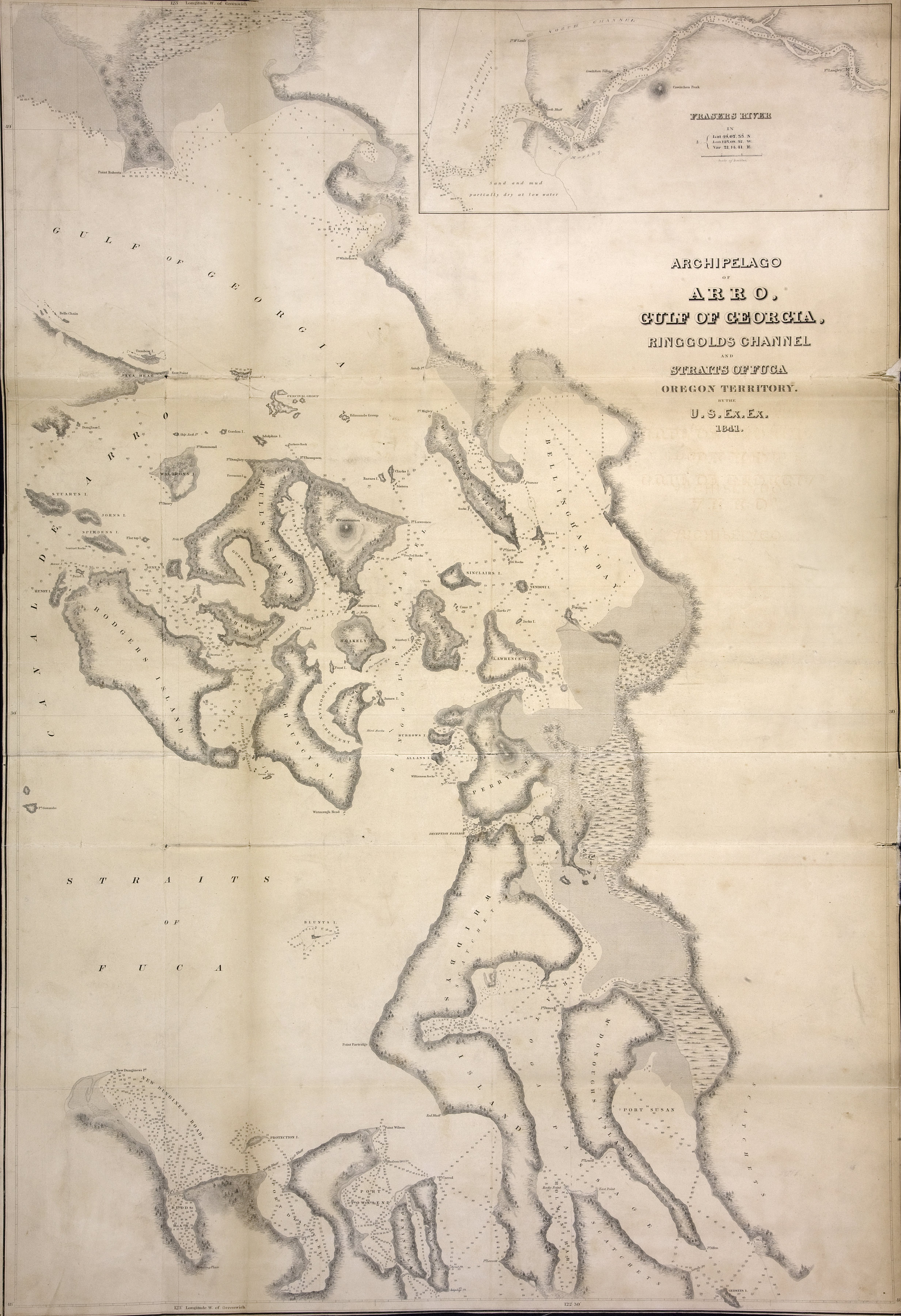
Archipelago of Arro, Gulf of Georgia, Ringold's Channel and Straits of Fuca, Oregon
Territory by the US Exploring Expedition, 1841. About 2 sea miles to an inch. Inset:
Frasers River. In Mr Bancroft's letter of 3 Nov 1848. US Government. [British Columbia,
1841; 1848]
Includes inset map of Frasers River, from the mouth of the river to Ft. Langley.
United States Exploring Expedition (1838-1842), Archipelago of Arro, Gulf of Georgia, Ringgold's Channel and Straits of Fuca, Oregon
Territory, 1841, National Archives of the UK, FO 925/1377. The Colonial Despatches of Vancouver Island and British Columbia 1846-1871, Edition 2.6, ed. James Hendrickson and the Colonial Despatches project. Victoria,
B.C.: University of Victoria. https://bcgenesis.uvic.ca/fo_925-1377_1841_georgia_haro.html.
Title: Archipelago of Arro, Gulf of Georgia, Ringgold's Channel and Straits of Fuca, Oregon Territory
Author: United States Exploring Expedition (1838-1842)
Subject: Juan de Fuca Strait (B.C. and Wash.)--Maps; Georgia, Strait of (B.C. and Wash.)--Maps; San Juan Islands (Wash.)--Maps; Gulf Islands (B.C.)--Maps
Subject: British Columbia, 1841, 1848
Identifier (repository): FO
Identifier (repoNumber): 925
Identifier (repoVol): 1377
Identifier (libFileName): FO925-1377
Identifier (penfoldNum): 373
Identifier (doc_id): FO 925/1377
Date: 1841
Funder: Funded by a Canadian Council of Archives, Archival Community Digitization Program.
Publisher: National Archives of the UK.
49 00'N--48 00'N / 123 00'W--122 30'W