Colonial Despatches
The colonial despatches of Vancouver Island and British Columbia 1846-1871
Straits of Juan de Fuca, Oregon Territory, from surveys of the U.S. Ex. Ex. and Spanish and English authorities
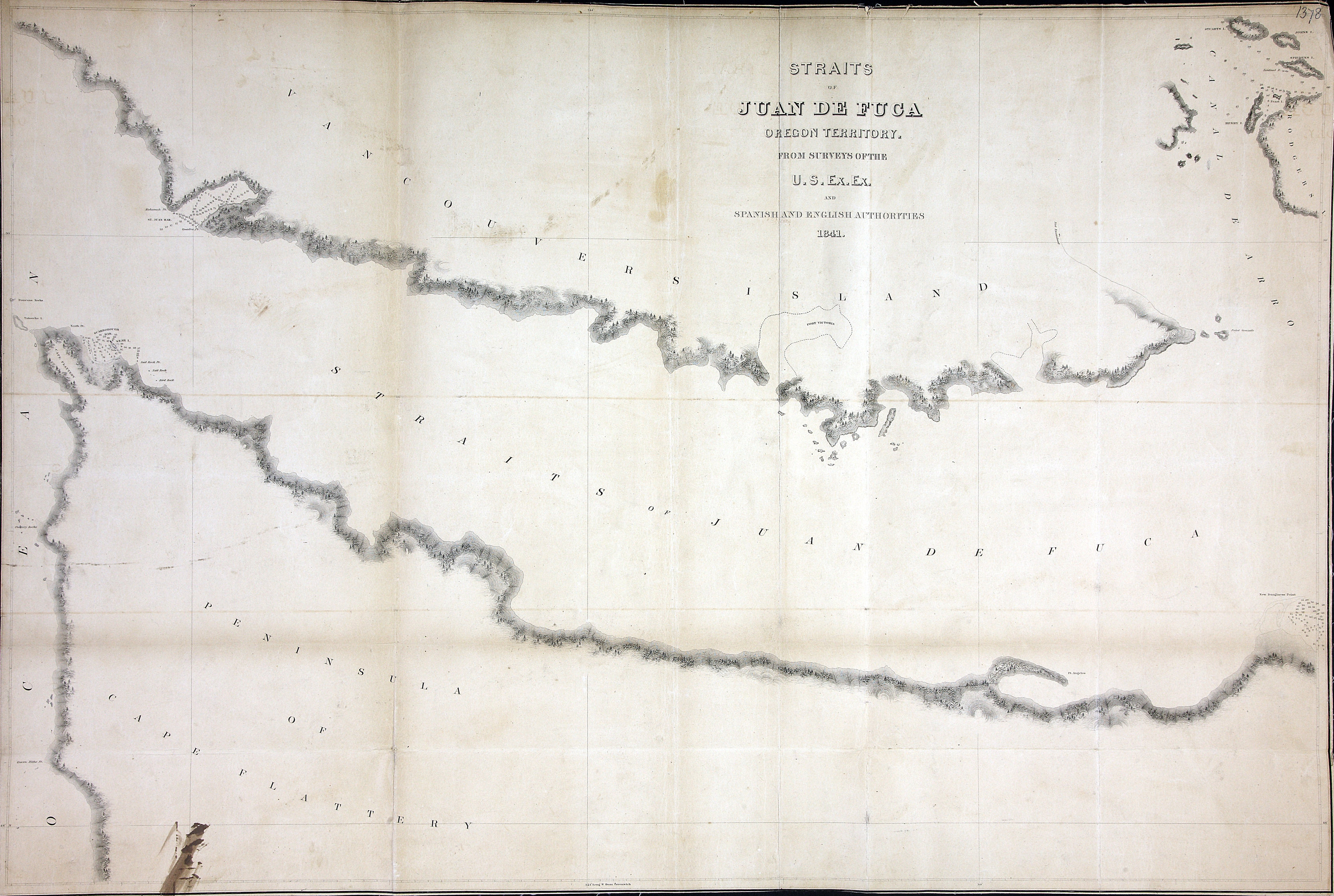
Straits of Juan De Fuca, Oregon Territory. From Surveys of the US Exploring Expedition
and Spanish and English Authorities, 1841. About 2 sea miles to an inch. In Mr Bancroft's
letter of 3 Nov 1848. US Government. [Juan de Fuca, Strait, 1841; 1848]
United States Exploring Expedition (1838-1842), Straits of Juan de Fuca, Oregon Territory, from surveys of the U.S. Ex. Ex. and Spanish
and English authorities, 1841-1849, National Archives of the UK, FO 925/1378. The Colonial Despatches of Vancouver Island and British Columbia 1846-1871, Edition 2.6, ed. James Hendrickson and the Colonial Despatches project. Victoria,
B.C.: University of Victoria. https://bcgenesis.uvic.ca/fo_925-1378_j_d_f_s_1849_1841.html.
Title: Straits of Juan de Fuca, Oregon Territory, from surveys of the U.S. Ex. Ex. and Spanish and English authorities
Author: United States Exploring Expedition (1838-1842)
Subject: Juan de Fuca Strait (B.C. and Wash.)--Maps; Washington (State)--Maps; British Columbia--Maps
Subject: Juan de Fuca, Strait, 1841, 1848
Identifier (repository): FO
Identifier (repoNumber): 925
Identifier (repoVol): 1378j
Identifier (libFileName): FO925-1378
Identifier (penfoldNum): 508
Identifier (doc_id): FO 925/1378
Date: 1849
Funder: Funded by a Canadian Council of Archives, Archival Community Digitization Program.
Publisher: National Archives of the UK.
48 30'N--48 00'N / 124 30'W--123 30'W