Colonial Despatches
The colonial despatches of Vancouver Island and British Columbia 1846-1871
Strait of Juan de Fuca
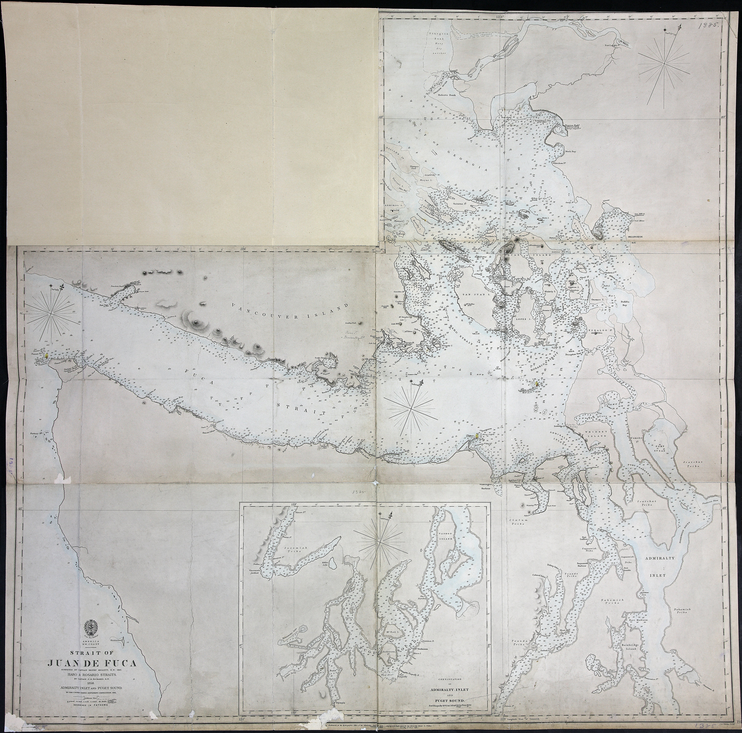
America N.W. Coast. Strait of Juan de Fuca, surveyed by Capt Henry Kellett 1847, Haro
and Rosario Straits, by Capt G.H. Richards, 1858. Admiralty Inlet and Puget Sound
by the US Exploring Expedition 1841. Admiralty Chart 1911. About 3 sea miles to an
inch. J. & C. Walker, Sculpt. [Juan de Fuca, Strait and Gulf of Georgia, 1849; 1858].
Soundings in fathoms.
Great Britain. Hydrographic Office., Strait of Juan de Fuca, 1849-1858, Great Britain. Hydrographic Office, FO 925/1385. The Colonial Despatches of Vancouver Island and British Columbia 1846-1871, Edition 2.6, ed. James Hendrickson and the Colonial Despatches project. Victoria,
B.C.: University of Victoria. https://bcgenesis.uvic.ca/fo_925-1385_j_d_f_1849_1858_stitched.html.
Title: Strait of Juan de Fuca
Author: Great Britain. Hydrographic Office.
Subject: Juan de Fuca Strait (B.C. and Wash.)--Maps; Puget Sound (Wash.)--Maps; Admiralty Inlet (Wash.)--Maps
Subject: Juan de Fuca, Strait and Gulf of Georgia, 1849, 1858
Identifier (repository): FO
Identifier (repoNumber): 925
Identifier (repoVol): 1385
Identifier (libFileName): FO925-1385
Identifier (penfoldNum): 513
Identifier (doc_id): FO 925/1385
Date: 1858
Funder: Funded by a Canadian Council of Archives, Archival Community Digitization Program.
Publisher: Great Britain. Hydrographic Office.
Publisher: National Archives of the UK.
48 35'N--47 30'N / 124 45'W--122 10'W