Colonial Despatches
The colonial despatches of Vancouver Island and British Columbia 1846-1871
Vancouvers Island
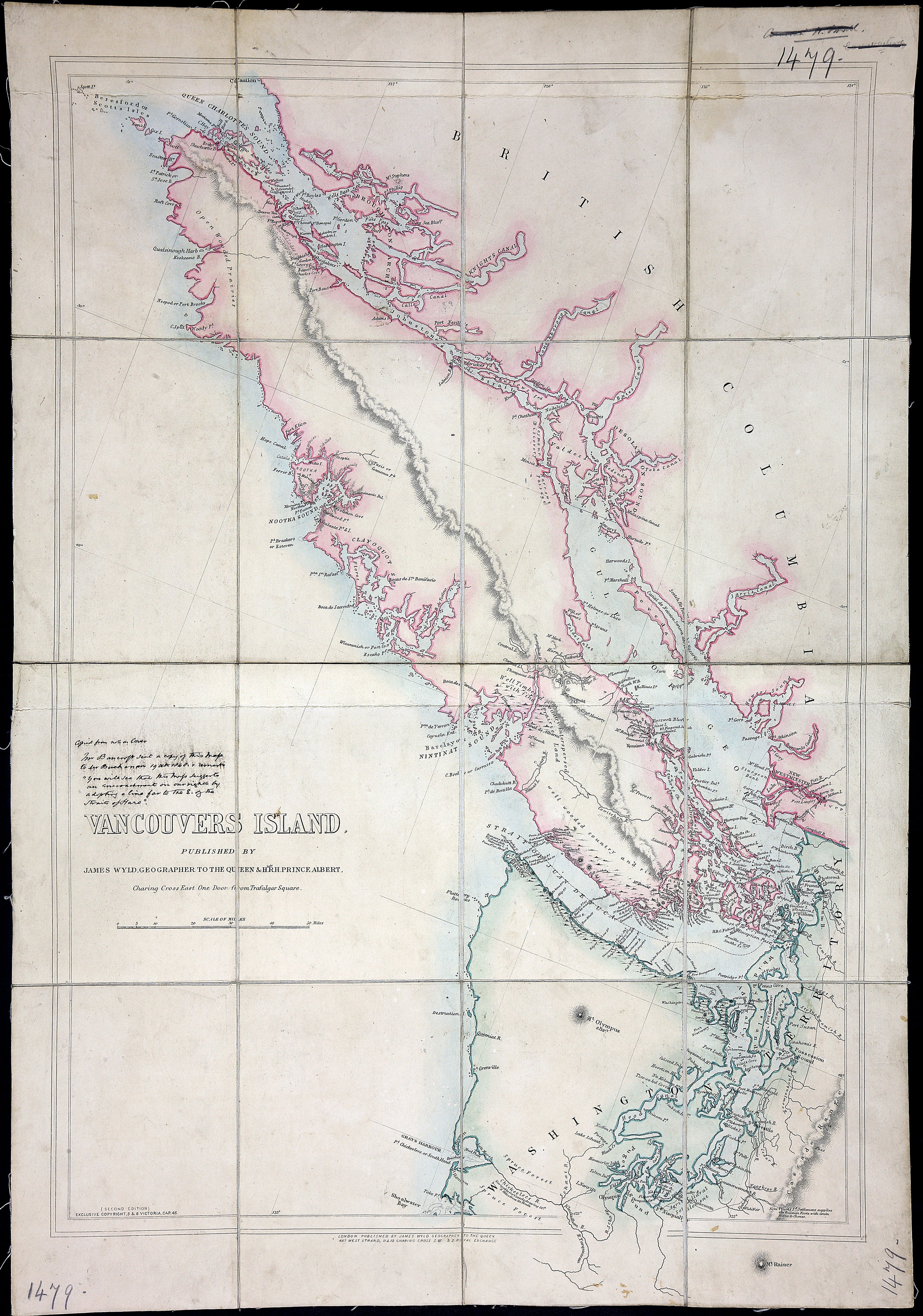
Vancouvers Island, 2 Editions, with MS Notes. 12.5 miles to an inch. J. Wyld, London.
[Vancouver Island, 1848; 1861]. Published by James Wyld, geographer to the Queen
& H.R.H. Prince Albert, Charing Cross East, four doors from Trafalgar square. Relief
shown by hachures. Descriptive text. At lower left of map: (Second edition) Exclusive
copyright, 5 & 6, Victoria, Cap.45.
Copied from note on cover. Mr. Bancroft sent a copy of this map to Mr Buchanan 19
Octr. 1848. & remark'd
You will see that this map suggests an encroachment on our rights by adopting a line far to the E. of the Straits of Haro.
Wyld, James, 1812-1887, Vancouvers Island, 1848, James Wyld, FO 925/1479. The Colonial Despatches of Vancouver Island and British Columbia 1846-1871, Edition 2.6, ed. James Hendrickson and the Colonial Despatches project. Victoria,
B.C.: University of Victoria. https://bcgenesis.uvic.ca/fo_925-1479_van_isl_1848.html.
Title: Vancouvers Island
Title: Vancouver Island
Author: Wyld, James, 1812-1887
Subject: Vancouver Island (B.C.)--Maps
Subject: Vancouver Island, 1848, 1861
Identifier (repository): FO
Identifier (repoNumber): 925
Identifier (repoVol): 1479
Identifier (libFileName): FO925-1479
Identifier (penfoldNum): 561
Identifier (doc_id): FO 925/1479
Date: 1848
Funder: Funded by a Canadian Council of Archives, Archival Community Digitization Program.
Publisher: James Wyld
Publisher: National Archives of the UK.
51 00'N--49 00'N / 125 00'W--122 00W