Colonial Despatches
The colonial despatches of Vancouver Island and British Columbia 1846-1871
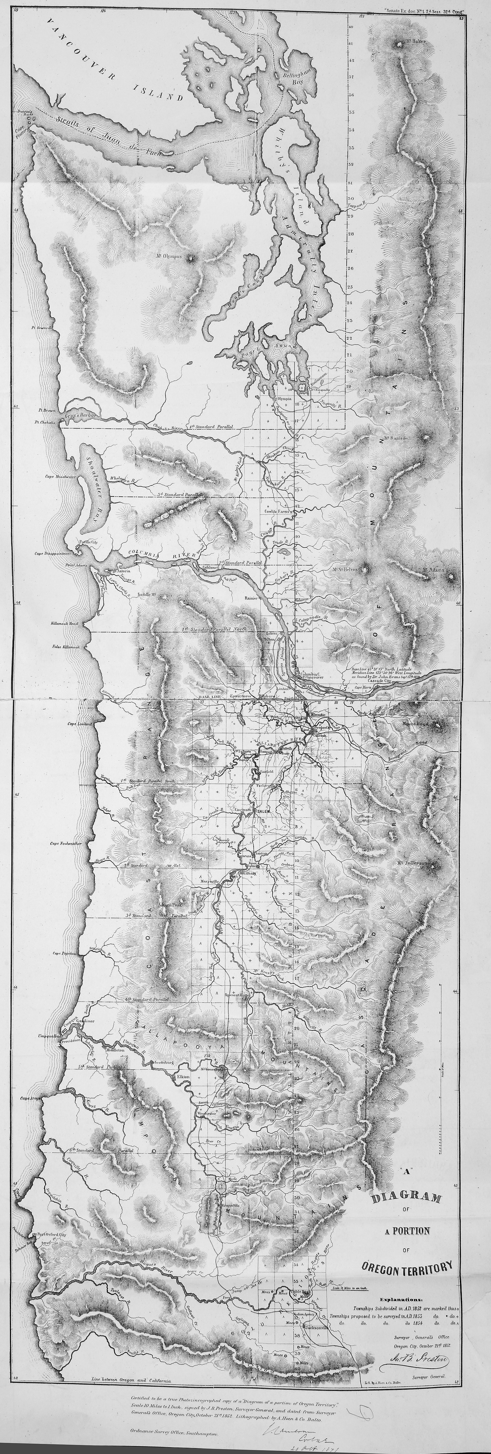
Diagram of a Portion of Oregon Territory
San Juan Boundary Arbitration. Atlas (10 maps with list).
[Map 9].
Certified to be a true Photozincographed copy of aDiagram of a portion of Oregon Territory,Scale 10 Miles to 1 Inch. signed by J.B. Preston, Surveyor General, and dated from Surveyor General's Office, Oregon City, October 21st 1852. Lithographed by A. Hoen & Co. Balto.
Diagram of a Portion of Oregon Territory, 1852, Surveyor General's Office, Oregon City, FO 925/1647B. The Colonial Despatches of Vancouver Island and British Columbia 1846-1871, Edition 2.6, ed. James Hendrickson and the Colonial Despatches project. Victoria,
B.C.: University of Victoria. https://bcgenesis.uvic.ca/fo_925-1647b_9_1852.html.
Title: Diagram of a Portion of Oregon Territory
Subject: San Juan Boundary Dispute, 1846-1872
Subject: Oregon Territory; Southern Vancouver Island
Identifier (repository): FO
Identifier (repoNumber): 925
Identifier (repoVol): 1647b
Identifier (libFileName): FO925-1647B (9)
Identifier (penfoldNum):
Identifier (doc_id): FO 925/1647B
Date: 1852
Funder: Funded by a Canadian Council of Archives, Archival Community Digitization Program.
Publisher: Surveyor General's Office, Oregon City
Publisher: Ordnance Survey Office, Southampton
Publisher: National Archives of the UK.