Colonial Despatches
The colonial despatches of Vancouver Island and British Columbia 1846-1871
Strait of Juan de Fuca and the channels between Vancouver Id. & the continent, showing the boundary line between British & American possessions
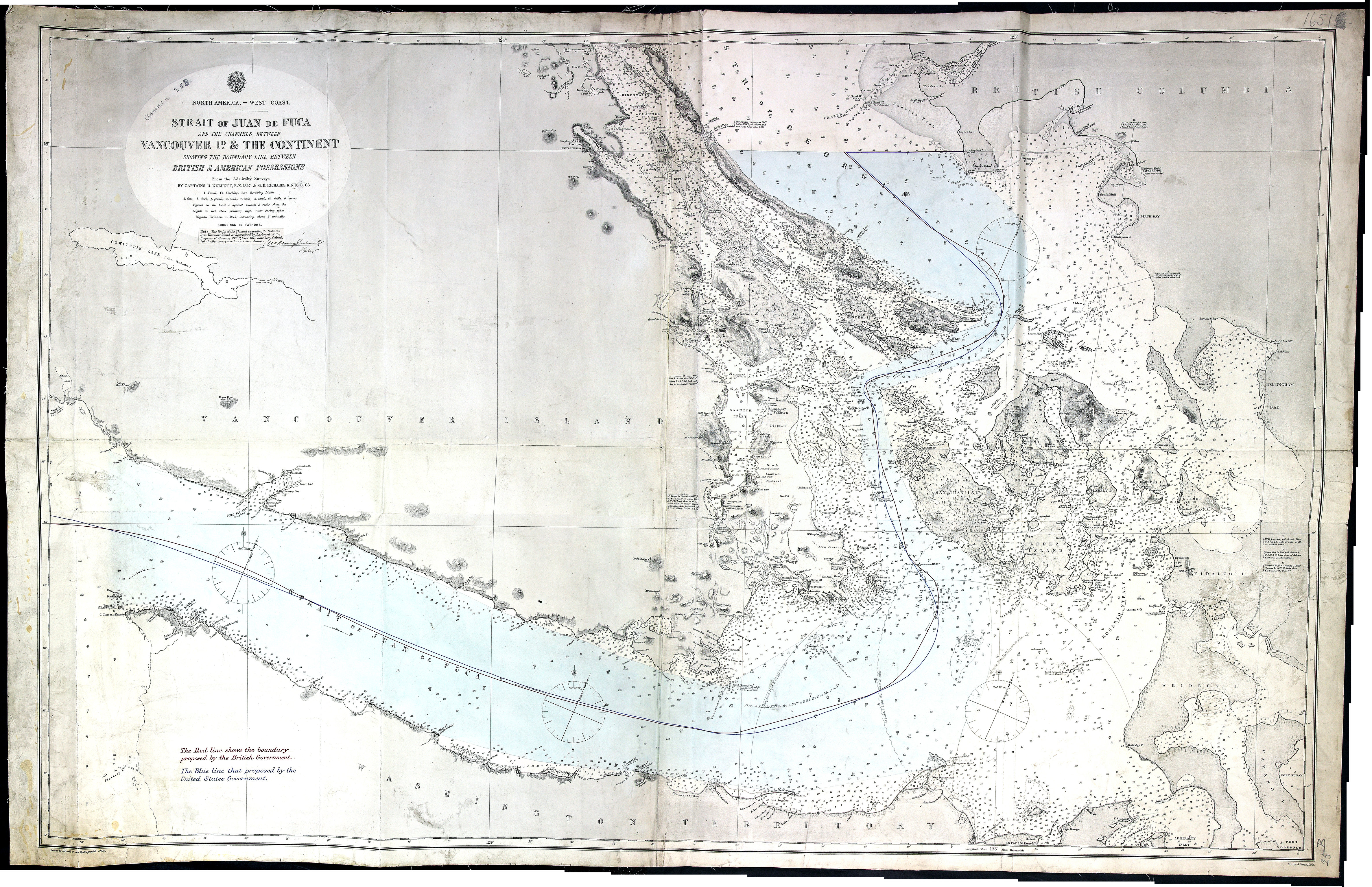
Note. The limits of the Channel separating the Continent from Vancouver Island as determined by the award of the Emperor of Germany 21st October 1872, have been defined but the boundary line has not been drawn. [signed] Geo. Henry Richards.
Title: Strait of Juan de Fuca and the channels between Vancouver Id. & the continent, showing the boundary line between British & American possessions
Author: Powell, E. J.
Subject: Vancouver Island (B.C.)--Maps; Juan de Fuca, Strait of (B.C. and Wash.) -- Maps; Nautical charts -- Juan de Fuca, Strait of (B.C. and Wash.); Puget Sound (Wash.) -- Maps; Nautical charts -- Puget Sound (Wash.); Nautical charts -- Haro Strait (B.C. and Wash.); Nautical charts -- Rosario Strait (Wash.); Nautical charts -- Georgia, Strait of (B.C. and Wash.); Flattery, Cape (Wash.); San Juan Boundary Dispute, 1846-1872.
Subject: Juan de Fuca, Strait, 1873
Identifier (repository): FO
Identifier (repoNumber): 925
Identifier (repoVol): 1651
Identifier (libFileName): FO925-1651
Identifier (penfoldNum): 525
Identifier (doc_id): FO925-1651
Date: 1872
Funder: Funded by a Canadian Council of Archives, Archival Community Digitization Program.
Publisher: Great Britain. Hydrographic Office
Publisher: National Archives of the UK.
49 05'N--48 05'N / 124 50'W--122 25'W