Colonial Despatches
The colonial despatches of Vancouver Island and British Columbia 1846-1871
Map showing the line of boundary between the United States and British possessions. : from the point where the 49th parallel of north latitude strikes the western coast of the continent "to the middle of the channel which separates the continent from Vancouver's Island and thence southerly through the middle of said channel" &c. to Fuca's Straits, in accordance with Treaty of June 15th, 1846.
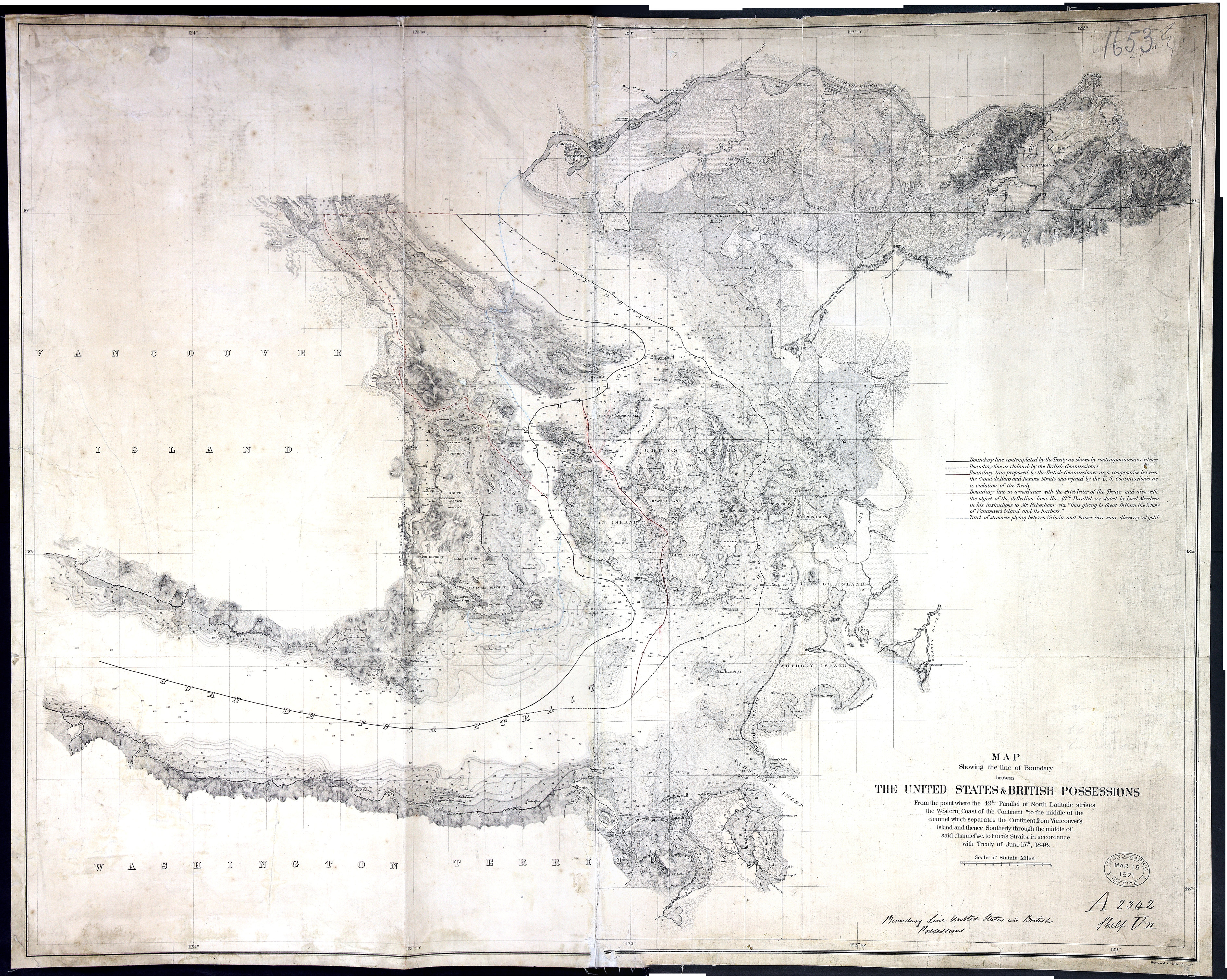
Bowen & Co. lith, Philada.MS note: Boundary line United States and British Possessions. Stamped Hydrographic Office Mar. 15 1871. Relief shown by hachures and spot heights; depths by soundings. Also shows route of steamers plying between Victoria and Fraser River gold deposits. Includes detailed topography of coastal areas and islands.
Title: Map showing the line of boundary between the United States and British possessions. : from the point where the 49th parallel of north latitude strikes the western coast of the continent "to the middle of the channel which separates the continent from Vancouver's Island and thence southerly through the middle of said channel" &c. to Fuca's Straits, in accordance with Treaty of June 15th, 1846.
Author: Bowen & Co.
Subject: Northwest boundary of the United States -- Maps; Canada -- Boundaries -- United States -- Maps; United States -- Boundaries -- Canada -- Maps; British Columbia -- Boundaries -- Washington (State) -- Maps; Washington (State) -- Boundaries -- British Columbia -- Maps; San Juan Boundary Dispute, 1846-1872.
Subject: British Columbia, 1871
Identifier (repository): FO
Identifier (repoNumber): 925
Identifier (repoVol): 1653
Identifier (libFileName): FO925-1653
Identifier (penfoldNum): 429
Identifier (doc_id): FO925-1653
Date: 1871
Funder: Funded by a Canadian Council of Archives, Archival Community Digitization Program.
Publisher: United States. Government Printing Office
Publisher: National Archives of the UK.
49N-48N/124W-122W