Colonial Despatches
The colonial despatches of Vancouver Island and British Columbia 1846-1871
Haro and Rosario Straits
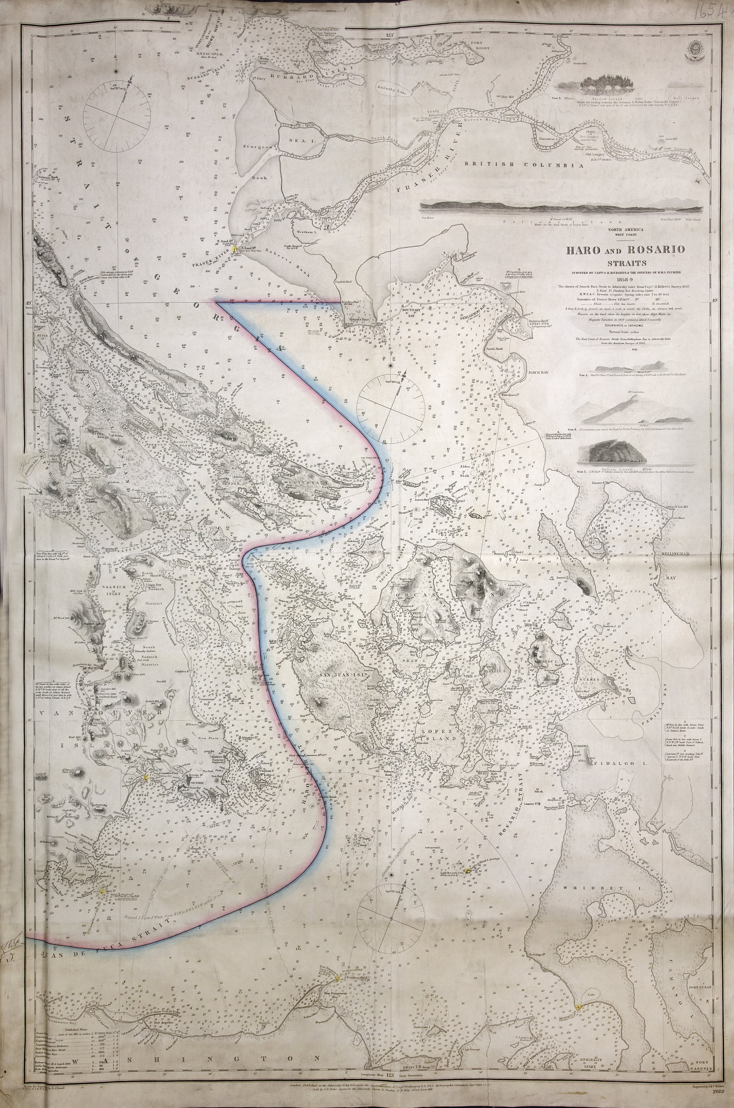
San Juan Boundary. Haro and Rosario Straits, surveyed by Capt G.H. Richards and others,
with boundary line between British and American possessions. Admiralty Chart 1689.
2 sea miles to one inch. Admiralty. [Haro and Rosario Straits, 1859; 1871]
Richards, G.H. (George Henry); Kellett, Henry, 1806-1875; Powell, F.J.; Great Britain.
Hydrographic Office, Haro and Rosario Straits, 1859-1865, J. and C. Walker, FO925-1654. The Colonial Despatches of Vancouver Island and British Columbia 1846-1871, Edition 2.6, ed. James Hendrickson and the Colonial Despatches project. Victoria,
B.C.: University of Victoria. https://bcgenesis.uvic.ca/fo_925-1654_1859_1865_haro_and_rosario_ss.html.
Title: Haro and Rosario Straits
Author: Richards, G.H. (George Henry); Kellett, Henry, 1806-1875; Powell, F.J.; Great Britain. Hydrographic Office
Subject: Haro Strait (B.C. and Wash.)--Maps; Rosario Strait (Wash.)--Maps; San Juan Island (Wash.)--Maps; Boundaries
Subject: Haro and Rosario Straits, 1859, 1871
Identifier (repository): FO
Identifier (repoNumber): 925
Identifier (repoVol): 1654
Identifier (libFileName): FO925-1654
Identifier (penfoldNum): 493
Identifier (doc_id): FO925-1654
Date: 1865
Funder: Funded by a Canadian Council of Archives, Archival Community Digitization Program.
Publisher: J. and C. Walker
Publisher: National Archives of the UK.
49 15'N--48 05'N / 123 55'W--122 25'W