Colonial Despatches
The colonial despatches of Vancouver Island and British Columbia 1846-1871
Sketch of Fraser's River, from Fort Hope to the forks of Thompson's River, showing the Auriferous districts.
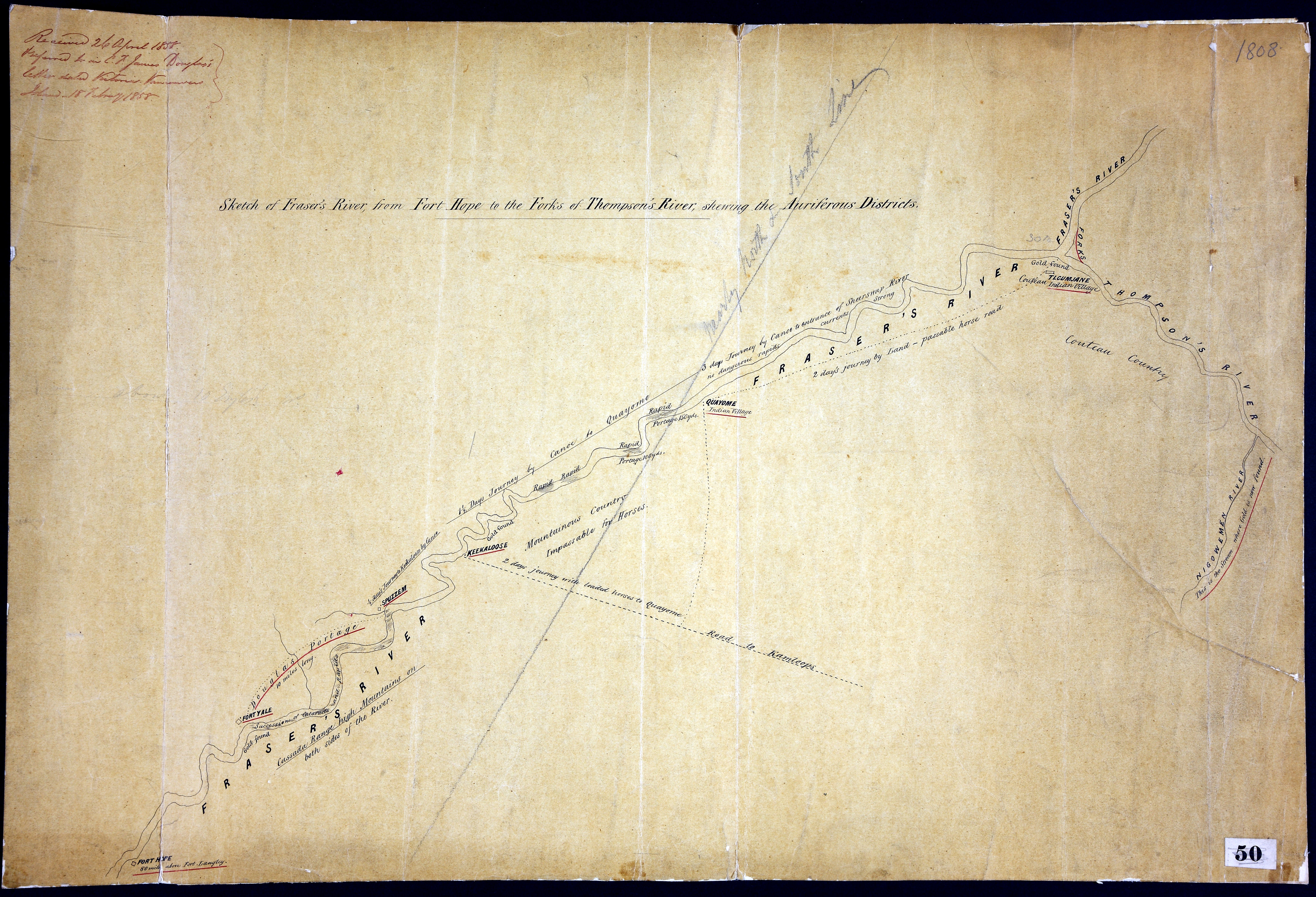
Sketch of Fraser's River, from Fort Hope to the forks of Thompson's River, showing
the Auriferous districts. Original. In C.F. James Douglas' letter dated Victoria,
Vancouver's Island, 18 Feb 1858. [Fraser River, 1858].
MS map with notes on terrain, river conditions, portage, travel time, trails, gold
locations and First Nations villages.
Douglas, James, Sir, 1803-1877, Sketch of Fraser's River, from Fort Hope to the forks of Thompson's River, showing
the Auriferous districts, 1858, National Archives of the UK, FO 925/1808. The Colonial Despatches of Vancouver Island and British Columbia 1846-1871, Edition 2.6, ed. James Hendrickson and the Colonial Despatches project. Victoria,
B.C.: University of Victoria. https://bcgenesis.uvic.ca/fo_925-1808_fraser_river_1858.html.
Title: Sketch of Fraser's River, from Fort Hope to the forks of Thompson's River, showing the Auriferous districts.
Author: Douglas, James, Sir, 1803-1877
Subject: Fraser River (B.C.) -- Maps; Thompson river (B.C.) -- Maps; Gold mines and mining -- British Columbia; Indians of North America -- British Columbia.
Subject: Fraser River, 1858
Identifier (repository): FO
Identifier (repoNumber): 925
Identifier (repoVol): 1808
Identifier (libFileName): FO925-1808
Identifier (penfoldNum): 477
Identifier (doc_id): FO 925/1808
Date: 1858
Funder: Funded by a Canadian Council of Archives, Archival Community Digitization Program.
Publisher: National Archives of the UK.