Colonial Despatches
The colonial despatches of Vancouver Island and British Columbia 1846-1871
British Columbia, reduced copy of the map referred to in the despatch of Governor Douglas of 16 July 1861.
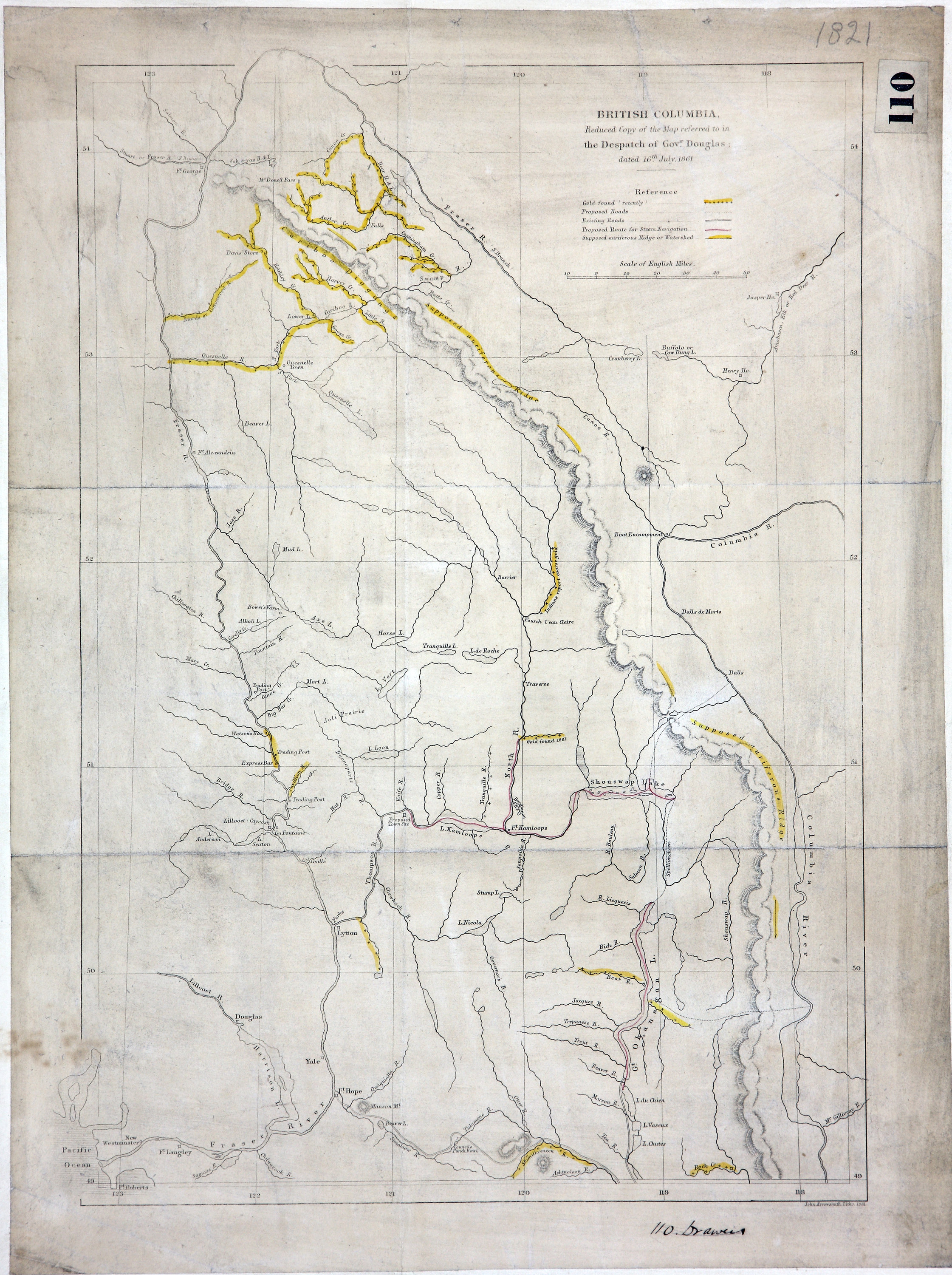
British Columbia, reduced copy of the map referred to in the despatch of Governor
Douglas of 16 July 1861. Showing roads, proposed route for steam navigation and supposed
Auriferous Ridge or Watershed. 24 miles to one inch. J. Arrowsmith, London. Lithographed.
[British Columbia, 1861].
See Colonial Despatches for letter (Despatch to London
Douglas to Newcastle 8719, CO 60/10, p. 301)
Arrowsmith, John, 1790-1873., British Columbia, reduced copy of the map referred to in the despatch of Governor
Douglas of 16 July 1861, 1861, John Arrowsmith, FO 925/1821. The Colonial Despatches of Vancouver Island and British Columbia 1846-1871, Edition 2.6, ed. James Hendrickson and the Colonial Despatches project. Victoria,
B.C.: University of Victoria. https://bcgenesis.uvic.ca/fo_925-1821_bc_1861.html.
Title: British Columbia, reduced copy of the map referred to in the despatch of Governor Douglas of 16 July 1861.
Author: Arrowsmith, John, 1790-1873.
Subject: British Columbia -- Maps; Gold mines and mining -- British Columbia -- Maps; Roads -- British Columbia -- Maps
Subject: British Columbia, 1861
Identifier (repository): FO
Identifier (repoNumber): 925
Identifier (repoVol): 1821
Identifier (libFileName): FO925-1821
Identifier (penfoldNum): 398
Identifier (doc_id): FO 925/1821
Date: 1861
Funder: Funded by a Canadian Council of Archives, Archival Community Digitization Program.
Publisher: John Arrowsmith
Publisher: National Archives of the UK.
54N-49N/123W-118W