Colonial Despatches
The colonial despatches of Vancouver Island and British Columbia 1846-1871
Vancouvers Island
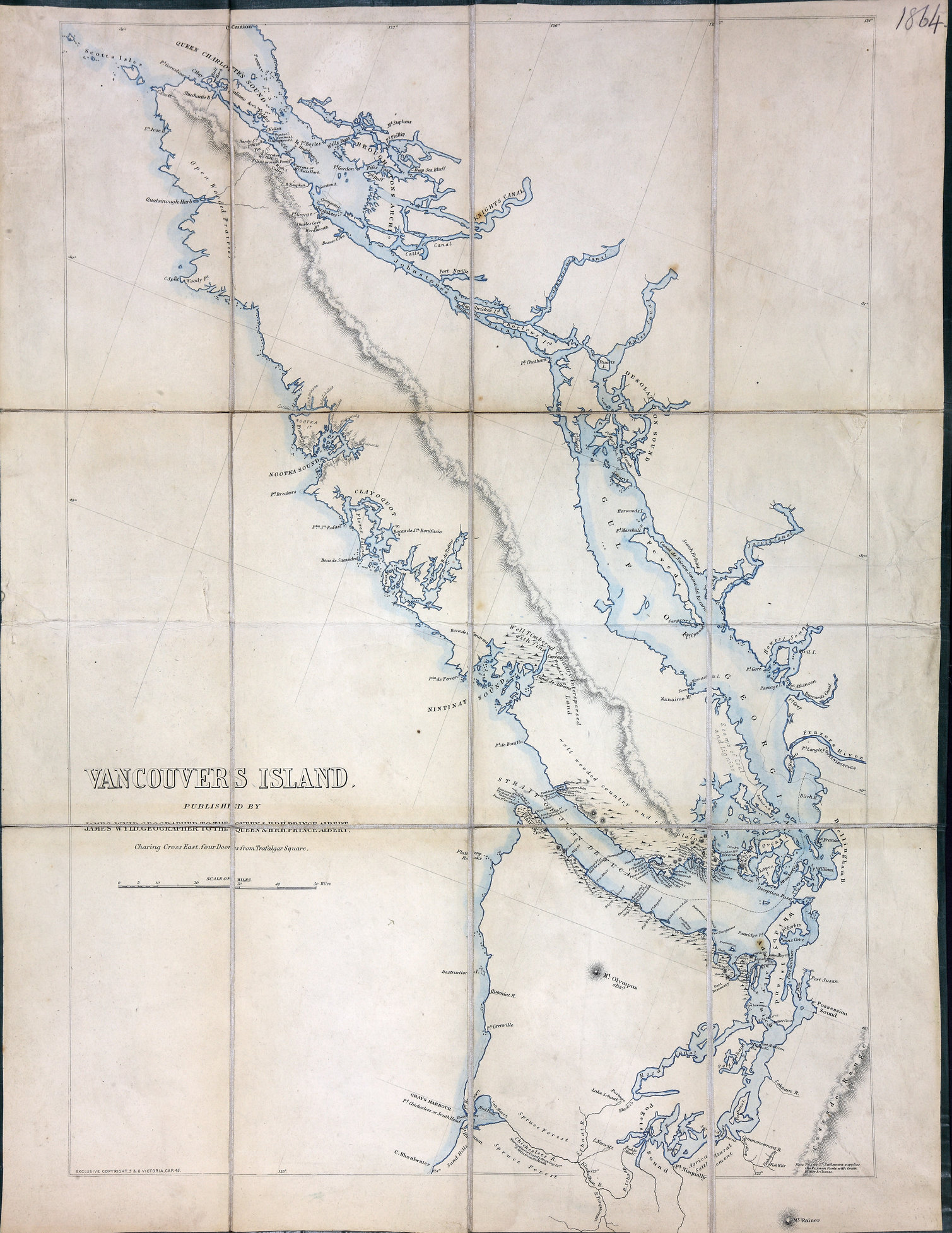
Vancouver's Island. 12.5 miles to one inch. Published by James Wyld, geographer to
the Queen & H.R.H. Prince Albert, Charing Cross East, four doors from Trafalgar square.
[Vancouver Island, 1848]. Relief shown by hachures. Descriptive text. At lower left
of map: Exclusive copyright, 5 & 6, Victoria, Cap.45.
Wyld, James, 1812-1887, Vancouvers Island, 1848, James Wyld, FO 925/1864. The Colonial Despatches of Vancouver Island and British Columbia 1846-1871, Edition 2.6, ed. James Hendrickson and the Colonial Despatches project. Victoria,
B.C.: University of Victoria. https://bcgenesis.uvic.ca/fo_925-1864_van_isl_1848.html.
Title: Vancouvers Island
Title: Vancouver Island
Author: Wyld, James, 1812-1887
Subject: Vancouver Island (B.C.)--Maps
Subject: Vancouver Island, 1848
Identifier (repository): FO
Identifier (repoNumber): 925
Identifier (repoVol): 1864
Identifier (libFileName): FO925-1864
Identifier (penfoldNum): 560
Identifier (doc_id): FO 925/1864
Date: 1848
Funder: Funded by a Canadian Council of Archives, Archival Community Digitization Program.
Publisher: James Wyld
Publisher: National Archives of the UK.
50 00'N--49 00'N / 125 00'W--122 00'W