Colonial Despatches
The colonial despatches of Vancouver Island and British Columbia 1846-1871
Straits of Juan de Fuca, Oregon Territory. From surveys of the U.S. Ex. Ex. and Spanish and English authorities
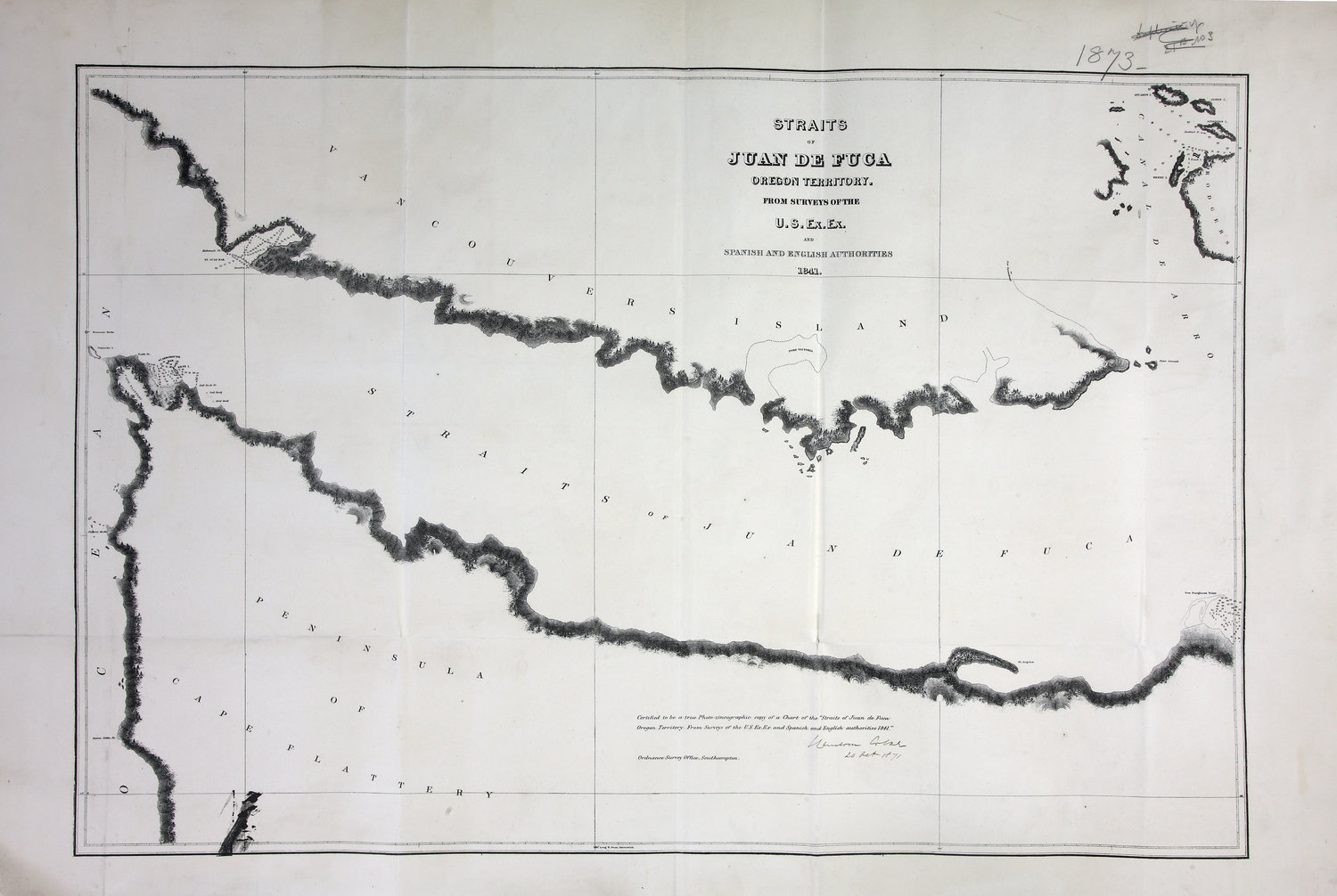
Straits of Juan De Fuca, Oregon Territory. From surveys of the US Ex. Ex. and Spanish
and English authorities, 1841. 2 sea miles to one inch. Certified true copy of FO
925/1378. Ordnance Survey, Southampton. [Juan de Fuca, Strait, 1841; 1871]
Great Britain. Ordnance Survey., Straits of Juan de Fuca, Oregon Territory. From surveys of the U.S. Ex. Ex. and Spanish
and English authorities, 1841-1873, Great Britain. Ordnance Survey Office, Southampton, FO 925/1873. The Colonial Despatches of Vancouver Island and British Columbia 1846-1871, Edition 2.6, ed. James Hendrickson and the Colonial Despatches project. Victoria,
B.C.: University of Victoria. https://bcgenesis.uvic.ca/fo_925-1873_j_d_f_1873_1841.html.
Title: Straits of Juan de Fuca, Oregon Territory. From surveys of the U.S. Ex. Ex. and Spanish and English authorities
Author: Great Britain. Ordnance Survey.
Subject: Juan de Fuca Strait (B.C. and Wash.)--Maps
Subject: Juan de Fuca, Strait, 1841, 1871
Identifier (repository): FO
Identifier (repoNumber): 925
Identifier (repoVol): 1873
Identifier (libFileName): FO925-1873
Identifier (penfoldNum): 510
Identifier (doc_id): FO 925/1873
Date: 1841
Funder: Funded by a Canadian Council of Archives, Archival Community Digitization Program.
Publisher: Great Britain. Ordnance Survey Office, Southampton
Publisher: National Archives of the UK.