Colonial Despatches
The colonial despatches of Vancouver Island and British Columbia 1846-1871
Map of the Victoria District Vancouver's Island
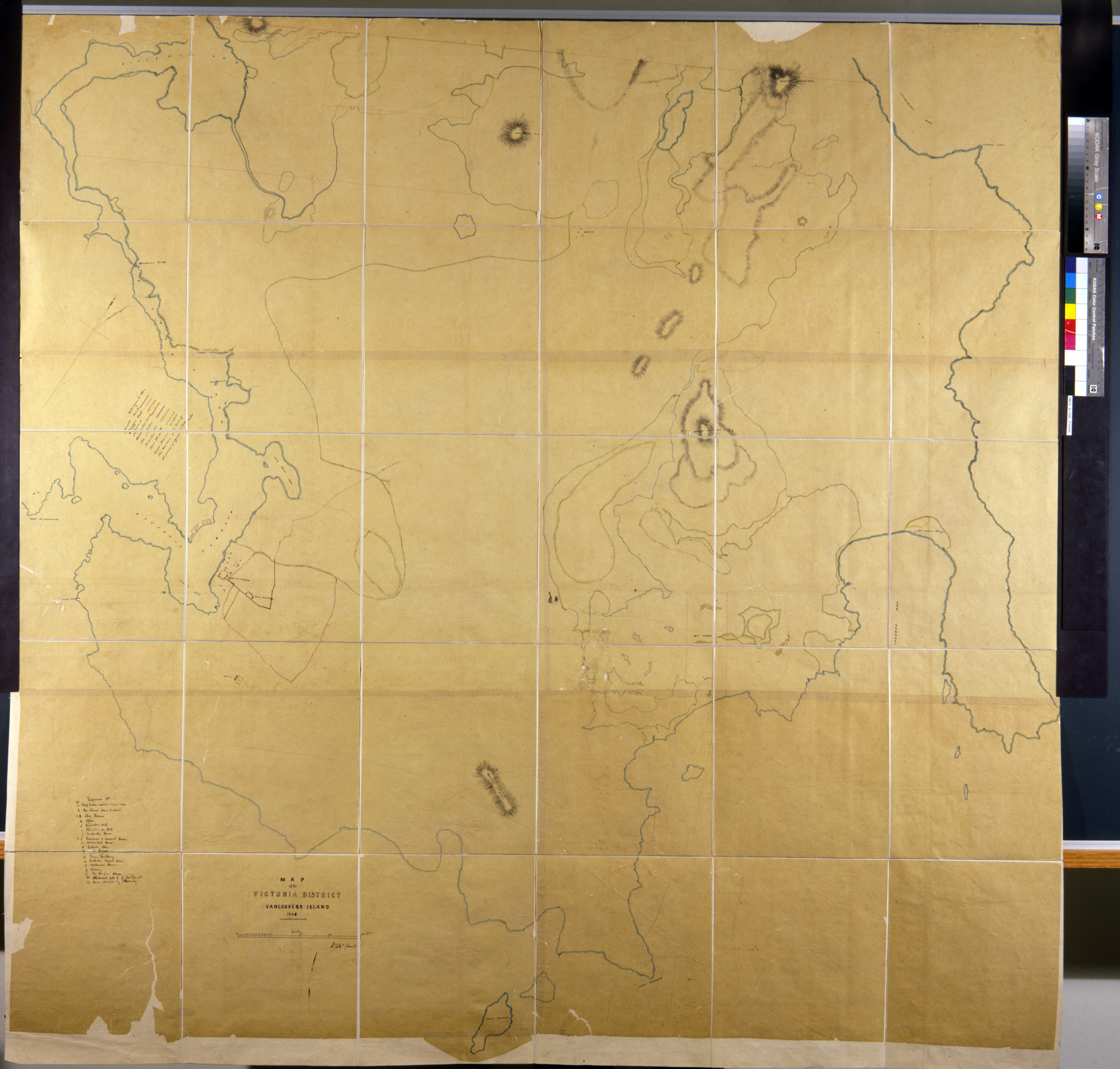
Map of the Victoria District Vancouver's Island 1850. W. Colqn. Grant. Hudson’s Bay
Company Archives, G1/256. Scale 1 inch=600 feet. Size: 149x152cm.
W. Colquhoun. Grant, Victoria District Vancouver's Island, 1850, Hudson's Bay Company Archives, G1/256. The Colonial Despatches of Vancouver Island and British Columbia 1846-1871, Edition 2.6, ed. James Hendrickson and the Colonial Despatches project. Victoria,
B.C.: University of Victoria. https://bcgenesis.uvic.ca/hbc_g1_256_1850.html.
Title: Victoria District Vancouver's Island
Author: W. Colquhoun. Grant
Identifier (repository): HBC
Identifier (doc_id): G1/256
Date: 1850
Publisher: Hudson's Bay Company Archives
Funder: Funded by a Canadian Council of Archives, Archival Community Digitization Program.